Richard Thornton's timing was excellent. On December 21, 2011, exactly one year before the world was supposedly going to end on the Maya calendar, Examiner.com ran his article about stone ruins in the mountains near Blairsville, Georgia, a 50-minute drive from Helen. Bands of Maya peasants, he argued, had fled a collapsing civilization and made it all the way to our backyard. The site, he added, "is possibly the site of the fabled city of Yupaha, which Spanish explorer Hernando de Soto failed to find in 1540."
The piece reportedly started life under an even louder headline. A Native American pop culture blog, Newspaper Rock, noticed that the web address still carried the earlier title, "Massive 1,100-year-old Maya site discovered in Georgia mountians," spelling and all.
The case for the Maya
Thornton told ABC News he was an architect and urban planner by training, had been hired to research the history of native people in and around Georgia since 2003, and was Georgia Creek Indian by birth. His argument leaned on a word. Towns across the Southeast were once called Itsate, he wrote, and both the Itza Maya and the Hitchiti Creek called themselves that. He pointed to pottery at Ocmulgee in central Georgia and to place names he said sounded like Maya words. Then there were the terraces, which he called "identical in form" to farming terraces in Chiapas, Guatemala, Belize and Honduras.
His Maya weren't the temple builders. Archaeologists had been looking for the wrong crowd, he wrote, when it was really the commoners "who got the heck out of Dodge City" as "wars, famines, droughts and almost non-stop volcanic eruptions became unbearable." He also mentioned "an apparently dormant volcano fumarole that reaches down into the bowels of the earth." Hold onto that one if you enjoy a good detail. The Atlanta paper's account of the actual archaeology mentions springs and a natural underground "vent" in the area that releases warm air in winter, and says Indians referred to these as "portals to the underworld." Thornton's fumarole may be that vent. We can't tell, and nobody we read says a volcano is involved except Thornton.
The hillside is real
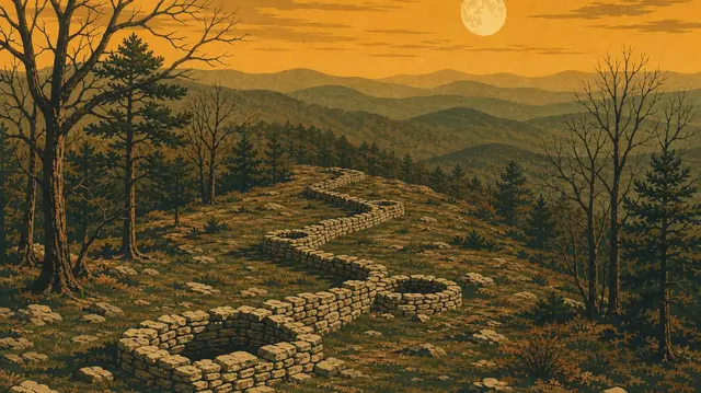
None of this came out of nowhere, which is why it traveled so well. In the 1990s, a retired engineer named Carey Waldrip was taking morning walks when he stumbled onto the rock structures. He and Tommy Hudson, a home inspector interested in ancient rock art, started cataloging them and raised money to bring in an archaeologist. The Atlanta Journal-Constitution put the count at more than 300, perhaps 500, sprinkled over the side of the mountain. "It might be like those cathedrals in Europe," Waldrip told the paper. "It's part of the human psyche to put up something permanent and say 'We were here.'"
That archaeologist was Johannes Loubser. He excavated a rock wall and a waist-high mound at the site, number 9UN367, and soil testing put both areas somewhere between 800 and 1100 A.D. He stopped digging the rock pile when there was evidence it was a grave. His report didn't say who built it all, though he figured the Cherokee or an earlier tribe were likely candidates.
Thornton took those dates and ran. They "exactly matched the diaspora from the Maya lands," he wrote. Loubser, by the AJC's account, chuckled at all the fuss. "I think that [Thornton] selectively presents the evidence," he said. "But he's a better marketer than I and other archaeologists are." The paper's own description of the job was "a lonely activity filled with shovels and dirt screens and carbon-dating and sunburn," which is a hard thing to make go viral. Thornton had a summary of his own: "I'm not an archaeologist. I'm a big picture man."
Move along now
Thornton had cited a University of Georgia archaeologist named Mark Williams, who had spent 40 years researching ancient Indian sites. Williams found out and said so in public. ABC puts this in the article's comments section and the AJC puts it on Facebook.
"I am the archaeologist Mark Williams mentioned in this article. This is total and complete bunk. There is no evidence of Maya in Georgia. Move along now."
Nobody moved along. The AJC said the theory was "spreading as fast as the latest Kardashian stunt." As ABC News reported, one commenter called him "completely pompous and arrogant," another called him "completely disrespectful to the Public at large," and a third promised to urge the state to cut off funding for his department. Thornton said he was "dumfounded." "I actually was giving Williams a plug," he told ABC. "I've got a regular readership, but this thing just went viral." He told the AJC, "I was just trying to get the archaeologists to work some more on the site and they come back snapping like mad dogs."
Williams held his ground. "The sites are certainly those of Native Americans of prehistoric Georgia," he wrote to ABC. "Wild theories are not new, but the web simply spreads them faster than ever." The Atlanta paper reported he wasn't sure how the structures came about or who built them. "But it's a wonderful mystery without having to bring in the Mayans or people from Mars," he said. That's our favorite position anyone took in this whole fight.
Then the visitors came
James Wettstaed, the Forest Service's heritage program manager for the Chattahoochee-Oconee, knew the hillside before the article ran. "I've been out to the site since the summer of 2009 and there [were] no signs of visitation," he told ICT, the Native news outlet, in 2012. "A week after the article, user-created trails began to grow from a small footpath to something that was more obvious. Whenever I've been out there people are looking for the site."
Over the next eight months, Maya enthusiasts kept coming. "People were moving things around," he said, "rocks within the site." The Forest Service blocked the main unauthorized trail with felled trees. A second Examiner article accused the agency of cutting more than 100 trees without permission from the Creek and Cherokee. The agency said it was about 20 dead or damaged trees, none of them inside the archaeological zone, and that it had kept the nations informed.
Lisa LaRue-Baker, acting tribal historic preservation officer for the United Keetoowah Band of Cherokee Indians in Oklahoma, confirmed that her nation had been told about the trees and hadn't objected. A film crew applying to shoot a documentary was another matter, and she told Wettstaed her nation was adamantly opposed. "It's a sacred site and we don't want sacred sites commercialized and exploited," she said. She told ICT she was "baffled" by the "fabricated Mayan-Cherokee connection." Then she said the thing that ought to end the conversation: "It's the last stronghold we have on our homeland."
Wettstaed said he hoped that after December 2012 the hype would "go away." The world did not end, so he at least got to find out.
What the Forest Service put in writing
In February 2013, Wettstaed laid out the agency's answer for the Society for Georgia Archeology. The rock art and stone landscape sites, he wrote, were "created by Creek and Cherokee people beginning more than 1000 years ago and continuing into the 1800s." And: "There is no archeological evidence of any link to Mayan people or culture at this site."
The line we like best is the plainest. "Stone landscape sites occur throughout the region and are not unusual, but they should be respected and protected." After a year of volcanoes and lost cities, the federal government's position was that the mountains have a lot of these, and please stop moving the rocks.
There is still real disagreement here, and we'd rather say so. The agency credited Creek and Cherokee people. Williams wasn't sure who. Loubser figured the Cherokee or someone earlier. That gap is honest, and it still doesn't get you to Guatemala.
The rocks that were never lost
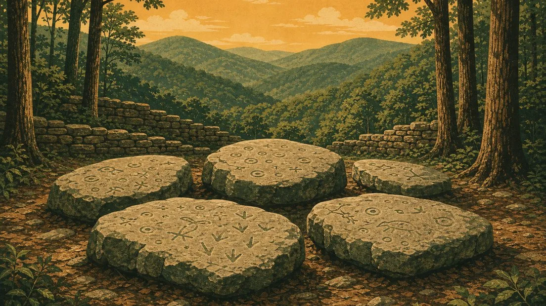
All that noise drowned out the better thing nearby, which the Forest Service described in 2013 as easily accessed. Six table-sized soapstone boulders carry carved animals, birds, tracks and geometric figures, hundreds of symbols by the historical marker's count and more than a hundred by the Forest Service's. Soapstone explains how it began. People were cutting bowls out of this rock at least 3,600 years ago, says the Forest Service, because it's soft enough to work and holds heat without breaking. Most of the figures you'd see are newer, likely made on repeated visits over several hundred years starting around A.D. 1000, either pecked out with a hard hammerstone or rubbed in, stroke after stroke. The agency's own summary points out that this took a lot of work, soft rock or not.
These were no secret. In September 1867, a mountaineer who had put up a young John Muir told him about a wondrous gap. "It is called Track Gap," he said, "from the great number of tracks in the rocks." Those were "bird tracks, bar tracks, hoss tracks, men tracks, all in the solid rock as if it had been mud." Muir doesn't say where the gap was, but the name fits and he came through Blairsville two days later. He wrote the story down, kept walking and never mentions stopping to look.
The earliest written account came in 1834, from Dr. Matthew Stephenson. (Mooney spells him Stevenson.) The historical marker calls him director of the US Branch Mint in Dahlonega, and other sources call him the mint's assayer. He counted 136 figures, including a footprint with six toes, which he took as proof of descent from a Titan.
He also helped himself, and this is our favorite document in the whole pile. A 2003 local history column by Ethelene Dyer Jones reprints his account of going to lift out one of the tracks, credited to a 1988 family history, so we're reading it at a couple of removes. "The first strokes of the hammer were responded to by a large peal of thunder," he wrote, and soon "a deluge of rain was precipitated upon our offending heads." Most people would take the hint. "I continued, however, to labor until I succeeded in disintegrating the impression of a youth's foot, which I carefully wrapped up." As he left the mountains, he says, the rain quit and the sun came out. That's the weather report of a man who found a Titan's toe, so salt it to taste.
The theft holds up better than the thunder. When the ethnographer James Mooney sketched the boulders around 1890, he wrote that many of the finest carvings had "been cut out from the rock and carried off by vandals, Stevenson himself being among the number, by his own confession." Mooney's drawing marks the missing pieces with lighter shading. Stephenson went on to a louder kind of fame. The Gainesville Times credits him with telling Dahlonega miners in 1849 "There's millions in it," in a speech meant to keep them out of California, a line later corrupted into "There's gold in them thar hills."
Mooney recorded the Cherokee names for the place: one means "where there are tracks," the other the "printed (branded) place." He also recorded their explanations. Some said hunters carved the marks to pass the time while resting in the gap. Others said a great army of birds and animals made them while fleeing through, when the new earth was still soft.
The famous version is the flood. Animals stepping out of a great canoe left prints on rock softened by the water, and in the account Mooney reprints, swans towed the canoe there. The Georgia Historical Society's marker lists this among the Cherokee stories, and we'd keep it, though with a label on it. That telling reached print on the authority of the same hammer-swinging doctor, and Mooney called the account "misleading and greatly exaggerated" and its tradition "ostensible." The Cherokee do have a flood story of their own, which Mooney recorded separately. As for what the carvings meant, the marker doesn't hedge: "No one knows the exact meaning of the symbols or glyphs."
Four metal grates once covered the boulders, which protected them and made the carvings hard to see. Beginning in 2009 the Forest Service hired Loubser to make a complete recording of the site, then took off the grates and put up interpretive panels. That work was done in January 2011, eleven months before the Examiner article.
Graffiti begets more graffiti
On March 26, 2021, Loubser found the boulders scarred with rocks and knives and marked with blue, red and yellow paint. "I just thought 'Oh no, this can't be true,' and then you see it," he said. "I was angry. It's uncalled for, it's thoughtless and selfish." A Forest Service spokesperson counted five boulders scratched and two painted. Nobody knows exactly when it happened. Loubser thought it might have happened the year before and gone unreported, and he didn't think it was one incident. "I think people came and saw other things and that emboldened them," he said. "Graffiti begets more graffiti."
The Forest Service's post about the damage called the place one of the most significant rock art sites in the Southeast and the only such site on public land in Georgia. Its own archaeologist had written "one of the few" in 2011, and we can't tell you which count is right. The Eastern Band of Cherokee Indians' heritage office said that whether through ignorance or malice, "the result is irreparable damage to a unique site that connects us directly to the people of the past." Principal Chief Richard Sneed told the New York Times, as quoted by Smithsonian, "It is our history, and to have that defaced and to be treated with such disrespect, it is very sad."
We couldn't pin down the day the site closed. Smithsonian described the site as open again in April 2021. The Forest Service page, updated in August 2026, says "Site Closed" and "Temporarily closed," with no reason and no reopening date. It also says the Arkaquah Trail parking lot and trailhead stay open while the carvings are closed, though the page spells it Arquaqua. That trail runs about 5.5 strenuous miles one way from there to Brasstown Bald, and FIND Outdoors warns against treating it as an out-and-back, so line up a second car or a ride before you start.