Cultural and Historical Guide to the Sautee Nacoochee Valley: A Comprehensive Analysis
Cherokee legends, the iconic Indian Mound, Hardman Farm, and folk art in the valley south of Helen
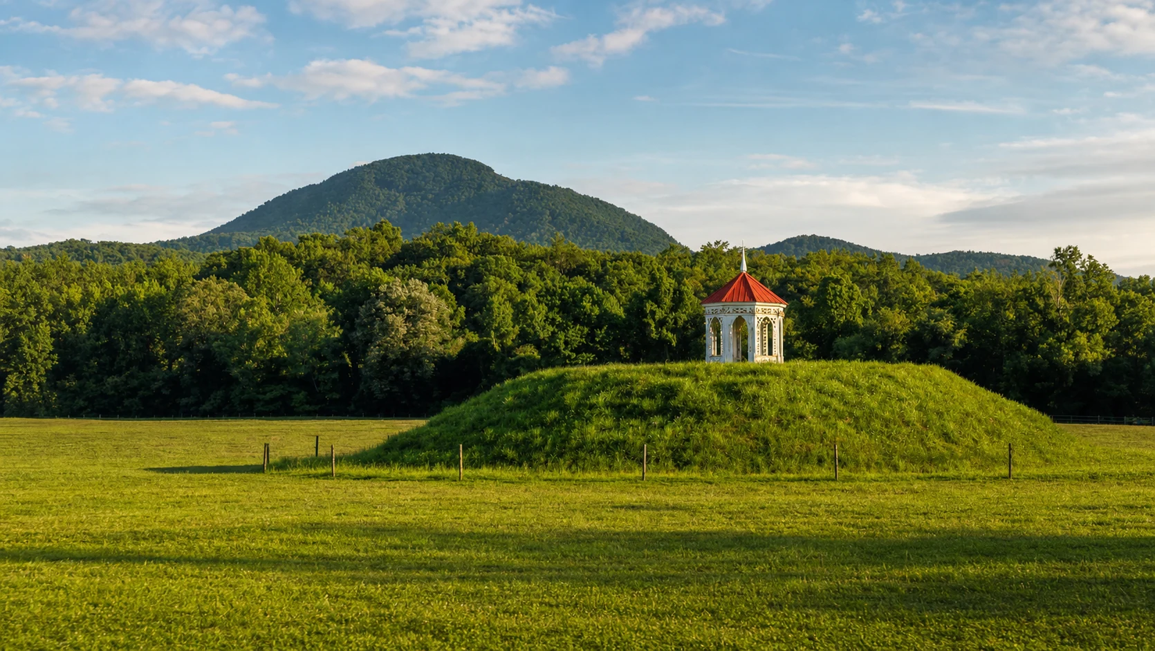
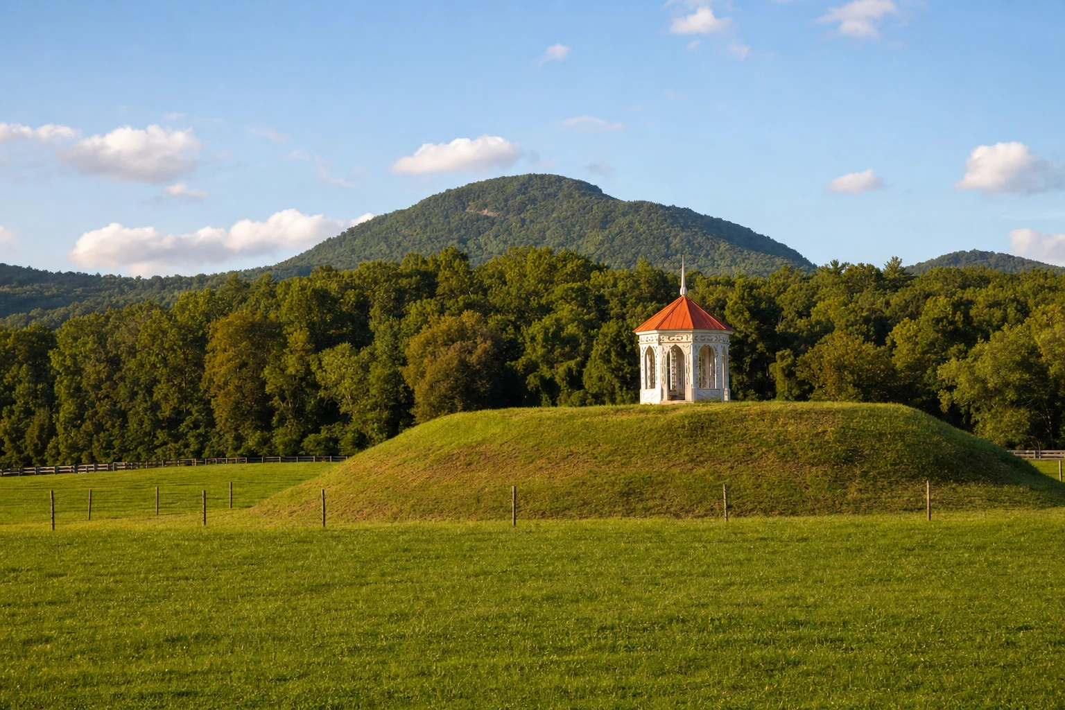
Historical Duality: The Sautee Nacoochee Valley is defined by a dichotomy between popular mythology and archaeological reality. While the famous "Lover's Leap" legend of Sautee and Nacoochee attributes the local Indian Mound to a Cherokee Romeo-and-Juliet tragedy, archaeological excavation confirms the mound is a South Appalachian Mississippian burial site (circa 1350–1600 CE), predating significant Cherokee habitation in the specific mound vicinity.
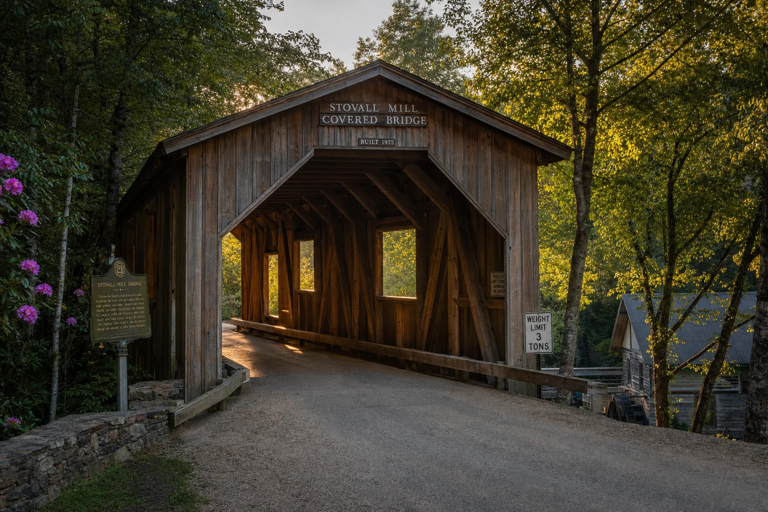
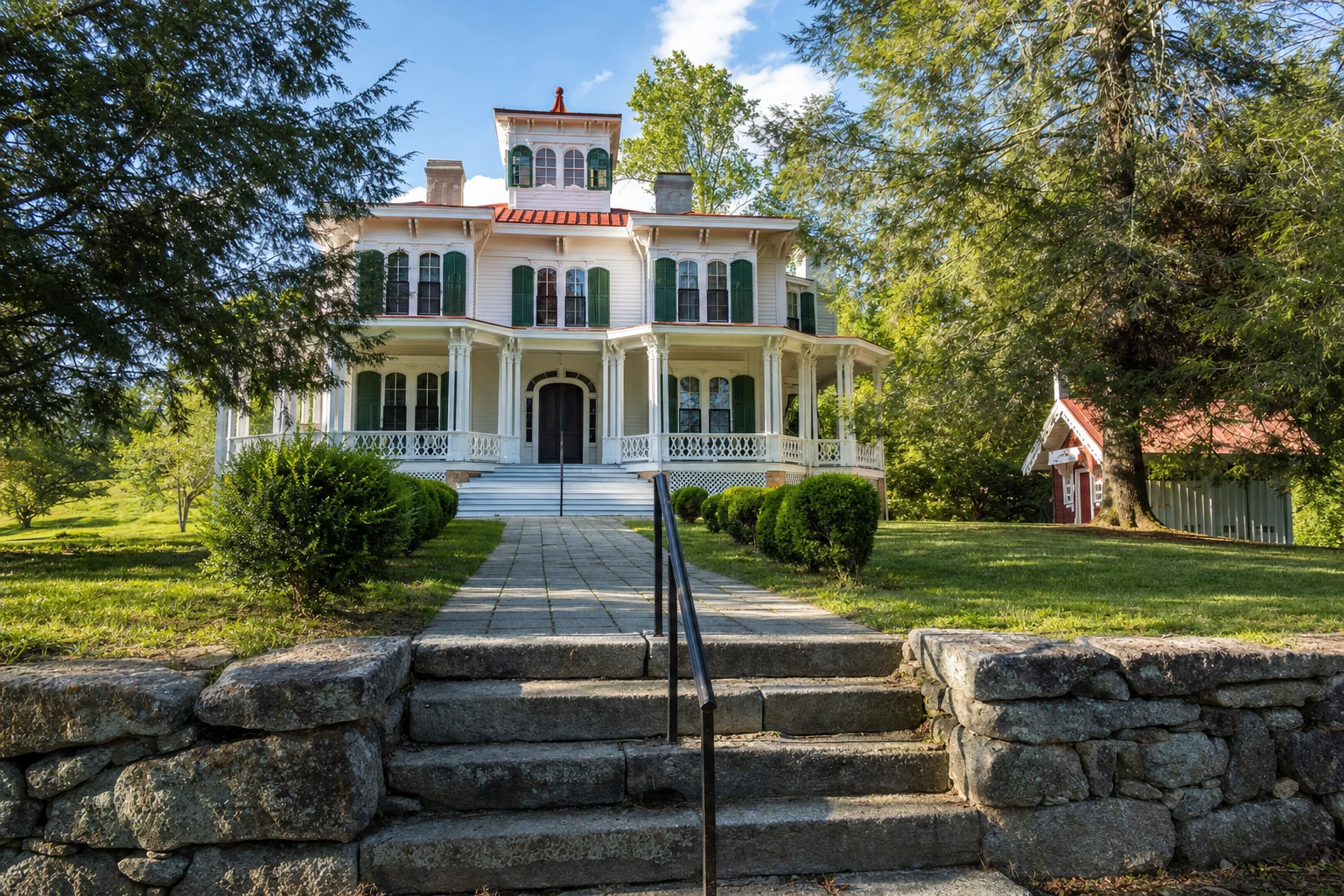
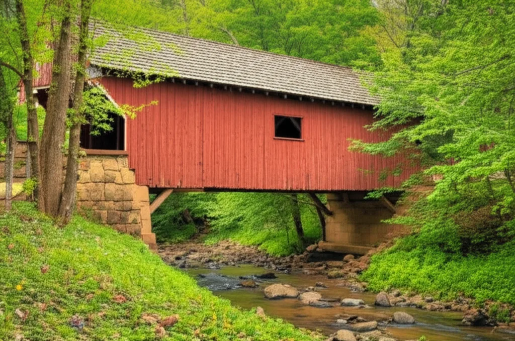
Architectural Heritage: The valley contains some of Georgia's most significant preservation sites, including the Hardman Farm State Historic Site, which features the 1870 Italianate "West End" mansion and the 1895 Stovall Mill Covered Bridge, the smallest historic covered bridge in the state.
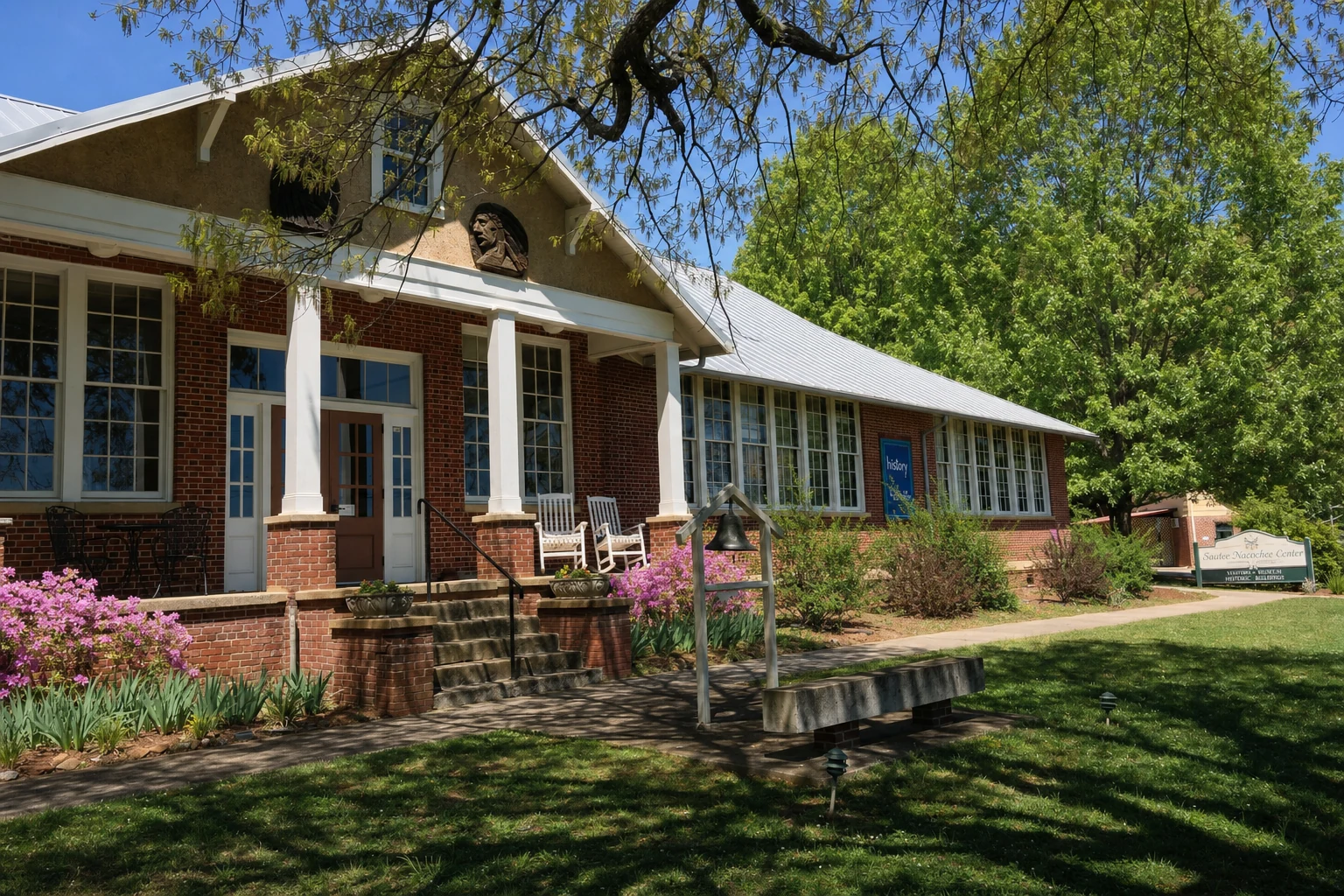
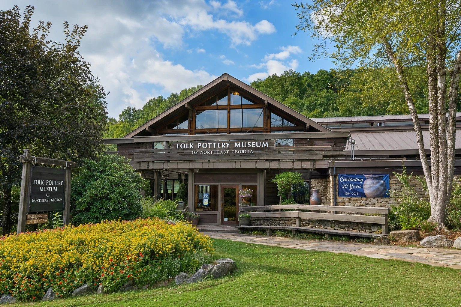
Cultural Hub: The Sautee Nacoochee Center (SNC) is the heart of the valley's arts and history scene, housing the Folk Pottery Museum of Northeast Georgia and a rare, preserved antebellum slave cabin that tells the story of the enslaved Bean Creek community.
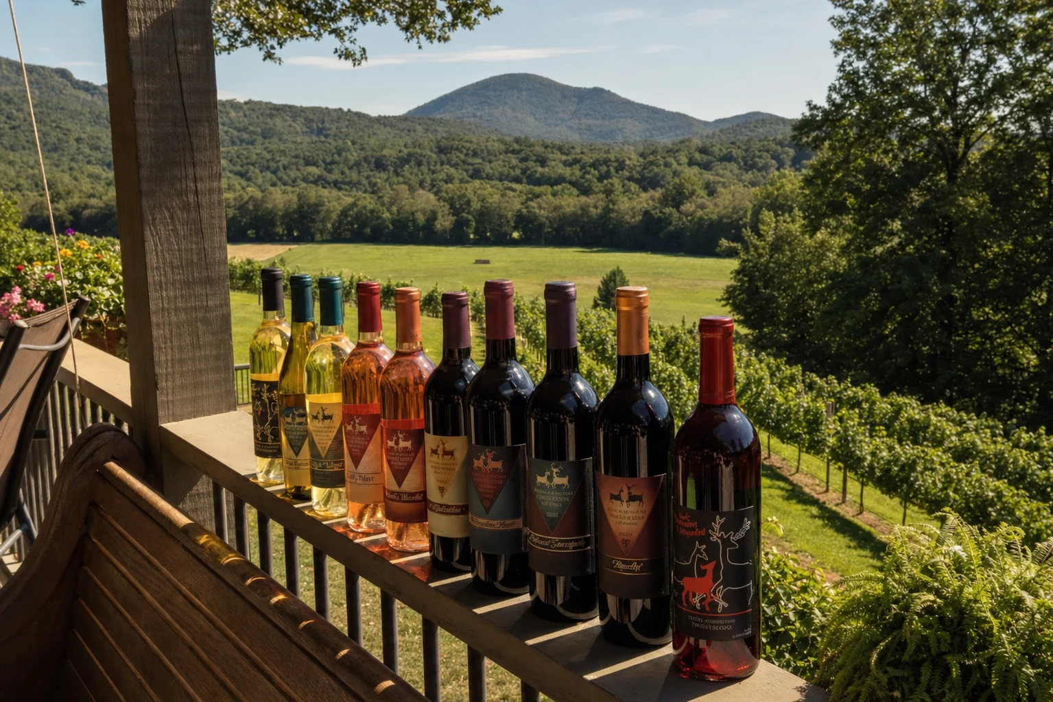
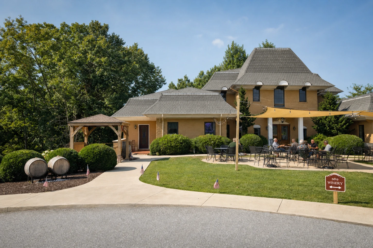
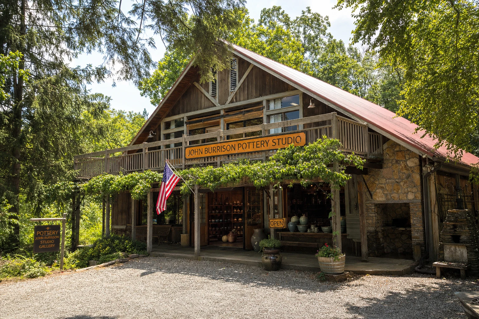
Viticulture and Arts: Transitioning from an agricultural past, the valley has emerged as a premier destination for enology and ceramics. It hosts multiple vineyards (e.g., Sautee Nacoochee Vineyards, Creekstone Winery) and continues a 200-year folk pottery tradition through institutions like the new John Burrison Pottery Studio.
1. Introduction and Geographic Context
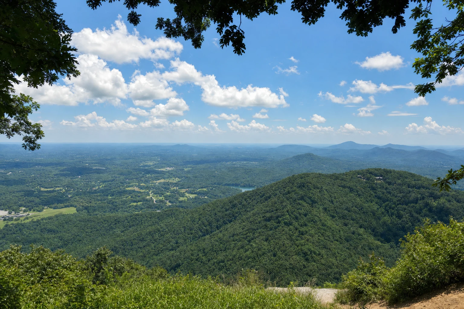
The Sautee Nacoochee Valley sits in White County, Georgia, where Appalachian geography, indigenous history, and 19th-century farming culture all come together in one of the most historically rich areas of the state. Located in the foothills of the Blue Ridge Mountains, roughly 95 miles north of Atlanta and just southeast of the Alpine tourist town of Helen, the area is actually two intersecting valleys: the Sautee and the Nacoochee. Both were shaped by the headwaters of the Chattahoochee River and its tributaries, creating fertile bottomlands that have drawn people to live here for thousands of years.
Unlike the commercially dense environment of nearby Helen, the Sautee Nacoochee Valley functions as a preservation district, characterized by rolling pastures, historic structures, and a strong emphasis on the arts. The region is federally recognized as the Sautee and Nacoochee Valleys National Historic District (added to the National Register in 1986), a designation that acknowledges its agricultural, architectural, and historic significance. The cultural identity of the valley is maintained largely through the efforts of the Sautee Nacoochee Community Association (SNCA), which operates a multi-faceted campus dedicated to history, visual arts, and performance.
2. Historical Evolution: From Antiquity to the Present
2.1 Pre-Contact and The Mississippian Era
The human history of the valley begins significantly earlier than the Cherokee era often cited in local lore. Archaeological evidence indicates habitation as early as the Woodland period (100–500 CE), but the most intensive occupation occurred during the South Appalachian Mississippian period, specifically the Lamar Phase (1350–1600 CE).
During this time, the valley was home to a stratified chiefdom society. The most visible remnant of this era is the Nacoochee Indian Mound (Smithsonian trinomial 9WH3). Excavations have revealed that this was a platform mound used for ceremonial purposes and as a burial site for the elite, serving as a local administrative center for surrounding villages. Artifacts recovered, including Etowah-style pottery, copper celts, and conch shell beads, indicate a sophisticated trade network and social hierarchy.
2.2 The Cherokee Era and The Legend of Sautee and Nacoochee
By the 18th century, the valley was part of the Cherokee Nation. The names "Sautee" and "Nacoochee" are Anglicizations of Native American terms. "Nacoochee" is derived from the Cherokee Na-gu-tsi (meaning "Evening Star" or potentially related to the Muscogee Nokose for "bear"), while "Sautee" is believed to be derived from the Muscogee Sawate ("Raccoon People") or the Cherokee Itsati.
The Legend: The cultural narrative of the valley is dominated by the "Legend of Sautee and Nacoochee," a Romeo and Juliet-style tragedy popularized in the 19th century. The legend purports that Nacoochee, a Cherokee princess, fell in love with Sautee, a Chickasaw warrior. According to the myth, the opposing tribes forbade the union, leading to Sautee being thrown from Yonah Mountain. Nacoochee then leapt to her death to join him, and they were allegedly buried together in the mound.
Historical Reality: Academic research and archaeological data overwhelmingly refute this legend. The mound predates the historic Cherokee presence in the valley by centuries, and the 1915 excavation found no evidence of a dual lover’s burial, but rather 75 distinct interments from the Mississippian period. Eighteenth-century maps identify "Nacoochee" as a Cherokee town, but the mound itself was likely abandoned as a functional administrative center before the historic Cherokee period began.
2.3 Early European Settlement and the Gold Rush
European incursions into the valley began with Spanish exploration. A 1955 historical marker claims Hernando de Soto visited the "ancient Cherokee town of Gauxule" (Nacoochee) in 1540; however, modern scholarship suggests De Soto’s route lay further north.
Permanent white settlement followed the 1820s treaties and the Georgia Gold Rush. The discovery of gold in the region (Dukes Creek and Dahlonega) accelerated the displacement of the Cherokee, culminating in the Trail of Tears (1838). The Unicoi Turnpike, originally a buffalo trail and Native American trading route, became a primary artery for settlers and commerce, running directly through the valley.
2.4 Antebellum Agriculture and Slavery
Following the removal of the Cherokee, the valley was developed into large agricultural estates. Prominent among the early settlers was the Williams family. E.P. Williams established a plantation in the valley, using enslaved labor to cultivate the fertile river bottoms. The Bean Creek community, located nearby, was established by these enslaved populations and their descendants, remaining a vital African American community in the region to this day.
2.5 Post-Civil War and the Modern Era
After the Civil War, the valley transitioned through various phases of ownership. Captain James H. Nichols, a businessman, purchased the "West End" property (now Hardman Farm) in 1870. In 1893, it was sold to Calvin Hunnicutt, and subsequently to Dr. Lamartine Griffin Hardman in 1903, who would later serve as Governor of Georgia (1927–1931).
In the 20th century, the valley saw the rise of the Nacoochee Institute, a Presbyterian mission school, which later merged to form the Sautee-Nacoochee Consolidated School. The school building, constructed in 1928, now houses the Sautee Nacoochee Center.
3. Key Landmarks and Historic Sites
3.1 The Nacoochee Indian Mound
The Nacoochee Indian Mound is arguably the most recognizable landmark in White County, located at the intersection of Highways 17 and 75.
Structure and Modification: The mound currently stands in a cow pasture. Its appearance is unique due to the white gazebo perched on its summit. This gazebo was not of indigenous origin but was constructed in 1890 by Captain James Nichols. To accommodate the structure, Nichols shaved approximately two feet off the original height of the mound.
Archaeology: In 1915, a joint expedition by the Heye Foundation (Museum of the American Indian) and the Smithsonian Bureau of American Ethnology excavated the site. They uncovered 75 burials, fire pits, and artifacts including celts, pipes, and pottery characteristic of the Etowah and Lamar cultures. The excavation proved the mound was a multi-layered burial and ceremonial site used over centuries, dispelling the singular "lovers' grave" myth.
Visiting: The mound is part of the Hardman Farm State Historic Site. While visitors cannot climb the mound (to preserve its integrity and respect the burials), it is easily viewed from the road and interpreted through guided tours at Hardman Farm.
3.2 Hardman Farm State Historic Site
Located directly across from the Indian Mound, Hardman Farm offers the most comprehensive look at the valley's 19th-century elite life.
The West End Mansion: Built in 1870 by Captain James Nichols, the main house is a premier example of Italianate architecture in rural Georgia. It features wide overhanging eaves, decorative brackets, and a climate control system considered advanced for its time. The interior retains much of the original furniture from the Hunnicutt and Hardman eras.
The Nacoochee Dairy: Under Dr. Hardman's ownership, the property operated as a state-of-the-art dairy farm from 1910 until the mid-1920s. The site preserves a massive dairy barn, a spring house (where milk was processed/cooled), and a horse barn. This complex illustrates the agricultural industrialization of the valley in the early 20th century.
Native Connection: The farm grounds include the section of the Unicoi Turnpike, facilitating interpretation of the ancient trade route that linked the Savannah River to the Tennessee River.
Anna Ruby Connection: The house was the childhood summer home of Anna Ruby Nichols, for whom the famous Anna Ruby Falls near Helen is named.
3.3 The Stovall Mill Covered Bridge
Spanning Chickamauga Creek (distinct from the northwest Georgia creek of the same name), this bridge is a beloved example of vernacular engineering.
Construction: The current bridge was built in 1895 by Will Pardue after the original 1890s structure washed away. It was part of a larger mill complex (grist, saw, and shingle mills) owned by Fred Dover and later Fred Stovall, Sr..
Dimensions and Design: At approximately 33 to 38 feet in length (sources vary slightly: 33 ft, 36.8 ft), it is the smallest covered bridge in Georgia. It uses a Queen-post truss design, characterized by two vertical posts separated by a horizontal crosspiece to support the span.
Cultural Significance: The bridge was featured in the 1951 film "I'd Climb the Highest Mountain," starring Susan Hayward, cementing its status as a local icon. It is located on GA Highway 255 and is open to pedestrian traffic.