Complete Guide to Amicalola Falls State Park, Georgia
The Southeast's tallest cascading waterfall, with lodge accommodations and the Appalachian Trail approach
Amicalola Falls State Park has the highest cascading waterfall in the Southeast and is the official starting point for the Appalachian Trail approach. Spread across 829 acres near Dawsonville, between Ellijay and Dahlonega, the park draws everyone from families looking for a quick waterfall hike to serious backpackers starting their thru-hike north. The hiking is excellent, the lodge is comfortable, and the waterfall alone is worth the drive.
The Waterfall: Georgia's Natural Wonder
What Makes Amicalola Falls Unique
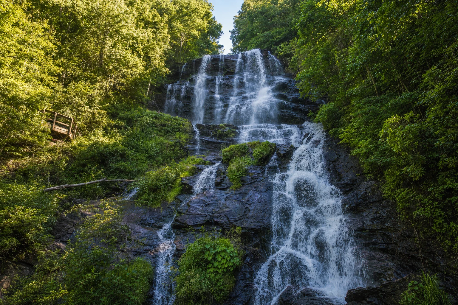
Amicalola Falls drops 729 feet, which makes it the tallest waterfall in Georgia and one of the tallest cascading falls east of the Mississippi. The name comes from the Cherokee word "ama uqwalelvyi," meaning "tumbling waters." One thing that surprises people is that it is not a single straight drop. The water falls in a series of cascades and slides down the rock face, which honestly makes it more interesting to watch than a simple plunge waterfall.
People have been marveling at these falls for centuries. One early explorer wrote in his journal: "I discovered a Water Fall perhaps the greatest in the World the most majestic Scene that I have ever witnessed," and he guessed the mountain was "at least three fourths of a mile high." He was off on the measurement, but the awe was real.
Amicalola Falls is one of the Seven Natural Wonders of Georgia, and after seeing it in person, you will understand why it made the list.
Film and Media Recognition
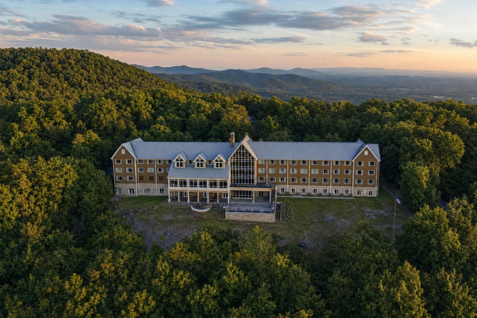
The park's lodge lobby was a filming location for "A Walk in the Woods," the Robert Redford and Nick Nolte movie about hiking the Appalachian Trail. If you have seen the film, you can stand in the same spot they filmed those scenes. It is a fun bit of trivia that connects the park to pop culture.
The Appalachian Trail Connection
The Approach Trail: Gateway to 2,000+ Miles
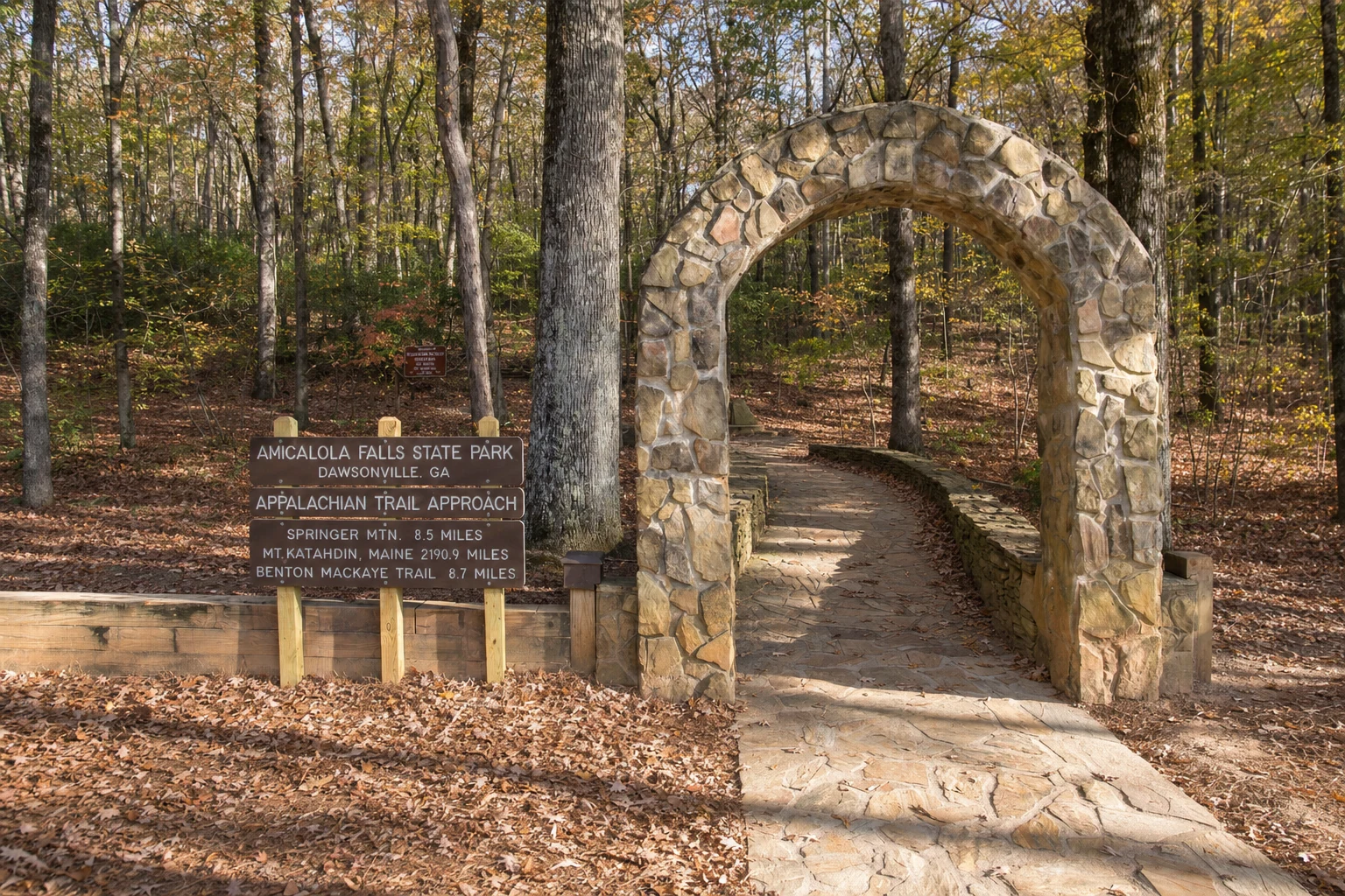
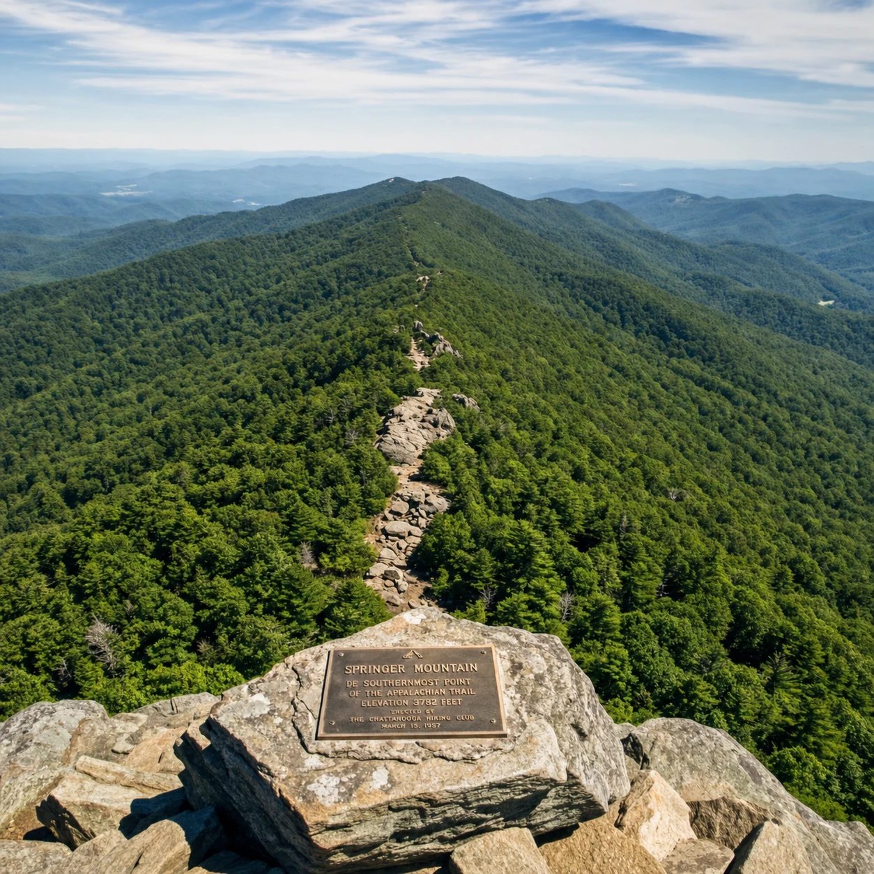
The big draw for serious hikers is the 8.5-mile Approach Trail, which connects the park to Springer Mountain, the official southern terminus of the Appalachian Trail. This blue-blazed trail is where many people start a 2,190-plus mile walk to Mt. Katahdin in Maine.
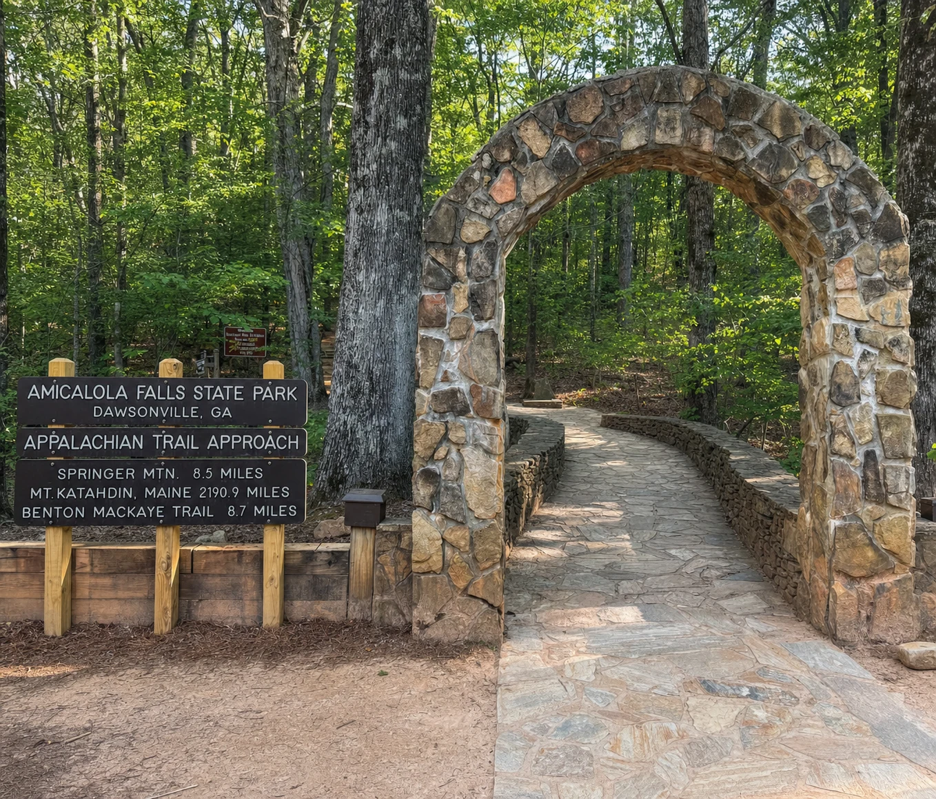
About half of northbound thru-hikers start here at Amicalola Falls instead of driving directly to Springer Mountain. The park is one of three official Appalachian Trail registration sites in the country. Staff at the visitor center can help with registration and answer questions about the trail. Look for the stone arch behind the Visitor Center - it marks the unofficial start of the approach trail and is the classic photo spot for AT hikers.
Trail Characteristics and Difficulty
The Approach Trail is no cakewalk. You gain about 3,000 feet of elevation over those 8.5 miles. The trail follows Little Amicalola Creek through thick rhododendron and laurel, passes over rocky mountainsides, and connects to several campsites if you want to break it into an overnight trip.
Along the way, you pass over Frosty Mountain (about 3,400 feet), Amicalola Mountain, and Black Mountain before reaching Springer Mountain at the end. The Black Gap Shelter is a good spot to camp if you want to split the hike into two days. You can also add the 5-mile Len Foote Trail as a side loop, which brings the total to about 11 miles and passes Georgia's only backcountry lodge.
Seasonal Considerations for AT Thru-Hikers
Most northbound thru-hikers start between late February and early April, with the biggest wave in March and April when the weather turns milder. This timing lets hikers reach Maine before fall. Early spring weather up here is unpredictable though. You can get freezing temperatures at elevation in the morning and comfortable hiking weather by afternoon. Rain gear and warm layers are non-negotiable.
Visiting the Waterfall: Viewing and Hiking Options
Easy Access: West Ridge Trail
If you do not want a hard hike, the ADA-accessible West Ridge Trail gives you a view of the falls without any real climbing. It works well for families with small kids, anyone with mobility concerns, or people who just want a short walk to see what all the fuss is about.
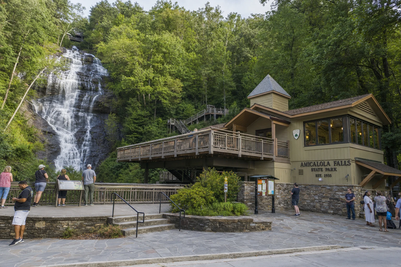
Moderate Challenge: Base of Falls Access
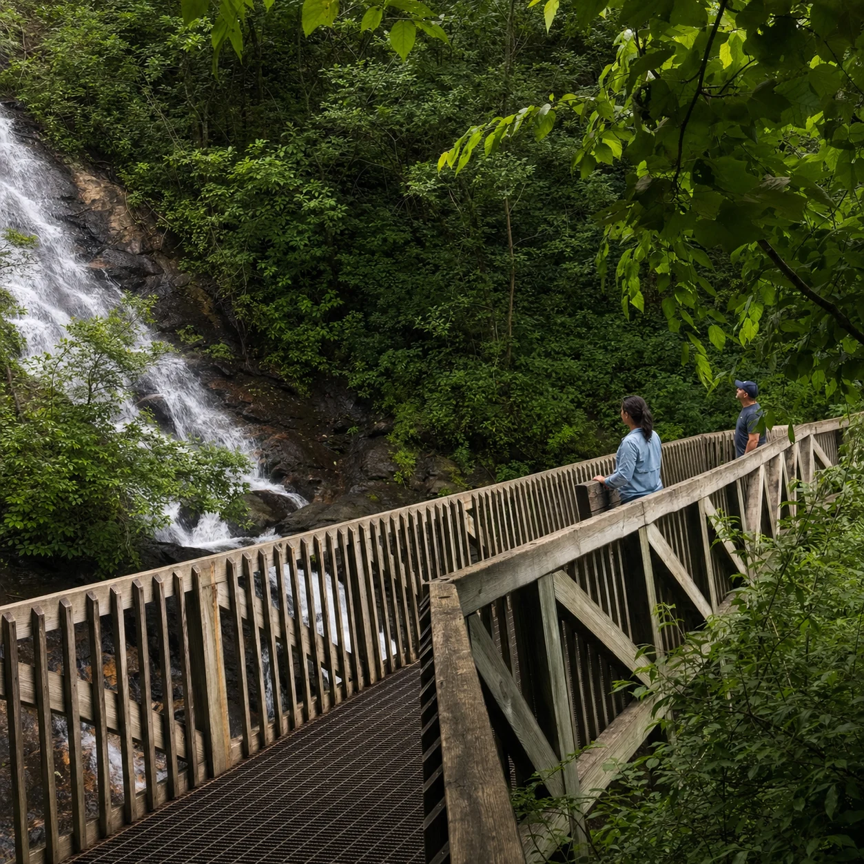
The most popular way to see the falls is to hike to the base and climb 175 stairs to the observation platform. You will feel the mist on your face and hear the water crashing below. Plan about 1.5 hours for this route. It is moderate to strenuous with some steep sections and uneven footing on the way down, but the view from the platform over the lower cascade is absolutely worth the effort.
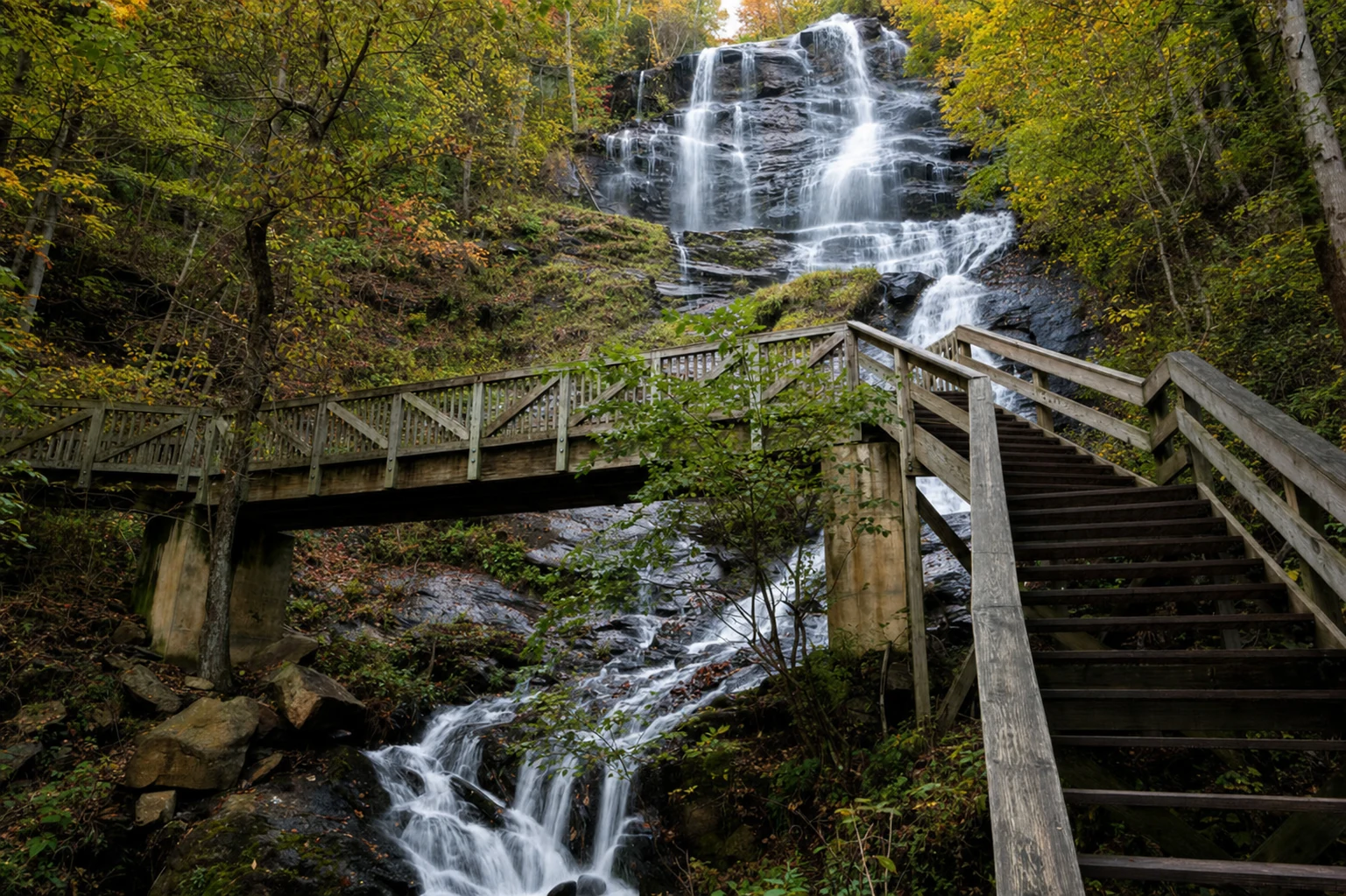
Canyon Climbers Club and Staircase Challenge
For the full experience, tackle all 600-plus steps to the top observation deck. Your legs will be burning, but the view from above the falls is unlike anything you get from below. When you finish, you can join the park's Canyon Climbers Club, which is their way of recognizing people who made it all the way up. Standing at the crest of the falls, watching the water disappear over the edge below you, is genuinely thrilling.
Photography Opportunities
If you are bringing a camera, the best shots usually come from below the falls where you can capture the full height of the water. The platform to the right of the stairs has excellent angles for both wide landscape shots and tighter compositions. Spring, from March through May, gives you the most dramatic water flow. Summer has fuller greenery around the falls but the water volume is often lower.
Accessibility Information
The park has ADA-accessible pathways and welcomes service animals throughout. Staff are helpful with accommodations for visitors who need assistance. The West Ridge Trail is the best accessible option for seeing the main waterfall drop without stairs or rough terrain.
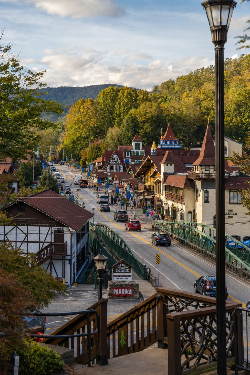
Related Imagery from Around Helen