Guide to DeSoto Falls, Georgia
Upper and lower waterfalls, easy hiking trails, and streamside camping in the Chattahoochee National Forest
DeSoto Falls Recreation Area in the Chattahoochee-Oconee National Forest has two beautiful waterfalls, easy-to-moderate hiking trails, and campground sites right along Frogtown Creek. About 30 minutes north of Helen, this 650-acre area is one of those spots that works for just about everyone, whether you want a short family hike to a waterfall or a quiet weekend of camping under the trees.
Location and Visitor Information
DeSoto Falls Recreation Area sits at 18365 US Highway 129 North, Cleveland, GA 30528, in the Blue Ridge Ranger District of the Chattahoochee National Forest. The main contact phone is (706) 745-6928 for inquiries about conditions or updates.
Day use requires a $5 per vehicle fee, payable via the Recreation.gov mobile app, kiosk, or envelope at the parking lot - download the app ahead due to spotty cell service. The area operates from sunrise to sunset for day visitors, with camping available 24 hours. No entry reservations are needed for day hikes, but camping books via Recreation.gov up to six months ahead.
From Helen, GA, drive about 30 minutes north: Head north on GA-75/GA-356 for roughly 15-20 miles, then turn left onto US-129/US-19 toward Blairsville/Dahlonega; the entrance is on the left after 17 miles from Blairsville or 18 miles from Dahlonega. Parking is limited, especially weekends - no spots for RVs or trailers in day use; arrive early.
Historical Context and the Legend of Hernando de Soto's Armor
DeSoto Falls earned its name from local lore claiming Spanish armor from 16th-century explorer Hernando de Soto's expedition was discovered near the base, fueling tales of his men searching for gold in the 1540s. De Soto's brutal march through the Southeast, including Georgia, left artifacts like possible breastplates and a sword found nearby, though not conclusively his - adding mystery to the cascading waters.
The recreation area developed in the mid-20th century within the Chattahoochee National Forest, established in the 1930s; the campground and trails formalized access to the falls along Frogtown Creek. Early promoters like Arthur Abernathy Miller built a dam upstream in the 1920s for a lake, envisioning a resort community, but nature preserved its wild charm. Today, it's a protected gem highlighting North Georgia's rugged history.
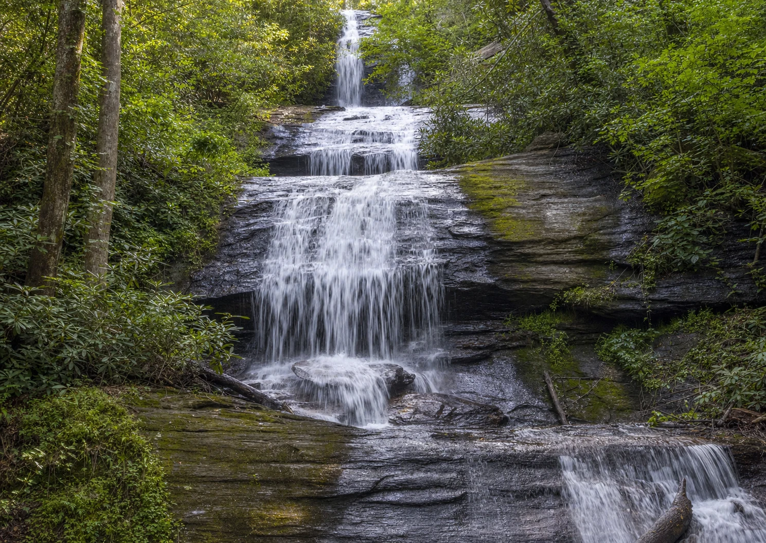
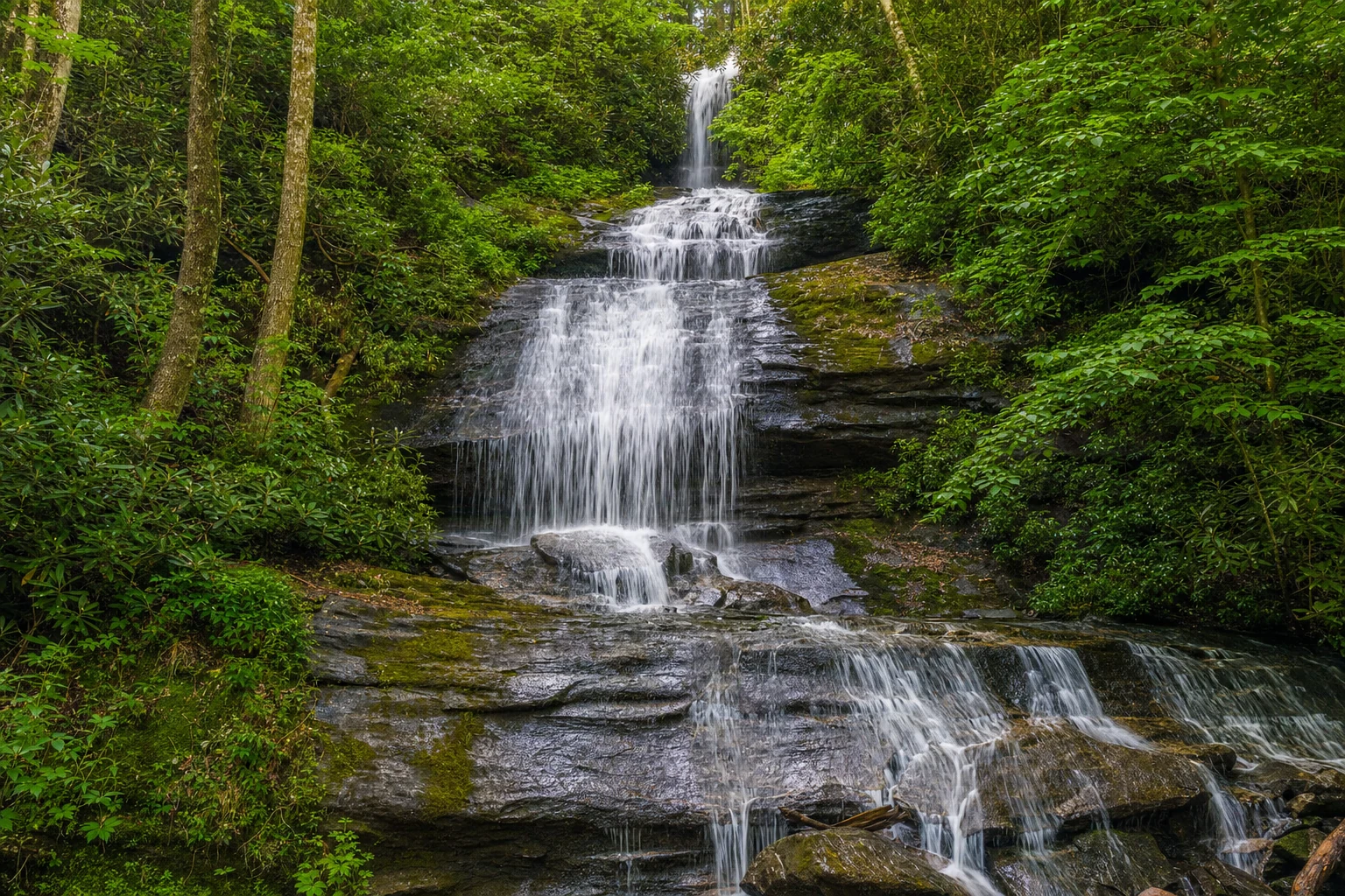
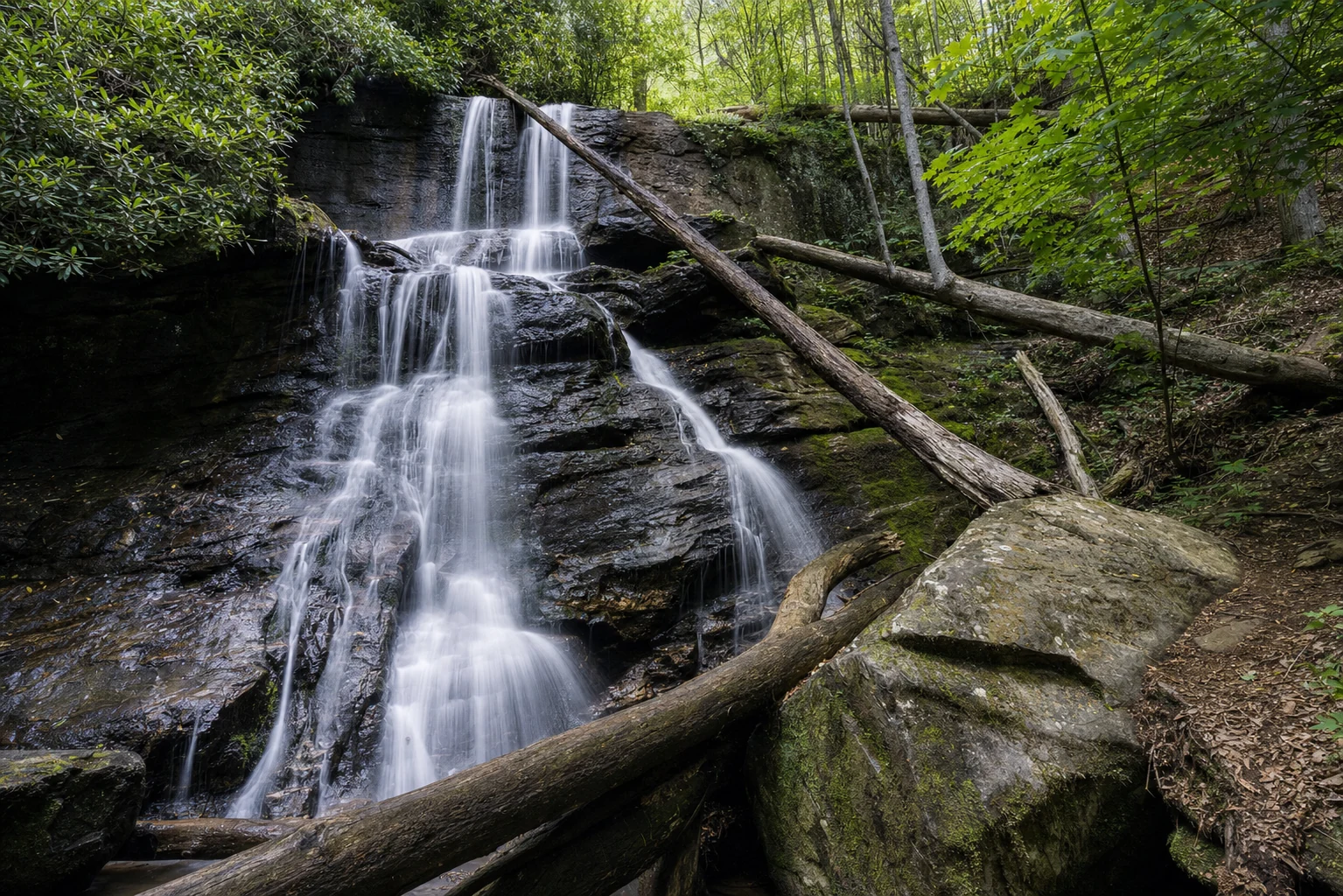
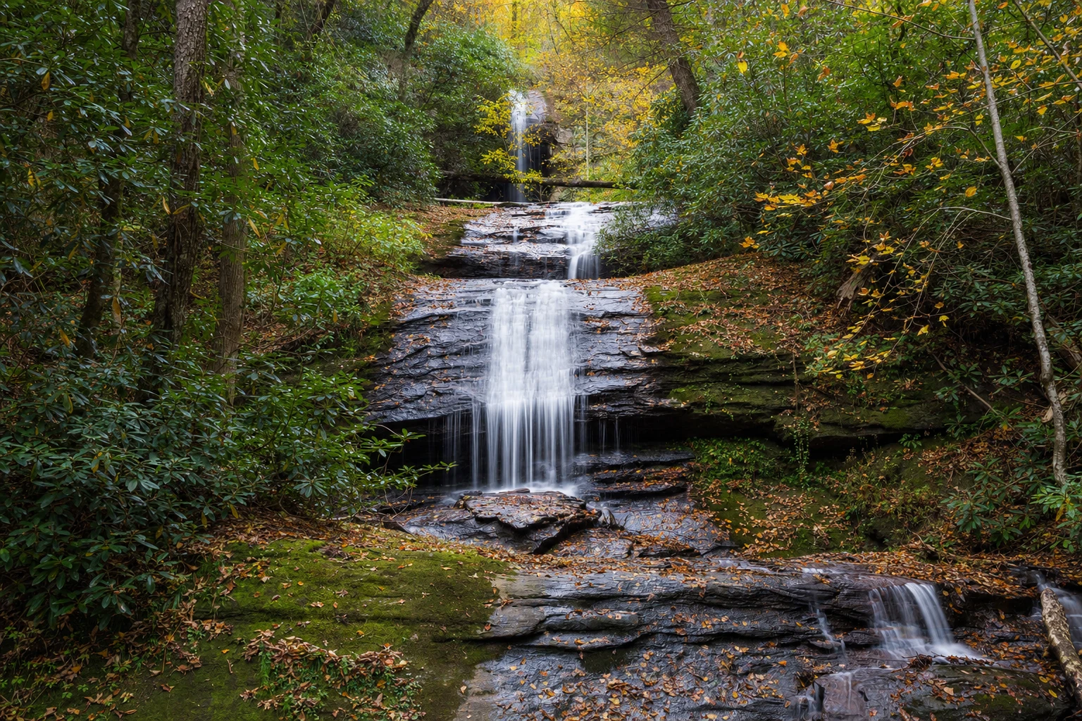
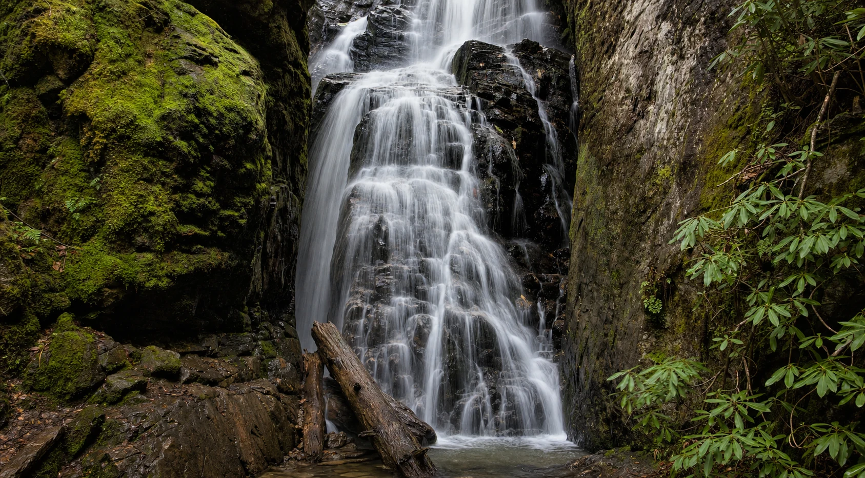
The Waterfalls: Upper and Lower DeSoto Falls
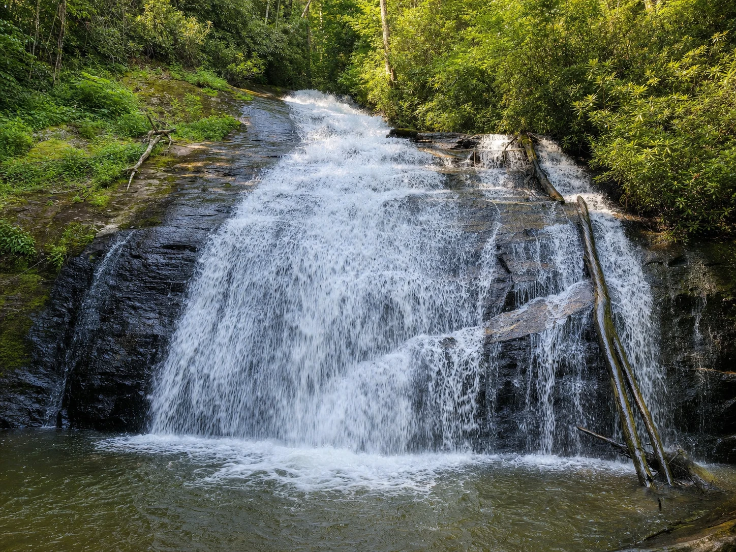
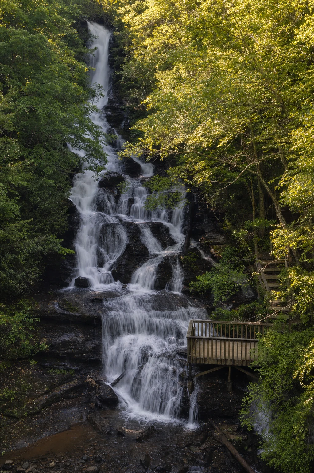
Lower DeSoto Falls drops about 20 feet over a sheer rock face into a pool ringed by boulders. It is pretty and intimate. Upper DeSoto Falls is the one that will stop you in your tracks. It drops 80 to 90 feet in multiple tiers down a granite wall, with a total cascade of nearly 200 feet. There is also a middle falls between the two, plus two more upstream.
Both falls have viewing platforms with benches. Lower Falls has a close-up feel, surrounded by lichen-covered rocks. Upper Falls is all about scale and power, especially after a good rain when the water roars. Spring storms bring the best water flow, and you might catch a rainbow in the mist. Summer flow is lighter, but the rock formations are worth seeing in any season.
Hiking Trails
The 2-mile out-and-back DeSoto Falls Trail is family-friendly, moderate with 200-300 feet elevation gain - kid- and dog-approved (leashed). Start at the brown-roofed kiosk in the gravel lot: Pass picnic areas, cross Frogtown Creek bridge, then fork left (0.25 miles uphill via switchbacks/stairs to Lower Falls platform) or right (0.75 miles gradual ridge climb through rhododendron/pine forest to Upper Falls deck).
Green blazes mark the shaded, rooty/rocky path - mostly flat near the creek, with mossy boulders and wildflowers in spring. Allow 1-2 hours; sturdy shoes essential for slippery spots. Extensions link to Helton Creek Falls or Blood Mountain on the Appalachian Trail.
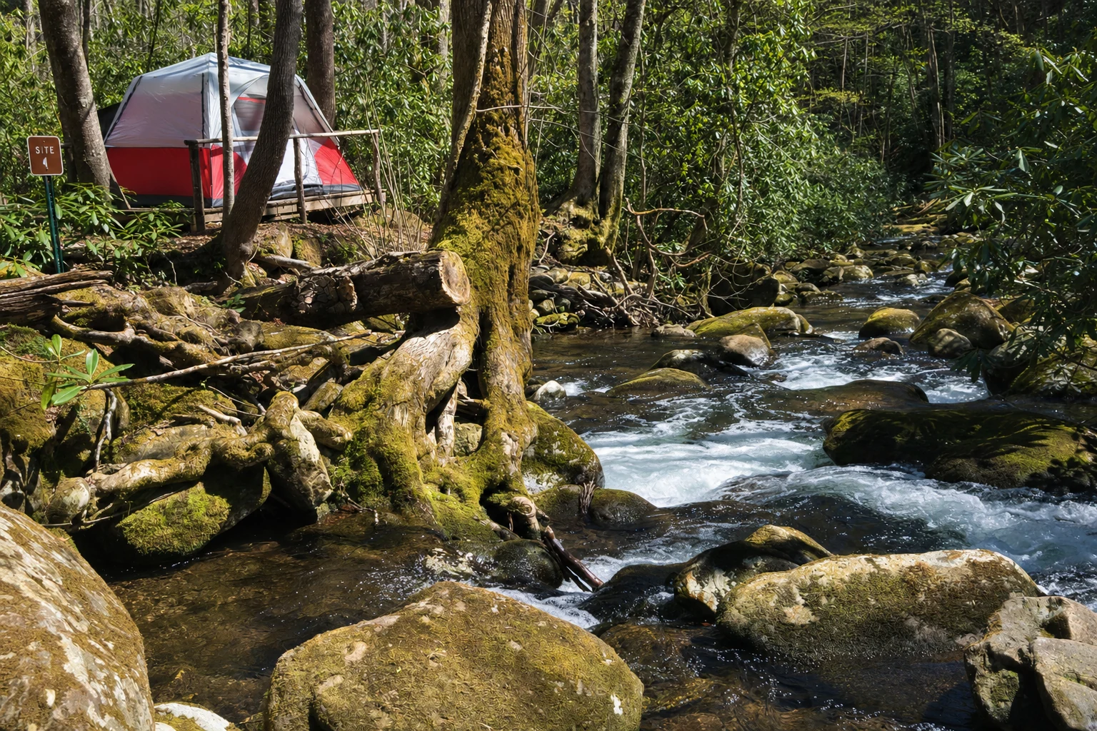
Camping Options
The 23-site campground sprawls in upper (B, 19 sites) and lower (A, 4 sites) loops along Frogtown Creek at 2,080 feet elevation, open year-round under dense canopy. Peak season (April 1-Oct 31): $20/night single, $40 double (Site 14); non-peak (Nov 1-Mar 31): $10/$20 - no water then. First-come sites or reserve via Recreation.gov (1-877-444-6777).
Creekside spots (#1-3 tents/RVs, #4-10 larger rigs/tents) feature picnic tables, grills, fire rings; vault toilets, drinking water (seasonal), trash service. No hookups/electricity - America the Beautiful Pass halves fees. Trout fishing stocked April-Labor Day by the Georgia DNR Wildlife Resources Division; quiet, shaded vibes with fall foliage fireworks.
Seasonal Considerations and Best Times to Visit
Spring (mid-April-late May) shines with heavy flow, wildflowers, rhododendrons blooming amid mild 50-70°F temps - post-rain magic. Summer heats to 80°F+; falls trickle, but creek wading/picnics thrive - hit early/late to dodge crowds/heat.
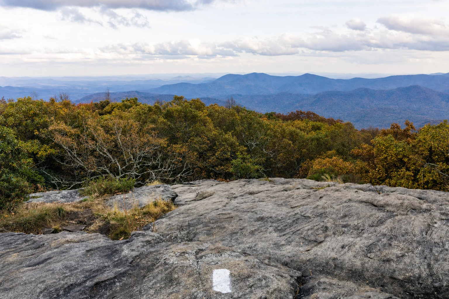
Fall (October) dazzles in red/orange/yellow under crisp 40-60°F air - peak color and fewer bugs. Winter delivers icy wonderland (30-50°F), fuller flows from rain/snow, but trails slick - microspikes advised; fewer visitors. Avoid midday summer; anytime post-rain boosts drama. Year-round open, but check weather - flash floods rare but possible.
Insider Tips and First-Person Visitor Perspectives
As a repeat visitor, I've stood mesmerized on the Upper Falls platform, mist kissing my face as the roar drowns out thoughts - pure reset button after Helen's bustle. Pack bug spray (summer gnats), rain gear, and headlamp for golden hour glow; picnic at creekside tables post-hike with creek trout fresh from the pan.
Pro move: Tackle Upper first (save energy), then Lower - steeper but shorter; kids love creek-crossing bridge views, spotting crayfish. Weekdays quieter than weekends; bring cash/coins for envelopes if app fails. "Trails rootsy - wear boots, not flips," one hiker notes; leashed dogs splash happily. Dip toes in pools (strong swimmers only), but platforms keep it safe - no cliff descents.
Practical Logistics
Parking/Accessibility: Compact lot fills fast - 20-30 cars max; no RV/trailer spots, overflow risky. Wheelchair-accessible to trailhead/bridge, but platforms/stairs limit falls views - uneven roots/grades beyond.
What to Bring: Sturdy shoes, water (1L/person), snacks/picnic, trash bag (pack-out), layers/poncho, sunscreen/hat, bug dope, camera/binocs. Kids: snacks/toys for energy dips; dogs: leash/poop bags/water. No concessions - stock up in Helen.
Safety: Stay on trails (cliffs slippery) and follow Leave No Trace principles, supervise kids near edges/creeks, check ticks/snakes (rare). Lightning? Seek car. Cell spotty - map/download offline.
Nearby Attractions and Connections to Helen/North Georgia
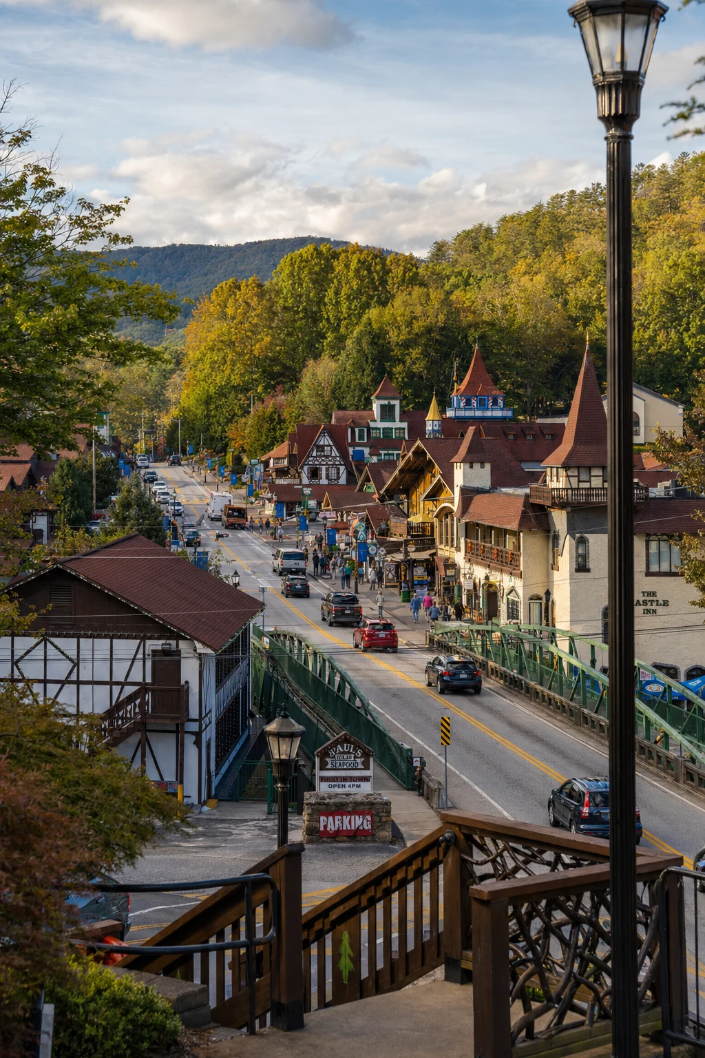
Just 30 minutes from Helen's Bavarian village, DeSoto pairs alpine charm with mountain wilds - hike here morning, beer garden afternoon.) Nearby: Helton Creek Falls (0.5-mile easy, double drops); Vogel State Park (Trahlyta Lake Trail waterfalls, lake views); Blood Mountain (Appalachian Trail vistas).
Dahlonega gold history 20 minutes south; Anna Ruby, Dukes Creek, Raven Cliff Falls cluster nearby for waterfall trifecta.) Blue Ridge Scenic Railway/Park 45 minutes north; tubing/kayaking on Chattahoochee River. DeSoto anchors North Georgia's "Waterfall Capital," blending Helen's tourist buzz with raw forest escape.)
DeSoto Falls is one of those places that feels just right, whether you come for the history, the waterfalls, or just a quiet afternoon by the creek. It is easy to get to, never feels as crowded as Anna Ruby, and the camping is about as peaceful as it gets in North Georgia.
Related Imagery from Around Helen