Dukes Creek Falls
A thundering 150-foot cascade plunging through layers of ancient rock into a forested gorge
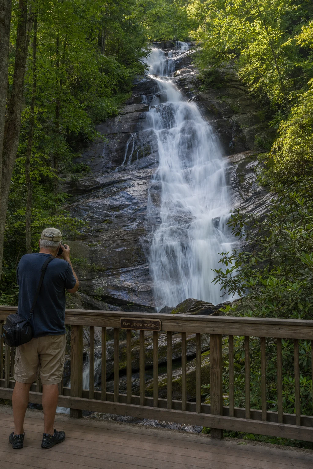
Dukes Creek Falls is one of the most visually dramatic waterfalls in the North Georgia mountains. Rather than a single sheer drop, this waterfall is a multi-tiered cascade - the water tumbles, slides, and plunges approximately 150 feet down a series of rock ledges into a deep, heavily forested gorge. The resulting spectacle is a wall of white water spread across a wide rock face, sending mist into the canopy and creating the kind of scene that makes northeast Georgia famous among waterfall chasers.
It is right off the Richard B. Russell Scenic Highway in the Chattahoochee National Forest, and for a waterfall this big, it is surprisingly easy to reach. The two-mile round trip trail has an ADA-accessible upper platform where you can see the falls without any steep hiking, plus a more challenging descent into the gorge for those who want to get closer. Either way, it is a genuinely impressive sight.
The Trail
Two miles of descending beauty to the gorge floor
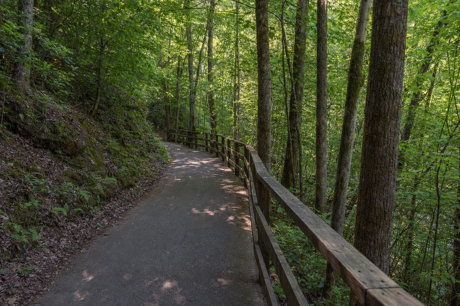
The Dukes Creek Falls trail begins at a well-maintained parking area and trailhead that includes restroom facilities and informational kiosks. The first section of the trail is a gentle, boardwalk-style path that leads to the upper observation platform. This ADA-accessible section offers a sweeping view of the falls and the surrounding gorge from above - a perfect spot for visitors who may not be able to complete the steeper descent.
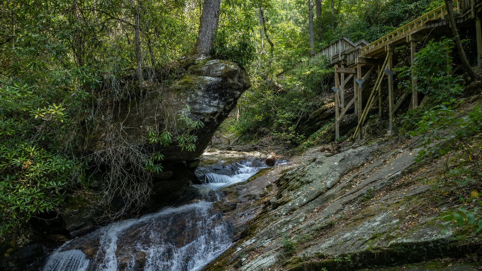
Beyond the upper platform, the trail begins its descent into the gorge via a combination of wooden steps, switchbacks, and natural terrain. The path winds through a dense corridor of rhododendron and mountain laurel, with massive hemlock and hardwood trees towering overhead. The air grows noticeably cooler and more humid as you descend, and the sound of the falls grows increasingly powerful.
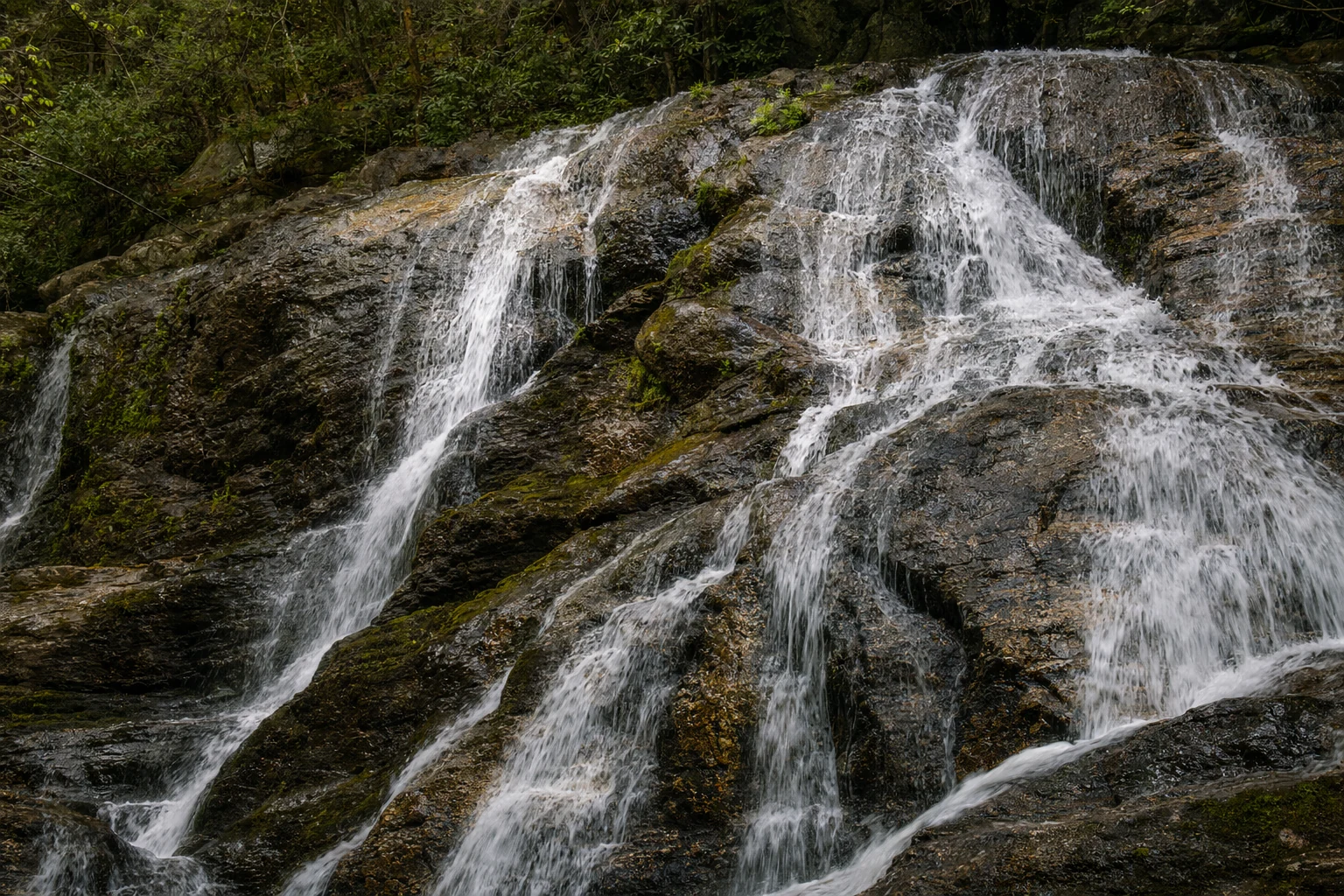
Multiple observation points along the descent offer different perspectives of the falls. Each platform reveals a new angle - the upper tiers, the main cascade, the misty pool at the base. The lowest viewpoint brings you close enough to feel the spray on your face and hear the deep rumble of water striking rock. The return hike back up is the most physically demanding part of the trip, as you regain all 340 feet of elevation on the climb out.
Natural Setting
A gorge of ancient stone and old-growth forest
The gorge carved by Dukes Creek is a microclimate unto itself. The steep, shaded walls trap moisture and cool air, creating conditions that support plant species more commonly found much farther north. Massive rhododendron thickets - some with trunks as thick as small trees - form a nearly continuous canopy along the creek. In late May and early June, these shrubs erupt in white and pink blossoms that rival any garden display.
The forest floor is carpeted with mosses, ferns, and wildflowers. Spring brings displays of trillium, violets, and foam flower among the rocks. In autumn, the hardwood canopy above transforms into a dome of amber, crimson, and gold, framing the white water of the falls in a spectacular seasonal display. Even in winter, when the deciduous trees are bare, the evergreen rhododendron and the frozen cascades create a hauntingly beautiful scene.
Wildlife is abundant in the gorge. Pileated woodpeckers hammer on dead trees, wood thrushes sing their flute-like songs in the understory, and salamanders - some found nowhere else on Earth - hide under rocks along the creek. The southern Appalachians are often called the "salamander capital of the world," and this moist, cool gorge is prime habitat for these elusive amphibians.
Photo Gallery
Views of the cascade, trail, and surrounding forest
The 150-foot multi-tiered cascade of Dukes Creek Falls
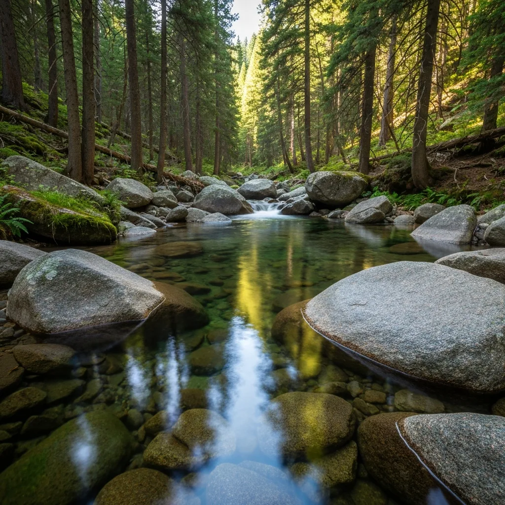
Dukes Creek winds through a lush mountain gorge
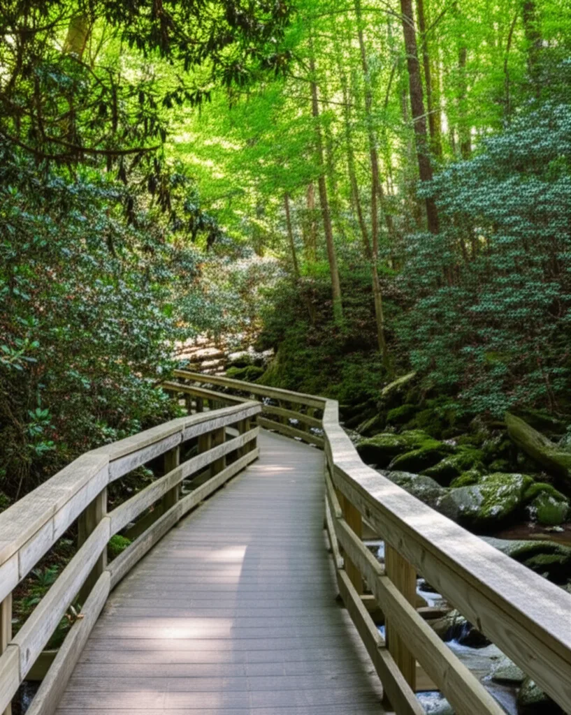
The trail descends through tunnels of rhododendron
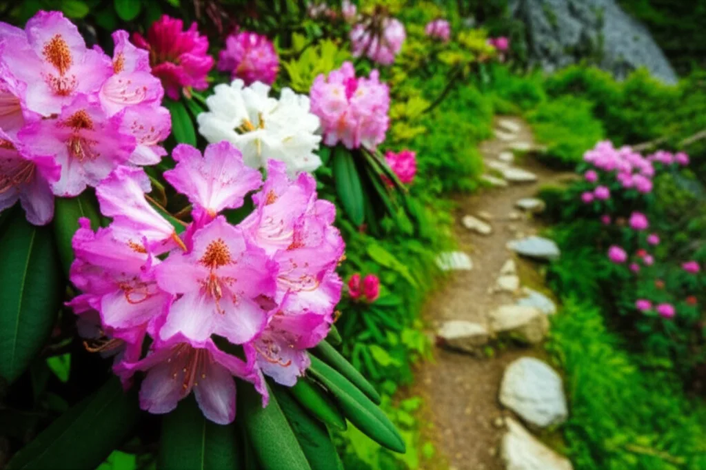
Late spring rhododendron blooms along the trail
Ancient hardwoods shade the trail throughout
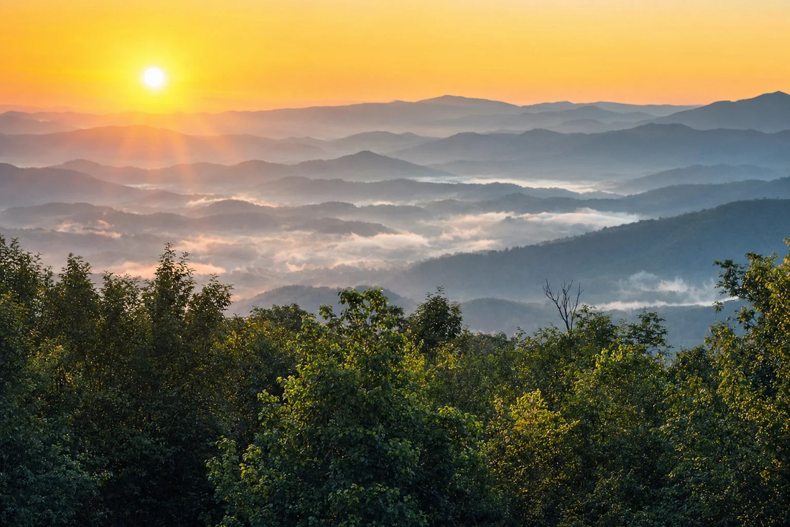
Ridgeline views from the upper observation platform
Visitor Tips
Make the most of your Dukes Creek Falls visit
Start from the Top
The trail descends to the falls, meaning the return is all uphill. Pace yourself going down and save energy for the climb back. The 340 feet of elevation gain is concentrated in the final half-mile.
Bring a Tripod
The observation platforms are perfect for photography. A tripod allows long-exposure shots that capture the silky flow of the multi-tiered cascade. Morning light is especially beautiful.
Watch the Steps
The wooden steps can be slippery when wet, especially near the lower overlooks where mist from the falls keeps surfaces damp. Use the handrails and wear shoes with good traction.
Combine with Scenic Drive
The Richard B. Russell Scenic Highway is one of Georgia's most beautiful drives. Combine your waterfall visit with a leisurely drive along the ridgeline for panoramic mountain views.
Getting There
A scenic drive from Helen or Cleveland
From Helen, take GA-75 south to GA-75 Alternate, then continue to the Richard B. Russell Scenic Highway (GA-348). The trailhead parking area is approximately 2 miles along GA-348 on the left. The total drive from Helen is about 15 minutes. From Cleveland, take US-129 north to the intersection with GA-348 and turn left - the trailhead is about 2 miles on the right. A $5 daily parking fee applies (annual passes and America the Beautiful passes accepted). The parking area has restroom facilities.
Trail Details at a Glance
Key stats for planning your hike
2.0 mi
Round Trip Distance
340 ft
Elevation Change
1.5–2.5 hrs
Typical Completion Time
The trail is managed by the U.S. Forest Service as part of the Chattahoochee National Forest. The route is classified as moderate difficulty primarily because of the return climb - the descent to the falls is gentle, but you regain all 340 feet of elevation on the way back. The trail surface alternates between improved boardwalk sections with handrails and natural packed-earth paths. GPS coordinates for the trailhead are approximately 34.7058° N, 83.8961° W along GA-348 (Richard B. Russell Scenic Highway).
What to Expect by Season
Every season offers a different spectacle
Spring (March – May)
Peak water volume from spring rains and snowmelt creates the most dramatic cascade. Wildflowers - trillium, violets, and foam flower - carpet the forest floor. Rhododendron blooms appear in late May. Temperatures along the trail hover in the 50s–60s°F, noticeably cooler in the gorge.
Summer (June – August)
The dense canopy provides welcome shade, keeping the gorge 10–15 degrees cooler than downtown Helen. Afternoon thunderstorms are common - start your hike before noon. The falls run lower but the lush greenery and rhododendron tunnels are at their fullest.
Autumn (September – November)
Peak fall foliage typically arrives mid-to-late October at this elevation. The contrast of white cascading water framed by crimson and gold hardwoods makes this the premier season for photography. Cooler temperatures and lower humidity make for ideal hiking conditions.
Winter (December – February)
Bare deciduous trees reveal expanded views of the gorge and cascades. During freezing events, spectacular ice formations build along the rock face. Crowds are thinnest in winter, offering a peaceful, meditative experience. Watch for icy steps on the boardwalks.
Nearby Waterfalls
Three of Georgia's finest falls within a 20-minute drive
The mountains around Helen contain one of the densest concentrations of waterfalls in the Southeast. Dukes Creek Falls is an ideal starting point for a day of waterfall exploration, with two other spectacular falls nearby. For a full tour, see our complete Helen waterfall guide or read up on waterfall viewing during peak fall foliage.