Tray Mountain Guide
One of the highest Appalachian Trail summits in Georgia, with panoramic ridge views and wildflowers
Guide to Tray Mountain, Georgia: Hiking the Appalachian Trail Section, Panoramic Views, Wildflowers, and One of North Georgia's Highest Peaks
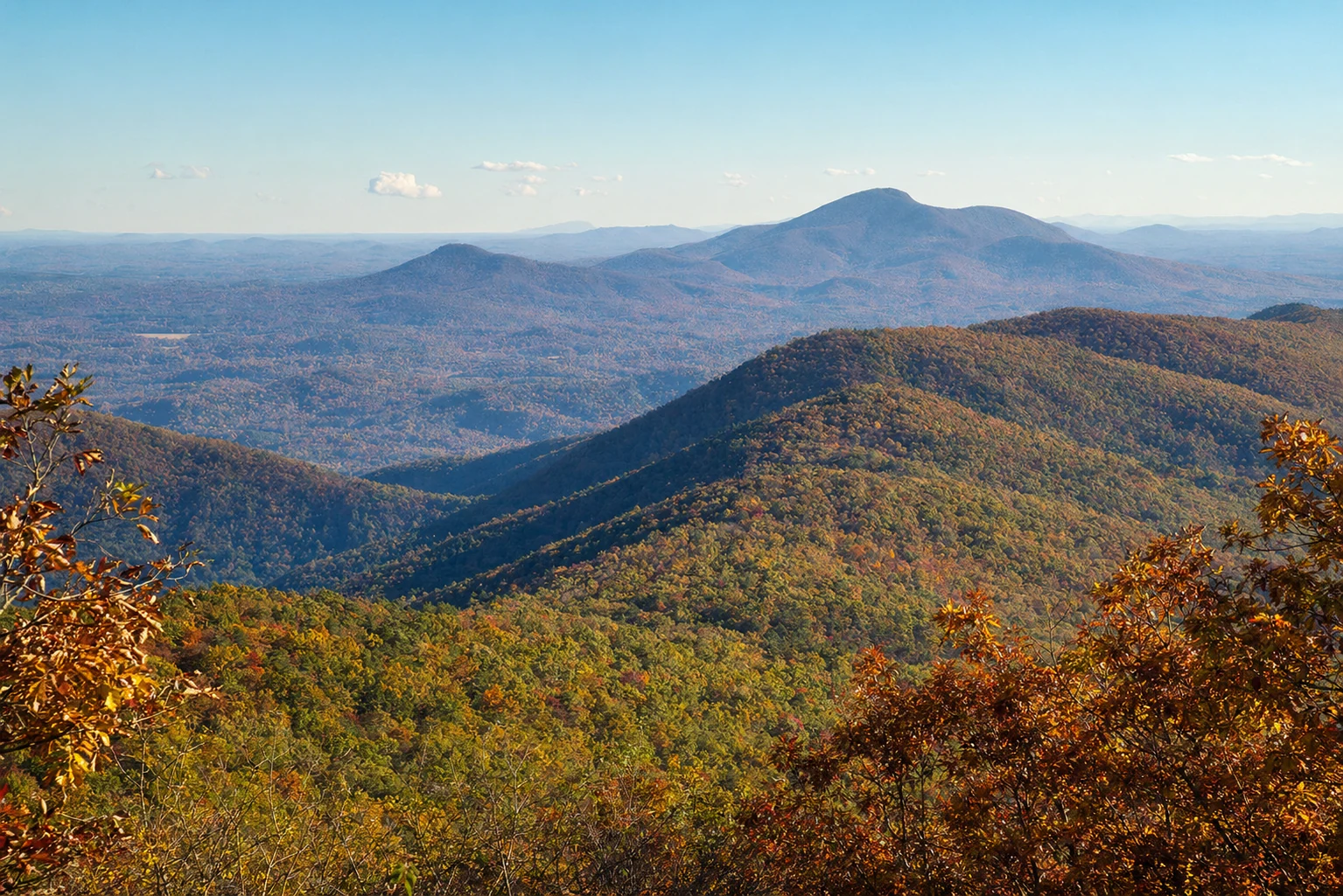
Tray Mountain, at 4,430 feet, is one of the best summit hikes you can do from Helen. It's the seventh-highest peak in Georgia and sits within the Tray Mountain Wilderness Area of the Chattahoochee National Forest, right on the Appalachian Trail. The views from the top are among the best on the entire Georgia AT, and many experienced hikers rate them higher than Blood Mountain's. You'll also find wildflowers along the trail in season and the kind of quiet you don't get on busier peaks.
Understanding Tray Mountain and Its Significance
Tray Mountain is a geographic and cultural landmark in the North Georgia mountains. The mountain's name likely derives from "Trail Mountain," named for the numerous trails that traverse its slopes. The peak straddles the boundary between White and Towns counties, though the summit itself lies in Towns County. The mountain's commanding 4,430-foot elevation places it on the exclusive list of Georgia's highest peaks and makes it a beacon visible for miles across the Blue Ridge region.
Tray Mountain is one of the most popular summits on the Appalachian Trail in Georgia, and for good reason. From the windswept summit, hikers enjoy southerly views overlooking Hickory Knob in the near distance, Unicoi State Park in the mid-distance, and the charming Alpine village of Helen visible near the horizon. Clear-day panoramic vistas extend to include Lake Chatuge, the Anna Ruby Falls valley, the iconic Yonah Mountain, and sweeping views of the Nantahala Mountains in North Carolina and the Georgia Blue Ridge. On exceptionally clear days, some claim that Kennesaw Mountain and Stone Mountain are visible from the summit - though these sightings are rare and depend on atmospheric clarity.
Access Routes and Getting There
The easiest and most popular approach to Tray Mountain comes from Indian Grave Gap, offering a more manageable 5-mile roundtrip hike compared to the longer routes. To reach Indian Grave Gap, follow Georgia Highway 75 north from Helen for approximately 10 miles. Once at the trailhead, parking is available at a gravel lot, though space can fill quickly during peak seasons in spring and fall.
For those seeking a more ambitious adventure, the 10-mile roundtrip route beginning at Unicoi Gap on Georgia Highway 75 provides access to Tray Mountain via Rocky Mountain (4,016 feet), offering two summits and significantly more elevation gain - approximately 6,600 feet of combined climbing and descending. This route crosses the source of the Hiwassee River, proceeds through Indian Grave Gap with its distinctive "hanging valleys," and presents a classic but strenuous Georgia mountain experience.
A third option - the shortest route - departs from Tray Gap via Forest Service Road 79 (Tray Mountain Road). From Helen, drive north on Georgia 17/75, then turn right onto Forest Service Road 79 and follow it approximately 9 miles to Tray Gap parking area. This approach covers just 1.6 miles roundtrip with 600 feet of elevation gain, making it ideal for families with children or those with limited time. However, this remote trailhead can be challenging to access in winter or wet conditions, and the narrow gravel road requires careful driving.
Parking Details and Logistics
Parking at Unicoi Gap and Indian Grave Gap (on the north AT crossing) is free and available on a first-come, first-served basis, with spaces for 20-plus vehicles. During peak weekends in spring (April-May) and fall (October), these lots frequently fill by mid-morning. For the most reliable parking experience, arrive before 8 a.m. or consider hiking on weekdays when crowds are significantly lighter.
Tray Gap parking is also free but primitive, with room for a handful of vehicles. No amenities exist at any of these trailheads, so plan accordingly with adequate water, snacks, and supplies for your entire hike.
The Appalachian Trail Experience
The section of the Appalachian Trail crossing Tray Mountain is renowned for its distinctive character and natural beauty. Hikers often describe this stretch as medieval-looking, with moss-lined paths, old stone steps, and archways formed by twisted laurel and rhododendron branches. The white blazes marking the Appalachian Trail guide you through this enchanting landscape with rectangular paint marks on trees and rocks.
The Indian Grave Gap to Tray Mountain Route
From Indian Grave Gap trailhead, the hike immediately begins climbing eastbound on the white-blazed AT. Dense groves of gnarled rhododendron and mountain laurel frame the path, while vibrant green mosses and ferns blanket the forest floor in the dappled shade. At roughly three-quarters of a mile, the trail crosses a gravel road and ascends a wooden staircase through a particularly dense laurel thicket.
The first significant landmark comes at 1 mile, where a large grassy campsite marks the junction with a blue-blazed side trail leading to High Shoals Creek. (This creek connects to the spectacular High Shoals Falls, worth investigating on a separate adventure.) The AT then ascends a ridge through sun-dappled hardwoods dotted with wildflowers during warm-weather months.
At 1.5 miles, hikers reach a campsite with an excellent overlook providing a dramatic preview of Tray Mountain's rocky peak. The trail enters Tray Gap at 1.7 miles, crossing a gravel road and officially entering the designated Tray Mountain Wilderness Area. This crossing marks a psychological shift - beyond Tray Gap, you're truly in remote backcountry far from human habitation.
The final push to the summit begins immediately, with steep switchbacks ascending through increasingly challenging terrain. At 2.5 miles, the trail summits Tray Mountain, reaching the 4,430-foot rocky pinnacle with extraordinary views extending in all directions. The descent retraces the same route, making this an out-and-back adventure totaling approximately 5 miles.
Wildflowers and Seasonal Flora
The wildflowers on Tray Mountain change with the seasons, and the displays can be impressive from spring through late summer. The diverse flora reflects the mountain's elevation range, from lower creek valleys to high-altitude summit areas, creating distinct ecological zones with different blooming periods.
Spring Wildflowers (March-May)
Spring represents peak wildflower season on Tray Mountain, with blooming beginning in earnest by mid-April. The mountain's extensive mountain laurel and rhododendron thickets explode into color, with dense groves of pink, white, and deep purple blossoms creating tunnel-like passages along the trail. Mountain laurel typically blooms May through late June, ushering in the summer season.
Beyond the laurel and rhododendron displays, the forest floor comes alive with spring ephemerals - flowers that bloom and set seed before tree canopy leafing fully blocks out sunlight. Look for trillium species (the park region supports multiple varieties), lady slipper orchids, showy orchis, crested dwarf iris, fire pink, columbine, bleeding heart, jack-in-the-pulpit, violets, and Virginia bluebells. Peak spring blooming typically peaks in mid-to-late April, making late April through early May the ideal window for wildflower enthusiasts.
Summer Wildflowers (June-August)
As spring ephemerals fade, summer wildflowers emerge to sustain color through the hotter months. Look for brilliant red cardinal flowers, pink turtleheads, Turk's cap lilies, small purple-fringed orchids, bee-balm, butterfly-weed, black-eyed susans, and jewel weed. By late summer, goldenrod, wide-leaved sunflowers, tall ironweed, mountain gentian, and numerous aster varieties add their hues to the mountain landscape.
Practical Hiking Considerations
Difficulty and Physical Demands
The Indian Grave Gap to Tray Mountain route (5 miles roundtrip) is considered moderate to moderately strenuous, with 1,250 feet of elevation gain. The steady climbing, exposed sections with cable handholds on steeper pitches, and high-altitude exposure create a hike suitable for those with regular hiking experience and decent fitness levels.
The Unicoi Gap route (10 miles roundtrip) is more strenuous, with 6,600 feet of combined elevation change and nearly continuous climbing to Rocky Mountain. This hike requires good cardiovascular fitness and mountain hiking experience.
The Tray Gap route (1.6 miles roundtrip) is short and steep but manageable for most hikers with moderate fitness.
What to Bring
Water: Carry at least 2-3 liters. Water sources exist at established campsites along the trail, but reliability varies by season.
Best Times to Visit
Spring (April-May)
Spring combines ideal hiking weather, abundant wildflower displays, and manageable crowds compared to peak fall season. Late April through early May offers the sweet spot for wildflower viewing while avoiding the heaviest tourist traffic.
Fall (September-October)
Peak autumn foliage season (late September through mid-October) brings exceptional visibility, crisp clear days, and some of the year's most spectacular panoramic views from the summit. However, expect significantly crowded parking areas and trails during this period, particularly on weekends. Plan for early starts and consider weekday hiking if possible.
Summer (June-August)
Summer provides warm, generally stable weather, though afternoon thunderstorms are common and create genuine lightning hazards at exposed high elevations. Start hikes early to be off the mountain well before typical 3-4 p.m. afternoon storm arrival times. The lush green landscape is beautiful, though wildflower displays are reduced compared to spring.
Connection to Helen and Broader North Georgia Recreation
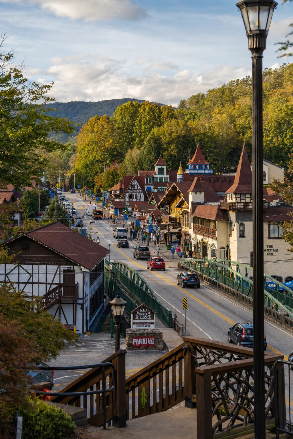
Tray Mountain sits approximately 10-15 miles north of Helen, Georgia, making it easily accessible from this popular mountain village. Helen's Alpine architecture, charming downtown shops, restaurants, and accommodations make it an ideal base for exploring Tray Mountain and surrounding attractions.
Nearby Attractions and Extended Trip Possibilities
Unicoi State Park: Just south of the Tray Mountain Appalachian Trail access points, Unicoi State Park (address: 2098 GA-356, Helen, GA 30545; phone: 706-878-2201) offers 1,050 acres with camping, cabins, four hiking trails ranging from 0.8 to 4.8 miles, and scenic Smith Lake. The park is open 7 a.m. to 10 p.m. year-round, with a $5 per vehicle day-use fee (or $50 annual pass). The Visitor Center hours vary seasonally but typically operate Sunday-Thursday 10 a.m.–5 p.m. and Friday-Saturday 10 a.m.–6 p.m.
Anna Ruby Falls: Located within the Chattahoochee National Forest but accessed through Unicoi State Park, Anna Ruby Falls is one of North Georgia's premier waterfall destinations. A spectacular paved 0.9-mile roundtrip trail leads to a rare pair of twin waterfalls cascading in tandem. The area includes a visitor center with gifts, educational items, and local crafts, picnic facilities, and restrooms. The Smith Creek Foot Trail connects Anna Ruby Falls to Unicoi State Park Campground via a 4.6-mile hike, offering multi-destination adventure options. Access is only through Unicoi State Park, requiring the $5 parking fee, plus a separate entrance fee for the Anna Ruby Falls parking area.
Helen, Georgia Downtown: Alpine Helen's charming downtown features restaurants, breweries, shops, and Bavarian-themed architecture. The town sits on the Chattahoochee River, with tubing and paddling opportunities. It's an excellent place for pre- or post-hike meals, supplies, and lodging.
Brasstown Bald: Georgia's highest peak at 4,784 feet, Brasstown Bald lies approximately 40 minutes southwest of Tray Mountain. A visitor center and observation tower at the summit provide 360-degree views on clear days, with parking and facilities making it accessible to those unable to hike the steep 1.5-mile trail from the parking area.
Insider Tips and Visitor Perspective Details
Timing Your Visit
If summiting Tray Mountain is your goal, aim to start hiking from either Unicoi Gap or Indian Grave Gap no later than 8 a.m. This ensures adequate daylight for the return journey, provides a safety margin for unexpected delays, and increases your chances of finding parking. On popular days, parking lots fill by 10-11 a.m., and latecomers may be turned away.
The Cheese Factory Campsite
The nickname "Cheese Factory" for a large grassy campsite at approximately 3.5 miles on the Unicoi Gap route comes from its history as a 1800s dairy operation. While little evidence of the original structure remains, this generously-sized grassy area offers excellent camping for those attempting an overnight adventure and provides a nice lunch stop for day hikers.
Water Management
While the AT crosses several small springs, particularly near established campsites, water availability can be unpredictable outside peak season. Carry adequate water for your entire planned hike rather than relying on finding natural sources, particularly during late summer through early spring periods when springs may run dry.
Planning Your Visit: Checklist and Final Considerations
Check Weather: Review forecast before committing to your date; avoid summit hikes during thunderstorm predictions.
Verify Access: Confirm that Tray Gap road access is passable if that's your intended route (particularly in winter).
Gather Maps: Obtain official Appalachian Trail maps before hiking.
Notify Someone: Leave detailed hiking plans and expected return time with someone.
Start Early: Aim for 7-8 a.m. departures for good parking and adequate daylight.
Pack Properly: Bring more water, snacks, and layers than you think necessary.
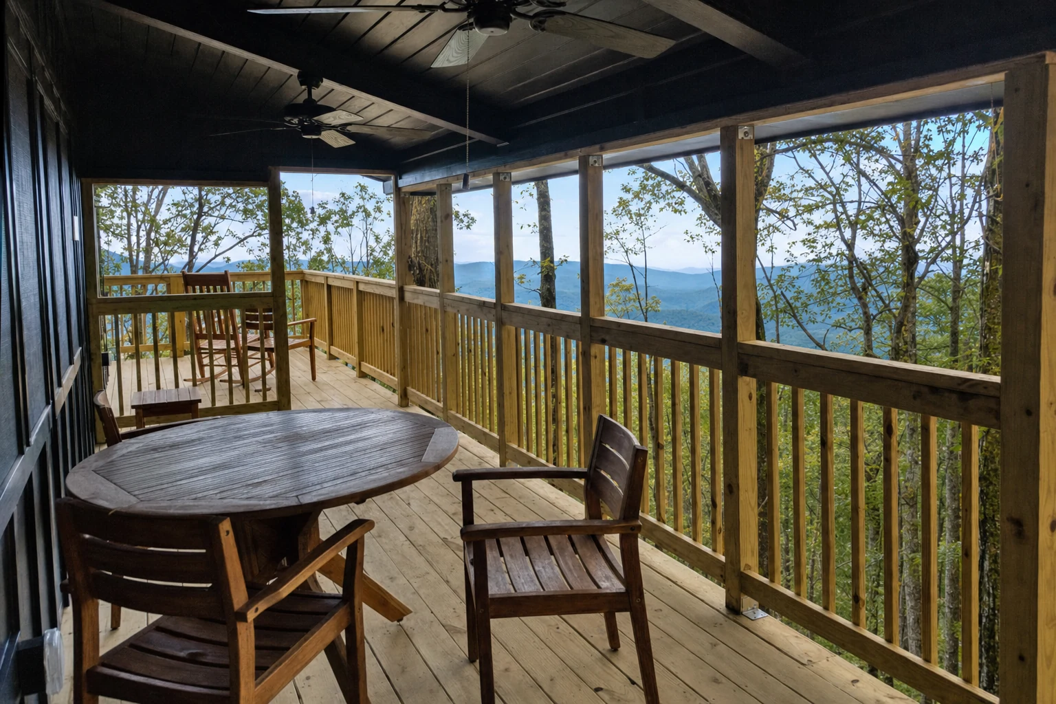
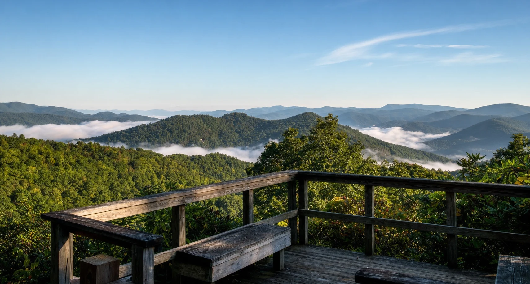
Related Imagery from Around Helen