Fort Mountain State Park: An Exhaustive Guide to the Archaeological Mysteries, Cherokee Legends, and Recreational Wilderness of the North Georgia Cohuttas
A mysterious ancient stone wall, a mountain-top lake, and miles of Cohutta Wilderness trails
Key Points
Archaeological Significance: The park is named for an ancient, zigzagging stone wall, approximately 855 to 885 feet long, located at the summit. Its origins remain debated, with theories ranging from ceremonial Middle Woodland construction (500 AD–1500 AD) to fortifications against pre-Columbian adversaries.
Mythology and Folklore: The site is central to the legend of the "Moon-eyed people" - a race of light-skinned, nocturnal inhabitants allegedly driven out by the Cherokee - and the controversial theory of Welsh Prince Madoc’s 12th-century exploration.
Geographic Context and Logistics for Helen Visitors
Location and Topography
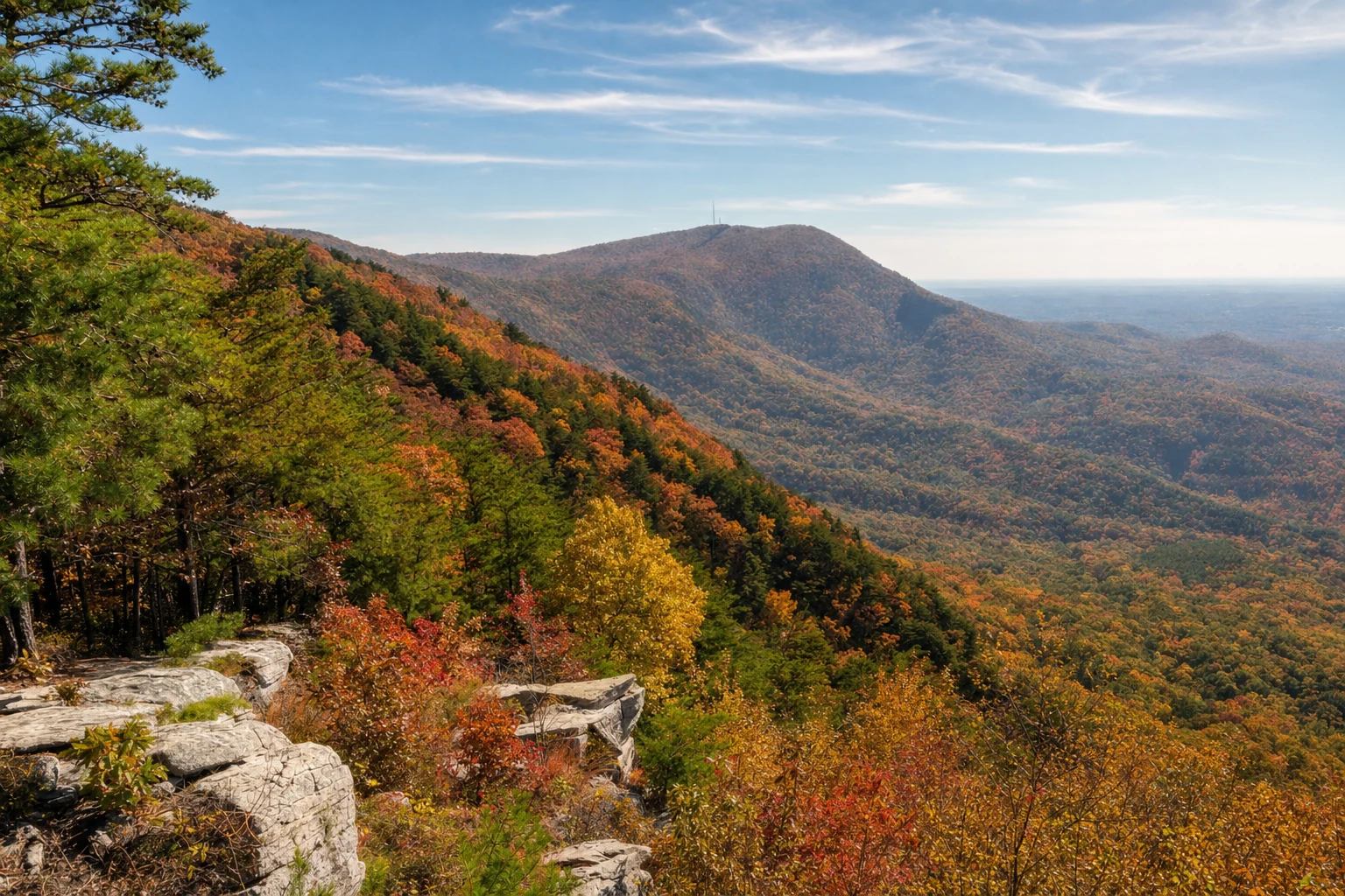
Fort Mountain State Park covers about 3,712 acres at the southwestern end of the Cohutta Mountains. At 2,850 feet elevation, you can see where the Appalachian Mountains give way to the Piedmont and Valley and Ridge regions to the south. It is managed by Georgia State Parks.
The Drive from Helen, GA
Getting to Fort Mountain from Helen takes you across the North Georgia highlands, from the eastern Blue Ridge over to the western Cohuttas. It is a great drive.
Route: The most direct and scenic route involves traveling west on GA-75/GA-11, connecting to GA-52. The drive typically routes through Dahlonega and Ellijay before ascending the steep gradients of Fort Mountain.
Distance and Time: The distance is approximately 67 to 91 miles, depending on the specific route taken (scenic vs. highway). The drive time is generally estimated between 1 hour 40 minutes and 2 hours 15 minutes.
Scenic Highlights: The drive along Highway 52 (often called the Cohutta-Chattahoochee Scenic Byway) is noted for its twists, curves, and panoramic views, particularly as one approaches the park entrance from Ellijay.
The Archaeological Enigma: The Ancient Stone Wall
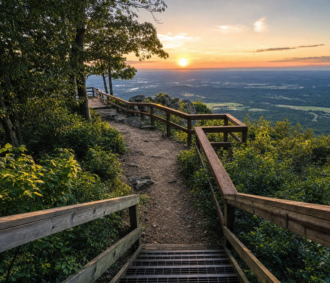
The main reason people make the drive is the ancient stone wall that zigzags along the mountainside near the summit. Nobody knows for certain who built it or why. After more than a century of study and speculation, it is still one of Georgia's biggest archaeological puzzles.
Physical Description and Dimensions
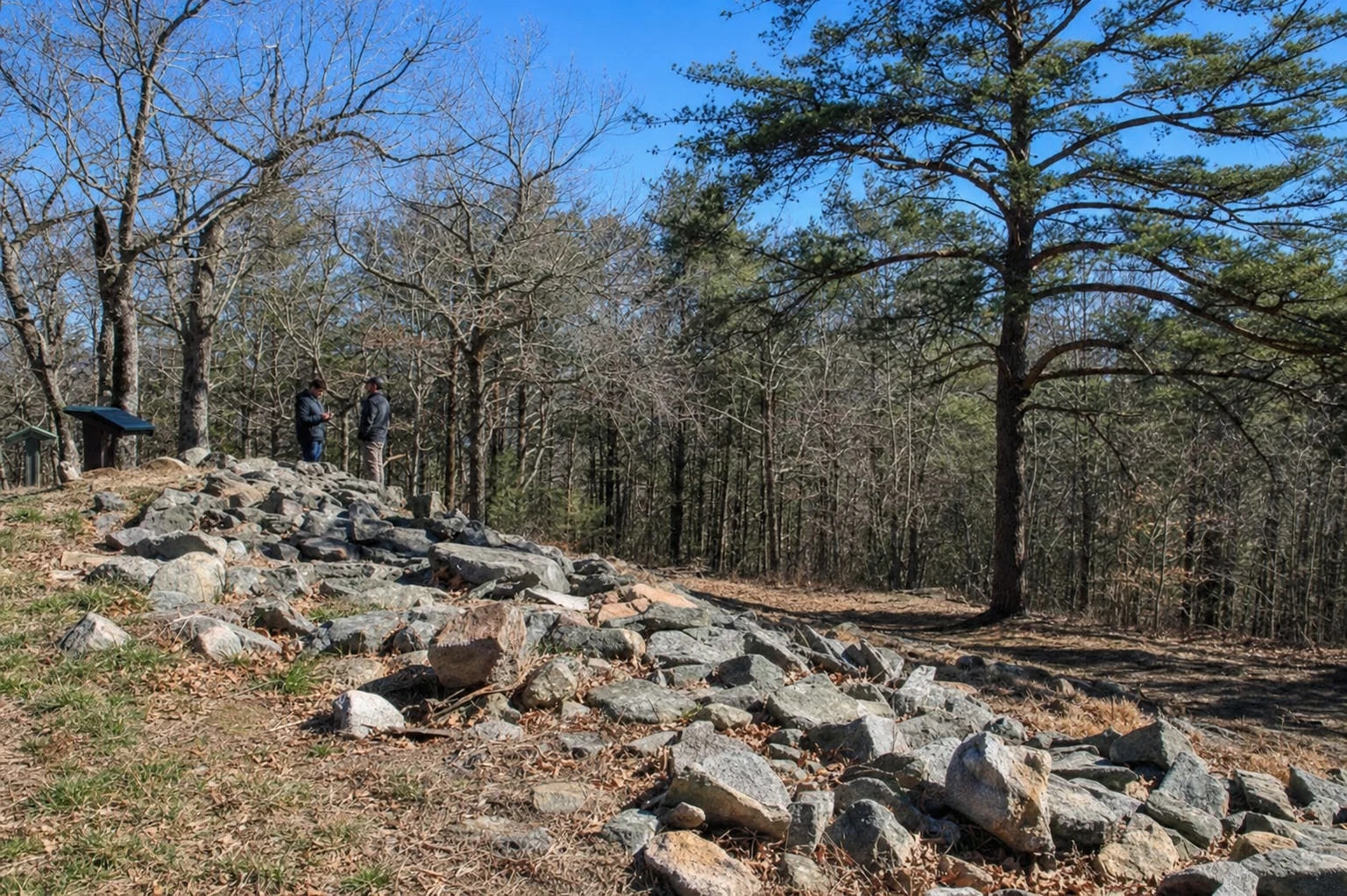
The wall does not enclose the summit entirely but rather guards the southern and eastern approaches.
Length: Sources vary slightly on the exact length, citing it as either 855 feet or 885 feet.
Composition: The structure is a dry-masonry wall built from local metamorphic stones (mica schist and gneiss) gathered from the immediate summit area.
Architecture: It follows a zigzag or serpentine pattern. The walls vary in height, currently standing between 2 and 6 feet, though they were likely higher before stone robbing and erosion occurred. The base thickness can reach up to 12 feet.
Associated Features: The wall is not merely a barrier; it contains distinct features including 19 to 29 pits (some described as "foxholes" or ceremonial pits), cairns, and the ruins of a gateway.
Theories of Origin
#### The Ceremonial Theory (Middle Woodland Period)
Most academic archaeologists and historians lean toward the theory that the wall was constructed during the Middle Woodland period (approximately 100 BCE to 500 CE) or perhaps as late as 1500 CE. The layout lacks essential military characteristics; crucially, there is no water source within the perimeter, and the wall is relatively low, making it poor for prolonged siege defense. This suggests a ceremonial or astronomical function, potentially related to seasonal solstices, similar to other stone structures in the Southeast.
#### The De Soto Hypothesis
Early 20th-century theories speculated that Spanish Conquistador Hernando de Soto constructed the wall around 1540 as a defense against the Creek Indians while searching for gold. This theory has been largely discredited by modern historians, who note that De Soto’s expedition was in the area for less than two weeks - insufficient time to construct such a massive lithic structure.
Ethnohistory and Folklore: The Cherokee and the Moon-Eyed People
The mystery of Fort Mountain is deeply entwined with Cherokee oral tradition and later European settler myths.
The Moon-Eyed People
According to Cherokee lore, the wall was not built by their ancestors but by a preceding race known as the "Moon-eyed people" (Yunwi Tsunsdi).
Characteristics: These people were described as small, bearded, pale-skinned, and having large blue eyes that were extremely sensitive to sunlight. Consequently, they were nocturnal, seeing better at night than during the day.
The Conflict: Legends state that the Cherokee (or in some versions, the Creek) waged war against this race, eventually driving them out of the Appalachians during a full moon when the Moon-eyed people were blinded by the light.
Interpretations: Some ethnographers suggest this legend may refer to a specific albino group or a distinct indigenous tribe with different physical characteristics. Others view it as a mythological explanation for pre-Cherokee ruins found in the region.
The Prince Madoc Legend
A persistent, though historically unsubstantiated, theory links the Moon-eyed people to Prince Madoc ab Owain Gwynedd of Wales.
The Legend: It is claimed that Madoc sailed to America in 1170, centuries before Columbus, and established colonies in the Southeast. The stone fortifications at Fort Mountain (and similar structures in Tennessee/Alabama) are attributed by proponents of this theory to these Welsh settlers.
Status: While a plaque at the park once mentioned the Madoc legend, it has been removed or modified as academic consensus finds no archaeological evidence to support a 12th-century Welsh presence in Georgia.
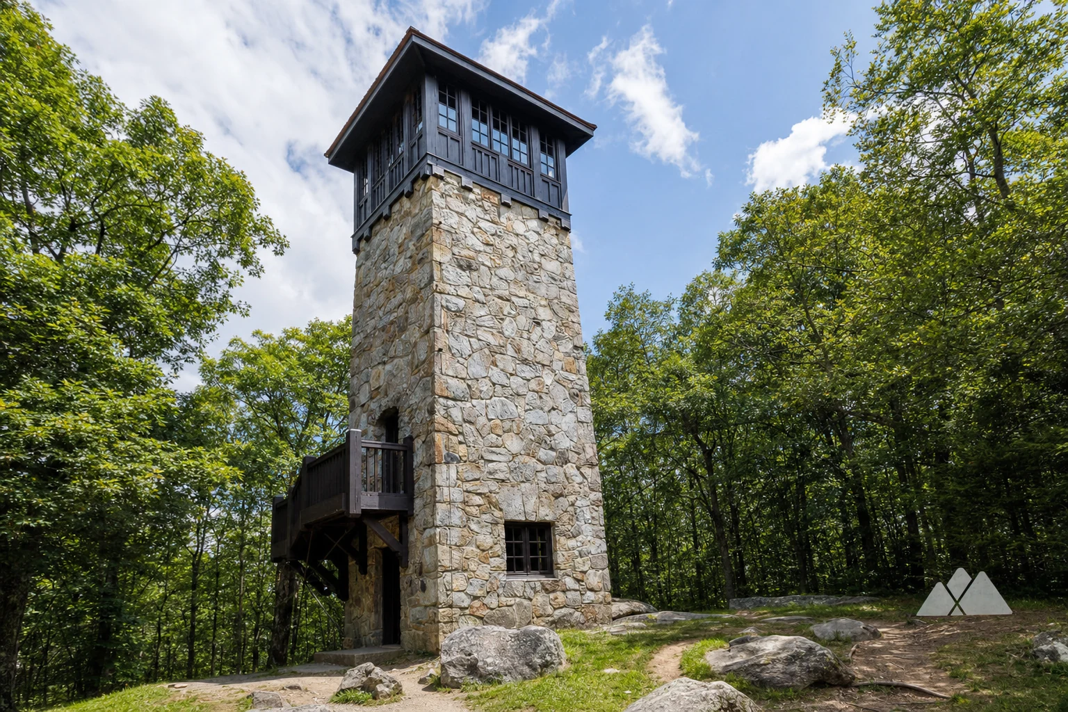
The Civilian Conservation Corps (CCC) Legacy
Beyond ancient history, Fort Mountain is a monument to the New Deal era. The Civilian Conservation Corps (CCC), specifically Company 468 (SP-6), developed the park’s infrastructure in the 1930s.
The Stone Fire Tower
Standing at the summit near the ancient wall is a four-story stone fire lookout tower built by the CCC between 1934 and 1935.
Function: It served as a fire lookout until the 1960s, allowing rangers to spot smoke up to 40 miles away.
Restoration: After the wooden cupola burned in 1971, the tower sat in disrepair until a major restoration project was completed in 2015-2016, returning it to its former glory.
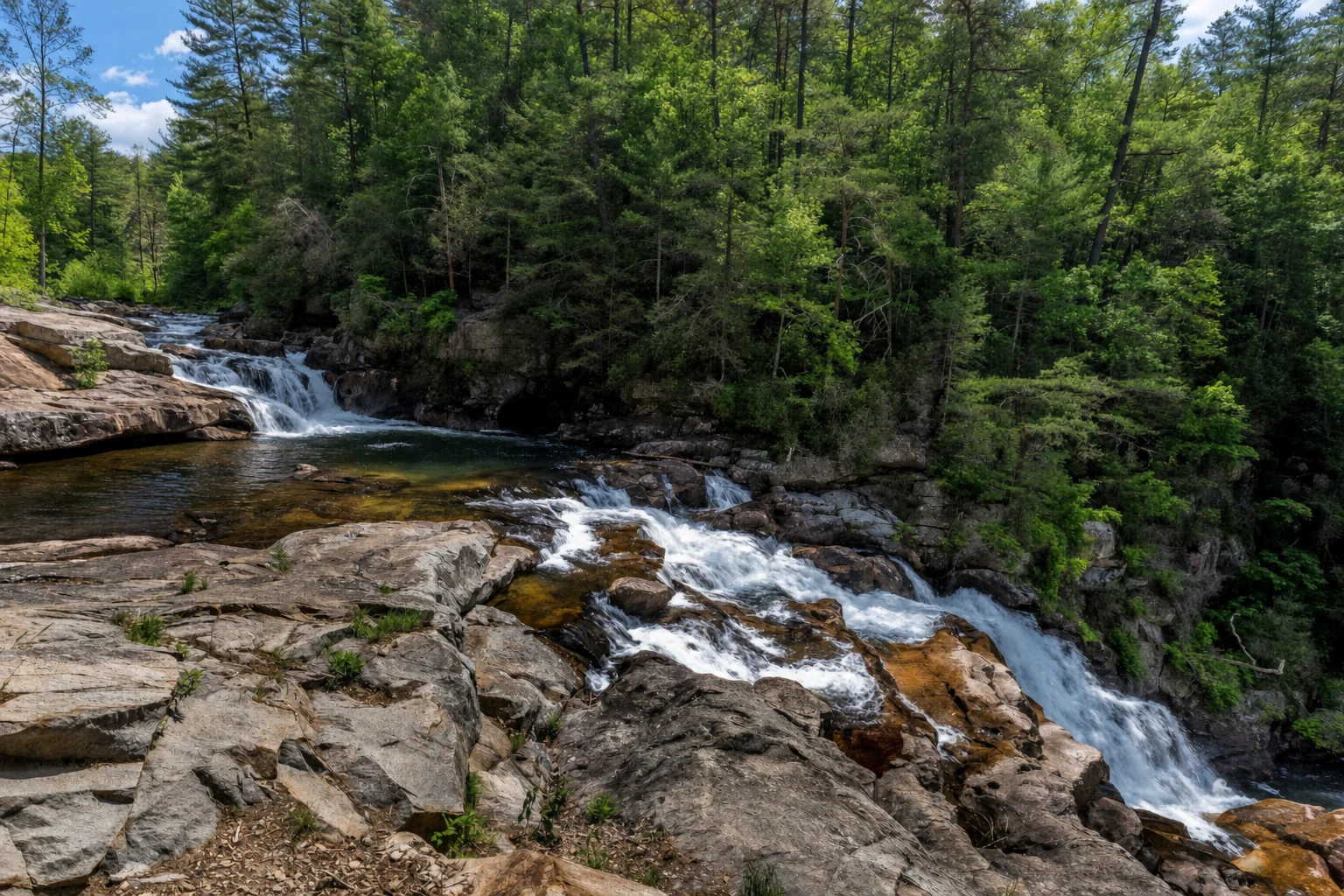
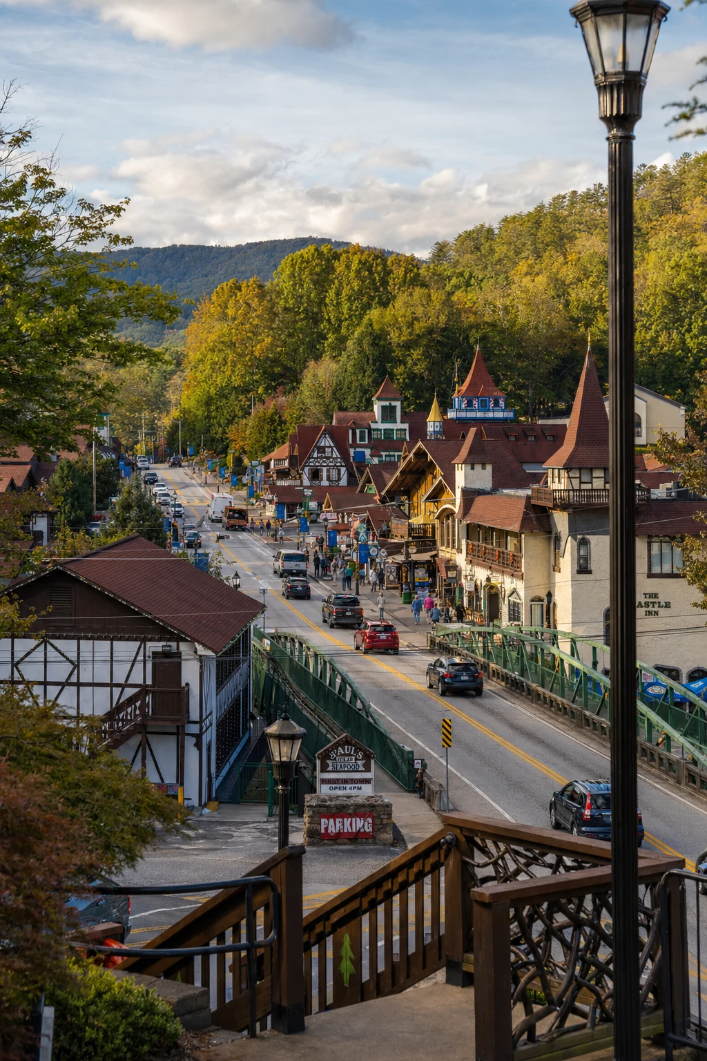
Related Imagery from Around Helen