Mount Yonah Trail
A strenuous climb to the iconic granite summit with panoramic views across the Blue Ridge
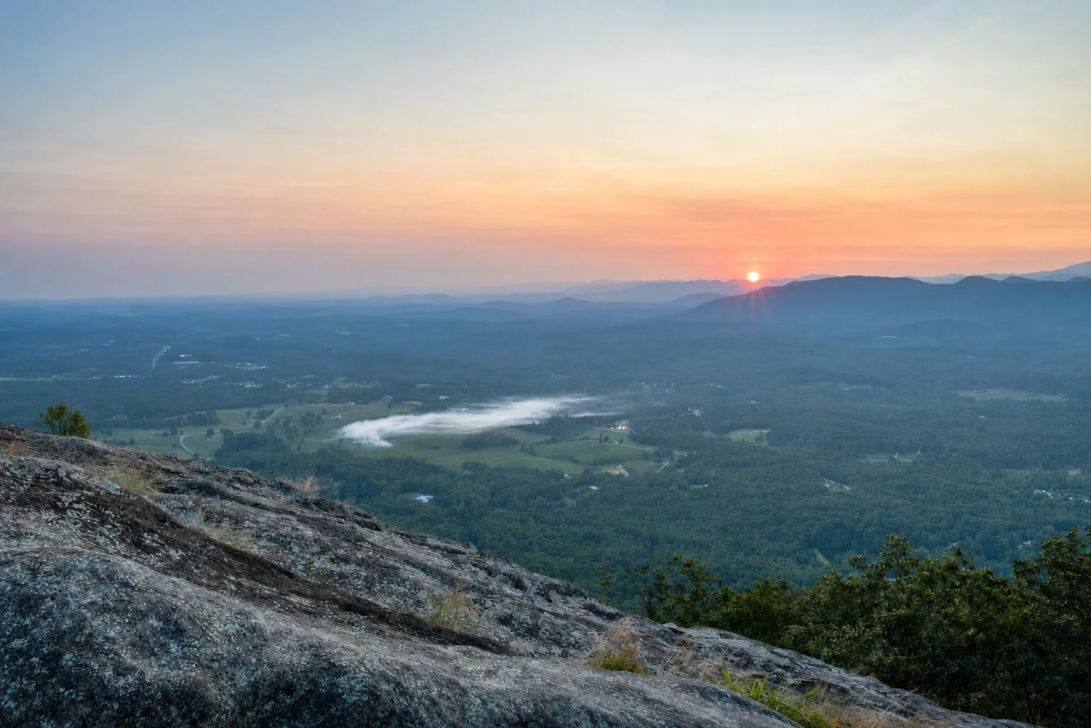
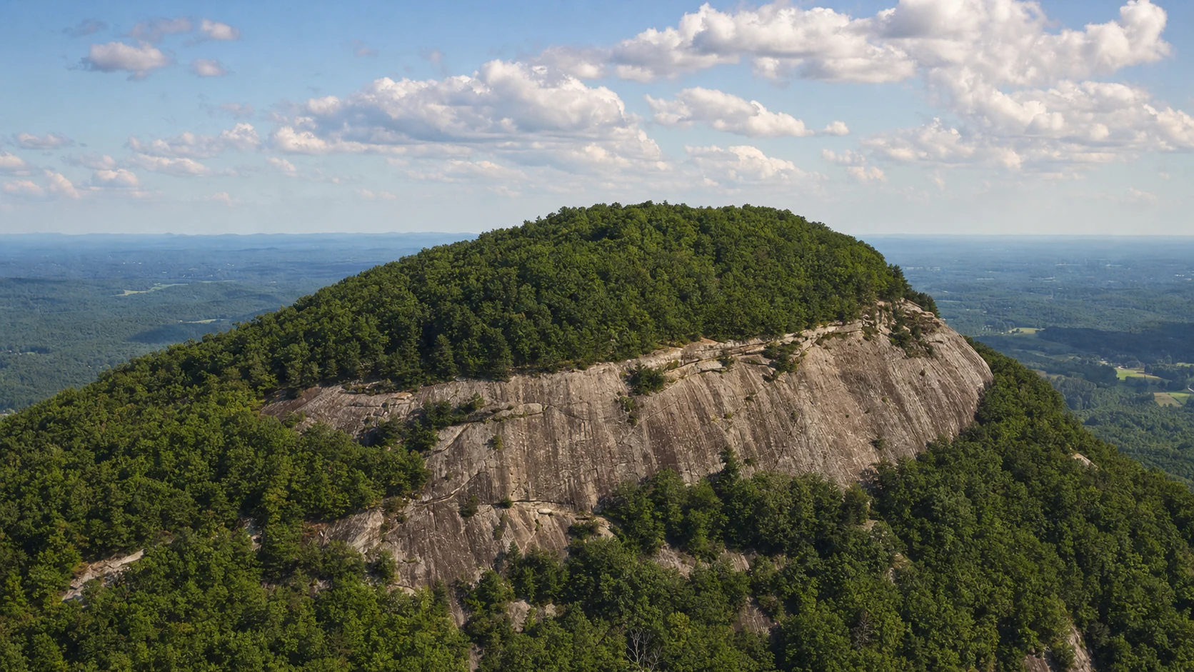
You can see Mount Yonah from half the roads in White County. At 3,166 feet, it's not the tallest mountain around, but that granite face, a sheer cliff rising hundreds of feet above the trees, makes it impossible to miss. The Cherokee called it "Yonah," meaning "bear," and the mountain has drawn people to it for centuries. These days it's one of the toughest hikes in the Helen area, a top-tier rock climbing spot, and a training ground for the U.S. Army Rangers based at nearby Camp Frank D. Merrill.
The trail is 4.4 miles round trip and rated strenuous, for good reason. You gain over 1,700 feet of elevation in just 2.2 miles, which makes this the hardest hike close to Helen. But when you get to the top, the 360-degree views are worth every labored breath. You can see across the Chattahoochee National Forest, out to the Blue Ridge ridgelines, and down to the town of Helen in the valley below. On a clear day, the view extends for dozens of miles.
Trail Description
A demanding climb with outstanding rewards
The trail begins at the end of Chambers Road (Forest Road 323), a gravel road accessible from GA-75 between Helen and Cleveland. The parking area is small and unimproved, with space for approximately 15 vehicles. From the trailhead, the path immediately begins climbing through a mixed hardwood forest of oak, hickory, and poplar. The first half mile is the most gradual section of the trail, following an old roadbed that switchbacks gently up the lower slopes of the mountain.
After the initial switchbacks, the trail steepens considerably. The surface transitions from packed earth to rocky terrain with exposed roots and loose stones. This middle section of the trail is the most physically demanding, climbing steeply through a dense canopy of laurel and rhododendron. The forest provides welcome shade, but the gradient is relentless - expect to stop frequently to catch your breath and drink water. Trekking poles are highly recommended for this section, both for the ascent and especially for the descent.
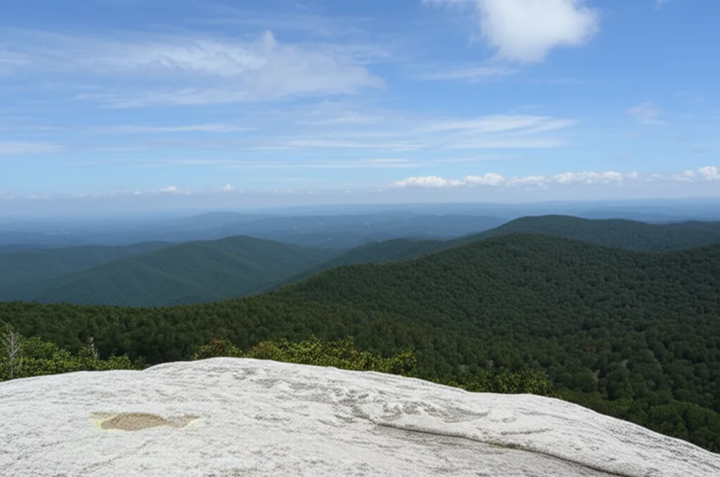
As you approach the summit ridge, the forest begins to thin and the trail emerges onto open granite slabs. This is where the views begin to open up, and the character of the hike changes dramatically. The final approach crosses exposed rock with sparse vegetation, and on breezy days the wind can be quite strong. Follow the blazes and cairns carefully across the granite to reach the main summit area, which features several large, flat rock outcroppings perfect for resting, eating lunch, and taking in the staggering panoramic views.
The Granite Face & Rock Climbing
An iconic landmark for climbers and hikers alike
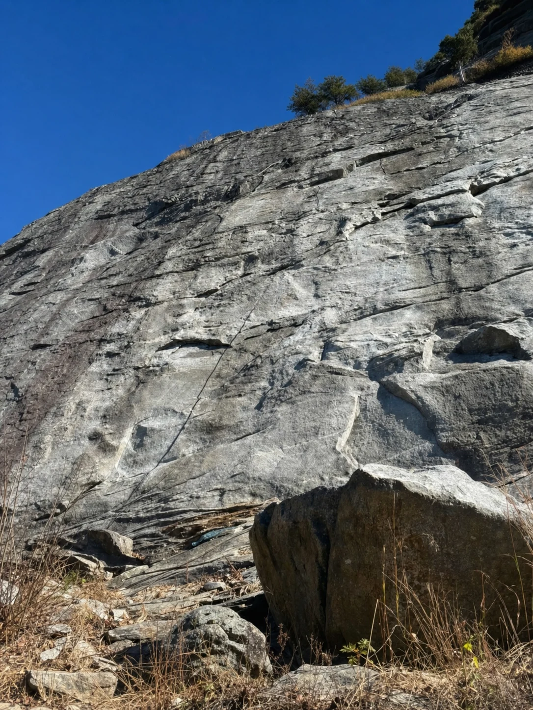
The defining feature of Mount Yonah is its massive granite face, a sheer cliff that rises hundreds of feet above the surrounding forest on the mountain's south side. This rock face is visible from the highway and from many points in the valley below, making Yonah one of the most visually distinctive mountains in north Georgia. The granite is ancient - part of the same geological formation that created Stone Mountain near Atlanta - and its weathered surface has been shaped by millions of years of erosion.
For rock climbers, the granite face offers some of the best traditional and sport climbing routes in the Southeast. Routes range from beginner-friendly friction slabs to challenging multi-pitch climbs that scale the full height of the cliff. For those interested in exploring climbing further, our Helen rock climbing guide provides a comprehensive overview of climbing areas near Helen, from beginner-friendly crags to challenging vertical faces. The climbing area is managed by the U.S. Forest Service, and climbers should check current access regulations before visiting. The Access Fund provides additional information about climbing access and conservation. The U.S. Army Rangers also use the rock face for rappelling training, and it is not uncommon to see soldiers descending the cliff in groups during training exercises.
Hikers who reach the summit should exercise extreme caution near the cliff edges. The granite is smooth and can be slippery, especially when wet. There are no safety railings or fences at the summit. Stay well back from the edges, particularly on windy days, and keep close watch on children and pets. The views from the summit are just as spectacular from a safe distance back from the edge.
Summit Views
A 360-degree panorama of the Blue Ridge
The summit of Mount Yonah delivers one of the most rewarding views in all of Georgia. To the north and west, the ridges of the Blue Ridge Mountains roll away toward the horizon, with the peaks of Tray Mountain (4,430 ft) and Brasstown Bald (4,784 ft - Georgia's highest point) visible on clear days. Experienced hikers looking for even more ambitious summit adventures should consider the trek to Springer Mountain, the southern terminus of the Appalachian Trail. To the south, the Piedmont stretches out flat and green toward Atlanta, and you can see the transition from mountains to foothills with remarkable clarity. The town of Helen is visible in the valley below, its Bavarian architecture looking almost like a miniature village from this elevation.
Fall is arguably the best time for summit views, when the surrounding mountains are painted in brilliant reds, oranges, and golds. The combination of autumn foliage and the long-distance visibility that comes with cool, dry air makes a clear October day on Mount Yonah an experience that rivals anything in the southern Appalachians. Spring mornings can also be stunning, with valleys filled with mist and dogwood blooms dotting the green forest below.
Getting There
From Helen and Cleveland
From downtown Helen, drive south on GA-75 toward Cleveland for approximately 5 miles. Turn left onto Chambers Road (also marked as Forest Road 323 on some maps). Follow the gravel road approximately 2.5 miles to its end at the trailhead parking area. The road is usually passable by standard vehicles in dry conditions, but after heavy rain some sections can become rutted. A high-clearance vehicle is recommended during wet periods.
There are no restrooms, water, or other facilities at the trailhead. Come prepared with everything you will need for the hike. The parking area fills up on weekend mornings during peak season, so arriving before 9 AM is advisable. GPS coordinates for the trailhead: approximately 34.6385, -83.7290.
Safety & Preparation
Essential tips for a safe summit attempt
Physical Fitness
This trail is strenuous. Be honest about your fitness level. The steep grade and rocky terrain require good cardiovascular endurance and lower-body strength.
Water & Nutrition
Bring at least 2 liters of water per person. There are no water sources on the trail. Carry high-energy snacks or lunch for the summit.
Cliff Safety
The summit has unfenced cliff edges with drops of hundreds of feet. Stay well back from edges. The granite is slippery when wet. Keep children and dogs close at all times.
Start Early
Begin your hike early in the day. Summer thunderstorms develop quickly, and being on an exposed granite summit during lightning is extremely dangerous.
More to Explore
Related trails, attractions, and experiences
Related Imagery from Around Helen