The Crown of Georgia: A Comprehensive Guide to Brasstown Bald
Summit trails, a mountaintop visitor center, and four-state views from Georgia's rooftop
Key Points
Highest Elevation: Brasstown Bald is the highest natural point in Georgia at 4,784 feet above sea level.
Access: The summit is accessible via a steep 0.6-mile paved foot trail or a shuttle service provided during operating hours.
Introduction: The Roof of the Peach State
Brasstown Bald is the highest point in Georgia at 4,784 feet (1,458 meters), and on a clear day, you can see four states from the top. It sits in the Chattahoochee-Oconee National Forest where Towns and Union counties meet. People come here to hike, to take in the view, and to see plants and animals that you will not find anywhere else in Georgia -- the summit is high enough to support species that are normally found much farther north.
Beyond the view, there is Cherokee history tied to this mountain, a funny naming mistake that stuck, and trails that range from a short paved walk to serious ridge hikes. Whether you take the shuttle to the top or earn the summit on foot, Brasstown Bald rewards the trip.
Historical and Cultural Context
Etymology: The Mistake of "Brasstown"
The name "Brasstown" is the result of a linguistic error by early European settlers. The Cherokee name for the area was Itse'yĭ (or Itseyi), which translates to "New Green Place" or "Place of Fresh Green." This name likely referred to the grassy, distinctively green vegetation of the summit area. However, settlers confused this word with the phonetically similar Cherokee word Ûňtsaiyĭ, which means "brass" or "copper." Consequently, the village and the mountain were mislabeled "Brasstown," a name that has persisted despite the absence of natural brass deposits in the region. To the Cherokee, the mountain remains Enotah.
Cherokee Legends: The Flood and the Great Spirit
The lack of trees on the summit - a geological feature known in Appalachia as a "bald" - is explained through dramatic Cherokee folklore. One primary legend parallels the biblical story of Noah. It tells of a Great Flood that submerged the earth, killing all inhabitants except a few Cherokee families who sought refuge in a giant canoe. This vessel eventually ran aground on the summit of Enotah. As the waters remained high, there was no land for crops and no game to hunt. In response to the survivors' plight, the Great Spirit cleared the trees from the mountaintop, allowing the people to plant crops and survive until the floodwaters receded.
The Legend of the Tlanuwa and U'tlun'ta
A darker, alternative legend explains the bald nature of the summit through conflict with mythical beasts. Some oral traditions speak of a giant bird of prey, the Tlanuwa (or sometimes a flying monster), that nested on the cliffs. This creature terrorized the local villages, swooping down to carry off children in its talons. Unable to reach the beast’s den to rescue their kin, the Cherokee prayed to Unetlanvhi (The Creator). The Creator answered with a powerful lightning bolt that blasted the summit, destroying the monster's nest and stripping the peak of timber. The Great Spirit promised that the summit would remain forever bare so that no such beast could ever hide there again.
Other variations involve U'tlun'ta, or "Spear-Finger," a shapeshifting stone-skinned witch who preyed on livers, though this figure is often associated with other high peaks in the region as well.
Logistics and Operational Details
Location and Directions
Brasstown Bald does not have a standard street address compatible with all GPS units, but the Visitor Center is generally located at:
2941 Hwy 180 Spur, Hiawassee, GA 30546.
GPS Coordinates: 34.8742° N, 83.8107° W.
Driving Directions:
From Blairsville: Take US 19/129 South for 8 miles. Turn left (east) onto GA 180. Drive 9 miles to the intersection with GA 180 Spur. Turn left (north) and proceed 3 miles to the parking lot.
From Hiawassee: Take US 76 West, turn onto GA 75 South, then turn right onto GA 180. Follow to the Spur.
Hours of Operation and Seasonality
Visitor Center & Shuttle: Open daily from 10:00 AM to 5:00 PM.
Park Gates: Public access to the trails and observation deck is technically available 24/7, year-round, unless the road is closed due to inclement weather.
Winter Operations: During the winter off-season (typically late November/December through March), the shuttle, store, elevator, and indoor restrooms are closed. However, the road and hiking trails often remain open to the public provided there is no ice or snow. Portable restrooms are usually available in the parking lot during these times.
Road Closures: The Georgia Department of Transportation (GDOT) frequently closes GA 180 Spur during winter precipitation events due to hazardous ice.
Fees and Admission
Standard Admission (In-Season): $8.00 per person (ages 16+). This fee includes parking, Visitor Center access, and the shuttle ride.
Discounted/Off-Season Admission: $5.00 per adult. This applies when the shuttle is not operating or for visitors arriving after hours.
Pass Holders: Holders of the "America the Beautiful" Interagency Pass (National Park Pass) or Golden Senior Pass typically pay a reduced fee (approx. $3.00) if using the shuttle, or enter for free if hiking the summit trail (policies vary slightly by season, verify at gate).
Payment Method: When the gatehouse is unstaffed (after hours), visitors must use the self-pay honor system envelopes and drop boxes located in the parking lot.
The Summit Experience
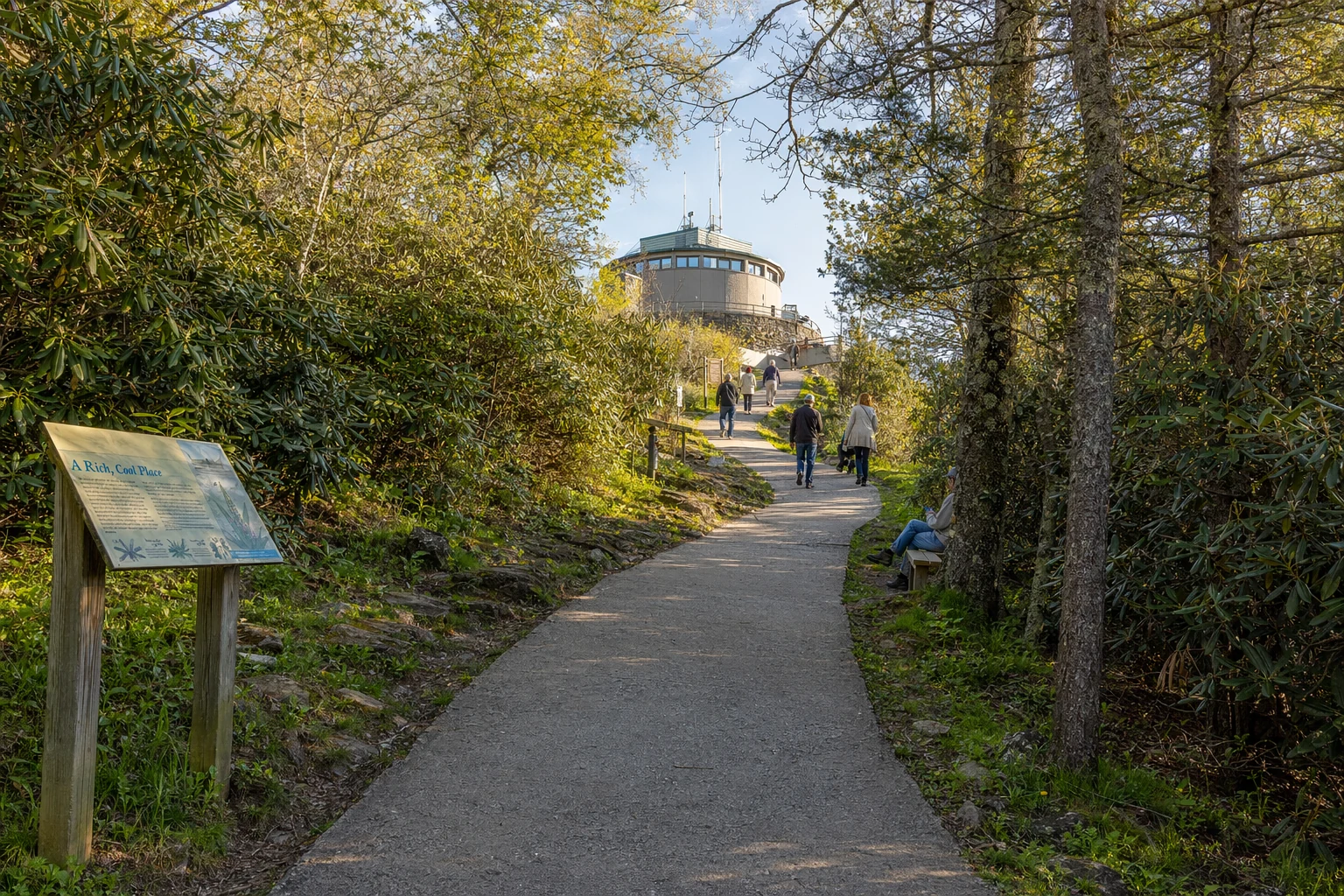
The Summit Trail
If you skip the shuttle and walk, it is a short hike but a real cardiovascular workout.
Trail Name: Brasstown Bald Summit Trail.
Distance: 0.6 miles (approx. 1 km) one way; 1.2 miles round trip.
Elevation Gain: Approximately 400 to 500 feet.
Difficulty: Moderate to Strenuous due to the steep incline (average gradient approx. 13-15%).
Surface: Fully paved asphalt, making it accessible for strollers, though the grade is challenging.
The Shuttle Service
A shuttle bus system operates during business hours (10:00 AM – 5:00 PM) to transport visitors from the parking lot to the Visitor Center.
Frequency: Runs continuously, though often breaks for lunch between 12:30 PM and 1:10 PM.
Pet Policy: Uniquely, leashed dogs are permitted on the shuttle bus, although they are not allowed inside the Visitor Center or museum buildings. They are allowed on the exterior observation decks and trails.
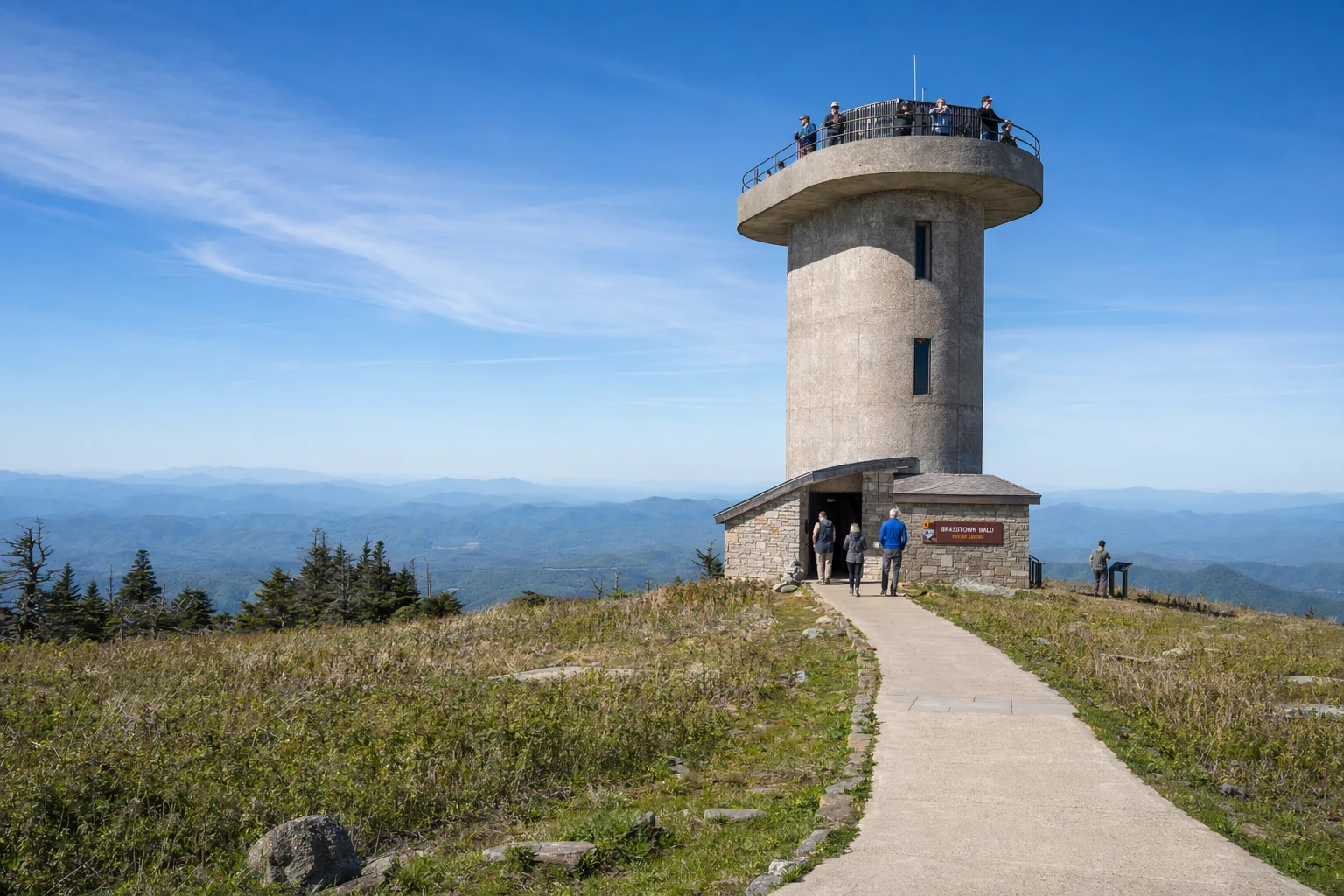
Observation Tower and Views
The observation deck on top of the Visitor Center is what most people come for.
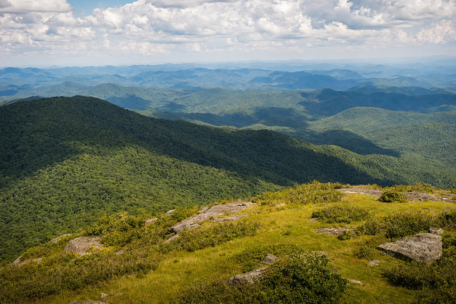
The View: On clear days, visibility can extend up to 80 miles, encompassing four states: Georgia, Tennessee, North Carolina, and South Carolina.
Landmarks Visible:
South: The skyline of Atlanta (approx. 85 miles away) and Sawnee Mountain.
East/Northeast: Rabun Bald (GA's 2nd highest peak), Black Rock Mountain, and the Nantahala National Forest.
Southwest: Blood Mountain (highest point on the AT in Georgia).