Blood Mountain
Your guide to blood mountain in Helen, Georgia and the Blue Ridge Mountains
Introduction to Blood Mountain
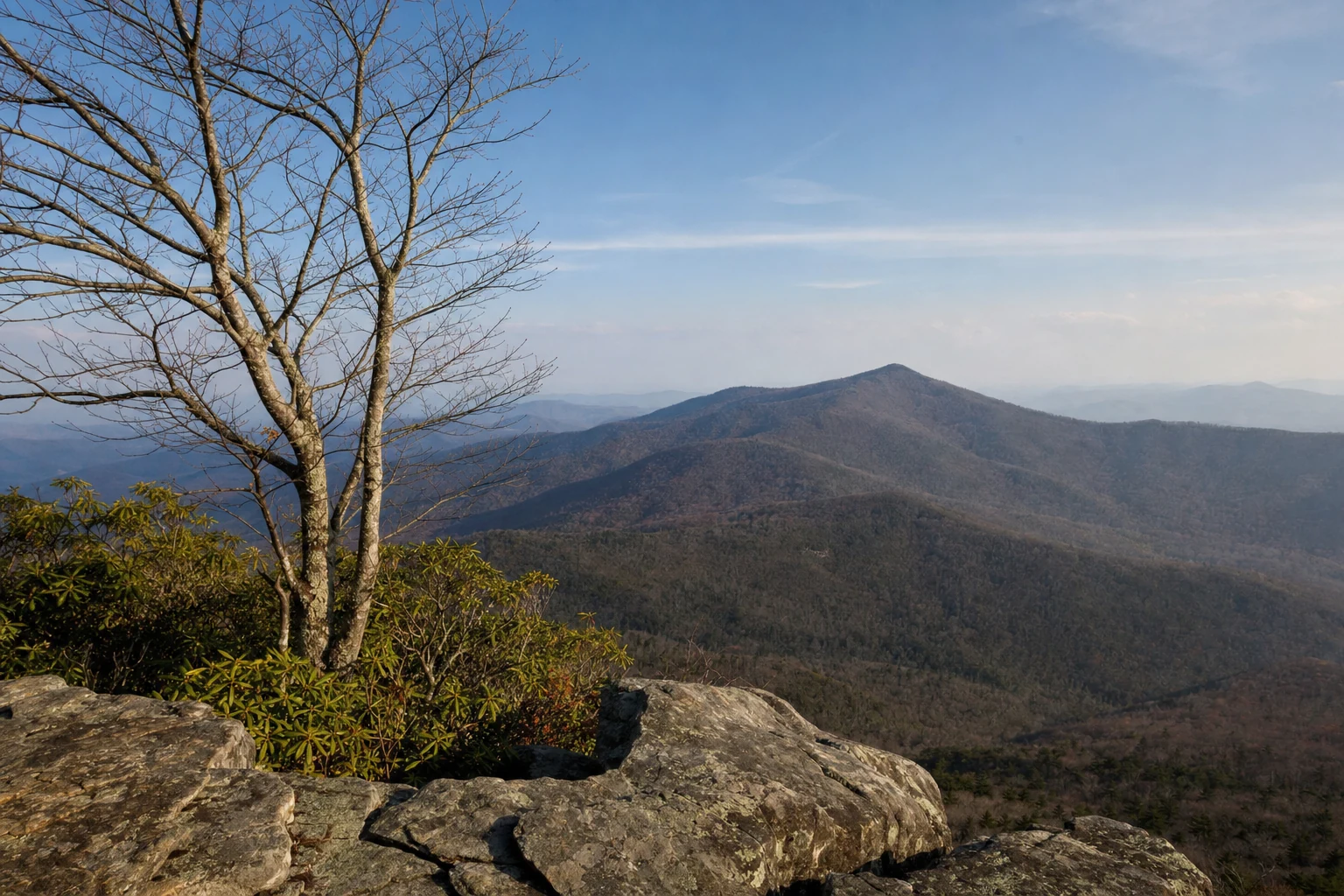
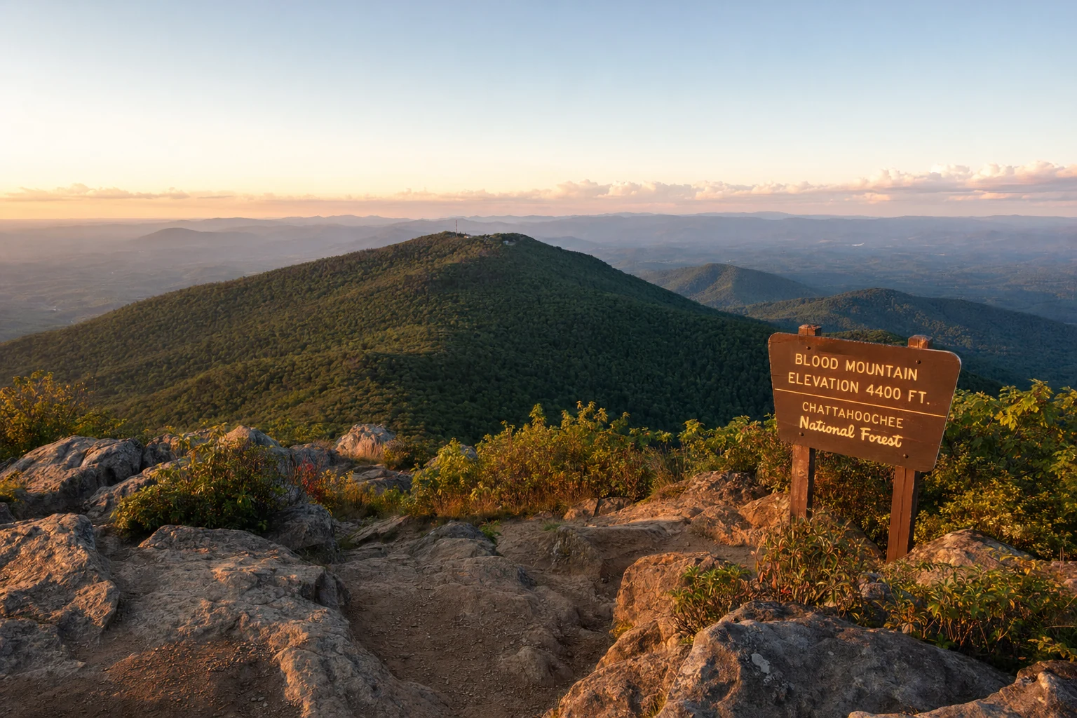
Blood Mountain is the highest point on the Appalachian Trail (AT) in Georgia at 4,458 feet, and the rocky summit delivers wide-open views of the North Georgia mountains. Located in the Chattahoochee-Oconee National Forest within the Blood Mountain Wilderness, the peak has challenging trails, a historic stone shelter built by the CCC, and Cherokee legends that go back centuries. It is about a 30-minute drive from Helen.
Historical Context and Legends
Blood Mountain's name evokes tales of bloodshed from Cherokee and Creek conflicts in the early 1800s, with one legend describing a fierce battle in nearby Slaughter Gap that stained the rocks red. Cherokee mythology portrays the peak as a home to the Nunnehi, immortal spirit people who lived in grand townhouses and aided lost hunters by guiding them home. Another story claims women climbed the mountain during menstruation for isolation, defending it violently against approaching hunters, cementing its "Blood" moniker.
The Blood Mountain Shelter, perched near the summit, was constructed in 1937 by Civilian Conservation Corps (CCC) workers from Camp Enotah at Vogel State Park using local stone. Transferred to the U.S. Forest Service in 1956, it underwent major renovations in 2010 while preserving its original rooms, windows, and doorways; today, the Georgia Appalachian Trail Club maintains it. This two-room structure with a fireplace serves as a rustic haven for AT thru-hikers, marking mile 28.3 from Springer Mountain.
Hiking Routes and Difficulty
The most popular route starts at the Byron Herbert Reece Memorial Trailhead, following the 0.7-mile blue-blazed Byron Herbert Reece Trail (400 feet elevation gain) to the AT, then 1.5 miles north to the summit for a 4.4-mile round-trip out-and-back rated moderate to strenuous. Expect rocky scrambles, steep switchbacks, and boulder fields in the final stretch, with 1,400 feet total gain; the "rock stair master" can be slick when wet. Allow 2-4 hours, depending on pace.
For a loop, continue south on the AT past the shelter to Freeman Trail and return via Byron Reece, creating a 6.2-mile circuit with more varied terrain. Ambitious hikers can start from Vogel State Park via the Coosa Backcountry Trail and Duncan Ridge Trail for an 8.5-mile round-trip, passing overlooks and Wolf Creek. All trails lie in the Blood Mountain Wilderness, so expect minimal blazes, signs, or structures - navigation apps like Gaia GPS are essential.
Difficulty suits experienced day hikers; beginners face constant elevation, rocks, and exposure. Thru-hikers tackle it early in Georgia's AT section, often in variable weather.
The Blood Mountain Shelter
This stone shelter at 4,450 feet offers shelter from rain and wind, with space for 10-12 hikers and a fireplace, but no water, restrooms, or bear storage - hang food properly or use a canister. Overnight stays follow Leave No Trace: no ground fires between Slaughter Creek and Neel Gap, limit to one night per site, and bear canisters are recommended (required March 1-June 1 in nearby gaps). It's first-come, first-served; arrive early as AT crowds fill it quickly.
From the shelter, scramble to nearby rock outcrops for 360-degree views rivaling Brasstown Bald on clear days. If you camp overnight, sunrise from the shelter is worth setting an alarm for. The mist rises from the valleys and the light comes in low across the ridges.
Seasonal Considerations and Best Times to Visit
Spring (April-June) brings wildflowers and moderate temps (50-70°F), ideal for fewer bugs; fall (September-November) dazzles with vibrant foliage, though crowds peak in October. Summer (July-August) is hot (80°F+), humid, and buggy - start pre-dawn; winter offers solitude but icy rocks and snow require microspikes and caution.
Avoid weekends in peak foliage; weekdays or shoulder seasons mean easier parking and parking. Check weather via Blue Ridge Ranger District, as sudden storms are common above 4,000 feet.
Practical Logistics
Trailhead Access: Byron Herbert Reece Memorial Trailhead at approx. 34.742906, -83.921309, off US 19/129, 0.5 miles north of Neel Gap's Mountain Crossings (9710 Gainesville Hwy, Blairsville, GA 30512). From Blairsville, drive south 13 miles; from Helen, north ~18 miles via GA-75 and US 19/129 (~30-40 min). Free parking: 24 paved spots (1 ADA), 14 gravel, max 38 vehicles; no RVs over 20 ft, arrives early (full by 9 AM weekends). No restrooms or water; nearest at Walasi-Yi Center.
What to Bring: 3L water/person (no sources), snacks, headlamp, small med kit (ibuprofen, Band-Aids, Benadryl), trekking poles for stability, camera, bear bag/canister, rain gear, layers, sunscreen, bug spray (summer), microspikes (winter). Stretch calves pre/post-hike; watch for snakes/millipedes.
Accessibility: One ADA parking spot, but trail is steep/rocky - not wheelchair-friendly beyond initial path. Cell service spotty; inform someone of plans.
Contact Blue Ridge Ranger District: 2042 Hwy 515 W, Blairsville, GA 30512; 706-745-6928; Mon-Fri 8 AM-4:30 PM.
Insider Tips and Visitor Perspectives
I've summited Blood Mountain a dozen times, and the thrill never fades - like earning your perch above the clouds. Pro tip: Park at Byron Reece at dawn, hit the trail by 7 AM to beat crowds; the quiet forest symphony of birds and streams sets a peaceful tone. At the boulder scramble near summit, hug the right for easier footing - left is sheer drop - and claim a "picnic rock" for breakfast with views stretching to distant ridges.
Watch wet rocks post-rain; poles saved my knees on descents. For shelter overnights, pack a lightweight tarp for wind; the fireplace crackles invitingly, but smoke lingers in clothes. Spot copperheads or millipedes - fascinating but step lively. Download AT maps from georgia-atclub.org; faded blazes demand vigilance. Post-hike, refuel at Mountain Crossings - hiker's paradise for gear/resupply.
Nearby Attractions and Helen Connections
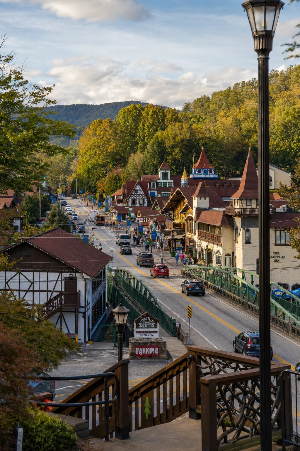
Blood Mountain anchors the North Georgia Blue Ridge adventure hub, 18 miles north of Helen's alpine streets. Drive 30 minutes south to Vogel State Park (7485 Vogel St, Blairsville, GA 30512; 706-745-2628; $5 parking) for Lake Trahlyta swims, Trahlyta Falls, and CCC museum - perfect pre-hike warm-up. Nearby DeSoto Falls (2-mile easy trail, Unicoi State Park area) cascades dramatically, linking to Helen's waterfall scene.
In Helen, tube the Chattahoochee River or hike Anna Ruby Falls (3455 Anna Ruby Falls Rd; $5/person) - pair with Blood for a falls-mountain combo. Vogel's Coosa Trail directly connects to Blood, making multi-day loops feasible. The Richard B. Russell Scenic Hwy (GA-348) from Helen offers en-route vistas of Dukes Creek Falls. Blairsville's mountain biking trails complement hiking; Vogel hosts fall festivals tying into regional foliage tours.
Blood Mountain is one of those hikes where you can be on a remote summit in the morning and sitting in a restaurant in Helen by lunchtime.
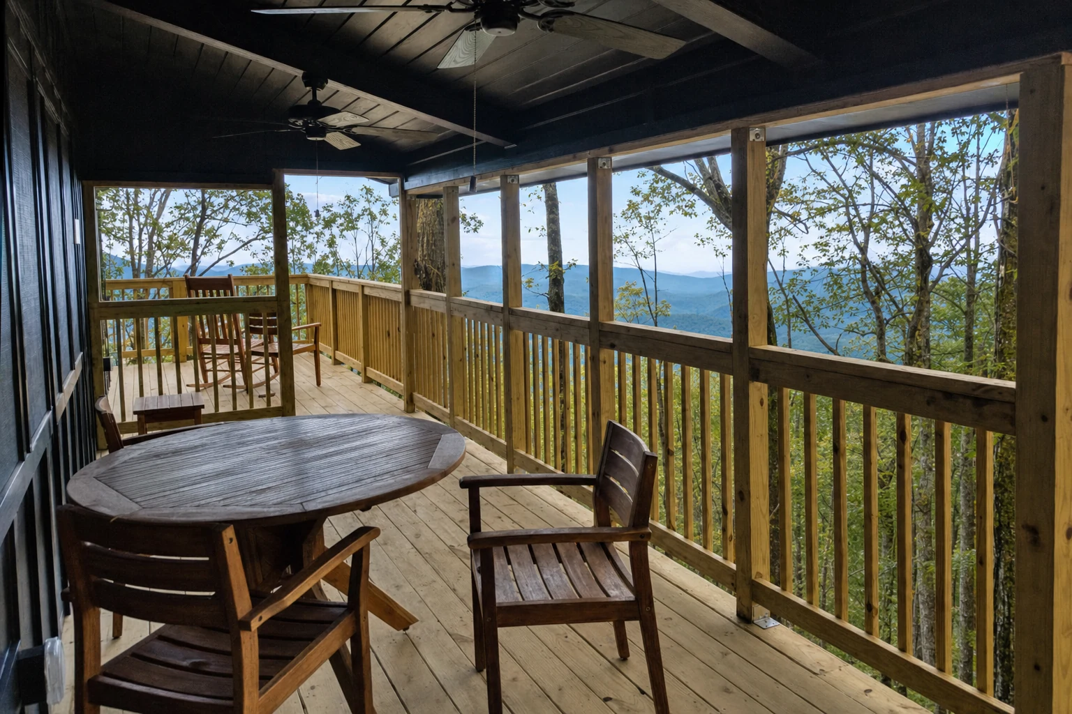
Related Imagery from Around Helen