A Comprehensive Analysis of Rabun Bald: Trail Characteristics, Ecological Significance, and Regional Context
Your guide to a comprehensive analysis of rabun bald: trail characteristics, ecological significance, and regional context in Helen, Georgia and the Blue Ridge Mountains
Geographic Prominence: Rabun Bald is the second-highest peak in Georgia at 4,696 feet, situated on the Eastern Continental Divide in Rabun County.
Trail Specifics: The primary route from Beegum Gap is a moderate-to-strenuous round-trip hike of approximately 3 to 4 miles, utilizing an access trail to connect with the historic Bartram Trail.
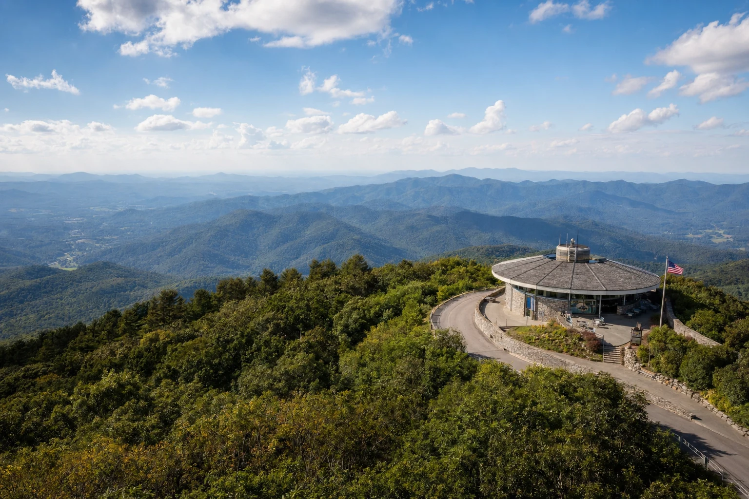
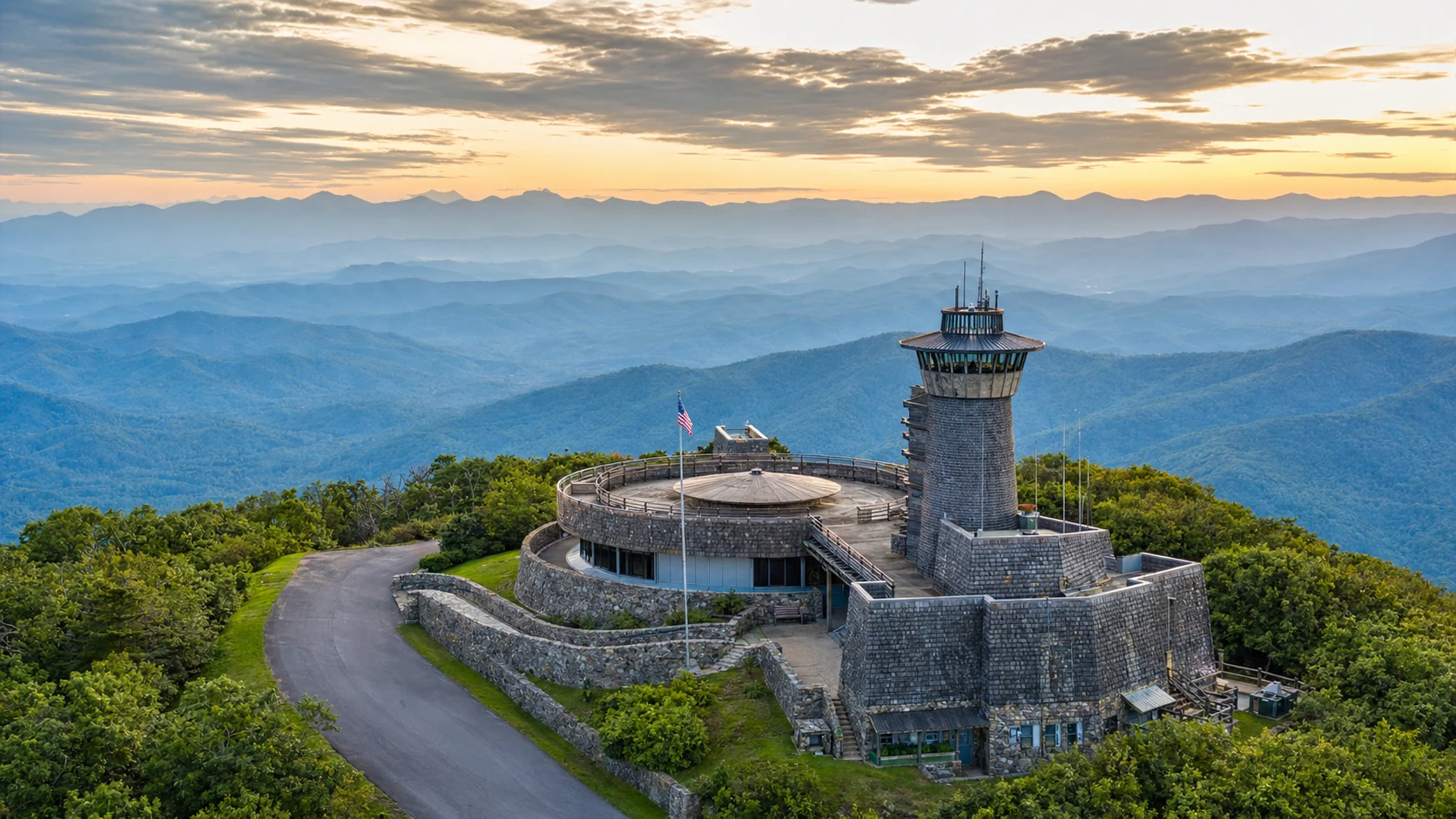
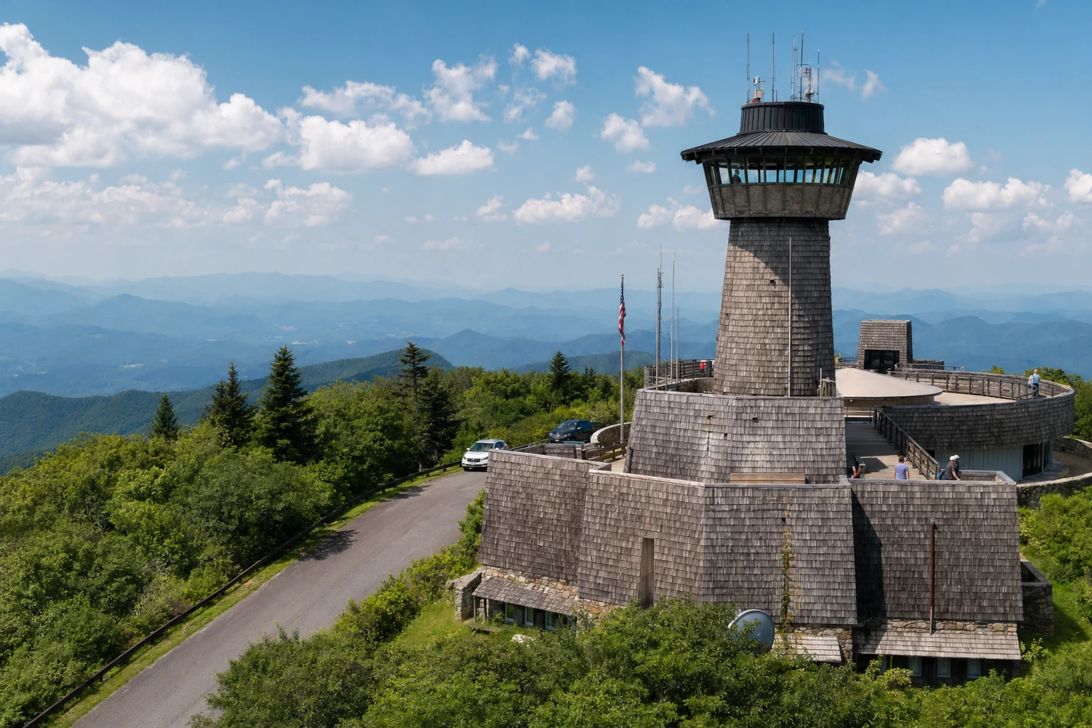
Summit Infrastructure: The peak features a unique observation platform constructed from a 1930s stone fire tower base topped with a wooden deck built by the Youth Conservation Corps.
Key Points
Geographic Prominence: Rabun Bald is the second-highest peak in Georgia at 4,696 feet, situated on the Eastern Continental Divide in Rabun County.
Trail Specifics: The primary route from Beegum Gap is a moderate-to-strenuous round-trip hike of approximately 3 to 4 miles, utilizing an access trail to connect with the historic Bartram Trail.
Summit Infrastructure: The peak features a unique observation platform constructed from a 1930s stone fire tower base topped with a wooden deck built by the Youth Conservation Corps.
Viewshed: The summit offers a 360-degree panorama, reportedly allowing visibility of four states (Georgia, North Carolina, South Carolina, and Tennessee) and landmarks such as Clingmans Dome and Brasstown Bald.
Ecological Highlights: The trail is renowned for its "rhododendron tunnels" and seasonal wildflower displays, particularly flame azaleas and mountain laurel in late spring and early summer.
Comparison: Unlike the paved, highly developed, and crowded Brasstown Bald, Rabun Bald offers a more rustic, secluded experience accessible only by foot.
Introduction
Rabun Bald is the second-highest peak in Georgia at 4,696 feet, and it offers something that the state's tallest mountain (Brasstown Bald) doesn't: solitude. There's no paved road to the top, no gift shop, no crowds. You earn this one on foot. The mountain sits in Rabun County within the Chattahoochee-Oconee National Forest and serves as a waypoint on the Bartram Trail, a long-distance path that traces the 18th-century route of naturalist William Bartram.
The hike from Beegum Gap gives you the full Southern Appalachian experience: hardwood forest, tunnels of rhododendron, and wide-open views from the top. You can check current trail conditions on AllTrails. Here's what to expect on the trail.
Geography and Geologic Context
Rabun Bald is situated immediately southeast of Sky Valley, Georgia, near the border with North Carolina. Geologically, it is part of the Blue Ridge province, a range characterized by ancient, weathered mountains that form the primary drainage divide in the eastern United States. The peak sits directly on the Eastern Continental Divide; precipitation falling on one side flows toward the Atlantic Ocean, while water on the other side eventually feeds into the Gulf of Mexico.
The mountain's prominence - calculated at approximately 1,119 feet - distinguishes it from the surrounding ridges, contributing to the expansive nature of the views from its summit. While the term "bald" typically refers to high-elevation grassy meadows found in the Southern Appalachians (such as Gregory Bald or Andrews Bald), Rabun Bald is currently forested up to its summit, with the "bald" nomenclature likely referencing historical conditions or the rocky exposures found at the top.
The Trail from Beegum Gap
The most popular and direct route to the summit of Rabun Bald commences at Beegum Gap. This section details the logistical and physical aspects of the hike.
Trailhead and Access
The trailhead is located at Beegum Gap, accessible via a gravel road system. Directions typically involve traveling north from Dillard, Georgia, on Highway 441, turning onto GA 246 towards Highlands, NC, and navigating a series of local roads including Old Mud Creek Road and Kelsey Mountain Road. The final approach is on a dirt road that dead-ends at the gap. Parking is limited, often described as "wide spots off the road" capable of accommodating only a handful of vehicles (5–6 cars), contrasting sharply with the developed lots of major state parks.
Distance and Configuration
The hike from Beegum Gap to the summit is generally classified as a round-trip distance of approximately 3.0 to 4.2 miles, depending on the specific GPS measurements and minor trail variations.
Out-and-Back: The standard route is an out-and-back configuration.
Loop Option: Some hikers utilize a 4x4 road for a portion of the return trip to create a partial loop, which can alter the total mileage slightly.
Difficulty and Elevation Profile
The hike is rated as moderate to difficult. The trail gains approximately 1,000 to 1,100 feet in elevation over a relatively short distance (1.5 to 1.6 miles one way). The ascent is described as "unrelenting" in sections, yet manageable due to the inclusion of switchbacks that mitigate the steepness of the ridge. The trailhead sits at approximately 3,660 feet, ascending to the summit at 4,696 feet.
Trail Description and Navigation
From the Beegum Gap parking area, the hike does not immediately begin on the Bartram Trail. Instead, hikers ascend steeply to the south on a green-blazed access trail (sometimes described as an unmarked but well-worn path).
The Approach: After climbing through a hardwood forest for approximately 0.25 miles, this access path intersects with the Bartram Trail, which is identified by yellow rectangular blazes.
The Bartram Junction: Hikers must turn right at this junction to head southbound on the Bartram Trail toward the summit.
The Ascent: The trail climbs moderately, crossing a roadbed at the 0.8-mile mark. Here, the route veers left to remain on the Bartram Trail.
Rhododendron Tunnels: The final leg of the hike is characterized by a "quick succession of switchbacks" that tunnel through dense thickets of rhododendron and mountain laurel. This "cooling canopy" is a defining aesthetic feature of the trail, creating a tunnel-like effect that obscures the sky until the hiker emerges at the summit.
The Bartram Trail Connection
The trail to Rabun Bald is not merely a path to a view; it is a segment of the historic William Bartram Trail.
Historical Significance
The trail commemorates William Bartram, an American naturalist who explored the Southern colonies between 1773 and 1777. His seminal work, The Travels of William Bartram (1791), documented the flora, fauna, and Native American cultures of the region. Bartram is believed to have traversed this specific area in 1775, exploring the Cherokee lands that encompass present-day Rabun County.
Related Imagery from Around Helen