Explore Helen, Georgia

A Bavarian Alpine Village in the Blue Ridge Mountains

Tubing Index
Loading — ft
🌤️ —°
🌤️ —°
🌤️ —°
Next Up A1A - The Official and Original Jimmy Buffett Tribute Show July 18, 2026
Helen Webcams & Live Mountain Views

Helen Webcams & Live Mountain Views

How to read current conditions before you make the drive — river gauge, weather, foliage, and traffic

Quick answer

  • River conditions: Check the State of the River page — live USGS gauge data updated every ~15 minutes, with plain-language tubing guidance.
  • Weather: NWS Helen forecast for mountain-specific conditions; standard weather apps work for general temperature and rain.
  • Foliage: Mid-October through early November. Higher elevations turn first. Full guide at fall foliage guide.
  • Traffic: Georgia 511 shows real-time conditions on GA-75. Peak weekends back up from Cleveland northward after 10 AM.
  • Webcams: No permanent public feed for downtown Helen. Live business and chamber social posts are the closest alternative — details below.

Before any trip to Helen, the question most people type into their phone is some version of: "What does it look like up there right now?" That is especially true for tubing trips, fall foliage drives, and weekends when GA-75 turns into a slow-moving parking lot. The good news is that there are several reliable ways to get a real-time read on conditions before you leave home. The bad news is that the answer is not as simple as clicking a webcam feed — a permanent public webcam for downtown Helen does not exist as a stable, continuously updated resource. What does exist is more useful anyway.

This page walks through the actual tools worth using: the live river gauge, mountain weather forecasting, foliage timing, and how to get a feel for traffic before committing to the drive. I have checked a lot of these sources myself on mornings when I was trying to decide whether the river was worth the trip, and I will tell you which ones actually answer the question.

State of the River: The Most Useful Live Tool

USGS gauge data for the Chattahoochee at Helen, updated every ~15 minutes

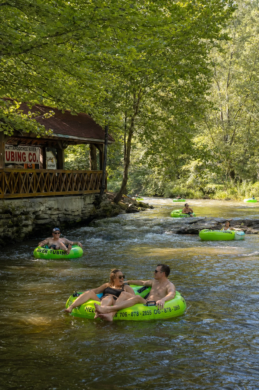
Chattahoochee River in Helen GA flowing past tubing outfitters on a summer afternoon

The Chattahoochee runs directly through downtown Helen. River level determines whether tubing is safe, slow, or closed on any given day.

The State of the River page on this site pulls from the USGS stream gauge on the Chattahoochee at Helen (gauge 02331000) and refreshes approximately every 15 minutes. It shows the current water level in feet and cubic feet per second, plus local weather conditions, and frames the number in plain language: whether the river is running at a good level for tubing, whether it is elevated from recent rain, or whether outfitters are likely to be closed.

This is the single most important check before a tubing trip. The Chattahoochee can rise quickly after rain anywhere in the upper watershed, which extends well north of Helen through the mountains. It is possible for the river to be at flood stage in the morning after an overnight storm and back to normal tubing levels by afternoon — or vice versa. Checking the gauge the evening before your trip and again the morning of gives you the clearest picture.

Tubing outfitters on the Chattahoochee also monitor the gauge and post closures on their own websites and social media. But the gauge data itself is public and updates faster than any outfitter's social post.

Checking Helen Weather Before You Go

Mountain forecasts differ meaningfully from what Atlanta shows

Helen sits at roughly 1,435 feet elevation in a valley between ridges that rise to 3,000 feet and higher. The temperature is consistently 5 to 10 degrees cooler than Atlanta, and afternoon thunderstorms build fast in summer over the mountains when the radar shows clear skies to the south. Fog is common on GA-75 north of Cleveland, particularly on cool mornings after a warm night.

The National Weather Service forecast for Helen is the most accurate source for mountain-specific conditions, including hourly projections that are more reliable than most apps for the 24-hour window. Weather Underground and similar aggregators that pull from nearby personal weather stations can give you current temperature and wind readings that major apps often miss in a town this small.

If you are planning an outdoor activity — tubing, hiking, or a drive on the Richard Russell Scenic Highway — check the hourly forecast rather than the daily summary. A "30% chance of afternoon thunderstorms" in Helen can mean clear and sunny until 2 PM followed by heavy rain and lightning, with no in-between.

Summer (June–August)

High temperatures around 80°F in the valley. Afternoon thunderstorms most days — plan outdoor activities for morning. River levels vary week to week based on upstream rain.

Fall (September–November)

Cooler and drier. Foliage weekends in October bring heavy traffic. Morning temperatures can drop into the 40s on ridge roads like GA-348 even when the valley stays mild.

Winter (December–February)

Snow and ice are possible, particularly on mountain roads above 2,500 feet. GA-75 through town is maintained, but GA-348 and Unicoi Gap may close temporarily after winter storms.

Spring (March–May)

Wildflower season. River levels are typically higher from snowmelt and spring rain. Tubing may be limited in early spring. Weather is variable — layers are useful even on warm days.

Live Webcams for Helen: What Actually Exists

The honest answer about real-time cameras in the area

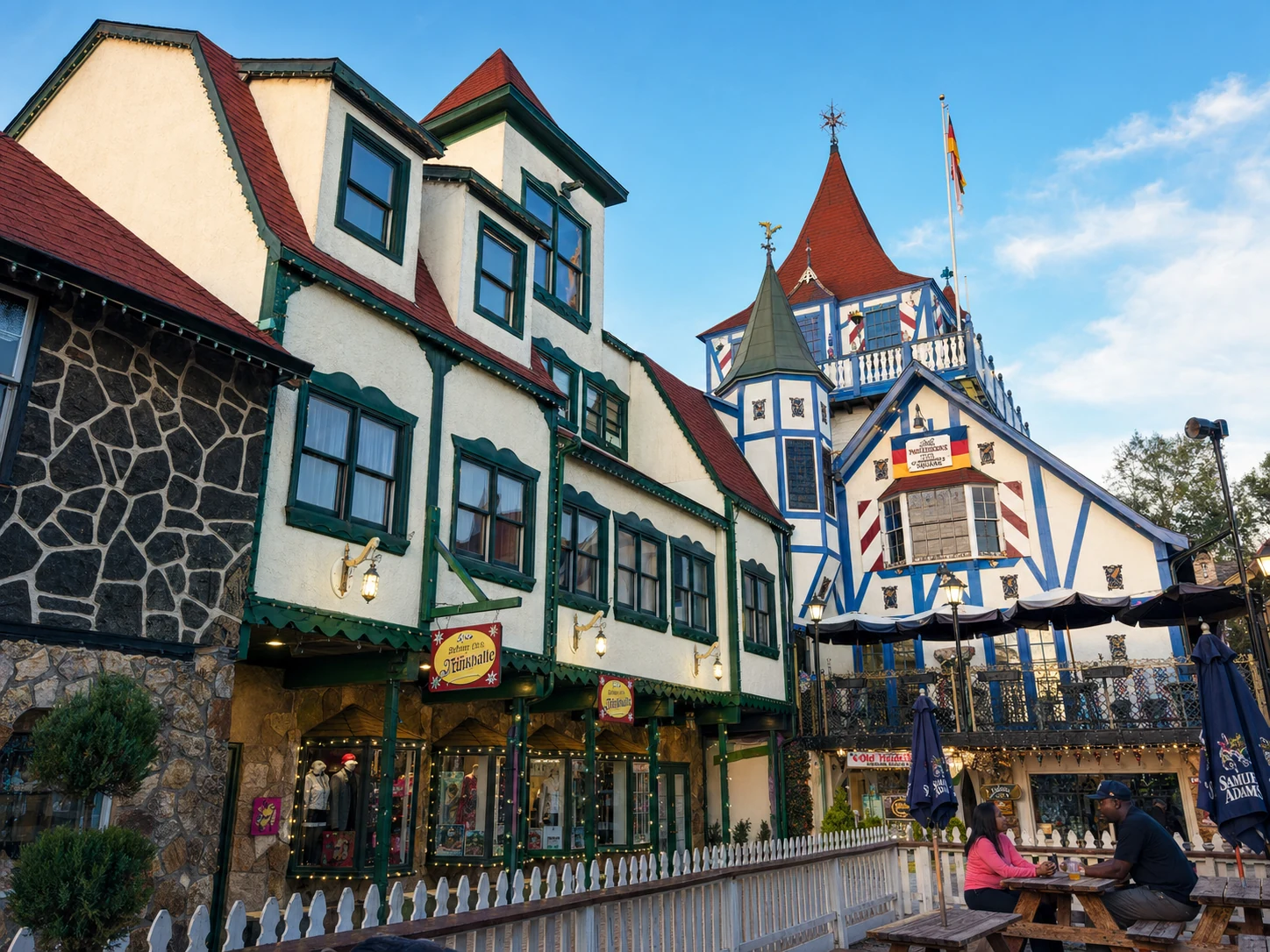
Downtown Helen Georgia alpine village storefronts along Main Street

Downtown Helen's compact village is easy to gauge from recent visitor photos and social media posts when a live webcam isn't available.

A common search before visiting Helen is something like "Helen GA webcam" or "Helen Georgia live camera." The expectation is a public feed trained on the river or Main Street. That kind of always-on, publicly accessible webcam does not currently exist as a permanent resource for Helen. Some local businesses have operated cameras at various points, and the Georgia Department of Transportation maintains traffic cameras on GA-75 for road-condition monitoring, but those feeds are not consistently available to the public at a stable URL.

What does work reasonably well: checking the Helen/White County Chamber of Commerce social media pages (Facebook and Instagram) on busy weekends, when staff often share photos or short video clips of current conditions in the village. During Oktoberfest and peak foliage weekends, the chamber and local businesses post frequently enough that you can get a genuine read on crowd levels and weather within the past few hours.

The Georgia DOT's 511 system does include road cameras at select locations on GA-75 and other northeast Georgia highways, and those images update on a short interval. For traffic and road-surface conditions specifically, that is the most direct live view available. Check the 511 map and look for camera icons along GA-75 north of Gainesville.

For a ground-level feel of what the town looks like right now, recent Google Maps Street View imagery and current Instagram posts tagged #HelenGA give a reasonable impression — not live, but updated far more often than most people expect.

Tracking Fall Foliage in Real Time

When to go, how to read the signs, and what elevation matters

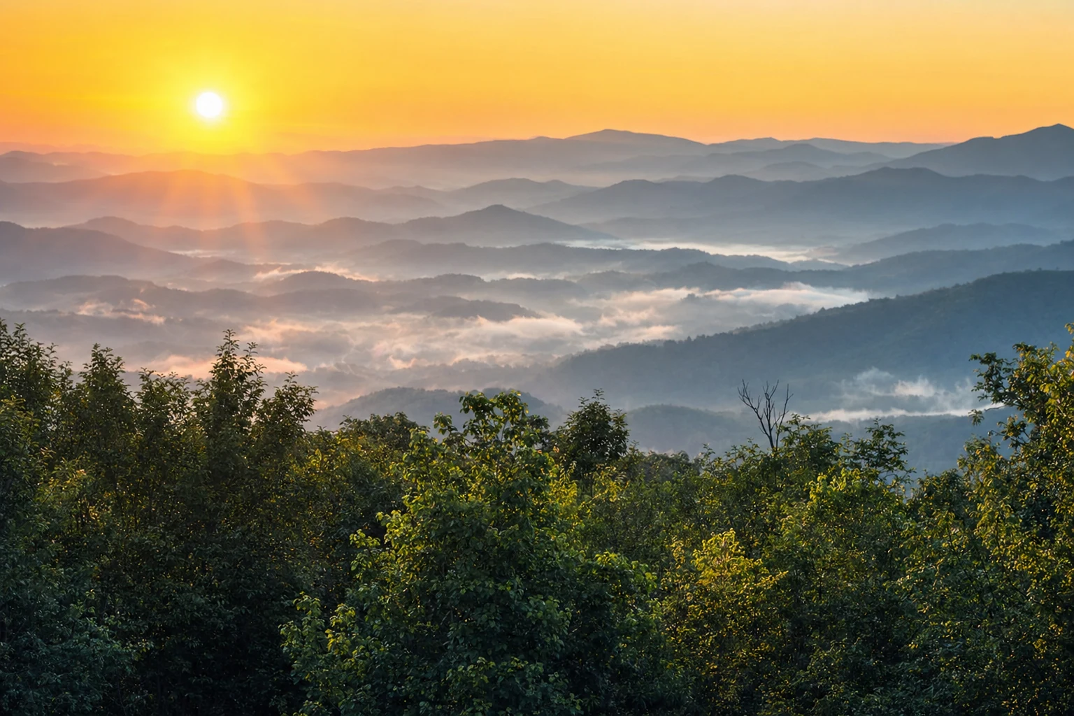
Blue Ridge Mountains at sunrise with autumn foliage color in the valleys near Helen Georgia

The Blue Ridge ridgelines surrounding Helen typically show peak color before the valley floor, giving you a reliable early indicator from the drive up GA-75.

Helen's fall foliage season is the single most crowded time of year, and knowing where color actually stands before you make the drive matters. The fall foliage guide on this site covers timing and peak-window history in detail, but the short version is this: higher elevations (Brasstown Bald at 4,784 feet, the Appalachian Trail ridges, the Richard Russell Scenic Highway at 3,400 feet) reliably turn 1 to 2 weeks before the valley floor in Helen itself.

For a real-time read on where color stands each fall, the Smoky Mountains foliage tracker and the Farmers' Almanac fall color map both cover the Blue Ridge broadly, and both are updated by season as reports come in from visitors. The Georgia Forestry Commission occasionally posts fall color updates for northeast Georgia. None of these is a live camera, but during the six-week window from late September through early November, updates come in fast enough to narrow your timing to within a weekend.

The most reliable real-time signal: check Instagram for recent posts tagged #HelenGA or #BlueRidgeGA in the last 48 hours. Visitors post from the ridge roads constantly during peak foliage, and the photos tell you more about actual color than any index.

GA-75 Traffic: Checking Before the Drive

Peak weekend congestion on the main corridor into Helen

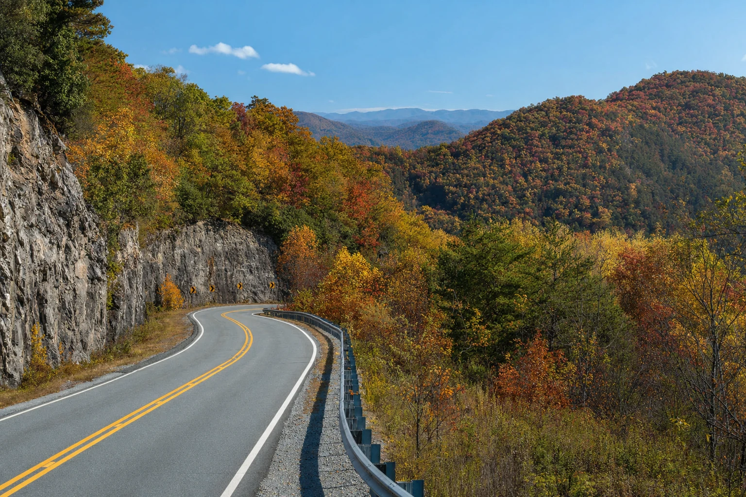
Richard Russell Scenic Highway GA-348 in northeast Georgia winding through forested mountain ridges

The Richard Russell Scenic Highway (GA-348) offers an alternative approach to Helen that avoids the GA-75 corridor on busy weekends — and the views are worth the extra time.

GA-75 is the main road into Helen from the south, and it is a two-lane highway through most of its mountain stretch. On peak fall weekends in October, traffic can back up from the Helen town limits all the way to Cleveland, 12 miles south. Google Maps and Waze both show real-time traffic on GA-75 and will suggest alternate routing when the main road is slow — typically GA-384 (Robertstown Road) as a bypass around the worst of it.

The Georgia 511 system at 511ga.org or by calling 511 on any cell phone shows incident alerts, road conditions, and camera images along GA-75 and neighboring corridors. Worth a quick check before departing on any October Saturday. The parking guide explains where to park once you arrive — knowing your destination lot in advance cuts down on circling time when the village is full.

One reliable workaround on busy weekends: arrive on Friday evening rather than Saturday morning. The difference in drive time and crowd density between a Friday night arrival and a Saturday at noon is dramatic. If you are staying overnight (the events calendar shows what is happening on any given weekend), book accommodations early — October rooms sell out weeks in advance.

Ready to book your trip?

Once you have checked the river gauge and the forecast, the next step is locking in a place to stay. Helen has lodging options from riverside hotels to mountain cabins within a short drive of town. See all availability below.

Browse accommodations guide

A Pre-Trip Checklist That Actually Works

What to check, in order, before driving to Helen

Here is the sequence I use when planning a Helen trip, particularly for tubing or a fall foliage drive:

  1. Check the river gauge at /state-of-the-river/ the evening before. If the gauge is elevated, watch it overnight — it can drop fast or stay high depending on what is happening upstream.
  2. Check the NWS hourly forecast for Helen. Look at the 10 AM–3 PM window specifically for afternoon storm risk in summer and fog/ice risk in cooler months.
  3. Check Georgia 511 on the morning of. Any incidents on GA-75 or road work will show up there.
  4. Look at Instagram tagged #HelenGA from the past 24 hours. During busy weekends, visitors post constantly and you get an honest read on what the village actually looks like right now.
  5. Check the events calendar at /events/calendar/. Oktoberfest runs from mid-September through early November, and festival weekends pull significantly larger crowds than regular fall foliage traffic. Knowing what weekend you are walking into changes the plan.

None of this takes more than five minutes, and it has saved me a wasted drive more than once. The river gauge in particular is genuinely reliable — the USGS maintains that sensor year-round, and the reading at Helen correlates closely with what you will find when you arrive.

Helen webcams & live views — FAQ

Is there a live webcam for Helen, Georgia?
There is no single official webcam with a permanent public feed for downtown Helen. The most reliable real-time tool is the ExploreHelen State of the River page, which pulls the USGS Chattahoochee gauge data and local weather conditions updated approximately every 15 minutes. Local businesses and the Helen/White County Chamber of Commerce occasionally share live or recent footage on social media during peak seasons.
How do I check whether the river is safe for tubing before I drive to Helen?
Visit ExploreHelen's State of the River page at /state-of-the-river/ before you leave. It shows the current USGS gauge reading for the Chattahoochee at Helen, along with an interpretation of what that level means for tubing — safe, borderline, or closed. Tubing outfitters also post closures on their websites and social media when the water is too high or too low.
When does fall foliage peak in Helen, GA?
Peak color in Helen typically falls between mid-October and early November, with the exact timing shifting by a week or two depending on summer temperatures and early-fall rainfall. The higher elevations around Brasstown Bald and the Richard Russell Scenic Highway usually turn first. Our fall foliage guide at /guide/planning/fall-foliage-guide/ tracks typical peak windows and what to look for on your drive up GA-75.
How bad is traffic on GA-75 into Helen on fall weekends?
During peak fall foliage weekends in October, GA-75 north of Cleveland can back up several miles, particularly between 10 AM and 3 PM on Saturdays. Arriving before 9 AM or after 4 PM makes a noticeable difference. Check Georgia 511 (511ga.org) for real-time road conditions before you head north, and consider using the parking guide at /guide/planning/parking-guide/ to know where to head once you arrive.
What weather app is most accurate for Helen, GA?
The National Weather Service forecast for Helen (weather.gov, zone GAZ011) is the most authoritative source. Weather apps like Weather.com and Weather Underground that use personal weather stations can give you a more granular read on current conditions in the valley. Mountain weather changes fast — a clear morning in Atlanta can mean afternoon fog on GA-75 near Unicoi Gap.
Can I see the river level from the road when I arrive?
Yes. The Chattahoochee flows directly through downtown Helen and is visible from the main pedestrian bridge and riverside restaurants. If the water is visibly fast or brown, that usually means the gauge is elevated. The USGS gauge station is located on the river near town, and outfitters check it every morning before deciding whether to run tubing operations.

Find Your Place to Stay in Helen

See live prices and real-time availability for cabins, hotels, and vacation rentals — compared across Booking.com, Expedia, Vrbo, and more on one interactive map.

Free to browse · we may earn a commission at no extra cost to you