The Road to the Alps: A Comprehensive Transportation Guide to Alpine Helen, Georgia
Driving routes from Atlanta, parking tips, shuttle options, and getting around Helen without a car
Key Points
Primary Route: The most reliable driving route from Atlanta is I-85 North to I-985, which transitions into GA-365, followed by a left on GA-384 (Duncan Bridge Road). This route takes approximately 1.5 to 2 hours.
Navigation Warning: GPS systems frequently attempt to route drivers over Tray Mountain Road or Chimney Mountain Road to save time. These are unpaved, rutted Forest Service roads often impassable for standard vehicles. Do not follow these shortcuts.
Rideshare Reality: Uber and Lyft availability is extremely sporadic. Visitors should rely on local services like Miles by Kniles or Uber for You (a local independent operator), and booking in advance is highly recommended.
EV Infrastructure: A new Tesla Supercharger (V4) station is available at Mully’s Nacoochee Grill, significantly improving accessibility for electric vehicles. Older Blink chargers exist but have reported reliability issues.
Walking & Parking: The Alpine Village is compact and walkable. Paid parking is standard ($10 average), and the Edelweiss Strasse public lot is the central hub for river and Festhalle access.
*
Introduction
Helen, Georgia, sits in the Blue Ridge Mountains about 90 miles north of Atlanta. The Bavarian-themed village looks like it belongs in the Alps, but getting there means driving through Appalachian foothills on mountain roads that can surprise unprepared visitors. Knowing the route options, GPS pitfalls, and local transportation quirks before you go will save you headaches on the road.
This guide covers driving routes, parking options, electric vehicle charging, airport connections, and local transit so you can spend your time enjoying Helen instead of stressing over logistics.
1. The Approach: Driving Routes from the Metropolis
Helen is accessible primarily by car, serving as the terminus for several scenic arteries winding northward from the Atlanta sprawl. Check Georgia 511 for real-time traffic and road conditions before departing. The drive itself is a transition from urban density to the rolling foothills of the Appalachians.
The Gateway Route: I-985 to GA-365
The most direct and commonly utilized artery from Atlanta and Hartsfield-Jackson International Airport (ATL) utilizes the I-985 corridor. This route offers the most consistent travel times and four-lane highway conditions for the majority of the journey.
The Path: Depart Atlanta via I-85 North (approx. 30 miles) to the split for I-985 North (Exit 113).
The Transition: I-985 transforms into GA-365 North near Gainesville. Continue on GA-365 for approximately 42 miles.
The Turn: The critical juncture is the intersection with GA-384, locally known as Duncan Bridge Road. You will turn left here.
The Final Leg: Follow Duncan Bridge Road for 16.5 miles until it dead-ends into GA-75. Turn right; the Alpine village is approximately 3 miles ahead.
Estimated Time: 1.5 to 2 hours (traffic dependent).
The Scenic Alternative: GA-400
For travelers departing from the northern arc of Atlanta (Alpharetta, Roswell, or Buckhead), the GA-400 corridor provides a pastoral alternative that avoids the heavy industrial traffic of I-85.
The Path: Take GA-400 North until the expressway ends and narrows into a two-lane road at the Chestatee River.
The Connection: Continue straight onto Long Branch Road (GA-115).
The Square: Follow signs to Cleveland, Georgia. At the historic Cleveland Courthouse square, navigate around the building to turn left onto US-129 North, then almost immediately right onto GA-75 North.
The Arrival: GA-75 leads directly into the southern gateway of Helen.
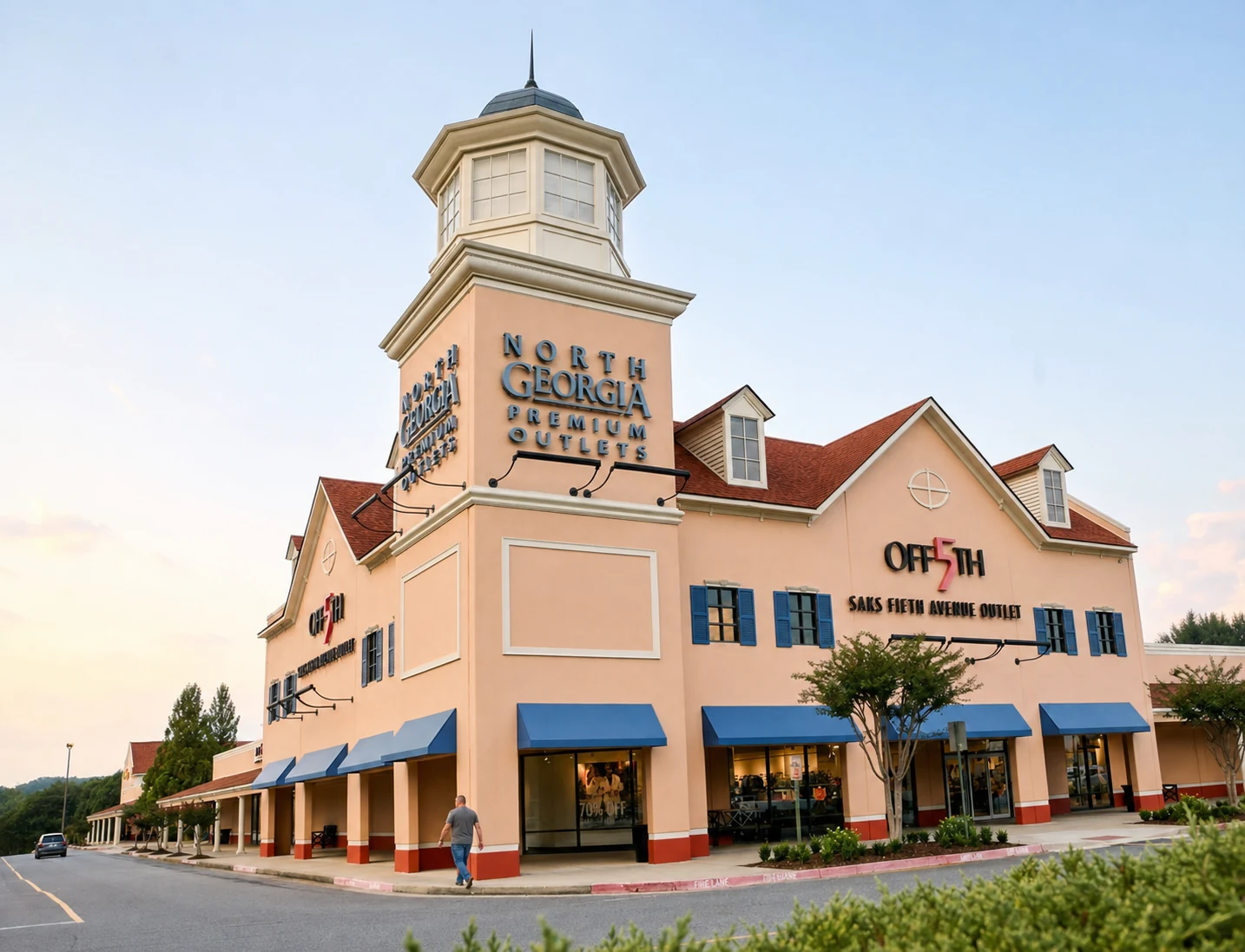
Scenic Note: This route passes the North Georgia Premium Outlets and offers glimpses of the Chestatee River, though it can be prone to congestion at the end of GA-400 during peak rush hours.
2. The Digital Trap: GPS and Navigation Warnings
Perhaps the most critical information for any driver heading to Helen is a warning regarding GPS navigation. Modern algorithms prioritize distance over road quality, a calculation that can have disastrous consequences in the Appalachian foothills.
The Tray Mountain Trap
Navigational apps (Google Maps, Waze, Apple Maps) frequently attempt to route drivers coming from the north or seeking "shortcuts" around traffic via Tray Mountain Road or Chimney Mountain Road.
The Reality: These are Forest Service roads (FS 79). They are unpaved, deeply rutted, steep, and often obstructed by fallen trees or washouts. They are designed for high-clearance 4x4 vehicles, not sedans or minivans.
The Consequence: Tow trucks charge premium rates for off-road recovery, and cell service is virtually non-existent in these gaps.
The Rule: If your GPS instructs you to turn onto a "gravel" or "unpaved" road, disregard the instruction. Stick to state highways (GA-17, GA-75, GA-356, GA-348) at all times.
Navigation Tip: Configure your GPS app settings to "Avoid Unpaved Roads" before departing, though even this is not fail-safe in rural areas. Visual verification of asphalt is the only guarantee.
3. Aerial Gateways: Airport Connections
While Helen has no commercial airport, it is serviced by two major regional hubs.
Hartsfield-Jackson Atlanta International Airport (ATL)
Located approximately 90-100 miles south of Helen, ATL is the primary gateway for international and long-haul domestic travelers.
Drive Time: 1 hour 45 minutes to 2.5 hours, heavily dependent on Atlanta perimeter traffic.
Shuttle Connection: Direct public transit to Helen does not exist. However, Groome Transportation operates a scheduled shuttle service from ATL to Gainesville, GA (approx. 35 minutes south of Helen).
Groome Gainesville Hub: 1810 Browns Bridge Rd, Gainesville, GA 30501.
Cost: ~$39-$49 one way.
Phone: (470) 252-7887.
Greenville-Spartanburg International Airport (GSP)
Located to the northeast in South Carolina, GSP is a viable alternative, particularly for travelers coming from the Mid-Atlantic.
Drive Time: Approximately 2 hours 15 minutes (approx. 109 miles).
Route: I-85 South to GA-17 North. This route is generally more scenic and less prone to the gridlock of Atlanta.
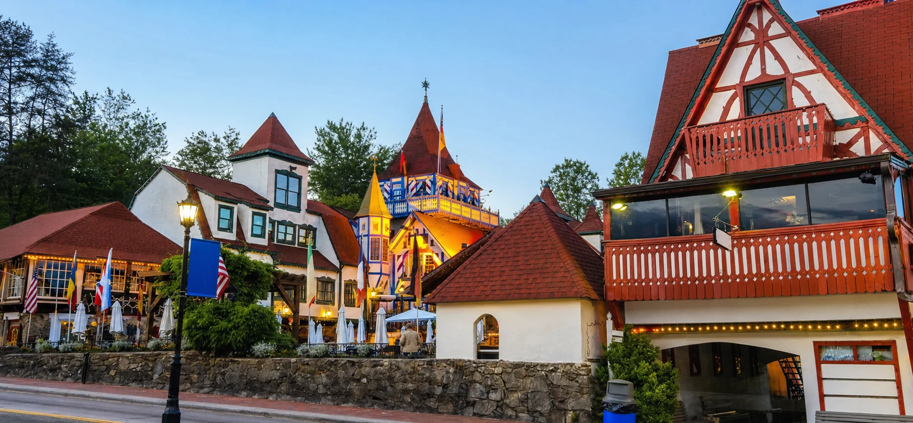
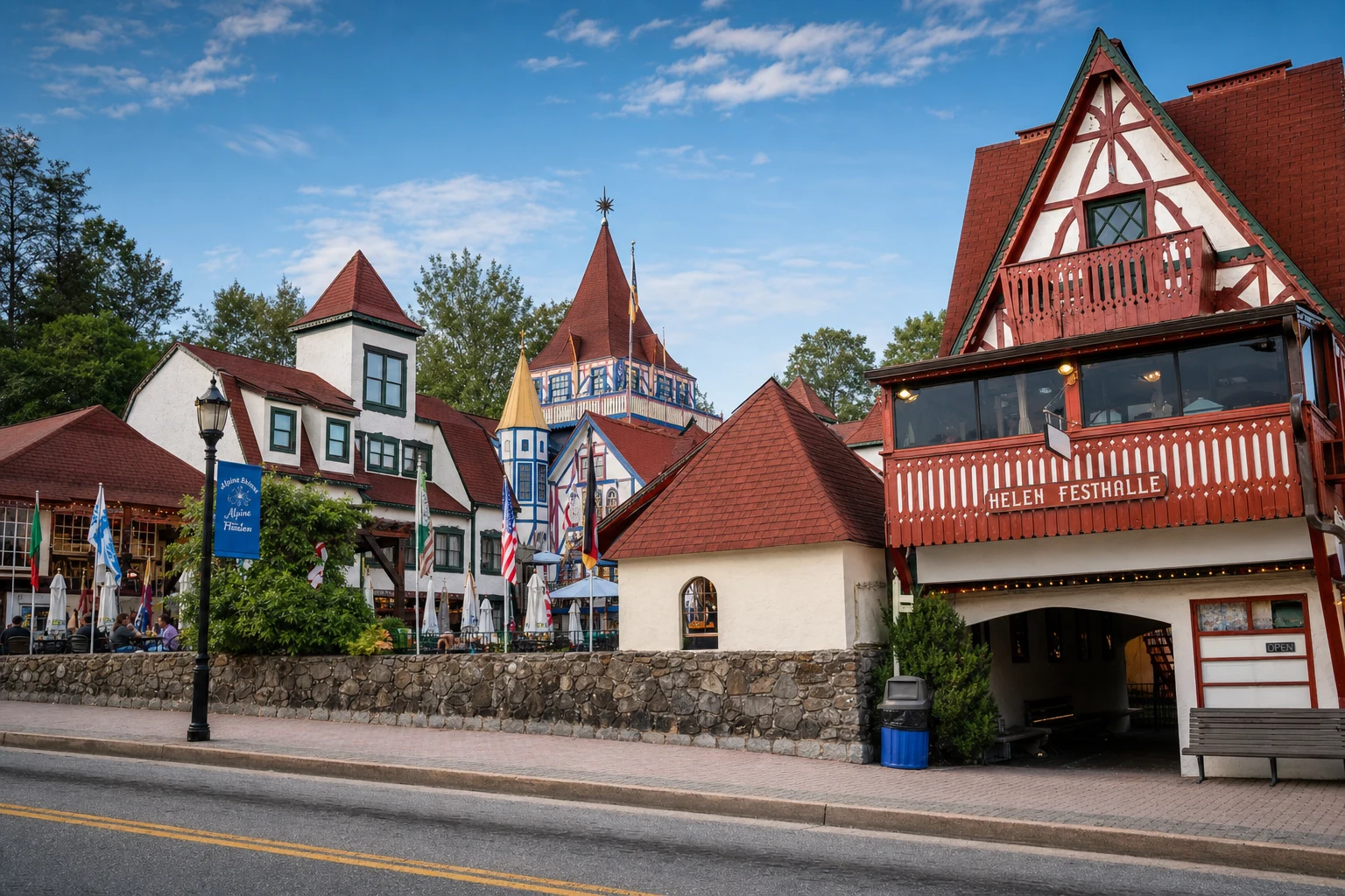
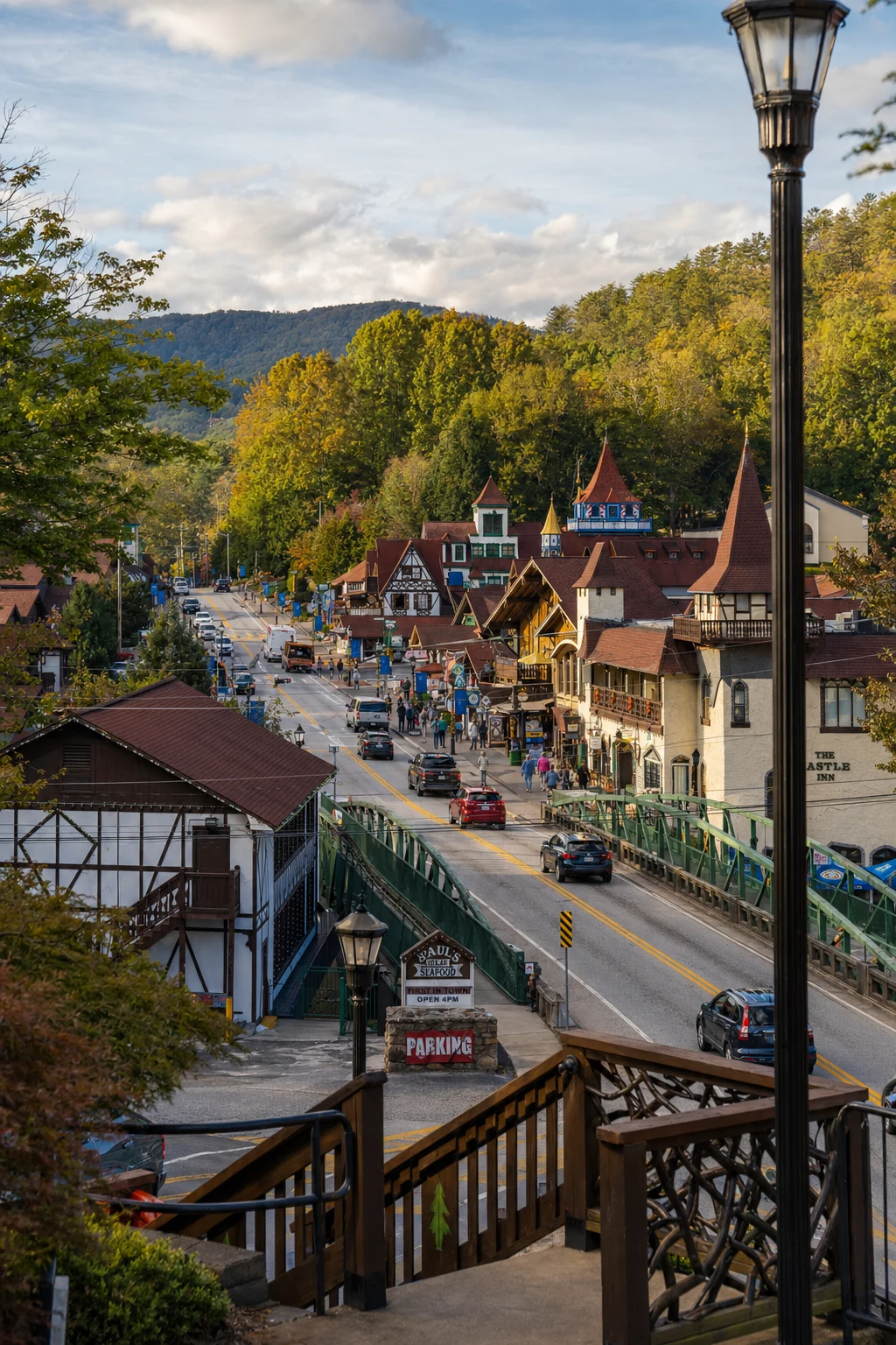
Related Imagery from Around Helen