Scenic Drives Near Helen
Winding mountain roads through the heart of the Blue Ridge
The mountains surrounding Helen, Georgia are laced with some of the finest driving roads in the southeastern United States. These winding highways climb through dense forests, cross mountain gaps, pass cascading waterfalls, and emerge onto ridgeline overlooks with views that stretch for miles across the layered Blue Ridge range. For visitors who enjoy the journey as much as the destination, a scenic drive from Helen is one of the most rewarding ways to experience the full breadth of this stunning landscape.
Each drive listed here begins and ends in or near Helen, making it easy to incorporate a scenic route into your visit without a major detour. Pack a camera, fill your gas tank, download your maps for offline use (cell service is unreliable on mountain roads), and set aside enough time to stop at the overlooks, waterfall trailheads, and roadside vistas that make these drives so memorable.
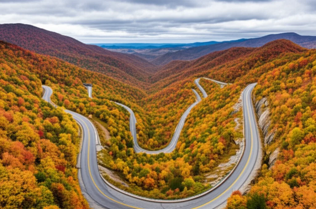
Richard B. Russell Scenic Highway
Georgia's premier mountain driving road
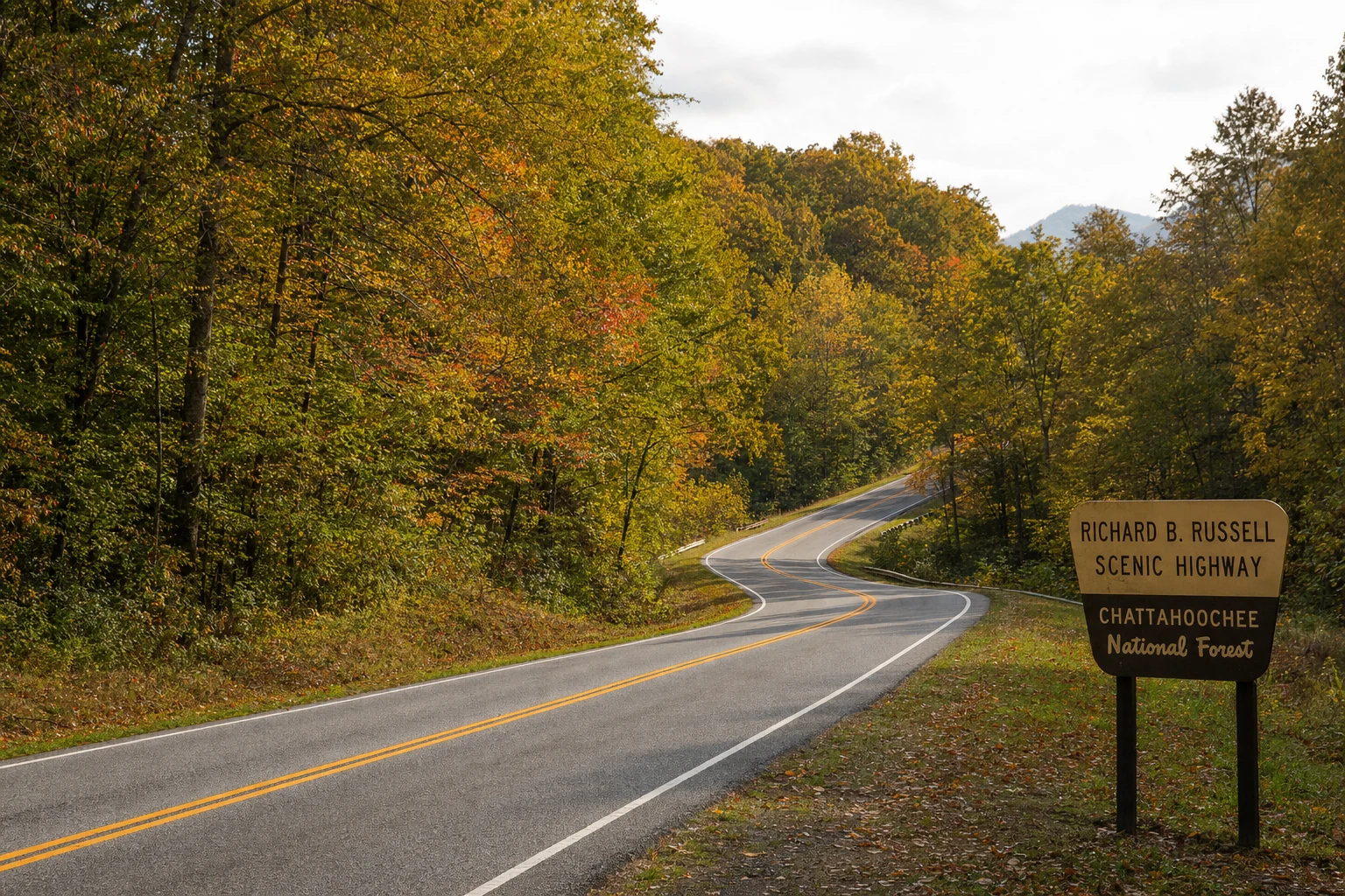
The Russell Scenic Highway climbs above 3,400 feet with sweeping views of the Blue Ridge range.
The Richard B. Russell Scenic Highway (GA-348) is widely considered the finest scenic drive in north Georgia, and it begins just a few miles north of Helen. This 14.1-mile mountain highway connects GA-75 near Unicoi Gap to GA-180 near Brasstown Bald, climbing through the Chattahoochee National Forest to elevations above 3,400 feet. The road follows a high ridgeline with dramatic views in both directions - on clear days you can see the layered mountain ranges stretching to the horizon like waves frozen in blue-green stone.
Several pull-off overlooks along the route provide safe places to stop, photograph the views, and simply absorb the scale of the landscape. The westward-facing overlooks are particularly spectacular at sunset, when the descending sun paints the mountain ridges in shades of gold, orange, and purple. During fall foliage season in October, this drive is transcendent - the forest canopy below the road becomes a mosaic of red, orange, yellow, and green that extends as far as the eye can see.
The road is paved and well-maintained but features sharp curves, steep grades, and occasional blind turns. Drive carefully and watch for motorcycles, which are especially common on weekends. The drive from Helen to the GA-180 junction takes approximately 45 minutes without stops, but plan for at least 90 minutes to enjoy the overlooks properly. From the GA-180 junction, you can continue to Brasstown Bald (Georgia's highest peak at 4,784 feet) or loop back to Helen via GA-180 and GA-75. A highly recommended stop along this route is Neel Gap, where the Appalachian Trail passes through the historic Mountain Crossings outfitter building - the only place the AT passes through a man-made structure.
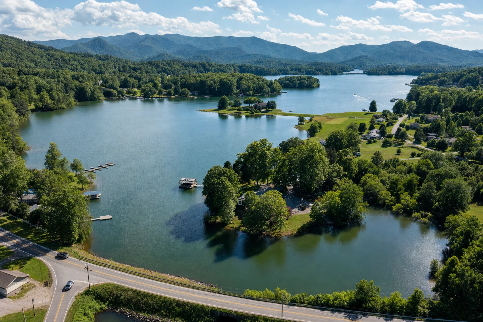
GA-75 North to Hiawassee
Lake Chatuge, mountain valleys, and the high country
Heading north from Helen on GA-75 takes you through Unicoi Gap (elevation 2,949 feet) and down into the mountain valleys leading to Hiawassee and Lake Chatuge. This drive is approximately 30 miles one-way and passes through some of the most pastoral mountain scenery in Georgia. After climbing out of the Helen valley and crossing Unicoi Gap - where the Appalachian Trail crosses the road - the highway descends through the small community of Robertstown and follows a series of mountain valleys northward.
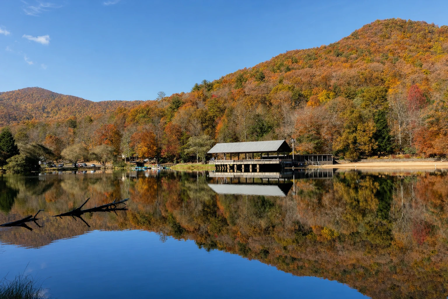
The landscape along this route alternates between dense forest, open meadows, and small farms tucked into the valley bottoms. In spring, the roadsides bloom with wildflowers and flowering trees. In fall, the valley framing is spectacular, with the surrounding ridges ablaze in autumn color. The drive terminates at Lake Chatuge on the Georgia-North Carolina border, a beautiful mountain lake with a scenic waterfront park in Hiawassee. The entire round trip from Helen takes about two hours without stops, or three to four hours with a lakeside lunch in Hiawassee and photo stops along the way.
GA-17 South to Clarkesville
Rolling foothills, farmland, and historic charm
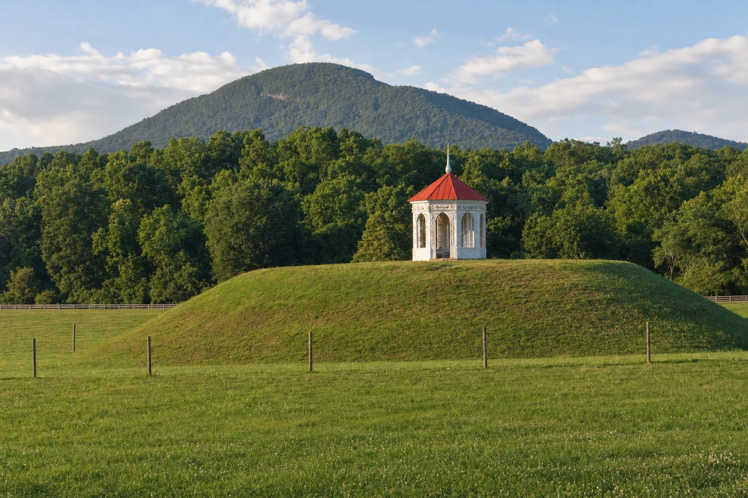
For a gentler, more relaxed drive, GA-17 south from Helen through Nacoochee Valley to Clarkesville offers a different kind of beauty. This route passes directly by the Nacoochee Mound, one of the most significant archaeological sites in Georgia, where the ancient earthwork topped by its distinctive white gazebo sits in the center of the picturesque valley. The Nacoochee Valley itself is one of the loveliest settings in the Georgia mountains - a broad, fertile bottomland surrounded by gentle ridges that feels timeless and serene.
Continuing south, the road passes through the Sautee Nacoochee community, home to the Sautee Nacoochee Center - a cultural center housed in a historic building that hosts art exhibitions, concerts, and community events. The route continues through rolling foothills to Clarkesville, a charming historic town with a well-preserved downtown square, antique shops, and several excellent restaurants. The drive from Helen to Clarkesville is about 20 miles and takes approximately 30 minutes, making it an easy afternoon excursion.
Waterfall & Overlook Stops
Don't just drive past - stop and explore
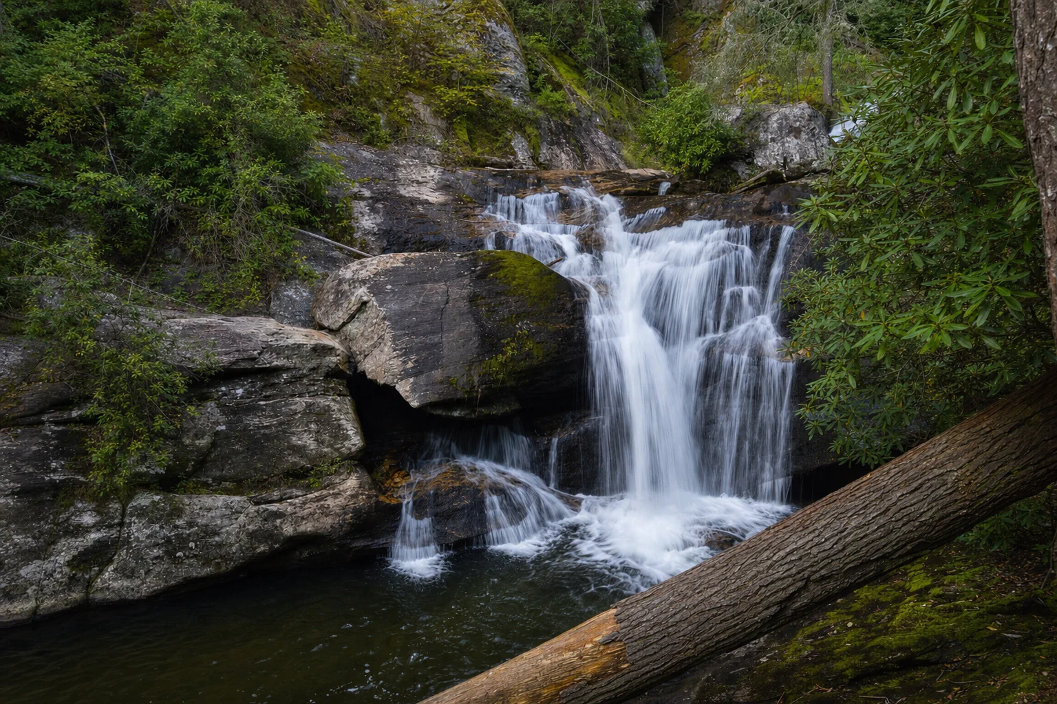
Raven Cliff Falls Trailhead
Located on the Russell Scenic Highway. A 2.5-mile trail leads to one of Georgia's tallest waterfalls. Even if you do not hike, the trailhead area offers beautiful forest scenery.
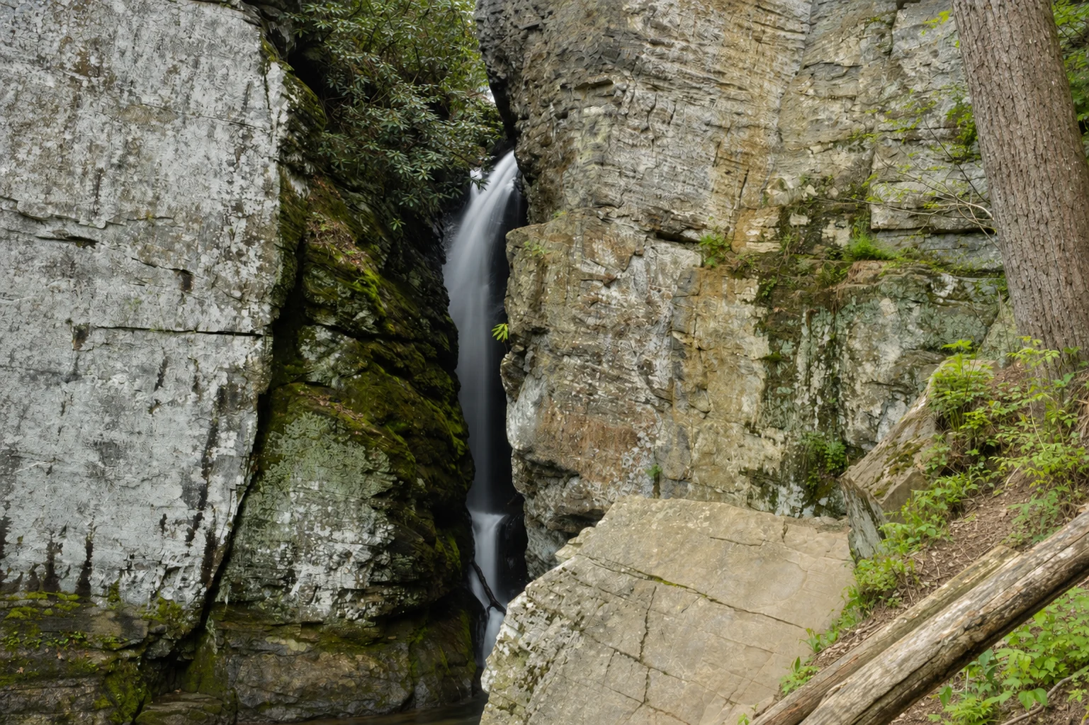
Dukes Creek Falls
Accessed from GA-348. A one-mile trail descends to a dramatic overlook of this multi-tiered cascade. One of the most scenic short hikes in the area.
Unicoi Gap (AT Crossing)
The Appalachian Trail crosses GA-75 at Unicoi Gap. Park here and walk a short section of the AT for a taste of the legendary 2,190-mile trail.
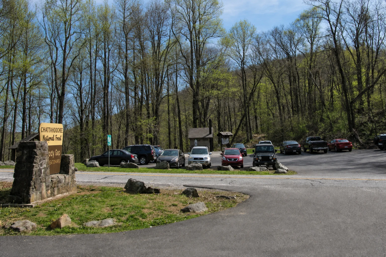
Brasstown Bald
Georgia's highest point at 4,784 feet. The summit observation tower offers 360-degree views of four states on clear days. A paved path leads from the parking area.
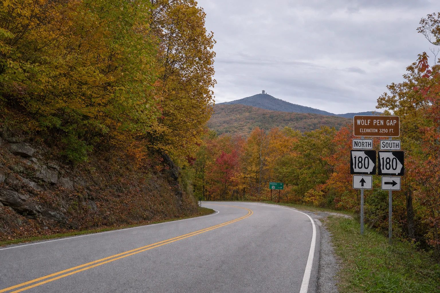
GA-180: Wolf Pen Gap Road
A motorcyclist's paradise through the high country
GA-180, also known as Wolf Pen Gap Road, is one of the most exhilarating mountain roads in north Georgia and a favorite among motorcyclists for its sweeping curves and dramatic elevation changes. The road connects GA-19/129 near Vogel State Park to GA-348 (the Russell Scenic Highway) near Brasstown Bald, passing through some of the highest terrain in the state. The curves are well-banked and the pavement is generally good, but the tight switchbacks demand full attention.
Wolf Pen Gap Road is particularly popular during fall foliage season, when the high-elevation hardwoods turn early and the views through the gaps are spectacular. The road intersects with the access road to Brasstown Bald, making it easy to combine this drive with a visit to Georgia's highest peak. On weekends from April through October, expect to share the road with groups of motorcyclists - drive cautiously and watch for bikes on the blind curves.
Driving Tips
Safety and preparation for mountain roads
Mountain driving requires a bit more attention than highway cruising. These roads feature sharp switchback curves, steep grades, and occasional blind corners where oncoming traffic appears suddenly. Use lower gears on long descents to save your brakes, pull over at designated overlooks to let faster traffic pass, and be especially cautious in wet conditions when road surfaces become slick with fallen leaves. Fog can roll in rapidly at higher elevations, reducing visibility to near zero - if you encounter dense fog, slow down significantly and use your low beams.
Winter driving on these roads demands extra caution. While Georgia mountain roads are generally passable year-round, ice can form on bridges and at higher elevations, particularly on the Russell Scenic Highway. Check road conditions before departing during winter months and carry emergency supplies. Regardless of season, fill your gas tank before heading out - there are no gas stations on the Russell Scenic Highway or on GA-75 between Helen and Hiawassee.
A Visitor's Perspective
Lessons from many miles of mountain driving
After driving every route listed here multiple times and in every season, I can offer a few hard-earned recommendations. The Richard B. Russell Scenic Highway (GA-348) during mid-October is, without exaggeration, one of the most beautiful drives I have experienced anywhere in the eastern United States. The canopy below the road becomes a continuous mosaic of color that extends to the horizon. If you can only do one scenic drive during your visit, make it this one. For the best times to catch peak fall color, see our Helen area fall color guide.
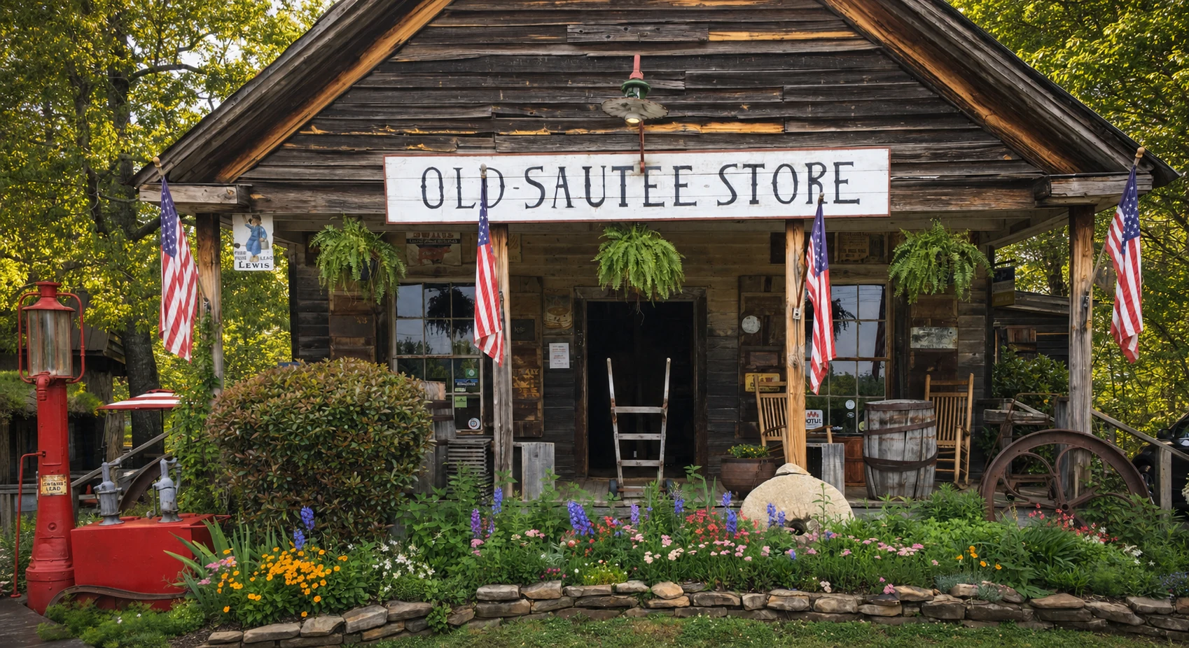
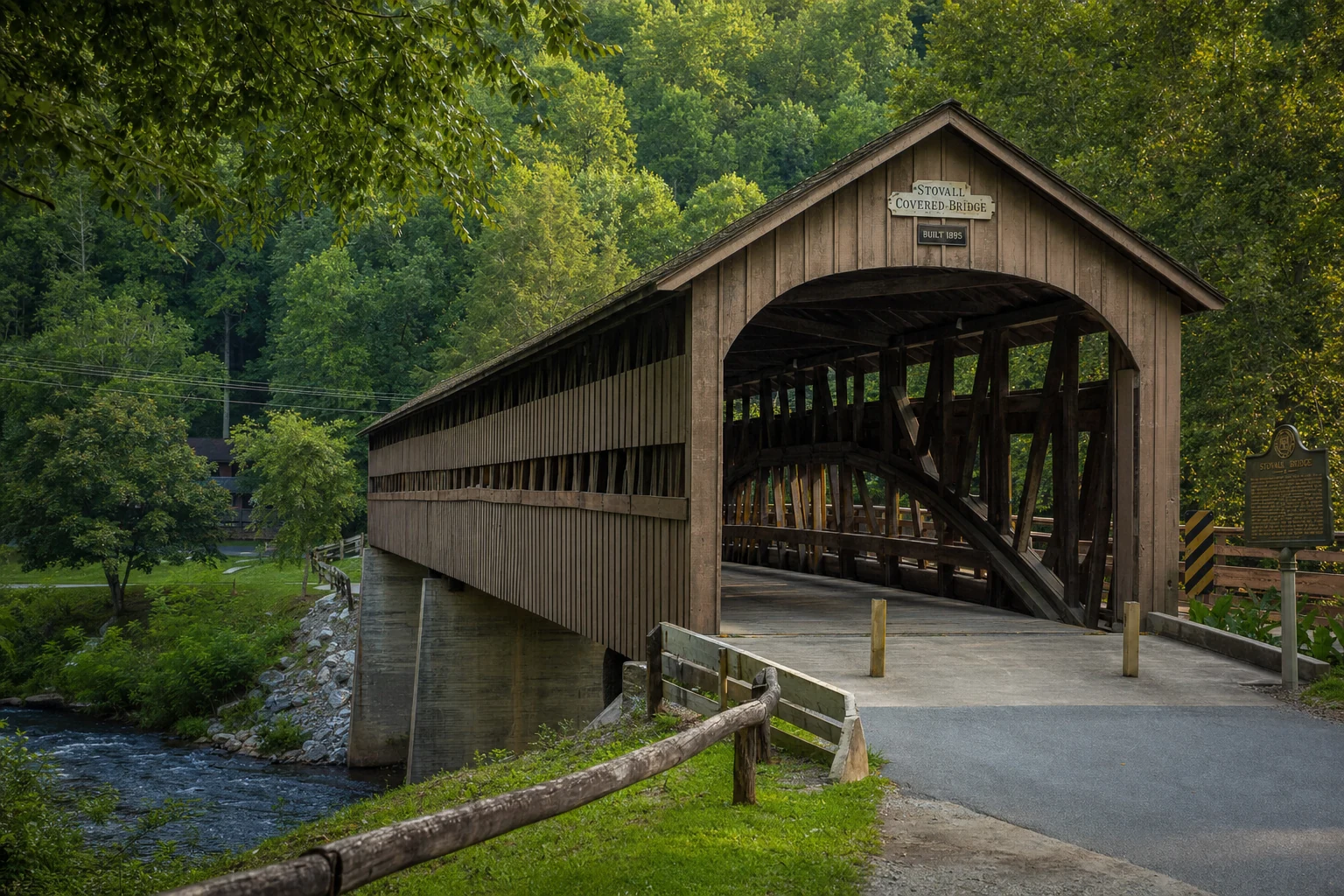
For a quieter experience, the GA-17 route through the Sautee Nacoochee Valley is my favorite for a relaxed afternoon. The rolling farmland, the Nacoochee Mound, and the pastoral scenery feel like a different century. Stop at the Old Sautee Store for lunch and the Stovall Covered Bridge for photographs - the whole loop from Helen takes about three hours and is never crowded. For photographers seeking the perfect shot, explore our guide to Helen's best photography spots. And one practical note: download your maps before you leave Helen. Cell service disappears on the Russell Highway and does not return until you descend the other side.
More to Explore
Discover nearby attractions