Appalachian Trail North GA
Your guide to appalachian trail north ga in Helen, Georgia and the Blue Ridge Mountains
Introduction to the Appalachian Trail in North Georgia
The Appalachian Trail (AT) stretches over 2,190 miles from Georgia to Maine, but its southern terminus at Springer Mountain in North Georgia marks the iconic starting point for thousands of thru-hikers annually. In Georgia, the trail covers about 78.6 miles through the Chattahoochee-Oconee National Forest, offering rugged terrain, stunning vistas, and a gateway to the North Georgia Blue Ridge Mountains region near Helen. Here is what you need to know about section hiking from Springer Mountain, popular day hikes, shelters, difficulty levels, and trail town stops near the Helen area.
Historical Context
The Appalachian Trail was envisioned in the 1920s by hiking enthusiast Benton MacKaye as a way to connect remote wilderness areas for spiritual renewal amid growing urbanization. Construction began in 1923, with the Georgia section completed by the early 1930s under the efforts of local clubs like the Georgia Appalachian Trail Club (GATC), founded around that time to maintain it. Originally, the southern end was at Mount Oglethorpe, but in 1958, it shifted 14 miles southwest to Springer Mountain due to development pressures, solidifying its place in Fannin County's wilds.
The GATC has managed the Georgia AT since 1930 under a U.S. Forest Service agreement, relying on over 1,000 volunteers to maintain 130 miles of trail, including side paths. This legacy ties directly into Helen's backyard, as the trail weaves through White, Lumpkin, and Union Counties, influencing local tourism and conservation - think thru-hikers fueling Helen's alpine economy since the 1960s Bavarian makeover.
Springer Mountain: The Southern Terminus
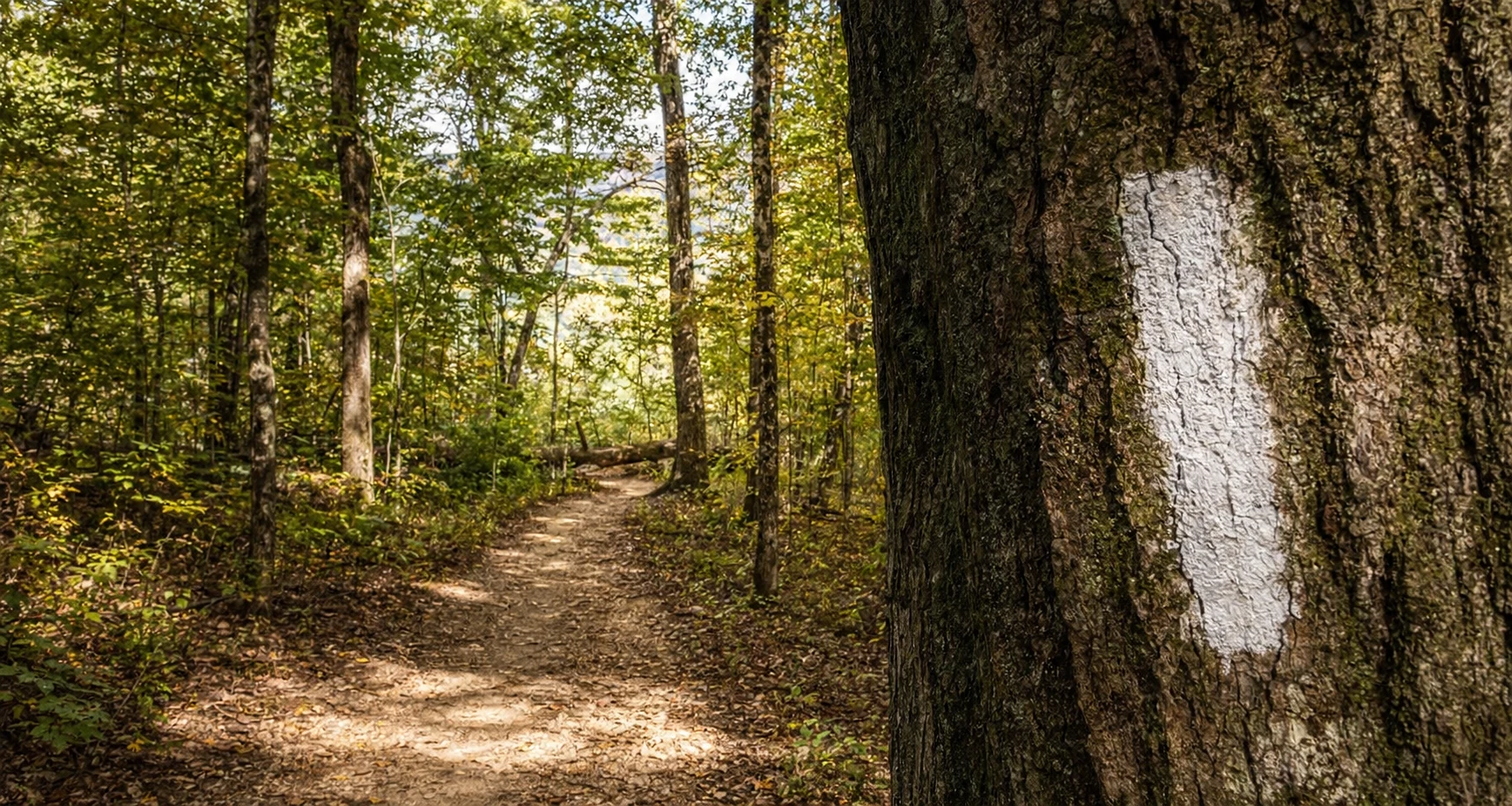
Springer Mountain (3,782 feet) is the holy grail for northbound (NOBO) hikers, featuring a bronze plaque with the AT logo, a trail register in a vault, and panoramic views westward through dense forest. Access the summit via a 1-mile southbound hike from the parking lot on Forest Service Road 42 (FS 42), coordinates 34.637522, -84.195078, or the popular 8.8-mile Approach Trail from Amicalola Falls State Park (240 Amicalola Falls State Park Rd, Dawsonville, GA 30534; 706-265-6056; georgiaatclub.org).
The Springer Mountain Shelter sits 0.2 miles east at 3,733 feet (capacity 12), a three-sided log structure typical of AT shelters. No fees for day use, but overnight parking is permitted up to 14 days; the lot holds 20+ cars but fills weekends - arrive early or use shuttles from Dahlonega. Historically, it's where dreamers sign the log before epic journeys, with plaques commemorating the trail's spirit.
Section Hiking from Springer Mountain
Section hiking lets you tackle Georgia's AT in chunks, ideal for weekend warriors. A classic 3-5 day itinerary: Day 1, Springer to Hawk Mountain Shelter (8.1 miles); Day 2, to Gooch Mountain Shelter (15.8 miles total); Day 3, to Woods Hole Shelter (28.2 miles); extend to Blood Mountain (29.3 miles) or Low Gap (43.2 miles). Expect 7-10 miles/day for beginners due to steep climbs - Georgia's section demands low mileage early on.
For a moderate 75-mile thru-Georgia push (8 days), hit resupplies at Unicoi Gap (mile 52.5) near Helen or Dicks Creek Gap (mile 69.2). Difficulty ramps up with 464,500 feet of total elevation change across the full AT, but Georgia's roots and rocks test ankles - strenuous overall, with black bears requiring proper food hangs. Insider tip: NOBO in spring aligns with thru-hiker "trail magic" (free food/drinks from locals), but book shuttles via GATC resources.
Popular Day Hikes
North Georgia's AT has several day hikes worth your time, with good access and great views.
Springer Mountain Loop: 2 miles round-trip from FS 42 parking; gentle ascent to summit plaque and views. Easy-moderate, 400 feet gain; perfect intro.
Woody Gap to Preachers Rock: 2 miles RT from GA Hwy 60 (Woody Gap parking); climbs to rocky overlook on Big Cedar Mountain. Moderate, popular for sunrise views near Dahlonega.
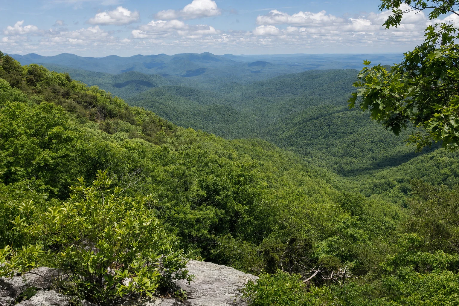
Blood Mountain via Neel Gap: 4.3 miles RT from Byron Herbert Reece parking (0.2 miles north of US 129/19 Neel Gap; holds 38 cars). Strenuous boulder scrambles to Georgia's highest AT point (4,461 feet) and stone shelter; iconic views.
Three Forks to Long Creek Falls: ~3.7 miles from FS 58 parking; flat creekside to waterfall, en route to Springer. Easy, with hiker crossing sign.
These connect seamlessly to Helen - Unicoi Gap (GA Hwy 75, 10 miles from town) launches Tray Mountain hikes.
Shelters Along the Georgia AT
AT shelters are free, first-come lean-tos spaced 5-12 miles apart, with privies and water sources (treat always). Key North Georgia ones (NOBO miles from Springer):
From the GATC-managed shelters, practice Leave No Trace - pack out trash, hang food 12 feet high. Pro tip: Arrive by 4 PM; popular ones like Hawk fill fast.
Difficulty Levels
Georgia AT is strenuous: rocky, rooty paths with relentless ups/downs (e.g., Blood Mountain's switchbacks). Ratings:
Easy: Three Forks flats (minimal gain).
Moderate: Springer summit (400 ft), Woody Gap (short climbs).
Strenuous: Blood/Tray Mountains (1,000+ ft gain, exposed ridges).
Factors include weather - thunderstorms common spring/summer - and wildlife; fit hikers average 8-12 miles/day here vs. 12-15 elsewhere. Not beginner-friendly without prep; test on day hikes first.
Trail Town Stops
Trail towns are lifelines for resupply, showers, and brews. Helen (helena.com; 15 mins from Unicoi Gap, mile 52.5) tops the list - Bavarian charm with groceries, lodging (e.g., hotels $100-200/night), and eateries; third-most visited GA city. Stock up at Betty's Country Store or sip at wineries post-hike.
Dahlonega (13 miles from Woody Gap; dahlonega.org): Gold Rush history, outfitters, near Amicalola. Lodging, laundry, post office.
Hiawassee (11 miles from Dicks Creek Gap, mile 69.2; explorehiawassee.com): Centralized shops, hostels; Trailful outfitter shop.
Others: Blairsville, Clayton, Ellijay - AT Communities with shuttles.
Connects to Helen's vibe: Hike Unicoi, refuel on German fare.
Seasonal Considerations and Best Times to Visit
Spring (April-May): Ideal for section hikes - wildflowers, mild temps (50-70°F days), but rain/snow possible early; NOBO peak. Summer (June-Aug): Hot/humid (80°F+), bugs, thunderstorms - avoid afternoons; better for early starts. Fall (Sept-Oct): Cool (40-60°F), foliage peaks; fewer crowds post-thru season. Winter: Snow/ice at elevations, clearest views but short days - experienced only.
Best: Spring/fall for North Georgia; avoid mid-summer heat. Check GATC for storm updates.
Nearby Attractions and Connections to Helen/North Georgia
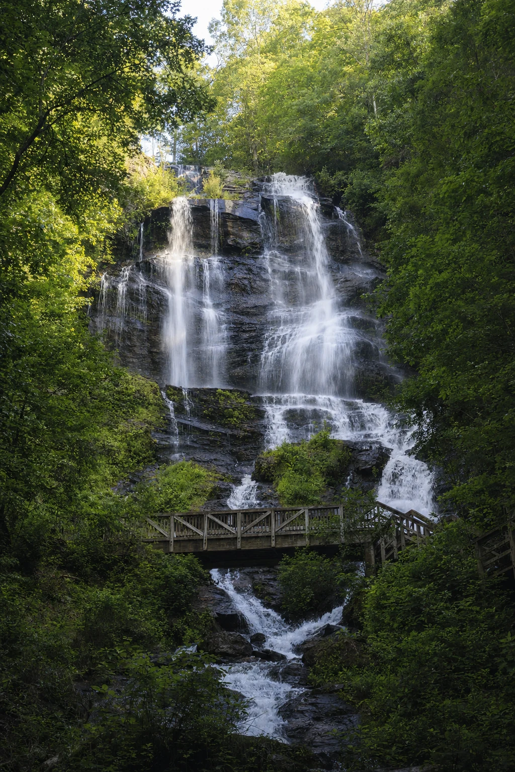
The AT anchors Helen's outdoor scene - hike Unicoi Gap to Tray, then tube the Chattahoochee or zipline Unicoi State Park (1788 GA-356, Helen; unicoistatepark.com). Near Springer: Amicalola Falls (highest GA waterfall), wineries in Dahlonega. Blood Mountain links to Raven Cliffs Wilderness; Hiawassee offers lake views.
Broader Blue Ridge: Pair with Benton MacKaye Trail or Anna Ruby Falls (Unicoi SP). Helen's alpine festivals (Oktoberfest) complement trail solitude.
Related Imagery from Around Helen