Guide to Springer Mountain, Georgia: The Southern Terminus of the Appalachian Trail
The southern terminus of the 2,190-mile Appalachian Trail, with day-hike and backpacking access
Introduction
Springer Mountain holds a special place in American hiking. It's not the tallest peak in Georgia or the most dramatic, but it's where something big begins. Located in North Georgia's Fannin County, this 3,782-foot peak marks the southern terminus of the legendary Appalachian Trail, making it the starting (or finishing) point for roughly 3,000-4,000 thru-hikers every year. Whether you're embarking on a 2,190-mile journey to Maine's Mount Katahdin or simply visiting to touch the bronze plaque marking the trail's beginning, Springer Mountain offers an unforgettable experience for hikers, history enthusiasts, and nature lovers drawn to the remote heart of the Blue Ridge Mountains.
The journey to Springer Mountain itself tells a story of determination and preservation. In 1958, the Appalachian Trail's southern terminus was relocated approximately 14 miles northeast from Mount Oglethorpe to Springer Mountain specifically to escape increasing development in the lower elevations. This remote location, nestled within the Chattahoochee National Forest and the Ed Jenkins National Recreation Area, has made Springer Mountain a sacred destination for outdoor enthusiasts and a gateway to the untamed beauty of North Georgia.
History and Significance
The Appalachian Trail's Origin Point
Springer Mountain sits at the border of Gilmer and Fannin counties, part of the Blue Ridge Mountains that extend from Georgia all the way to Maine. The trail that begins here stretches over 2,190 miles northward, making it one of the longest hiking trails in the world.
The relocation from Mount Oglethorpe to Springer Mountain in 1958 wasn't arbitrary - it was a strategic decision driven by preservation concerns. As development crept up the lower elevations around Mount Oglethorpe, the Appalachian Trail Conservancy and associated hiking clubs recognized that Springer's remote location would better protect the trail's integrity and maintain the wilderness experience that defines the AT. This decision has proven instrumental in preserving the southern terminus experience for future generations.
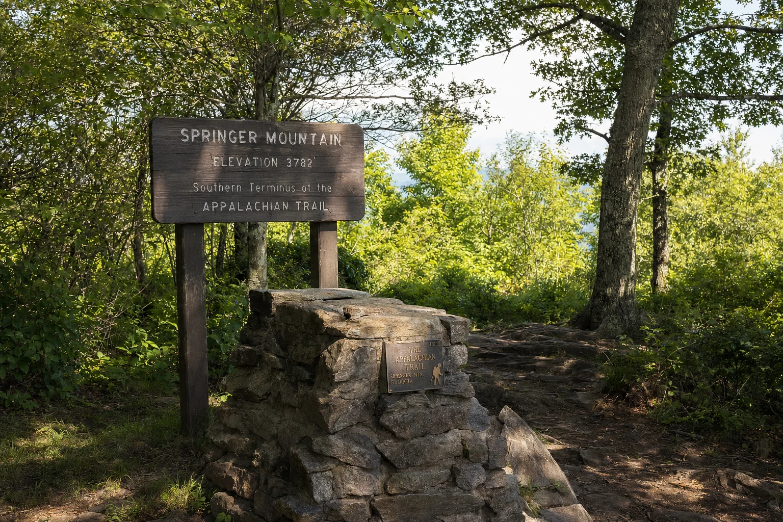
The Bronze Plaque and Summit Markers
At Springer Mountain's summit, you'll find the physical embodiment of this trail's legacy: a bronze plaque displaying the Appalachian Trail logo, a hiker's register where thousands of visitors have signed their names, and a benchmark marking the official location. This plaque has become a pilgrimage point for hikers worldwide. The first white blaze on the trail (heading northbound) is marked directly on the summit rocks, creating an iconic moment when thru-hikers touch this initial blaze after weeks of preparation.
Access and Getting There
Driving Directions and Parking
The journey to Springer Mountain begins long before you lace up your hiking boots. The approach requires navigating approximately 10 miles of rough, unpaved gravel Forest Service roads - a factor that discourages casual visitors but preserves the area's remote character.
From Helen or Blue Ridge area:
From Blue Ridge, take Aska Road 13.5 miles until it ends at Newport Road. Turn right and go 4.5 miles until it dead-ends into Doublehead Gap Road. Turn right on Doublehead Gap and go 2 miles until you reach Forest Service Road 42 (on the left). Turn onto FS Road 42 and drive approximately 6.5 to 7 miles to the parking area on your left at Big Stamp Gap.
From Dahlonega area:
From Georgia Highway 52, head north/northeast to Forest Service Road 28 (look for a sign for Jones Creek on the right). After 2.2 miles, take the left fork onto FS 77 and go 5.1 miles to Winding Stair Gap. Take a hard left onto FS 42 and travel 2.7 miles before finding the AT crossing where a large parking area is located on the north side of the road.
Parking Details
The parking lot access for Springer Mountain is located on USFS 42 and can accommodate 20-plus cars. The lot is often full on weekends, particularly during peak thru-hiker season (mid-February through April). The permitted length of parking at the lot is 14 days, accommodating backpackers and those spending extended time on the trail.
Insider tip: Arrive early on weekends or during spring hiking season (February-April). The parking situation during peak thru-hiker season can be competitive. Morning arrival between 6-8 AM is your best bet for securing a spot. The gravel road itself is suitable for all vehicles, but plan for a slower drive due to road conditions - locals recommend taking your time rather than rushing on the windy, bumpy forest service roads.
Hiking Routes to the Summit
Option 1: The Shortest Route from FS Road 42 (0.9 miles)
For visitors with limited time or those seeking a less strenuous hike, the direct approach from the Springer Mountain parking area offers immediate access to the terminus. From the parking lot, simply hike south on the white-blazed Appalachian Trail across FS Road 42. The hike is approximately 0.9 miles to the summit, though you must retrace your steps on the return.
Difficulty: Steep but short. Expect continuous elevation gain on a rocky, well-maintained trail. This is described by visitors as "like climbing a continuous flight of stairs for one mile." The climb is technically straightforward but demands steady endurance. Plan 30-45 minutes ascending and 20-30 minutes descending.
What you'll experience: The trail gains elevation rapidly through a hardwood forest with increasing rock outcrops. In summer months, you may spot wildflowers along the western slope, fed by mountain runoff. In winter, you might see icicles forming from the same water sources on rocky outcrops.
Option 2: The Approach Trail from Amicalola Falls State Park (8.5-8.8 miles)
For those seeking a more immersive experience or beginning an AT thru-hike, the approach trail from Amicalola Falls State Park offers the traditional pilgrimage route. This blue-blazed trail starts behind the visitor center and covers 8.5 miles with nearly 2,000 feet of elevation gain.
Why choose this route: This is the official start for most AT thru-hikers. At peak thru-hiker season (mid-February through April), the Georgia Appalachian Trail Club operates a base camp at the Amicalola Falls Visitor Center specifically to assist hikers in their final preparations before heading north on their 2,000+ mile journey.
Difficulty: Moderately challenging with several steep sections. The elevation gain is substantial over the 8.5 miles, with multiple difficult climbs. The entire trail climbs nearly continuously, making it suitable for those with good cardiovascular fitness and hiking experience.
Distance calculation note: Different sources cite 8.3, 8.5, or 8.8 miles - variations reflect different measurement methods and exact trailhead locations. The distance is effectively 8-9 miles one way.
What to expect: The blue-blazed approach trail passes through beautiful forest with increasing elevation throughout. Approximately 400 yards down a blue-blazed side trail from the summit, you'll find an open-front shelter for backpackers, built in 1993, which sleeps 12 and includes a privy and tentpads. This shelter is heavily used, particularly during peak hiking season.
Option 3: Benton MacKaye Trail Loop (4+ miles)
For experienced hikers wanting a longer adventure, the Benton MacKaye Trail - which also terminates at Springer Mountain - offers loop hiking options. One notable loop combines the AT with the Benton MacKaye Trail for approximately 4 miles of additional hiking around the summit area.
The Summit Experience: What to Expect
The Iconic Plaque and Terminus Marker
Your moment of arrival at Springer Mountain's 3,782-foot summit is marked by tangible symbols of the trail's legacy. The bronze plaque with the Appalachian Trail logo has been touched by hundreds of thousands of hands - from wide-eyed hikers at the start of their journeys to emotional thru-hikers completing their northbound trek.
The hiker's register at the summit offers an intimate view of who comes to Springer Mountain. You'll find entries from solo hikers, families, couples, seniors, and people from every continent. Many thru-hikers write additional notes - hopes, prayers, or simply "2,190 miles to Katahdin!" The benchmark marks the precise elevation and geographical location for surveyors and geodetic records.
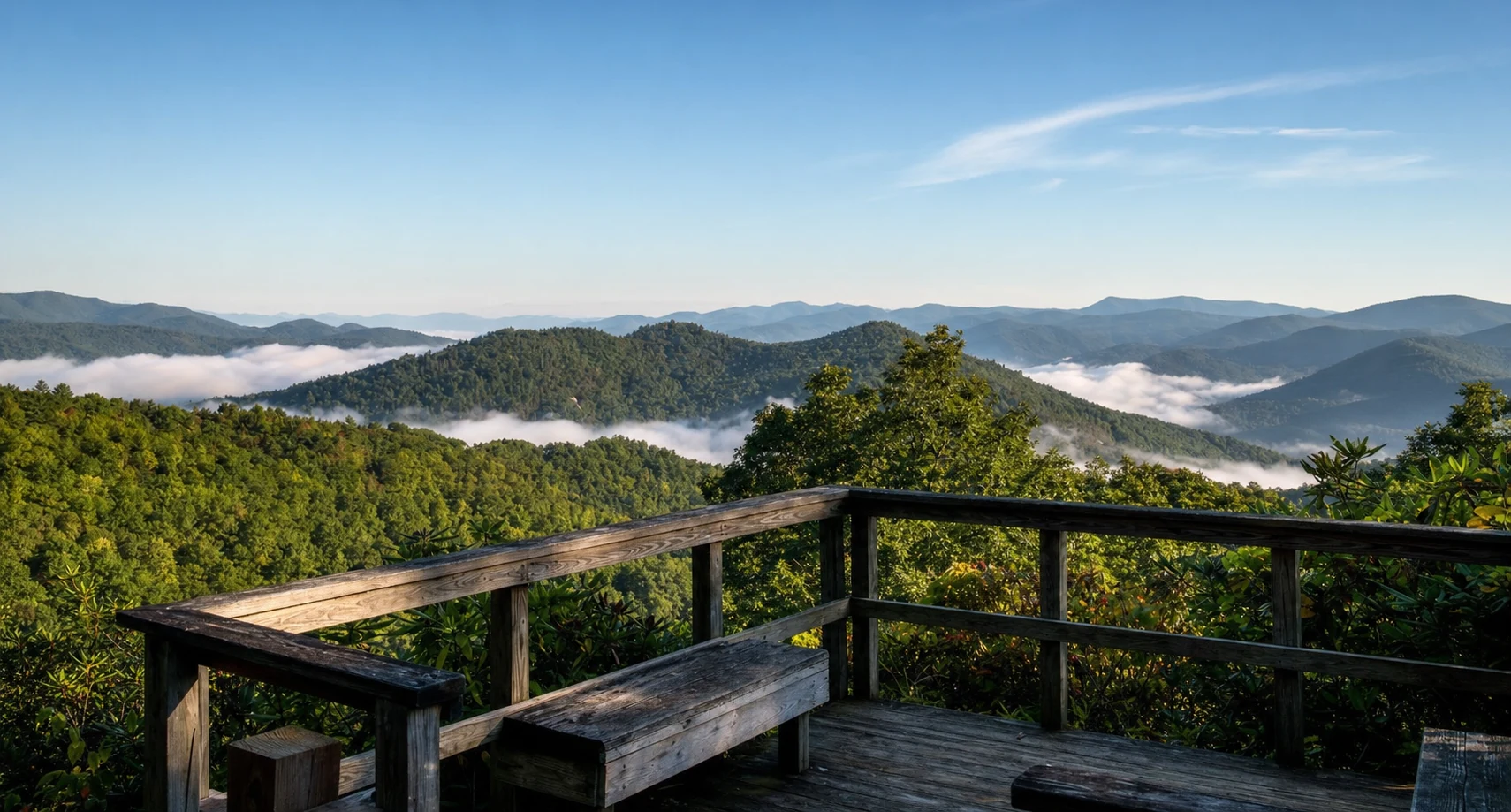
Views and Vistas
Views from the Springer Mountain summit look west into the southern Appalachians, offering scenic vistas across the rolling mountains. The view quality varies with season and weather conditions. Those who start their AT thru-hike in February enjoy an unexpected benefit: with bare trees, the forest opens up to "peekaboo views" through tree trunks that summer hikers never experience. The lack of foliage means less shade but more distant views - a fair tradeoff during cooler seasons.
Fall (October-November) offers perhaps the most dramatic summit views, when autumn colors explode across the surrounding valleys and ridges. Spring (April-May) brings wildflower blooms and renewed greenery. Summer vistas are obscured by the "green tunnel" of dense foliage that characterizes hiking through the southern AT.
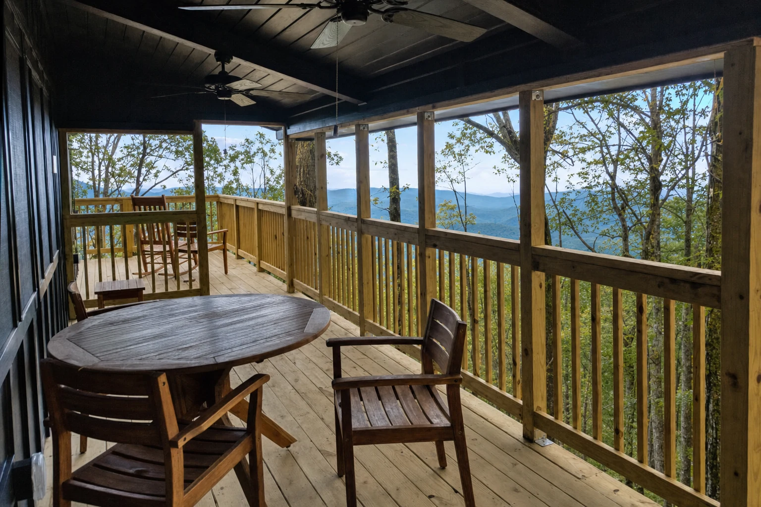
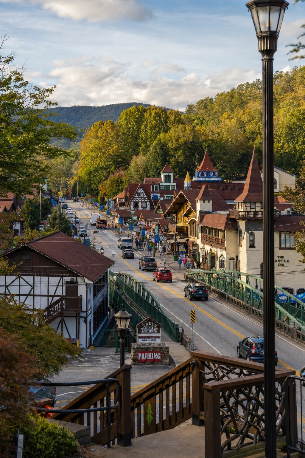
Related Imagery from Around Helen