Comprehensive Guide to Section Hiking the Appalachian Trail in North Georgia
Springer Mountain to Bly Gap: shelters, resupply points, and trail conditions on the AT's southern terminus
Key Points
Terrain Severity: The Georgia section of the Appalachian Trail (A.T.) is deceptively strenuous, characterized by frequent, steep vertical ascents and descents. Analysis suggests the elevation gain per mile in Georgia ranks in the 74th percentile of difficulty for the entire trail.
Primary Access: The 78.6-mile section stretches from Springer Mountain (southern terminus) to Bly Gap (NC border). Major road crossings facilitating section hikes include Woody Gap, Neels Gap, Unicoi Gap (closest to Helen), and Dicks Creek Gap.
Introduction
The Georgia section of the Appalachian National Scenic Trail runs through the Chattahoochee-Oconee National Forest, covering approximately 78.6 miles from Springer Mountain to the North Carolina border at Bly Gap. Thousands of aspiring thru-hikers start here every year, and the terrain earns its reputation quickly. For section hikers based near Helen, Georgia, there are options ranging from strenuous summit climbs to long ridge walks. This guide covers the route segment by segment, along with logistics and what to expect on the trail.
The Route: Springer Mountain to Bly Gap
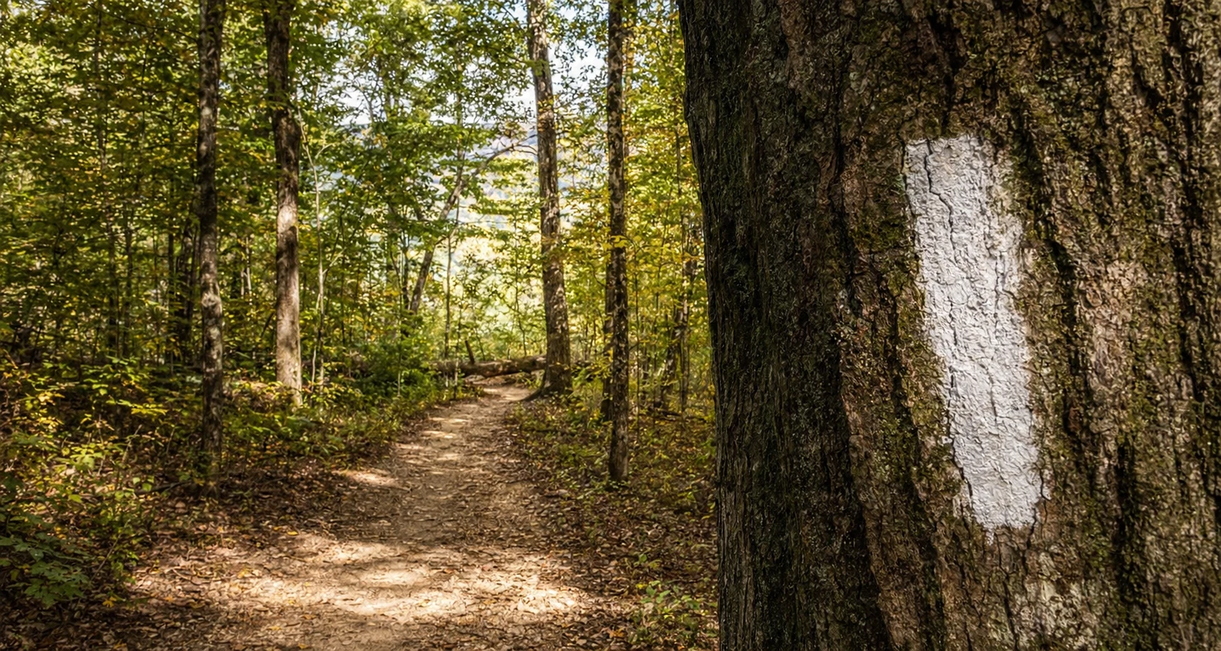
The Georgia A.T. is managed by the Georgia Appalachian Trail Club (GATC) in partnership with the U.S. Forest Service. The trail navigates the Blue Ridge Mountain chain, rarely dipping below 2,500 feet and frequently exceeding 4,000 feet. The route can be distinctively categorized into five primary segments based on major road crossings.
Segment 1: Springer Mountain to Woody Gap (~20.5 Miles)
This segment initiates the journey. Most hikers access Springer Mountain via the 8.8-mile Approach Trail from Amicalola Falls State Park, although a Forest Service road (FS 42) allows access 0.9 miles north of the terminus.
Terrain: The trail begins with moderate rolling hills but increases in difficulty. Key features include the Benton MacKaye Trail intersection and the Long Creek Falls scenic area near Three Forks.
Highlights: Long Creek Falls is a popular destination for day hikers. The Sassafras Mountain climb in this section is noted for its steepness, serving as an early physical test.
Segment 2: Woody Gap to Neels Gap (~10.7 Miles)
Located within the Blood Mountain Wilderness, this is the most heavily trafficked section of the A.T. in Georgia due to its scenic value and accessibility.
Terrain: The trail climbs Big Cedar Mountain, offering views from Preacher’s Rock, before descending into Jarrard Gap and ascending Blood Mountain.
Blood Mountain: At 4,461 feet, this is the highest point on the A.T. in Georgia. The summit hosts a historic stone shelter and offers panoramic views.
Neels Gap: The segment ends at the Walasi-Yi Center (Mountain Crossings), the only point where the A.T. passes through a man-made structure (a breezeway). It is a critical resupply point. You can find more information about trail conditions on AllTrails.
Segment 3: Neels Gap to Unicoi Gap (~21.7 Miles)
This section traverses the Mark Trail Wilderness and is characterized by significant elevation changes, crossing Tesnatee and Hogpen Gaps.
Terrain: Known for the "PUDS" (Pointless Ups and Downs), this section includes the climbs of Levelland Mountain, Wolf Laurel Top, and Blue Mountain.
Helen Proximity: Unicoi Gap (GA-75) is the primary gateway for hikers staying in Helen, located just 9 miles north of the town.
Segment 4: Unicoi Gap to Dicks Creek Gap (~16.7 Miles)
This rugged segment features two of the most significant climbs in the state: Rocky Mountain and Tray Mountain.
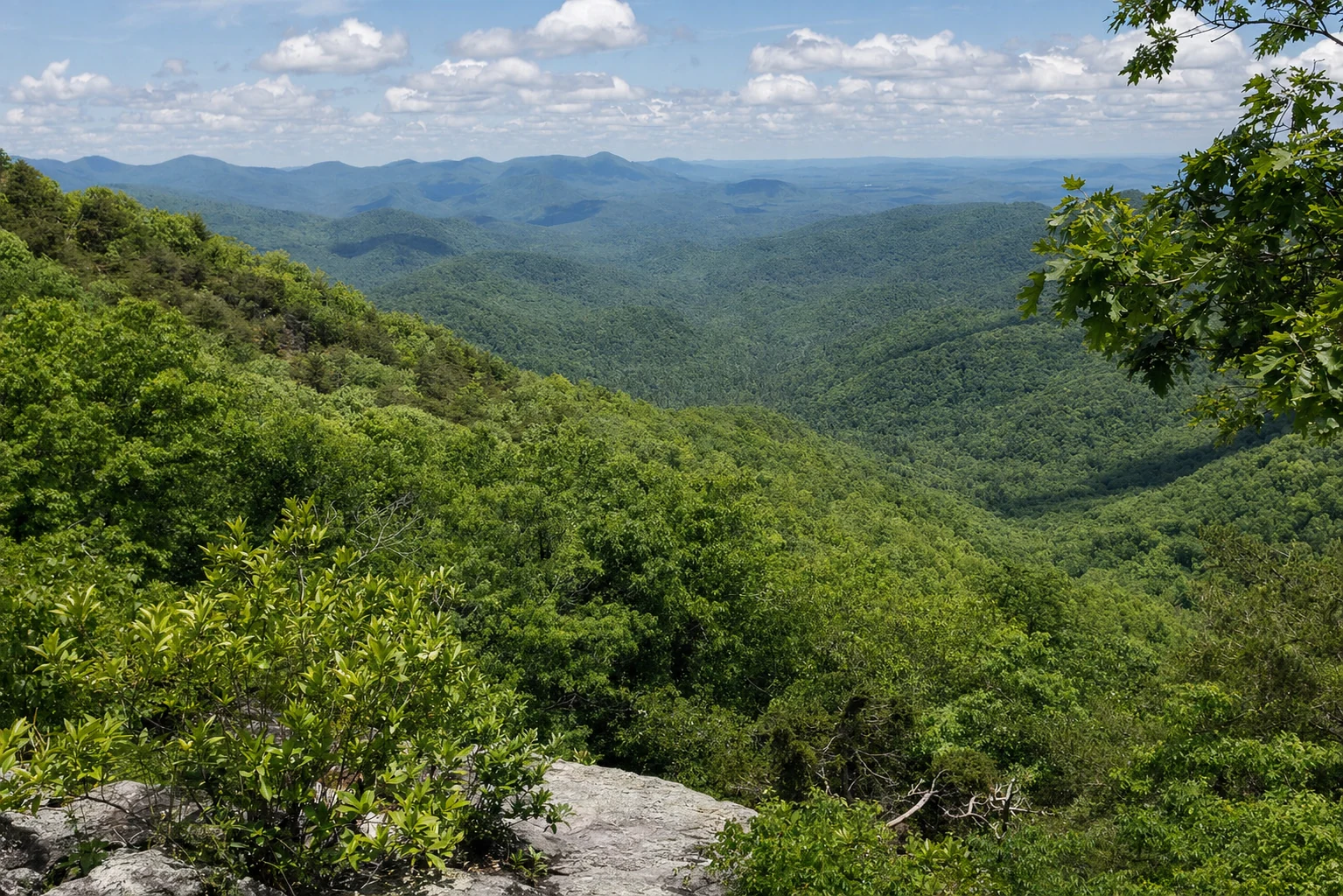
Tray Mountain: Rising to 4,430 feet, Tray Mountain offers arguably the best views in the section, looking back toward Blood Mountain and north into the Nantahala Mountains.
Terrain: The descent from Rocky Mountain to Indian Grave Gap is steep, followed immediately by the ascent of Tray Mountain, making this a physically demanding day for section hikers.
Segment 5: Dicks Creek Gap to Bly Gap (~8.8 Miles)
The final stretch to the North Carolina border is less accessible by road, contributing to a sense of remoteness.
Terrain: The trail passes Plumorchard Gap and ascends steadily toward the state line.
The Border: Bly Gap (3,840 feet) is marked by a gnarled oak tree. There is no vehicular access at Bly Gap; hikers must continue to Deep Gap, NC, or backtrack.
Best Day Hike Sections Near Helen
For visitors based in Helen, Georgia, several day hikes offer immediate access to high-elevation vistas and waterfalls.
Tray Mountain from Unicoi Gap
Distance: ~10 miles round-trip (or shorter options via Indian Grave Gap).
Description: Starting at Unicoi Gap (GA-75), hikers ascend Rocky Mountain, descend to Indian Grave Gap, and climb Tray Mountain. This dual-summit hike is considered one of the best for views but is graded as strenuous due to the 1,250+ foot elevation gain.
Alternative: Hikers can drive a gravel road to Indian Grave Gap to shorten the hike to just the Tray Mountain summit (approx. 5 miles out-and-back).
Blue Mountain from Unicoi Gap
Distance: ~5.2 miles round-trip.
Description: Hiking south from Unicoi Gap, this route climbs Blue Mountain. While the summit is forested, the Blue Mountain Shelter offers a destination, and further hiking leads to Chattahoochee Gap, the headwaters of the Chattahoochee River.
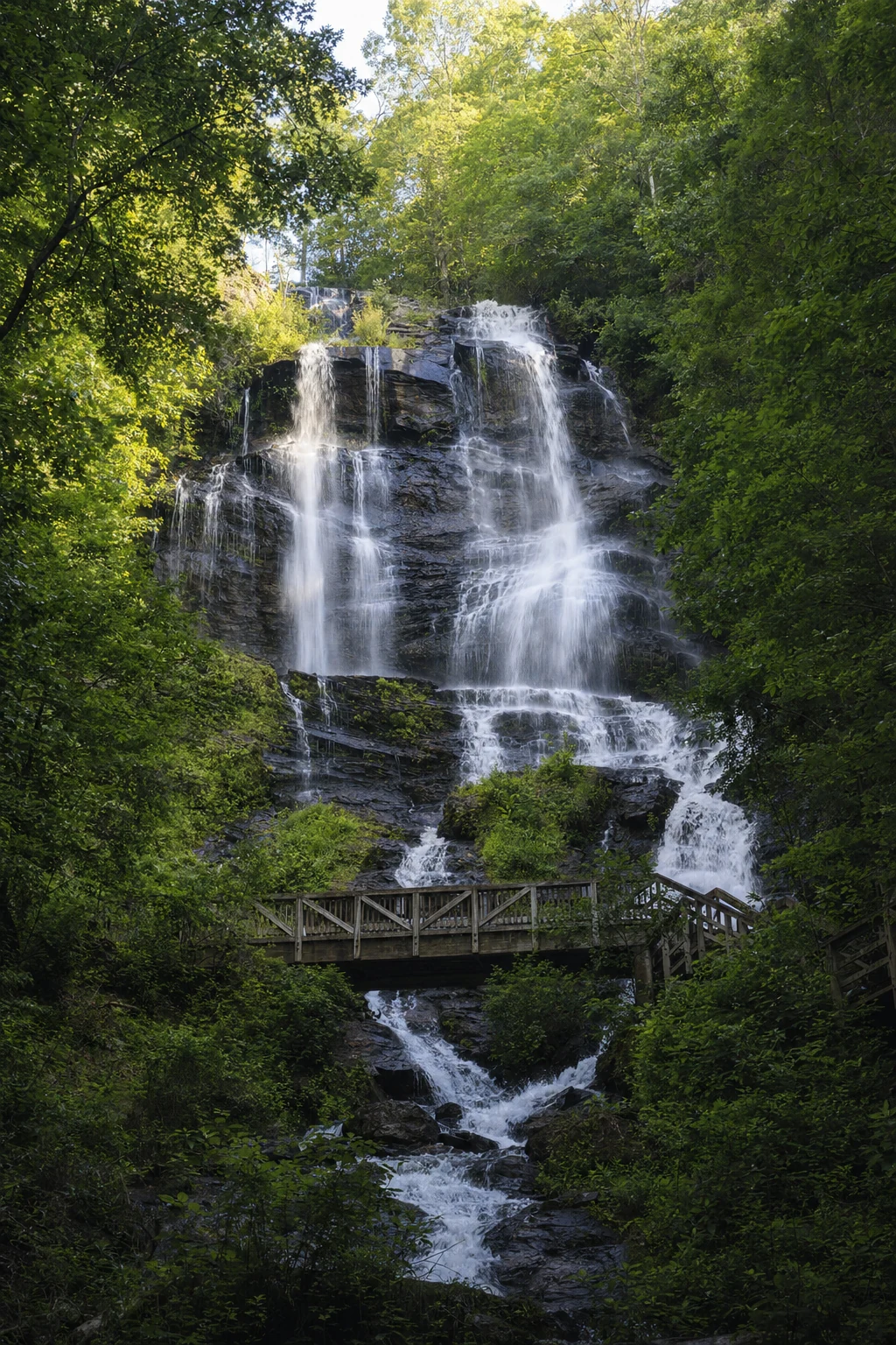
Related Imagery from Around Helen