Springer Mountain: The Southern Terminus of the Appalachian Trail
Your guide to springer mountain: the southern terminus of the appalachian trail in Helen, Georgia and the Blue Ridge Mountains
Geographic Significance: Springer Mountain (3,782 ft) in the Chattahoochee National Forest serves as the southern terminus of the Appalachian Trail (A.T.) and the Benton MacKaye Trail. It replaced Mount Oglethorpe as the terminus in 1958 due to industrial development.
Access Routes: The summit is accessible via a strenuous 8.8-mile Approach Trail from Amicalola Falls State Park or a shorter 0.9-mile hike from the Forest Service Road 42 parking lot. Access from Helen, Georgia, involves navigating winding mountain roads, often requiring high-clearance vehicles.
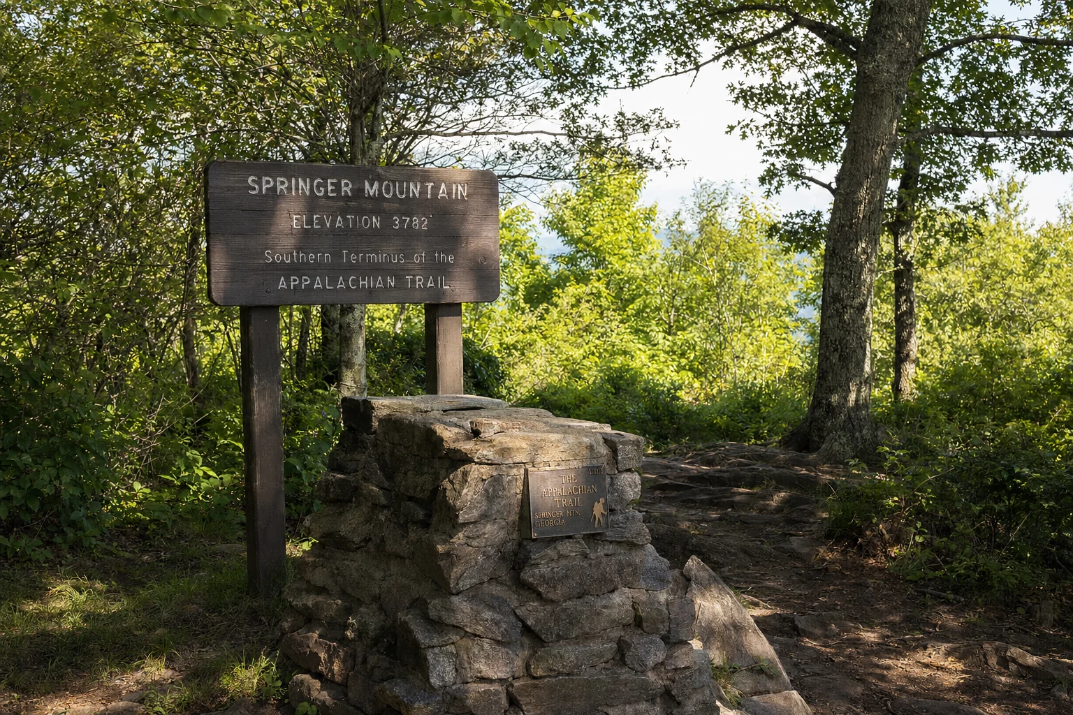
The Plaque: A bronze plaque mounted in rock at the summit bears the inscription "A Footpath for Those who seek Fellowship with the Wilderness," dating back to 1934. It is a central icon of the trail’s history and hiker culture.
Key Points
Geographic Significance: Springer Mountain (3,782 ft) in the Chattahoochee National Forest serves as the southern terminus of the Appalachian Trail (A.T.) and the Benton MacKaye Trail. It replaced Mount Oglethorpe as the terminus in 1958 due to industrial development.
Access Routes: The summit is accessible via a strenuous 8.8-mile Approach Trail from Amicalola Falls State Park or a shorter 0.9-mile hike from the Forest Service Road 42 parking lot. Access from Helen, Georgia, involves navigating winding mountain roads, often requiring high-clearance vehicles.
The Plaque: A bronze plaque mounted in rock at the summit bears the inscription "A Footpath for Those who seek Fellowship with the Wilderness," dating back to 1934. It is a central icon of the trail’s history and hiker culture.
Thru-Hiker Culture: The mountain is the emotional and physical starting line for thousands of northbound (NOBO) hikers annually, creating a unique "Springer Fever" atmosphere characterized by anxiety, community, and anticipation.
Approach Trail: This trail is infamous for its difficulty, featuring a 604-step staircase alongside Amicalola Falls and significant elevation gain, serving as a "shakedown" for aspiring long-distance hikers.
Springer Mountain matters not for its height but because it is where the Appalachian Trail (A.T.) begins. Located in Fannin and Gilmer counties within the Chattahoochee National Forest, this summit is the starting line for thousands of hikers each year attempting the 2,190-plus mile walk to Maine. The famous bronze plaque at the top marks the southern terminus, and getting here requires some planning, whether you are day-hiking from Helen or tackling the Approach Trail from Amicalola Falls.
Geographic and Historical Context
Springer Mountain, rising to an elevation of 3,782 feet (1,153 meters), is situated in the Blue Ridge Mountains of northern Georgia. It has served as the southern terminus of the Appalachian Trail since 1958. Originally, the trail ended at Mount Oglethorpe, approximately 14 miles to the southwest. However, the proliferation of chicken farms and communication towers around Oglethorpe led the Georgia Appalachian Trail Club (GATC) and the Appalachian Trail Conservancy (ATC) to relocate the terminus to the more remote and pristine wilderness of Springer Mountain.
The mountain is part of the Ed Jenkins National Recreation Area and holds significance not only for the A.T. but also as the southern start of the Benton MacKaye Trail (BMT), which runs nearly 300 miles north to the Great Smoky Mountains. The summit offers a western view into the Cohutta Wilderness, providing a rugged backdrop that reinforces the isolation sought by the trail’s creators.
Reaching Springer Mountain from Helen, Georgia
Helen, Georgia, a popular alpine-themed tourist town, serves as a common base of operations for visitors attempting to reach the southern terminus. However, reaching Springer Mountain from Helen is not a direct or simple commute; it involves navigating state highways and remote Forest Service (FS) roads that can be treacherous depending on weather conditions.
Driving Directions and Route Options
The drive from Helen to the Springer Mountain parking area on Forest Service Road 42 (FS 42) generally takes between one and a half to two hours, despite the relatively short linear distance. The route requires a transition from paved highways to gravel forest roads.
Primary Route via Dahlonega and Nimblewill:
Helen to Dahlonega: Travelers typically depart Helen via GA-75 Alt/GA-17 or GA-75 South to Cleveland, then take US-129 North/GA-11 to Turner's Corner, and finally US-19 South/GA-60 South into Dahlonega. Alternatively, one can take GA-75 to Cleveland and then GA-115 to Dahlonega.
Dahlonega to Forest Service Roads: From Dahlonega, the route heads west on GA-52 for approximately 9 miles. A key landmark is "Grizzle's Store" (or an old store site) near mile marker 5, where travelers turn right onto Nimblewill Church Road.
Navigating the Forest Service Network:
Pass Nimblewill Baptist Church (approx. 2 miles).
The Approach Trail: Amicalola Falls to Springer Mountain
For many thru-hikers and purists, the journey to Springer Mountain does not begin at the FS 42 parking lot but at the stone archway behind the Visitor Center at Amicalola Falls State Park. This is known as the Approach Trail.
Trail Specifications and Difficulty
The Approach Trail is an 8.8-mile (one-way) blue-blazed trail that connects the state park to the southern terminus. It is widely considered a strenuous undertaking and serves as an immediate "shakedown" for hikers attempting a thru-hike.
Distance: 8.8 miles (approx. 14 km) one way; often cited as 8.5 in older texts, but GATC current data lists 8.8.
Elevation Gain: The trail gains approximately 2,700 feet in elevation while losing only about 600 feet, making it a relentless uphill climb.
Difficulty Rating: Strenuous/Difficult. Hikers often underestimate this section, assuming it is merely a connector, but it rivals many sections of the A.T. proper in steepness.
The Stairs and Waterfall
The most iconic and physically demanding feature of the early Approach Trail is the staircase ascending Amicalola Falls.
The Falls: Amicalola Falls is the tallest cascading waterfall in the Southeast, dropping 729 feet (222 meters). The name derives from the Cherokee word Amicalola, meaning "tumbling waters".
The Stairs: Hikers must ascend a metal staircase consisting of 604 steps to reach the top of the falls. This section is often described as a "stair master" workout and creates a bottleneck of tourists and hikers.
Key Landmarks on the Approach Trail
The Arch: Located behind the Visitor Center, this stone archway marks the unofficial "start" for many. It features a sign indicating the distance to Mount Katahdin, Maine.
Top of the Falls: After the stairs, the trail levels briefly near the lodge before re-entering the forest.
Frosty Mountain: A peak reached at mile 4.1.
Nimblewill Gap: Located at mile 6.0, this gap features a marker commemorating a 1968 aircraft crash.
Black Gap Shelter: Located at mile 7.3, this is the last shelter before the Springer summit (1.5 miles away).
Day Hike Options at Springer Mountain
Visitors have several options for experiencing Springer Mountain, ranging from accessible short walks to multi-day backpacking trips.
Option 1: The Short Summit Hike (FS 42)
Distance: 1.8 to 2.0 miles round trip.
Difficulty: Easy to Moderate.
Route: From the parking lot on FS 42, hikers cross the road and follow the white blazes southbound for 0.9 to 1.0 mile to the summit. After viewing the plaque and signing the register, hikers backtrack north to the car.
Pros: Quickest access to the terminus; suitable for families and day trippers.
Cons: Requires a long drive on rough gravel roads; parking can fill up quickly on weekends.
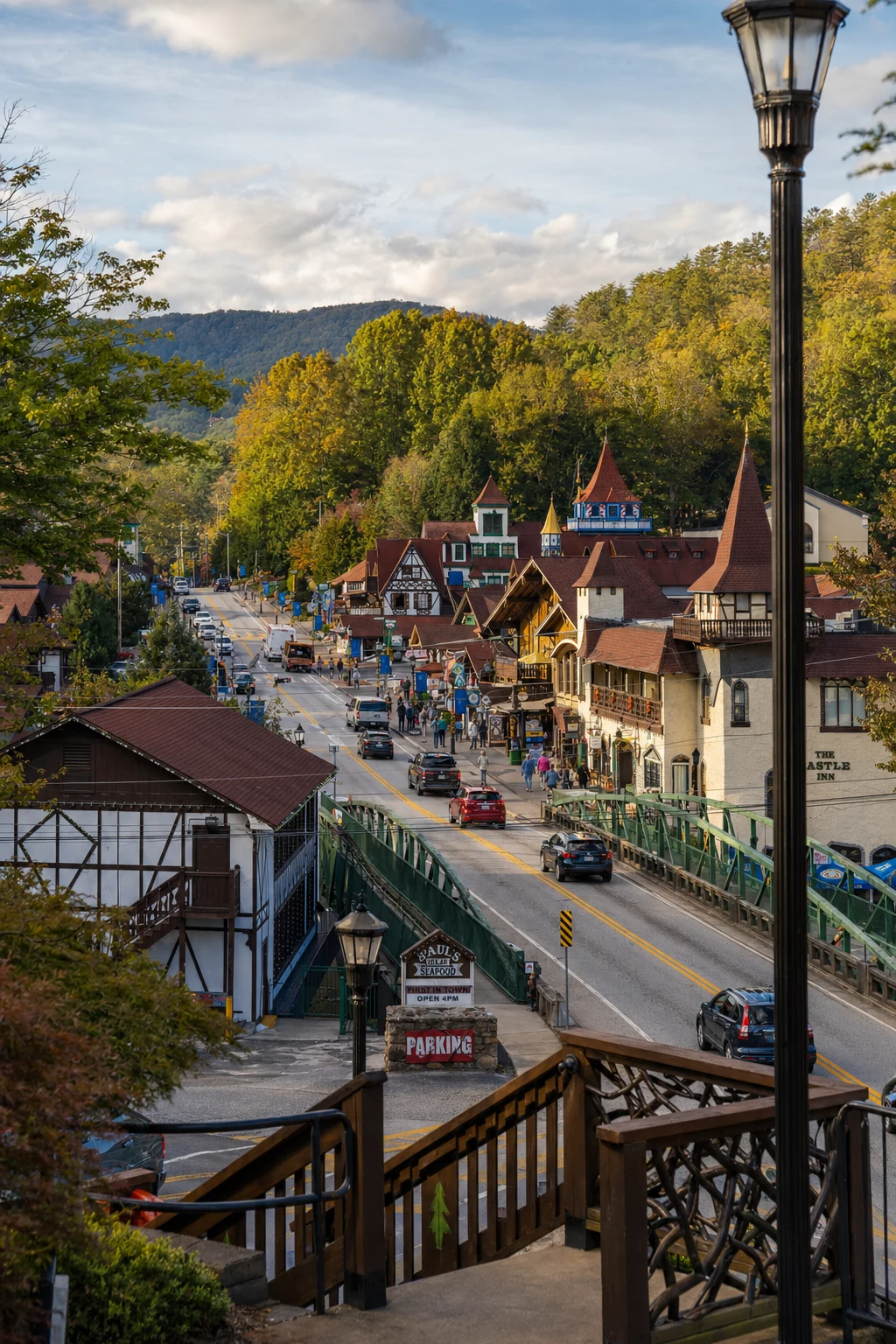
Related Imagery from Around Helen