The Crown of the Blue Ridge: An Exhaustive Guide to Black Rock Mountain State Park
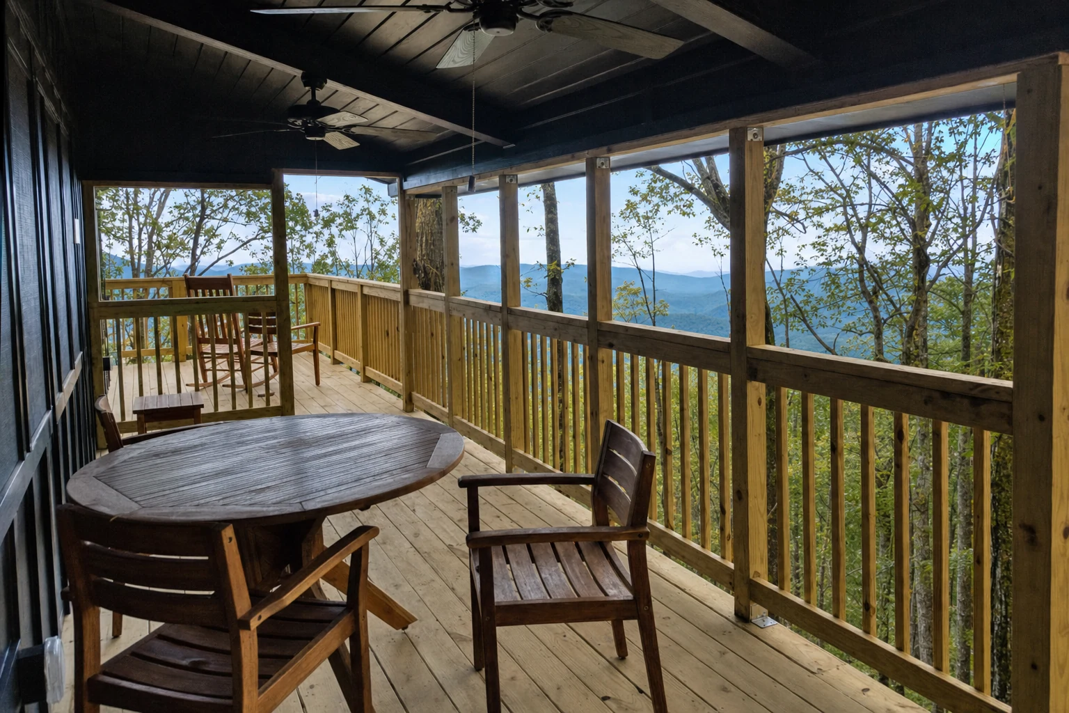
Georgia's highest state park, with panoramic overlooks, backcountry trails, and cabins at 3,640 feet
Key Points
Highest Elevation: Black Rock Mountain State Park is Georgia's highest state park. The summit of Black Rock Mountain sits at 3,640 feet, and you can feel the altitude difference the moment you step out of the car.
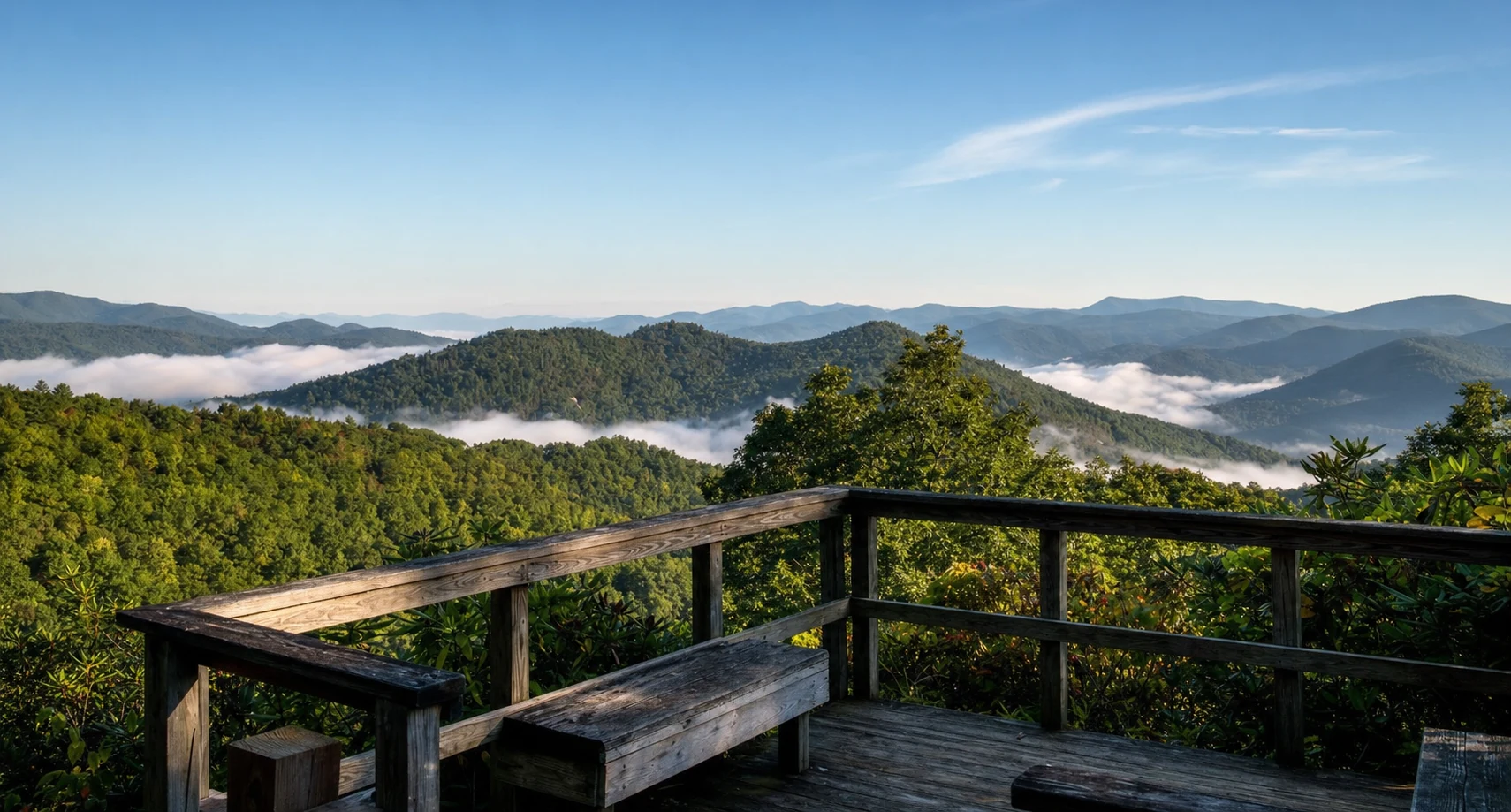
Scenic Vistas: The park offers signature 80-mile views spanning four states: Georgia, North Carolina, South Carolina, and Tennessee, particularly from the Cowee and Black Rock Overlooks.
General Information and Logistics
Black Rock Mountain State Park sits in the far northeastern corner of Georgia, right at the edge of the Blue Ridge Mountains.
Official Name: Black Rock Mountain State Park
Address: 3085 Black Rock Mountain Parkway, Mountain City, GA 30562
GPS Coordinates: N 34.9069220 | W -83.4083750
Primary Phone: 706-746-2141
Reservations (Camping/Cottages): 800-864-7275
Accessibility and Warning for RVs
You reach the park via Black Rock Mountain Parkway, which turns off U.S. Highway 441 in Mountain City. Fair warning: the road to the top is steep, narrow, and winding. The campground sites technically fit rigs up to 50 feet, but anyone who has driven this road will tell you to keep your RV under 25 feet. It is a white-knuckle drive in anything large. In winter, the road can close entirely due to ice. The summit runs 10 to 20 degrees cooler than nearby Clayton, so what is rain down below can be ice up here.
History and Geology
Formation and Composition
The park gets its name from the sheer cliffs of dark biotite gneiss, a metamorphic rock that forms the spine of the ridge. These dark outcrops are some of the ancient bedrock of the Blue Ridge Mountains, shaped by hundreds of millions of years of erosion. Four peaks in the park top 3,000 feet, with Black Rock Mountain itself reaching 3,640 feet.
Establishment and Development
The creation of Black Rock Mountain State Park is largely attributed to the foresight of Rabun County native John V. Arrendale (1878–1972). In the mid-1930s, Arrendale began a campaign to assemble the land that would become the park, finalizing his first purchase of a 70-acre tract in 1938. Land acquisition continued through the 1940s, with parcels often deeded first to the county before being transferred to the state. The park was officially established in 1952, originally consisting of 1,000 acres.
While the Civilian Conservation Corps (CCC) was active in Rabun County and nearby parks (such as Vogel State Park), Black Rock Mountain was established after the disbanding of the CCC. However, the park's development in the 1950s and subsequent expansions - including a significant 301-acre addition in 1995 under Governor Zell Miller's Preservation 2000 program - continued the tradition of conservation.
The 2011 Tornado
On April 27, 2011, an EF-2 tornado tore through the park. It was part of the same massive supercell system that devastated parts of Alabama that day. Thousands of mature hardwoods and pines were snapped or ripped out of the ground, especially on the western flank and along the Tennessee Rock Trail. You can still see the damage today. Young trees are growing up among the fallen trunks, and the open canopy has created clearings where wildflowers and berry bushes have taken hold. The Georgia DNR Wildlife Resources Division has been tracking the recovery closely.
Hiking Trails
Black Rock Mountain offers approximately 11 miles of hiking trails, ranging from easy lakeside strolls to strenuous backcountry treks. The high elevation and steep terrain make the difficulty ratings relative; "moderate" trails here often feel strenuous to those unaccustomed to the altitude and vertical grade.
1. Tennessee Rock Trail
Distance: 2.2-mile loop
Difficulty: Moderate to Difficult
Blaze Color: Yellow
Elevation Gain: Approx. 560 feet
This is the park's signature hike and the one you should not skip. The trail winds through hardwood forest and boulder fields along the north slope before climbing toward the summit. The payoff is the Tennessee Rock Overlook, where you can see north into the Great Smoky Mountains National Park, including Clingman's Dome (Kuwohi), Tennessee's highest point. Along the way, you pass through a "fragile botanical area" full of trillium, bloodroot, and ferns, documented by the Georgia Botanical Society. Spring wildflowers here are exceptional. Be aware that the western section passes through the 2011 tornado damage zone, so the canopy is thinner and the sun exposure is higher.
2. James E. Edmonds Backcountry Trail
Distance: 7.2-mile loop
Difficulty: Strenuous
Blaze Color: Orange
Elevation Gain: Significant; descends deep into coves and climbs steep ridges.
Named after "Mr. Eddie" Edmonds, one of the park's first rangers, this trail is built for people who want to work for their views. It drops steeply into laurel-filled coves, follows Taylor Creek past small cascades, then climbs hard to the summit of Lookoff Mountain at 3,162 feet. The views of Wolffork Valley from up there are excellent. This trail is genuinely steep in several places, and you need to be in decent shape to enjoy it rather than just survive it.
3. Ada-Hi Falls Trail
Distance: 0.25 miles (one way)
Difficulty: Moderate to Strenuous (due to stairs)
Blaze Color: Green Diamond (sometimes unblazed)
"Ada-Hi" is the Cherokee word for "forest". While short, this trail is a steep descent into a moist, north-facing cove filled with rosebay rhododendron and ferns. The trail utilizes a series of wooden steps to reach an observation platform. The falls themselves are small and rainfall-dependent; during dry spells, the water flow may be reduced to a mere trickle. The return trip requires a steep climb back up the stairs.
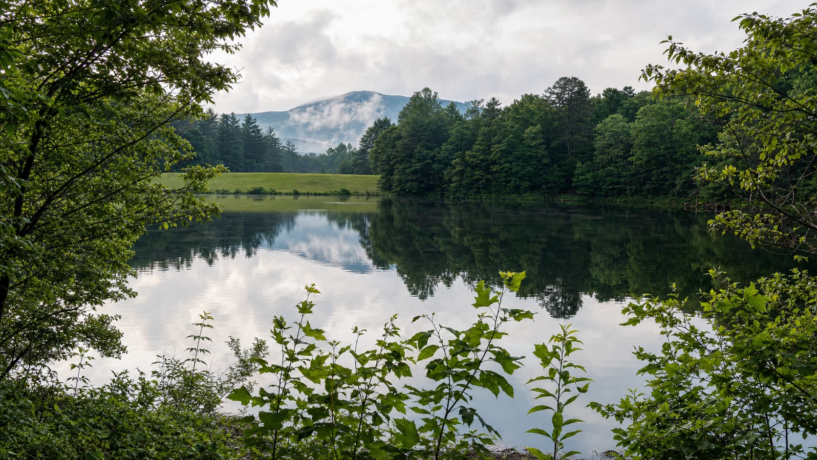
4. Black Rock Lake Trail
Distance: 0.85-mile loop
Difficulty: Easy
Blaze Color: Blue Diamond (or unblazed/signed)
Completed in 2007, this trail encircles the 17-acre Black Rock Lake. It is a gently rolling path suitable for beginners and families. The trail features wooden bridges crossing Taylor Creek and Greasy Creek, the two streams feeding the lake. An 80-foot bridge spans Cricket Cove. The area is shaded by white pines and yellow poplars, making it a cool retreat in summer.
Related Imagery from Around Helen