Comprehensive Guide to Dukes Creek Falls: Hydrology, History, and Recreational Access
A dramatic 150-foot cascade tucked into the Chattahoochee National Forest, just a short drive from Helen
Key Points
Location & Geography: Dukes Creek Falls is situated within the Chattahoochee National Forest near Helen, Georgia. The site features a unique hydrological confluence where Davis Creek plummets 150 feet to meet Dukes Creek, which also features its own cascading drops.
Trail Difficulty & Configuration: The trail is a moderate, out-and-back hike totaling approximately 2.0 to 2.3 miles round-trip. It involves a descent of roughly 400 feet into a gorge, requiring an uphill climb on the return journey.
Introduction and Geographical Context
Dukes Creek Falls is one of the best waterfall hikes near Helen, and it is only about six miles southwest of town along the Richard B. Russell Scenic Highway (GA-348). What makes this spot unusual is that you are actually looking at two creeks coming together. Davis Creek plunges down a tall cliff face while Dukes Creek cascades through the gorge below, and they meet at the bottom in a rush of white water.
Before you even start hiking, the trailhead parking lot has a clear view of Mount Yonah's granite dome. Then you descend into a steep gorge to reach the falls. Dukes Creek gets less attention than nearby Anna Ruby Falls, but I actually prefer it. The hike is more interesting, the setting is wilder, and you pass old gold mining remnants along the trail that give the whole experience some historical weight.
Hydrology: The Confluence of Davis and Dukes Creeks
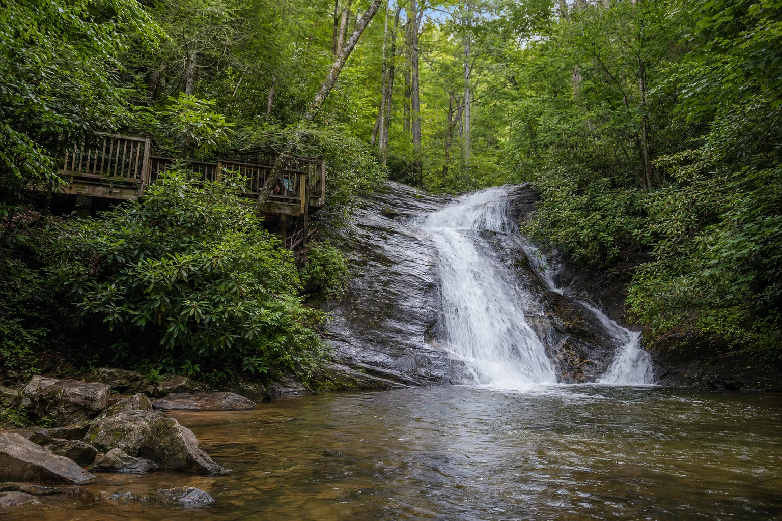
A common misconception among casual visitors is that the massive vertical drop observed from the main viewing platform is Dukes Creek itself. Hydrologically, the site is defined by the convergence of two distinct water bodies.
The Waterfall Complex
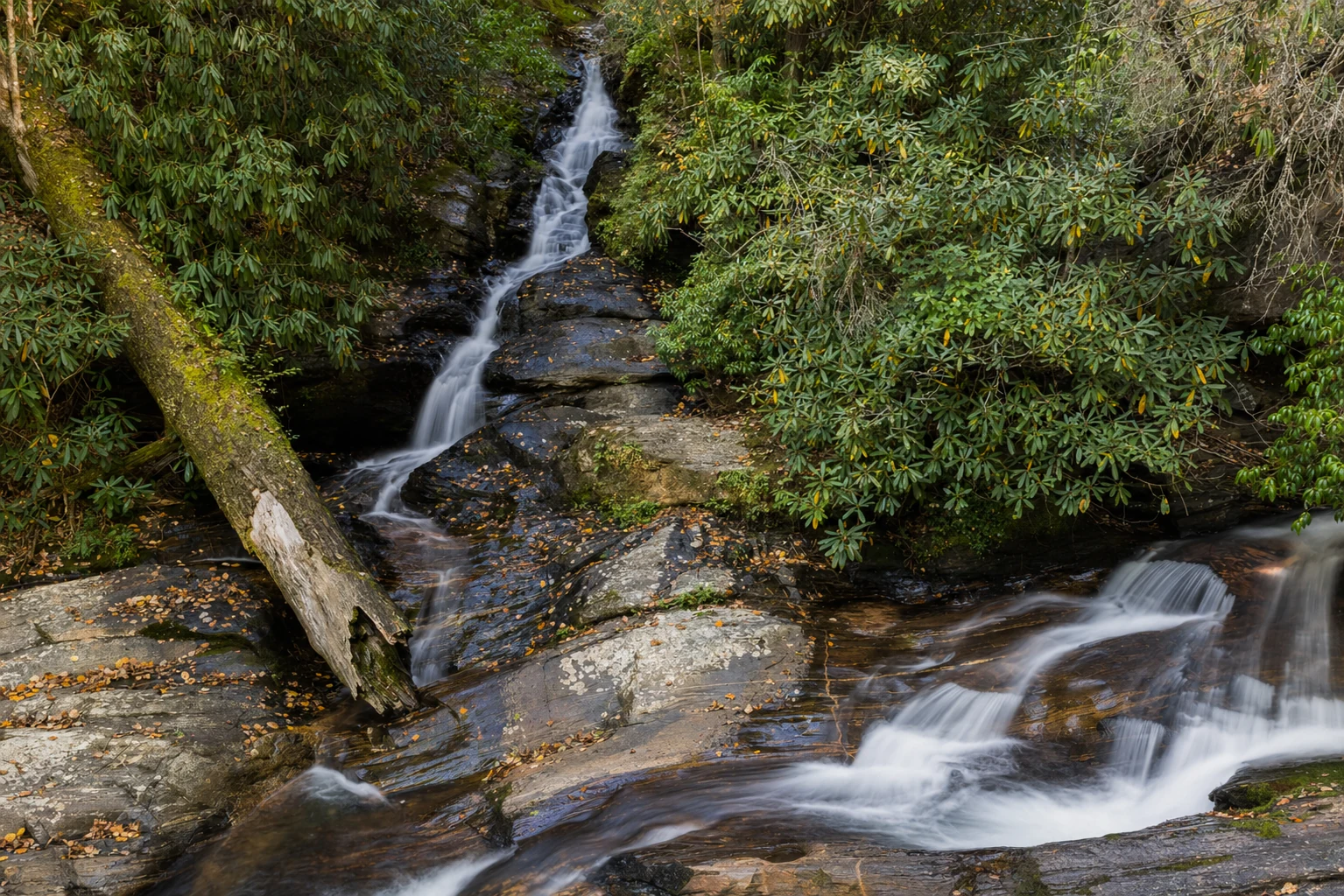
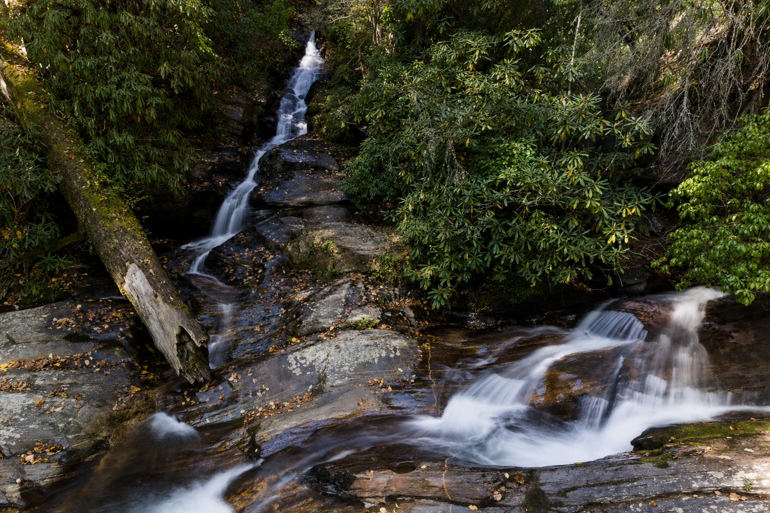
The visual centerpiece of the recreation area is actually Davis Creek, which plummets approximately 150 to 200 feet down a vertical cliff face. This towering drop occurs just moments before Davis Creek feeds into the larger Dukes Creek at the base of the gorge.
Simultaneously, Dukes Creek flows through the gorge, featuring its own series of cascades. While the drop on Dukes Creek is significantly shorter - often cited around 20 feet at the immediate junction - it provides a high-volume, turbulent flow that slides down exposed rock faces to meet the plunging water of Davis Creek. The result is a multi-tiered, multi-stream spectacle where a vertical ribbon of water (Davis) crashes into a sliding, cascading river (Dukes).
Watershed Characteristics
Dukes Creek rises near State Route 348 at the confluence of Bear Den Creek and Little Low Gap Branch. It serves as a significant tributary in the region, eventually flowing into the Chattahoochee River southeast of Helen. The drainage area encompasses approximately 22 square miles, playing a vital role in the local watershed. The clarity and temperature of the water in these creeks support trout populations, and the area is managed by the Georgia DNR Wildlife Resources Division to maintain these aquatic ecosystems, although fishing regulations vary by specific zone.
Historical Significance: The Cradle of the Georgia Gold Rush
The creeks you are hiking along were ground zero for the Georgia Gold Rush, which was the first major gold rush in the United States.
The Discovery of 1828
Historical consensus identifies 1828 as the year gold was discovered in the Nacoochee Valley region. While accounts vary regarding the specific individual responsible for the first find, two primary narratives persist in the historical record. One account attributes the discovery to John Witheroods (also spelled Witherood or Witherow) of North Carolina, who reportedly found a three-ounce nugget along the creek. A simultaneous discovery is often credited to an enslaved servant of Major Frank Logan.
These discoveries triggered the "Great Intrusion," a massive influx of prospectors into North Georgia - territory that was, at the time, legally held by the Cherokee Nation. The rush for gold in White and Lumpkin counties predated the California Gold Rush by two decades and led to significant geopolitical consequences, including the acceleration of the Indian Removal Act and the eventual Trail of Tears.
Remnants of Hydraulic Mining
The trail to Dukes Creek Falls serves as an open-air museum of 19th-century mining technology. As hikers descend into the gorge, they pass physical scars left by hydraulic mining operations. This method involved using high-pressure water cannons to blast away hillsides to reveal gold deposits, a practice that caused significant erosion and sedimentation.
Visible evidence along the trail includes historic water ditches and pits. These trenches were dug to divert water from higher elevations to power the hydraulic cannons and sluices used in the valley below. Interpretive signage and physical remnants allow hikers to observe these "historic water ditches," particularly near wooden bridges on the trail, grounding the scenic beauty of the falls in the industrial reality of the 1800s.
Hiking Guide: Dukes Creek Falls Trail
The Dukes Creek Falls Trail is a well-maintained path that offers a rewarding experience for hikers of moderate fitness levels. The trail is designated as Trail #15 in the Chattahoochee National Forest system.
Trail Statistics
Total Distance: Approximately 2.0 to 2.3 miles round-trip (out-and-back).
Difficulty Rating: Moderate. The trail is wide and non-technical, but the return journey requires a continuous uphill climb.
Elevation Change: Approximately 300 to 400 feet of elevation loss/gain.
Blaze: The trail is easy to follow and well-defined, though specific blaze colors are rarely necessary due to the clear path structure.
Trailhead and Parking
The trail begins at the Dukes Creek Falls Recreation Area parking lot. This paved lot requires a nominal day-use fee (typically $4), which can be paid via cash or digital pass systems where available. The parking area itself is a scenic viewpoint, offering a clear line of sight to the uniquely shaped summit of Yonah Mountain, an iconic granite dome in the region.
Related Imagery from Around Helen