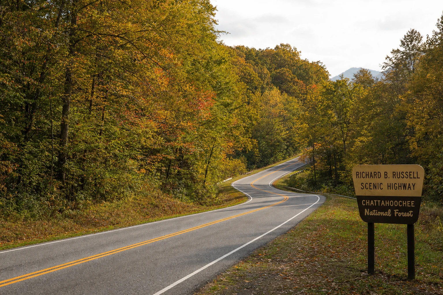
Russell Scenic Highway
Your guide to russell scenic highway in Helen, Georgia and the Blue Ridge Mountains
The Russell-Brasstown Scenic Byway is a 40-mile loop through Georgia's Chattahoochee-Oconee National Forest, renowned as one of the state's most scenic drives with winding roads, waterfalls, overlooks, and access to Brasstown Bald, Georgia's highest peak at 4,784 feet.
Introduction to the Byway
The Russell-Brasstown Scenic Byway is one of those drives that makes you glad you brought a camera. This 40-mile loop twists through valleys and granite canyons, with cool mountain creeks running alongside and wide-open views appearing at every hairpin turn. The byway circles the headwaters of the Chattahoochee River, and for Helen visitors, it is one of the best day trips you can take without driving far from town. In fall, the foliage is extraordinary. In summer, the wildflowers line the road. In any season, the scenery along this route is simply some of the best in north Georgia.
As a travel expert for ExploreHelen.com, I've traversed this route multiple times, once getting caught in a sudden fog at dusk that turned the forest into a mystical dreamscape. It's not just a drive; it's an invitation to slow down and savor Georgia's highlands.
Historical Context
The roots of the Russell-Brasstown Scenic Byway trace back to the early 20th century, with key segments established in the 1930s amid the push to develop North Georgia's infrastructure. The portion along SR 75 was graded and established between May and August 1932, evolving from dirt paths to semi-hard surfaces by 1939 and fully paved by 1946. SR 180 followed suit in the 1940s, while SR 348 (named Richard B. Russell Scenic Highway) connected in 1966, completing the paved loop.
Officially designated a National Forest Scenic Byway on June 5, 1989, it earned Georgia State Scenic Byway status in 1992 and full National Scenic Byway recognition on June 15, 2000. This honors its passage through the Chattahoochee National Forest, created in 1911 to protect these erosion-prone mountains. Named partly for Brasstown Bald (named after Cherokee "Ital-ye-late" or "Brasstown," meaning "where the white place is") and Senator Richard B. Russell, it reflects a blend of indigenous heritage and modern conservation.
From my visits, standing at historical markers along SR 348 feels like stepping into the era of New Deal road-building crews, who handcrafted these curves amid the Great Depression.
Route Details
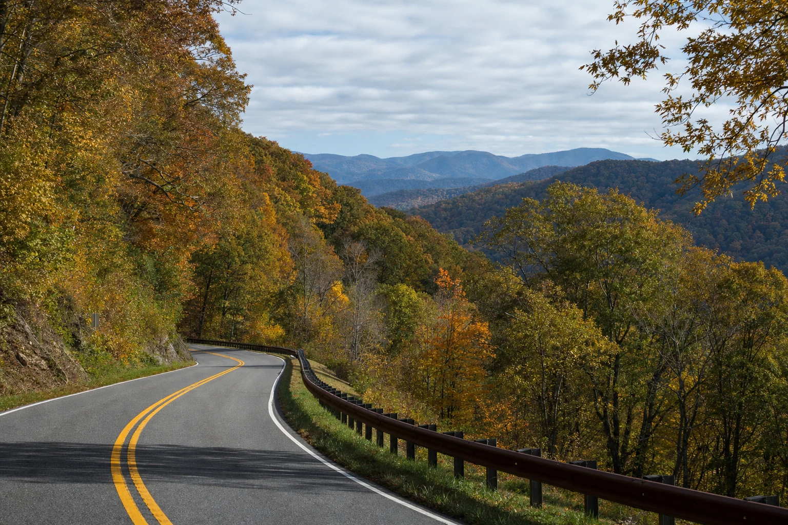
This 40-mile (64 km) loop starts and ends northwest of Helen at the junction of SR 17/SR 75 (Unicoi Turnpike) and SR 75 Alternate in White County, forming a counterclockwise circuit through White, Towns, and Union counties. Expect 1-1.5 hours of pure driving time, but plan 3-5 hours (or a full day) for stops - curves demand caution at 25-45 mph.
Key segments include:
SR 17/SR 75 north (0-10 miles): From Scorpion Hollow near Helen, climb steadily through forest into Towns County.
SR 180 west (10-22 miles): Turn left at the forest junction; optional 2-mile spur to Brasstown Bald at Jacks Gap (mile 15.6).
SR 348 southeast (22-37 miles): From Choestoe in Union County, loop back via Richard B. Russell Scenic Highway to SR 75 Alt.
SR 75 Alt. northeast (37-40 miles): Short connector back to start.
Must-See Viewpoints and Stops
The byway's magic lies in its pull-offs and short hikes revealing hidden gems.
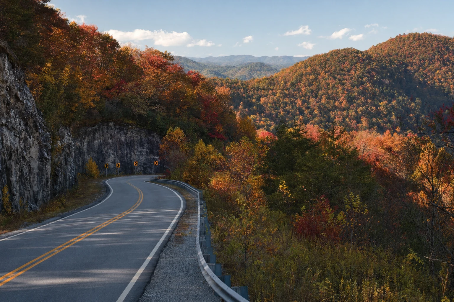
Hogpen Gap (SR 348): Roadside overlook with picnic tables and sweeping valley panoramas - prime for drone shots or lunch with a view. Ample free parking; I've picnicked here watching hawks soar.
Jacks Gap (SR 180 Spur): Gateway to Brasstown Bald; park and hike or shuttle 0.6 miles to the summit tower for 360-degree views spanning four states.
Dukes Creek Falls (near start, off SR 75): 2-mile round-trip trail to a 150-foot cascade; watch for Mount Yonah's cliffs.
Other pull-offs: Scattered vistas along SR 180 offer secluded wilderness peeks; stop for wildflowers in spring or rhododendrons in summer.
Insider tip: Early morning light at Hogpen Gap bathes the ridges in gold - arrive by 9 AM to claim the best picnic spot before RVs arrive.
Accessing Brasstown Bald
Brasstown Bald, Georgia's rooftop at 4,784 feet, anchors the byway via a 2-mile paved spur off SR 180 at Jacks Gap. Park at the lot (space for ~100 cars, $5 fee; free with America the Beautiful Pass) and choose the shuttle (seasonal, Memorial Day-Labor Day, every 15-20 min) or 1.2-mile round-trip hike (600-ft elevation gain, strenuous).
At the summit observation tower (706 steps up), gaze over the Blue Ridge Mountains, Chattahoochee National Forest, and distant skyscrapers on clear days. Visitor center offers exhibits on ecology and Cherokee history (706-745-6928; fs.usda.gov/recarea/conf/recarea/?recid=12473). Hours: Daily 10 AM-5 PM in peak season; closed midwinter (check weather).
From my ascent last fall, the tower's breeze carried scents of pine and earth - the ultimate payoff after the huffing climb.
Fall Foliage Spectacular
No visit rivals mid-October to early November, when oaks, maples, hickories, and hemlocks ignite in reds, oranges, and golds. Peak hits the byway 1-2 weeks before Atlanta, drawing leaf-peepers galore - use Georgia's Fall Color Map (gastateparks.org/FallColorMap) for real-time updates.
Drive SR 348 first for south-facing slopes that turn fiery earliest; Hogpen Gap and Brasstown Bald overlook the riot of color. Weekdays beat weekend crowds; I've witnessed traffic jams turning into impromptu tailgates with foliage views.
Seasonal Considerations and Best Times
Spring (March-May): Wildflowers carpet roadsides; mild 50-70°F temps ideal for hikes. Waterfalls rage post-rain.
Summer (June-August): Cool 70-80°F escape from lowland heat; swimming holes abound, but crowds peak weekends.
Fall (September-November): Prime foliage; crisp 40-60°F days. Book Helen lodging early.
Winter (December-February): Mild 30-50°F, fewer crowds; some overlooks snowy. Roads rarely close but check fs.usda.gov for ice - I've driven it in light flurries for ethereal bare-branch views.
Best overall: Late September-early October for color hints minus crowds, or anytime weekdays.
Practical Logistics
Driving and Parking: Paved but narrow/curvy - no RVs advised without experience; pull-outs limited but sufficient. Free parking at most stops; Brasstown Bald charges $5/vehicle (cash/card). Gas in Helen (e.g., Unicoi BP, 706-878-2200).
Accessibility: Roads wheelchair-friendly where paved; Brasstown Bald shuttle accommodates mobility aids, but tower steps are not (elevators rare). Trails like Dukes Creek are moderate; few ADA paths.
What to Bring: Water, snacks/picnic, layers (microclimates vary 20°F), bug spray, binoculars, camera/drone (FAA rules apply), trash bag (Leave No Trace). Download offline maps; cell service spotty (Verizon best).
Safety: Watch for deer/brakes; no guardrails everywhere. Pets leashed; fires banned except grills.
From Helen: 10-min drive to start via SR 75 N.
Nearby Attractions and Helen Connections
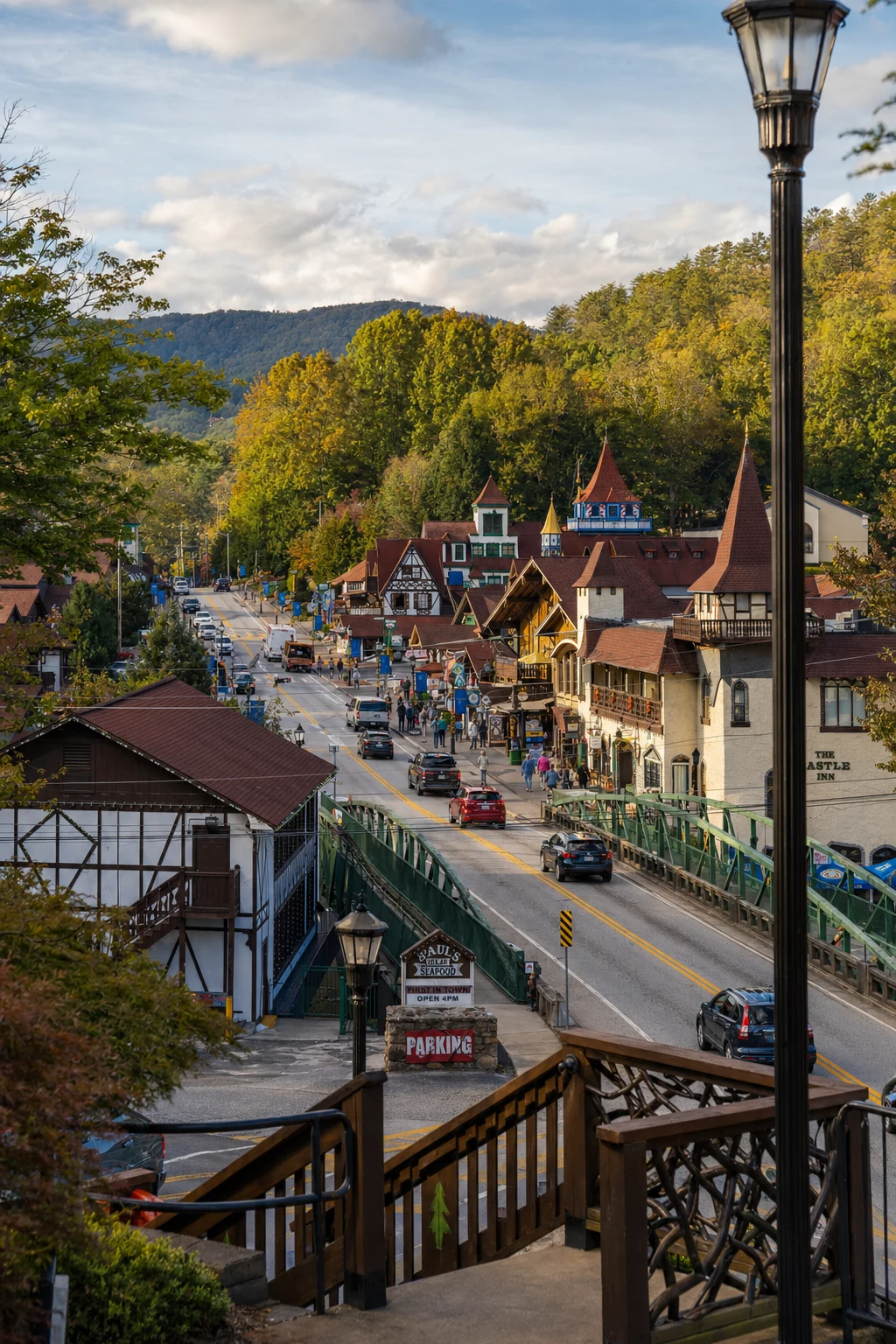
Perfectly paired with Helen's Bavarian charm, the byway starts just 5-10 miles north, making it a half-day jaunt from alpine streets.
Combine with Helen's Oktoberfest (fall) or wineries like Fox Winery for a full itinerary - I've ended drives with pretzels overlooking the byway's distant ridges.
The byway connects Helen's Alpine village directly to the wild mountain backcountry, and driving it is one of the best ways to experience how close real wilderness is to downtown. Fill the tank before you go and give yourself a full day to enjoy it.
Related Imagery from Around Helen