The Route: Mile by Mile
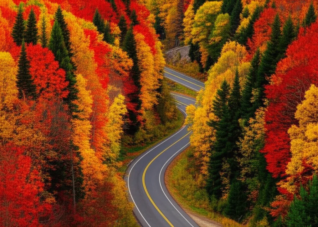
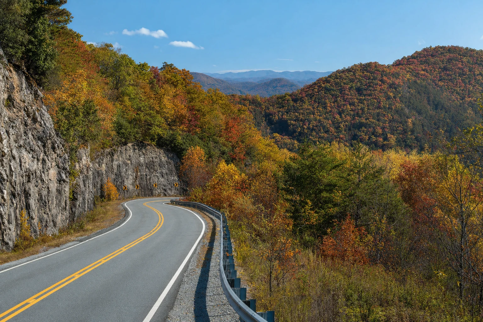
The Russell Scenic Highway begins at its junction with GA-75 Alternate in the Sautee-Nacoochee Valley (approximate GPS 34.7214° N, 83.7258° W), about 10 minutes south of Helen. From there, it climbs steadily westward through the Chattahoochee National Forest, gaining roughly 2,000 feet of elevation before cresting the Blue Ridge and descending toward its terminus at the intersection with US-129 / GA-180 (approximate GPS 34.7963° N, 83.8972° W) south of Blairsville. The road is two-lane throughout, with a posted limit of 45 mph that drops to 35 mph on the tightest switchbacks. The pavement is in excellent condition — GDOT resurfaced large sections between 2022 and 2024 — and the curves are properly banked, which matters more than you might think when the road is wet.
The western end of GA-348 connects directly to GA-180, the Wolfpen Gap road, which delivers you to Vogel State Park in about 4 miles and to the base of Brasstown Bald via GA-180 Spur in about 8 more. If you want to build a full day loop, drive 348 north, visit Vogel or Brasstown, then return to Helen via US-129 south through Neel Gap at Mountain Crossings and GA-19 — a circuit of about 55 miles that hits four of North Georgia's most photographed spots in a single afternoon. For more route ideas and driving loops radiating from Helen, see our Helen scenic drives roundup.
Plan at least two hours for the drive, more if you intend to stop at the trailheads and overlooks, which you absolutely should. The highway was specifically designed as a scenic route, with pull-offs and parking areas positioned at the points of greatest visual impact. Rushing through it would be like speed-reading a novel: you would get the general idea, but you would miss everything that makes it worth experiencing.
The Namesake: Senator Richard B. Russell, Jr.
The highway carries the name of Senator Richard Brevard Russell, Jr. (1897–1971), a Winder, Georgia native who served as the state's 66th governor before spending nearly four decades in the U.S. Senate. Russell chaired the powerful Armed Services Committee for most of the 1950s and 1960s, and his support of federal highway funding in the Appalachian Regional Development Act of 1965 helped bring paved mountain roads to the North Georgia counties that needed them most. GA-348 itself was officially dedicated in his memory in 1972, the year after his death. Whatever you think of Russell's long and often divisive political career, the road that bears his name is one of the prettiest drives in the eastern United States.
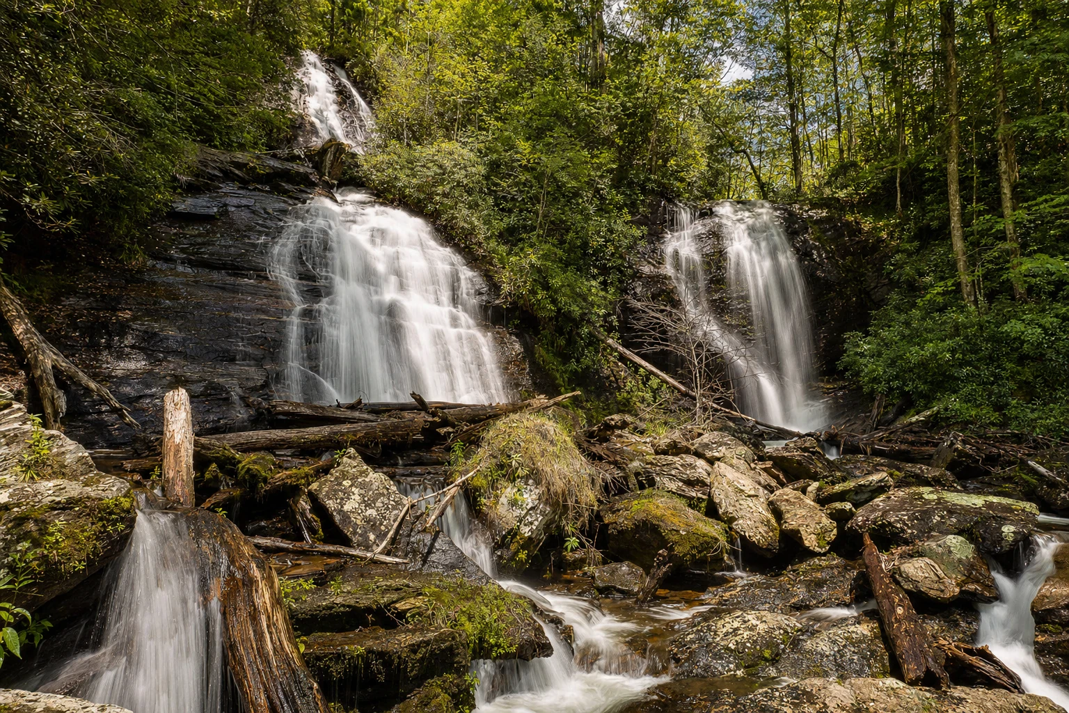
Stop 1: Dukes Creek Falls Trailhead (Mile 2)
About 2 miles from the eastern end of the highway, at roughly 1,900 feet of elevation, you will find the parking area for Dukes Creek Falls. There are paved parking, vault toilets, and a small picnic area on site. The trail descends approximately 340 feet over about a mile to a viewing platform overlooking a 150-foot cascade where Dukes Creek drops into a rocky gorge. The falls are impressive in any season but are most dramatic after heavy rain. Remember that the trail is all downhill going in, which means it is all uphill coming out, so budget your energy accordingly. The round trip takes about an hour at a moderate pace.
Stop 2: Raven Cliff Falls Trailhead (Mile 3)
A mile further up the highway, at about 2,000 feet of elevation, the Raven Cliff Falls trailhead offers access to one of the most scenic hiking trails in all of Georgia. The 5-mile round trip follows Dodd Creek through a narrow gorge to a 60-foot waterfall that plunges through a cleft in the granite. The trail is moderately strenuous but well-maintained, and the forest through which it passes — old-growth hemlock and hardwood with massive boulders — is magnificent. If you only have time for one hike during your Helen visit, this is the one to choose.
Stop 3: Tesnatee Gap (Mile 9, Elevation 3,138 ft)
As the highway climbs past the Raven Cliff trailhead, it switches back hard and gains elevation fast. About nine miles in, you reach Tesnatee Gap, where GA-348 crosses the Appalachian Trail for the first of two times. There is a modest gravel parking area on the north side of the road and no restrooms. Southbound AT hikers arriving at Tesnatee are coming down off Wildcat Mountain; northbound hikers face a steady 700-foot climb up Cowrock Mountain. Even a quarter-mile walk in either direction will remind you how much elevation the mountains still hold back from the road itself. For deeper hiking context, see our guide to the Appalachian Trail in North Georgia.
Stop 4: Hogpen Gap Overlook (Mile 10, Elevation 3,450 ft)
One mile west of Tesnatee, at the highest point on GA-348, the road crosses the AT a second time at Hogpen Gap. This is the money stop. The paved parking lot is generous — room for roughly 25 vehicles, including motorcycles and a couple of RVs — and vault restrooms are open year-round. A short, easy path leads to a west-facing overlook that takes in the forested spine of the Blue Ridge toward Blood Mountain and Brasstown Bald. On a clear winter morning, you can see ridgeline after ridgeline stretching toward Tennessee. Southbound AT hikers reach Hogpen after a steep ascent off Cowrock Mountain, and you will often see thru-hikers dropping packs, airing out their feet, and hitchhiking up the road toward food and showers. If you want to stretch your legs, walk 0.4 miles south on the AT to the rock outcrop locals call Wolf Laurel Top — one of the best long-distance views in North Georgia. For context on what else you can see from elevation in the Helen area, browse our Helen mountain views page.
"Standing at the Hogpen Gap overlook, looking out over a hundred miles of forested mountains rolling toward the horizon, you understand why people fall in love with these mountains and never quite get over it."
Stop 5: The Western Descent and GA-180 Junction (Mile 14)
After Hogpen the road falls away toward the Nottely River valley with a series of sweeping turns that every motorcyclist on the East Coast seems to know by heart. There are two more unmarked pull-offs where the forest opens up toward Slaughter Mountain and Blood Mountain; both are worth a stop for photos. The highway ends at its T-intersection with GA-180, about 6 miles east of Blairsville. A left turn takes you to Vogel State Park and on to US-19 south; a right turn leads to the GA-180 Spur and the summit road to Brasstown Bald. For Blairsville and its courthouse square of cafes and antique shops, see our Blairsville day-trip guide.
Motorcycles, Cyclists, and Sharing the Road
Ask almost any rider in Georgia, and they will tell you GA-348 is in the top three roads in the state, usually alongside the Wolfpen Gap Road and the Hogpen loop. The appeal is obvious: 14 miles of continuously curved, well-paved two-lane with almost no traffic signals, driveways, or commercial distractions. On weekend mornings from April through October you will see every flavor of bike from sport tourers to cruisers to ADV riders running the climb. The unofficial motorcycle day is Sunday, when the parking areas at Hogpen can hold forty bikes at a time. Triangle, AdvRider, and the Georgia Sport Touring Association all feature GA-348 in ride reports going back twenty years. If motorcycles are your thing, our motorcycle routes page covers several other loops you can tack on from here.
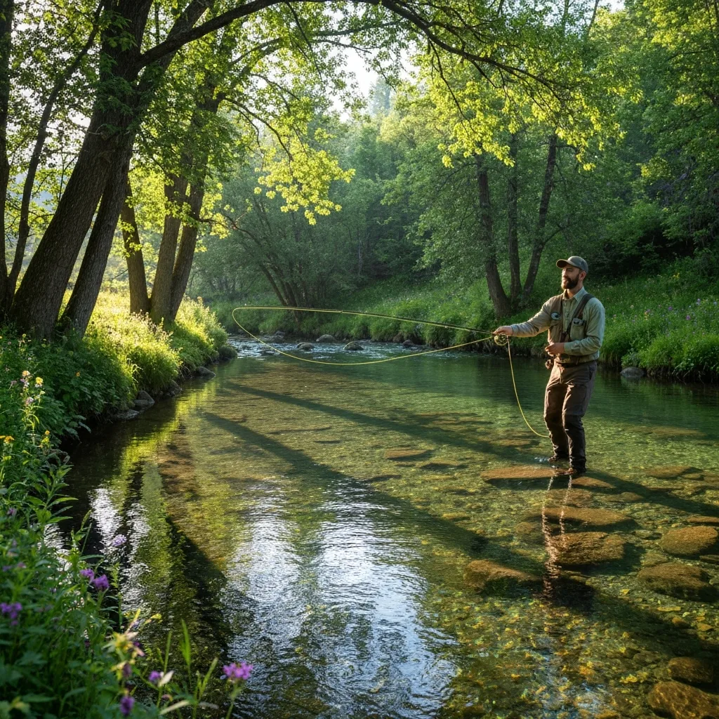
Cyclists love the road too, and this is where drivers need to pay attention. The climb from the Nacoochee Valley to Hogpen Gap is a marquee ride for Georgia road cyclists — roughly 2,300 feet of elevation gain over about 9 miles, with gradients that hit 9 percent. On any warm weekend you will meet cyclists on nearly every mile of the route. Georgia's three-foot passing law applies in full on GA-348, and there are several blind curves where crossing the double-yellow to pass safely is simply not possible. Be patient, wait for the straight sections, and treat the climb as part of the experience.
Elevation Profile at a Glance
- Eastern terminus (GA-75 Alt): ~1,450 ft
- Dukes Creek Falls trailhead (mile 2): ~1,900 ft
- Raven Cliff Falls trailhead (mile 3): ~2,000 ft
- Tesnatee Gap AT crossing (mile 9): 3,138 ft
- Hogpen Gap AT crossing (mile 10, high point): 3,450 ft
- Western terminus (GA-180): ~2,200 ft
Seasonal Highlights and Fall Foliage Timing
The Russell Scenic Highway is worth driving in any season, but each has its particular rewards. Spring (March through May) brings wildflowers — trilliums, bloodroot, and mountain laurel in May — migrating songbirds, and the soft chartreuse of new leaves. Summer offers lush forest, cool mountain air that runs 10 to 15 degrees below Atlanta temperatures, and the highest waterfall flows from afternoon thunderstorms. Winter brings bare trees that reveal distant views otherwise hidden by foliage, and occasional ice formations along the cliffs that are starkly beautiful.
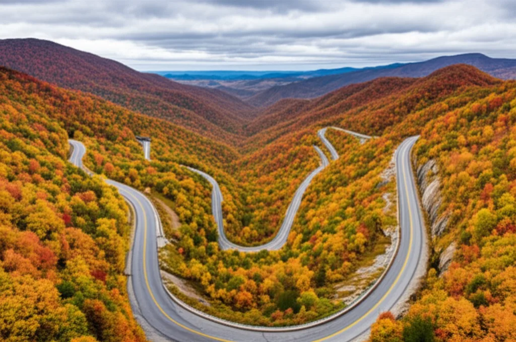
Autumn, of course, is the show. Color typically peaks at the highest elevations near Hogpen Gap during the first two weeks of October, then drops progressively down the mountain. By the third week of October, the mid-slopes are usually at their best. Valley-floor color in Helen and the Nacoochee Valley usually peaks between October 25 and November 5 in most years. The U.S. Forest Service Chattahoochee-Oconee foliage updates and Georgia State Parks' fall color page are the best sources for real-time tracking. For a complete local guide to chasing color near Helen, see our Helen fall foliage page.
Hazards, Closures, and Current Conditions
The highway is safe when driven sensibly, but a few hazards deserve respect. The curves are tight, the shoulders narrow, and sight lines are often blocked by laurel and hemlock. Wildlife is common — white-tailed deer at dusk, the occasional black bear crossing in the summer, and wild turkeys that do not seem to understand that a car is moving. Slow down at dawn and dusk. In fall, damp leaves pile in the outside edges of curves and can turn a confident driver's afternoon upside down. In winter, GA-348 is typically among the first roads GDOT closes when ice is in the forecast; the district uses manually placed gates at both ends, which is why a dusting of snow in Atlanta may mean the road is locked for three or four days up top. Always check Georgia 511 before you head out between November and March, and call the Brasstown Ranger District office if a major storm has just passed — rockslides are rare but do occur after heavy spring rains.
Picnic Spots and Side Trips
The best dedicated picnic spot on the road itself is the pavilion and tables at Hogpen Gap, which sit right next to the AT crossing and have restrooms close at hand. The Dukes Creek Falls trailhead also has two or three shaded tables, and the small pull-offs near the Raven Cliff trailhead are fine for a tailgate lunch. For a proper picnic with swimming, rental cottages, and a lake loop, turn right at the western end of 348 and drive 4 miles to Vogel State Park — one of Georgia's most beloved mountain parks and a perfect half-day detour. A few miles past Vogel, Helton Creek Falls sits just off GA-180 down a short forest road and rewards the detour with a pair of cascades totaling about 100 feet. From Helton Creek, GA-180 Spur climbs to the Brasstown Bald visitor center — at 4,784 feet, Georgia's highest summit — where a paved half-mile path and a shuttle van deliver 360-degree views over four states. Rounded out, the drive-and-detour package makes for a day you will remember for a long time. For hikers who want to tie the scenic highway into a trail day, our Appalachian Trail day-trip guide covers the best short hikes off GA-348.
Which Direction Should You Drive?
Most locals will tell you to drive GA-348 west-to-east — that is, starting at GA-180 near Blairsville and ending back at GA-75 Alt near Helen. The reason is the light: in the late afternoon the sun sits low over the western ridges, and the descent off Hogpen into the Nacoochee Valley is flooded with long golden light that makes every turn photogenic. If you are already staying in Helen, the easier plan is to drive it east-to-west in the morning (when the light is on the mountains you are climbing toward), stop at Vogel for lunch, and then reverse the run after lunch to catch the same golden descent on the way home. Either way works. The road is generous, and you will find new views in both directions.
Driving Guide
- Length: 14.1 miles, approximately 30 minutes without stops, 2-4 hours with stops.
- Starting point (Helen side): Junction of GA-348 and GA-75 Alt, about 10 minutes south of Helen. Approximate GPS 34.7214° N, 83.7258° W.
- Ending point (Blairsville side): Junction with GA-180 near US-129. Approximate GPS 34.7963° N, 83.8972° W.
- Key stops: Dukes Creek Falls, Raven Cliff Falls, Tesnatee Gap, Hogpen Gap, Vogel State Park, Brasstown Bald.
- Best time: Early morning or late afternoon for best light. Mid-October at elevation for peak fall color, May for rhododendron.
- Fuel and food: No gas stations or restaurants on the highway itself. Fill up and grab snacks in Helen or the Nacoochee Valley before starting, or at the Shell at the GA-180/US-129 intersection before heading east from Blairsville.
- Cell service: Spotty to nonexistent between miles 4 and 12. Download offline maps before you leave town.
The Richard B. Russell Scenic Highway is the single best showcase for the natural beauty that makes the Helen area special. In 14 miles, it takes you from a pastoral valley floor to the crest of the Blue Ridge, through forest that has been growing here for millennia, past waterfalls that have been falling since the mountains were young, and to overlooks that make you feel, for a few quiet moments, like you are standing on the roof of the world. Do not miss it.
Local writers sharing the hidden stories and trails of North Georgia's mountain country.
Related Stories
More drives, trails, and outdoor adventures