Comprehensive Visitor Guide: Anna Ruby Falls Scenic Area
Plan your visit to Anna Ruby Falls: trail access, parking, seasonal tips, and the Lion's Eye accessible path
Key Points
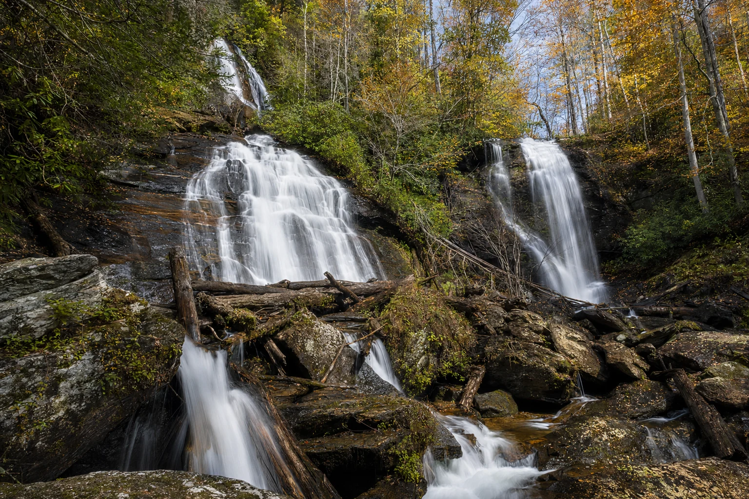
Twin Waterfalls Formation: Anna Ruby Falls is a rare double waterfall formed by the junction of Curtis Creek (dropping 153 feet) and York Creek (dropping 50 feet). These streams originate from Tray Mountain and merge at the base to form Smith Creek.
Accessibility Distinctions: While the main trail to the falls is paved, it is steep and generally considered not wheelchair accessible for self-propelled users. However, the site features the Lion’s Eye Nature Trail, a 0.1-mile path specifically designed with handrails and braille signage for visually impaired and mobility-challenged visitors.
Jurisdictional Complexity: The falls are located within the Chattahoochee-Oconee National Forest but are accessed via Unicoi State Park. The site is managed by the non-profit FIND Outdoors. Visitors must pay a federal amenity fee (interagency passes accepted), which is separate from the state park parking fee.
Historical Naming: The falls were named by Colonel John H. "Captain" Nichols, a Civil War veteran and owner of the nearby West End (Hardman Farm), in honor of his only surviving daughter, Anna Ruby Nichols.
Seasonal Dynamics: Water flow is typically highest in late winter and spring due to rainfall and snowmelt. Fall offers spectacular foliage, while winter allows for clearer views through the trees and potential ice formations.
Introduction to Anna Ruby Falls Scenic Area
Anna Ruby Falls is one of the best natural attractions in the North Georgia mountains, and it sits at the center of a 1,600-acre scenic area in White County, not far from Helen. The trail is a designated National Recreation Trail within the larger Chattahoochee-Oconee National Forest. What makes this place special is not just the waterfall itself but the fact that there are two of them running side by side -- two separate creeks, Curtis and York, both starting high up on Tray Mountain (Georgia's sixth-highest peak), dropping down and meeting at the base of the same cliff.
The U.S. Forest Service and the nonprofit FIND Outdoors (formerly the Cradle of Forestry in America Interpretive Association) manage the site together. They keep the trails in shape, protect the creek ecosystem, and run educational programs. Hundreds of thousands of people visit every year, and the place holds up well because it was designed to handle that traffic. Between the geology, the accessible trails, and the post-Civil War history tied to the Nichols family, there is more to this site than you might expect from a half-mile walk to a waterfall.
Hydrography and Geological Formation
The main draw here is what happens at the cliff face: two completely separate creeks arrive from different directions and pour over the rock wall at the same time. This is not one stream splitting into two. These are two independent waterways converging in one spot.
The Twin Waterfalls
The two streams involved are Curtis Creek and York Creek. Both originate from the upper slopes of Tray Mountain, which stands at an elevation of 4,430 feet.
Curtis Creek: On the left (when you are standing at the observation deck), Curtis Creek is the bigger and taller of the two, dropping about 153 feet (47 meters). The water tumbles down in stages over tiered rock faces rather than falling in a single clean sheet.
York Creek: On the right, York Creek has a shorter but steeper drop of 50 feet (15 meters). It is smaller, but it adds a lot to the overall effect -- the sound of both creeks hitting the rocks together is something you feel in your chest.
Formation of Smith Creek
Right at the base, Curtis and York Creeks join together and become Smith Creek. From there the water flows southeast, filling Smith Lake at Unicoi State Park before eventually reaching the Chattahoochee River. How much water comes over the falls depends entirely on recent rainfall. After a big storm, flows can hit 3,000 gallons per second, which turns this place into something truly loud and impressive.
Hiking and Trail Systems
There are three trails at the recreation area, and they are very different from each other in terms of difficulty and who they are designed for.
The Main Anna Ruby Falls Trail
This is the main route to the falls, and it is the one most visitors take.
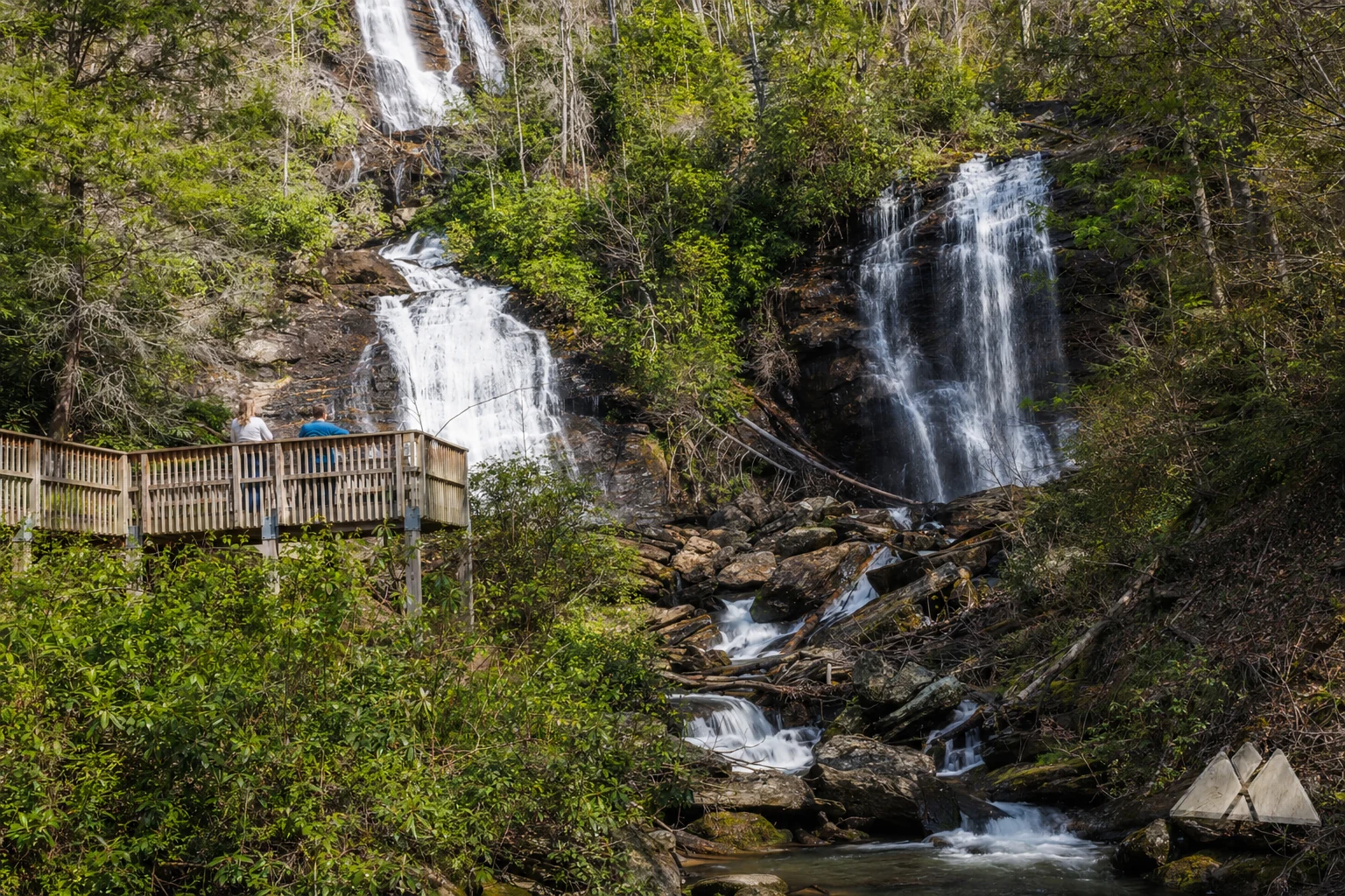
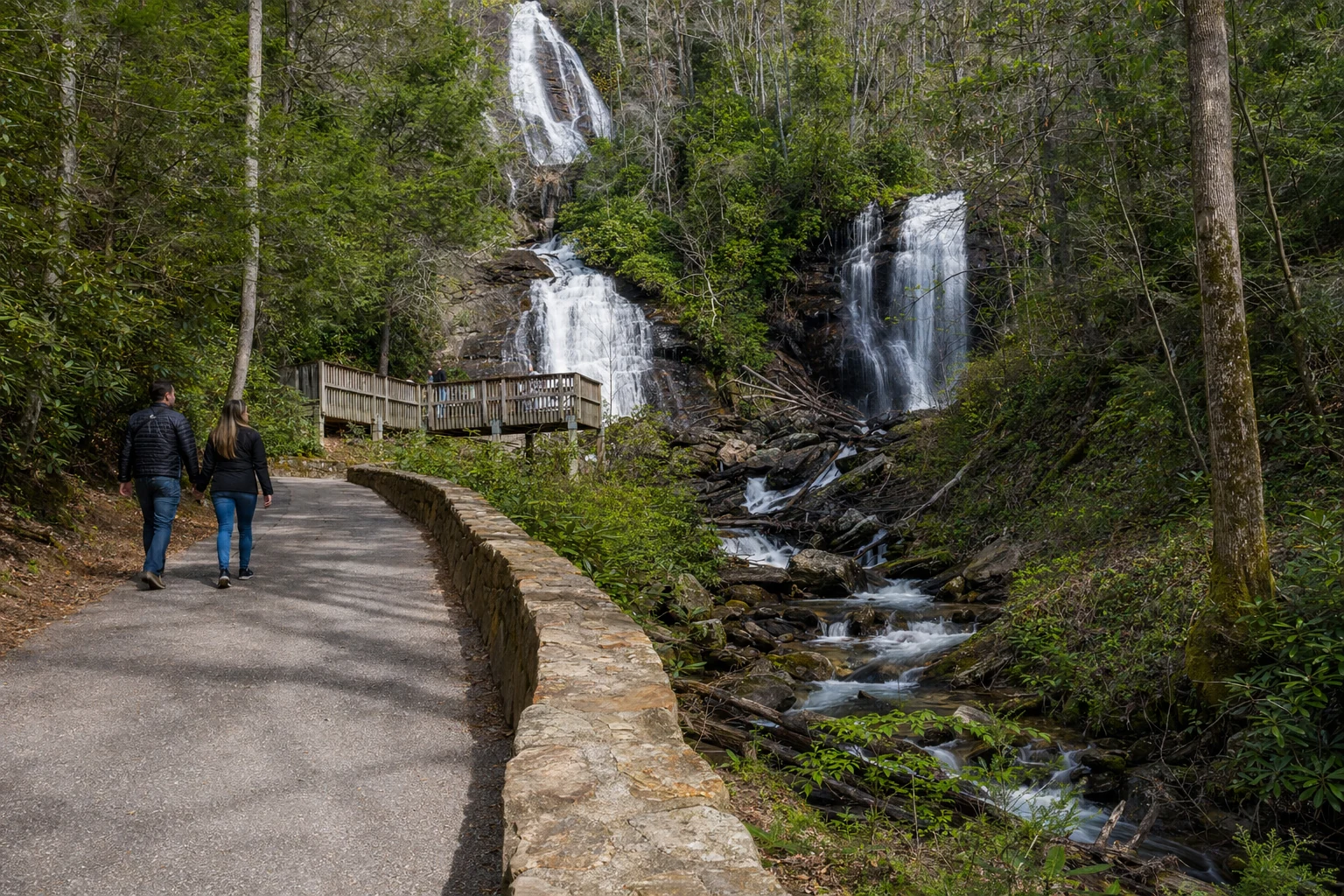
Distance and Configuration: The trail is approximately 0.4 miles one-way (0.8 miles round-trip). It follows the banks of Smith Creek upstream from the Visitor Center to the base of the falls.
Surface and Gradient: The entire length of the trail is paved, ensuring a smooth walking surface. However, visitors are frequently cautioned regarding the gradient. The trail ascends approximately 200 feet in elevation over a short distance. This results in a steady, sometimes steep incline that can be deceptive; while short, it is often classified as a moderate physical exertion for those with low cardiovascular fitness.
Amenities Along the Trail: To mitigate the steepness, park management has installed numerous benches and rest areas along the path. These allow visitors to pause and observe the cascading rapids of Smith Creek, massive boulders, and native rhododendron thickets that line the route.
Viewing Platforms: The trail terminates at two wooden observation decks. The lower deck provides a panoramic view of both falls, while an upper deck (accessible via stairs) brings visitors closer to the base of the Curtis Creek drop.
The Lion’s Eye Nature Trail
The Lion's Eye Nature Trail is one of the more thoughtful things about this recreation area.
Who it is for: This trail was built for visitors with visual impairments and people who use wheelchairs or other mobility aids.
Layout: It is a 0.1-mile (about 0.15 km) paved loop near the Visitor Center along Smith Creek. Unlike the main trail to the falls, this one is flat.
Features: A continuous cable handrail runs the length of the path so visually impaired visitors can follow it easily. Signs along the way are written in both regular text and braille, covering the local plants, animals, and ecosystem.
The Smith Creek Trail
If you want a real hike rather than a paved walk, the Smith Creek Trail connects the falls area to Unicoi State Park through the backcountry.
Route: This trail connects the base of Anna Ruby Falls to the campground area within Unicoi State Park.
Length and Difficulty: The trail is 4.6 miles one-way (approx. 9 miles round-trip). It is significantly more challenging than the paved tourist paths, winding through the Chattahoochee National Forest and traversing the steep terrain of the gold-mining era "Sautee Ditch".
Historical Context and Naming
The history of Anna Ruby Falls goes back to the years just after the Civil War, when settlers were putting down roots in the Nacoochee Valley.
Related Imagery from Around Helen