If you want a ready-made itinerary rather than a catalog, our Helen waterfalls day itinerary strings three or four of these falls together into a single dawn-to-dusk loop, and the complete Helen-area waterfalls reference lists everything mapped by drive time. For the broader regional picture, the North Georgia waterfalls overview pulls together the falls south and east of us that did not make this list.
Anna Ruby Falls
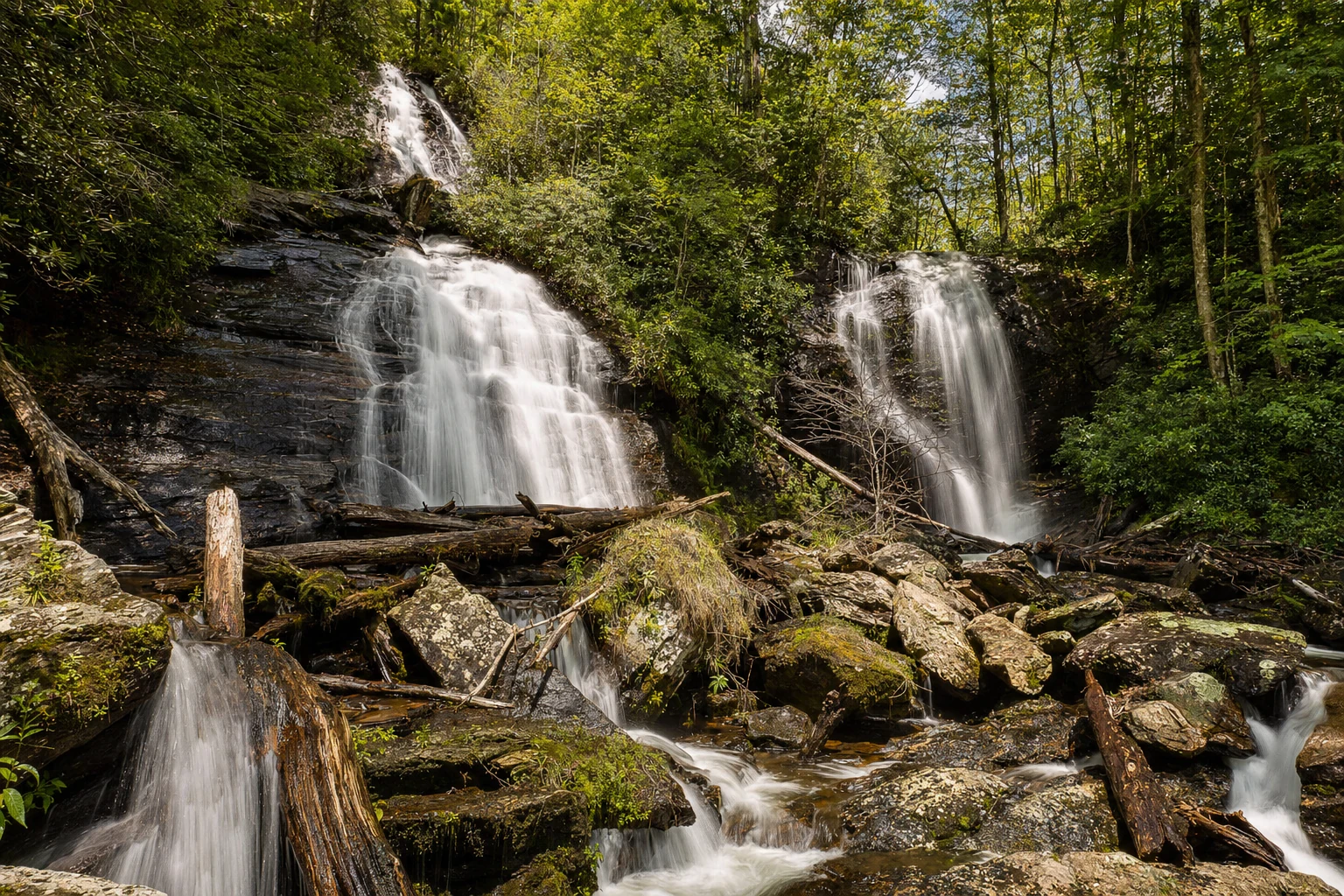
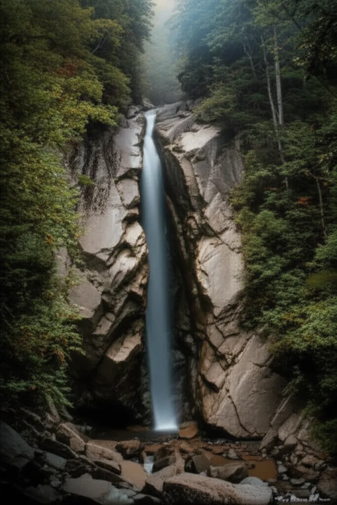
Anna Ruby Falls is Helen's signature waterfall, and for good reason. It sits roughly 7 miles north of town at about 34.7675 N, 83.7431 W, inside the Chattahoochee National Forest and adjacent to Unicoi State Park. The falls are formed where Curtis Creek and York Creek meet mid-air: Curtis drops 153 feet, York drops 50 feet, and the two streams braid together to form Smith Creek at the base. The paved 0.4-mile approach trail climbs only about 40 feet of elevation, so this is one of the few Blue Ridge cascades you can share with a stroller, a grandparent, and a wheelchair user in the same group. Our fuller write-up at the Anna Ruby Falls attraction page covers the visitor-center layout and the longer 4.6-mile Smith Creek Trail that connects down to Unicoi Lake.
Expect a $5 per-vehicle USFS day-use fee at the gate (America the Beautiful and Senior/Access passes are honored). The visitor center has real restrooms, a small gift shop, and drinking water, which makes Anna Ruby the best first stop if you are starting a bigger waterfall day. Leashed dogs are welcome on the paved trail. Drones are prohibited inside the recreation area, and so is swimming — the pool below the falls looks inviting in July but the ranger patrols are regular and the fines are real. For the best photograph, skip the upper railed platform and walk down to the lower viewing deck; you can frame both streams in one shot and the midday sun is diffused by the cove forest canopy. The name comes from Anna Ruby Nichols, the daughter of Captain James H. Nichols, a Confederate cavalry officer who owned much of this land in the 1870s. The Anna Ruby Falls trail guide has turn-by-turn notes and the current visitor-center hours.
Anna Ruby Falls Quick Facts
- Distance from Helen: about 7 miles north, 15-minute drive via Ga. 356 and Anna Ruby Falls Road
- Trail: 0.4 miles one way, paved, ~40 feet of climb
- Difficulty: Easy. Wheelchair and stroller friendly on the paved section.
- Fee: $5 per vehicle USFS day-use; federal passes honored
- Facilities: Visitor center with restrooms, gift shop, drinking water, paved parking
- Rules: No drones, no swimming, dogs on leash
Raven Cliff Falls
If Anna Ruby Falls is the crowd-pleaser, Raven Cliff Falls is the one that earns your respect. The trailhead sits about 10 miles southwest of Helen off the Richard B. Russell Scenic Highway at roughly 34.7475 N, 83.7915 W. The full round trip is about 4.9 miles along Dodd Creek with roughly 580 feet of accumulated climb, most of it rolling rather than steep. You will cross the creek a handful of times on log bridges, pass old-growth hemlock and carpets of rosebay rhododendron, and hear the creek long before you see the final drop.
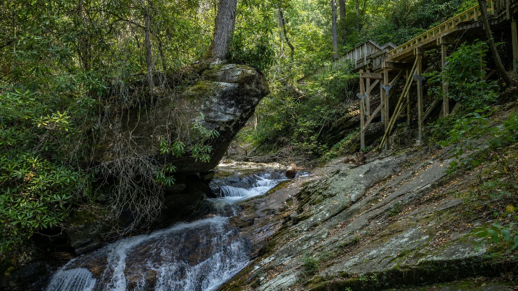
What makes Raven Cliff worth the miles is the geology of the falls themselves. Dodd Creek does not spill over a cliff — it actually carves straight through a cleft in a massive granite outcrop, so you are looking at water flowing through solid rock, not over it. There is no official parking fee at the Dodd Creek Trailhead but a primitive vault toilet is all you get for facilities, so use the Anna Ruby visitor center or the Helen welcome center before you drive over. Leashed dogs are allowed. Swimming is technically prohibited at the final falls because of current and slippery rock, but the pools along the lower creek are popular and legal. For full trail notes, check the Raven Cliff Falls trail guide; for the broader context of the surrounding 9,115-acre Raven Cliffs Wilderness, see our Raven Cliff Falls attraction page.
Dukes Creek Falls
Dukes Creek Falls may be the most underrated waterfall near Helen. The trailhead is at about 34.7570 N, 83.7718 W, just off the Russell Scenic Highway roughly 8 miles from town. The paved-then-gravel trail descends about 270 feet over a mile to a wooden viewing platform facing a 150-foot stepped cascade where Davis Creek and Dukes Creek join. What you see is less a single plunge and more a staircase of white water threading through boulders the size of small houses — the kind of scene that rewards patience with a camera rather than a quick selfie. The trail itself is a 2-mile round trip rated moderate, mostly because the return climb is steady uphill the whole way back.
Dukes Creek carries a piece of Georgia history that most visitors never notice. Benjamin Parks struck gold along this creek in 1828, six years ahead of the California rush and the nominal trigger of the Georgia Gold Rush that ended with the Cherokee Removal of 1838. A $5 per-vehicle USFS fee applies (federal passes honored). There are restrooms at the trailhead, dogs are allowed on leash, drones are prohibited, and swimming at the falls pool is banned. Our Dukes Creek Falls nature guide and the more detailed Dukes Creek Falls trail page cover the surrounding Smithgall Woods Conservation Area, which shares the drainage and offers its own easy creekside walking.
DeSoto Falls
Drive 15 miles south and west of Helen on US-129 toward Blairsville and you reach DeSoto Falls, a set of three cascades tucked into a cove at roughly 34.7088 N, 83.8444 W. The upper and lower falls are both reachable on a 2.2-mile round-trip trail that climbs about 300 feet — easy by Blue Ridge standards, though the footing is rocky in sections and icy in January. The lower falls (around 35 feet) drop into a classic tea-colored Appalachian plunge pool, while the upper falls (around 80 feet) fan out over a broad rock face. There is a middle falls that most people walk past without noticing; if you see a narrow spur trail with a log bench, that is the one, and the light there in late afternoon is arguably better than the main views.
The name comes from a piece of rusted metal armor that local settlers believed came from Hernando de Soto's 1540 expedition. No scholar today takes the identification seriously, but it is a nice reminder that these hollows were European-contact ground five hundred years ago. DeSoto Falls Recreation Area has a $5 day-use fee, a developed campground with flush restrooms, and a small picnic area. Dogs are allowed on leash, drones are prohibited, and swimming is banned in the falls pools. The trail is not wheelchair accessible.
Helton Creek Falls
Helton Creek Falls is the local secret that is no longer a secret, but it still feels like one on a weekday morning. The trailhead is tucked off Helton Creek Road near Vogel State Park, about 28 miles west of Helen. You walk 0.2 miles downhill from the gravel parking pullout and find two drops stacked close together: the upper falls at about 50 feet and a lower falls of about 10 feet with a wide wading pool at the base. There is no parking fee and no restroom — this is primitive Chattahoochee National Forest, not a state park. Unlike most of the falls on this list, swimming is actually permitted in the lower pool, and this is one of the best spots in the region for a cold-water plunge on a July afternoon. Dogs on leash are fine. For more unofficial swimming holes in the region, see our Helen swimming holes guide.
High Shoals Falls
High Shoals is the waterfall you drive to when you want to escape the Anna Ruby Falls bus tour. The trailhead is off Indian Grave Gap Road, a 1.5-mile rough forest road that requires a high-clearance vehicle — sedans have made it in the summer, but after rain the ruts will punish you. Once you start walking, the trail is about 1.2 miles round trip with 200 to 300 feet of elevation, following High Shoals Creek through a scenic designated area protected since 1986. There is no parking fee, no restroom, no signage to speak of, and the trail ends at two named drops: Blue Hole Falls (around 25 feet) and High Shoals Falls proper (around 50 feet). Because this is national forest outside the heavily regulated recreation areas, drones are generally permitted for recreational use and swimming in the pools happens at your own risk. Your cell signal dies about halfway down the access road.
Amicalola Falls
At 729 feet, Amicalola Falls is the tallest cascading waterfall in the southeastern United States. The park sits at 34.5573 N, 84.2494 W in Dawsonville, roughly 40 miles and an hour's drive southwest of Helen — outside the 30-mile ring but close enough that most people who plan a waterfall day end up adding it. The park offers three different approaches: the wheelchair-accessible West Ridge Falls Access Trail (0.3 miles one way, paved) to the lower observation deck, the notorious 604-step staircase from base to top, and the 8.5-mile Approach Trail that ends at Springer Mountain, the southern terminus of the Appalachian Trail. Aspiring northbound thru-hikers register inside the visitor center, weigh their packs on the official scale, and start their 2,197-mile walk to Maine here.
Amicalola Falls State Park charges a $5 per-vehicle parking fee (Georgia State Parks annual pass honored). Restrooms are available at the visitor center, the lodge, and near the top of the falls. Dogs on leashes of six feet or less are allowed on all trails and in the park. Drones are prohibited without a special permit — this is strictly enforced because of thru-hiker privacy and park wildlife. Fall foliage peaks in the last two weeks of October and the first week of November, and the parking lot is full by 10 a.m. on any clear weekend in that window. Come at sunrise or come on a Tuesday. Ice forms on the metal stairs reliably from late December through early February.
Toccoa Falls
Toccoa Falls is the Goldilocks waterfall of the region: a 186-foot free-falling plunge (taller than Niagara) reached by a paved 100-yard walk from the gift shop. That is not a typo — the falls are on the campus of Toccoa Falls College, about 38 miles east of Helen, and the approach is essentially a gentle stroll across manicured grass. A $2 per-person admission goes to the college. The path is wheelchair accessible, there are real restrooms at the gift shop, and the viewing area gets you close enough to feel the mist. Dogs on leash are welcome. Drones are strictly prohibited because the falls sit on private college property and because of the campus above.
One piece of local history travelers should know: on November 6, 1977, the earthen Kelly Barnes Dam above the falls failed at 1:30 a.m., releasing a 30-foot wall of water that killed 39 people on the college campus below. The falls themselves and the old stone bridge survived. A small memorial at the base of the falls marks the event, and the college has restructured the drainage above so the failure cannot repeat. Worth a moment of reflection when you visit.
Tallulah Gorge and Tallulah Falls
Tallulah Gorge State Park is the monster of the region: a nearly 1,000-foot-deep chasm that holds six named waterfalls in a roughly two-mile stretch. From the rim trails you look down on L'Eau d'Or Falls (16 feet), Tempesta Falls (76 feet), Hurricane Falls (96 feet, the tallest), Oceana Falls (50 feet), Bridal Veil Falls (17 feet, also called Sliding Rock), and Sweet Sixteen Falls (16 feet). The visitor center at 34.7387 N, 83.3915 W is about 45 miles east of Helen via Ga. 255 and US-441, roughly an hour's drive.
The rim trails on both the north and south sides are easy, paved in places, and accessible in stretches — you can see all six falls without descending the gorge. The Hurricane Falls Trail drops 600 feet into the gorge on 531 metal stairs to a suspension bridge at the lip of Hurricane Falls, then climbs another 221 stairs to a viewing platform on the far side. Round trip is about 2.25 miles with 1,100 feet of total elevation change. The gorge floor trail (Sliding Rock Trail) is restricted to 100 free permits per day, issued first-come, first-served at the visitor center starting at 8 a.m., and is closed entirely on the scheduled whitewater release weekends in April and November when Georgia Power spins up releases from Tallulah Falls Dam for raft trips. Parking is $5 per vehicle. Dogs on leash are fine on the rim but banned on the gorge floor. Drones are prohibited without a special permit. The general waterfalls overview has notes on how to time a Tallulah visit around the whitewater releases.
A historical note: in July 1970, Karl Wallenda of the Flying Wallendas walked a 1,000-foot steel cable across the gorge in 17 minutes, doing two handstands at the midpoint. The cable anchors are still visible from the north rim overlooks near Inspiration Point. It remains one of the most-watched tightrope walks in American history.
Photography Tips
Waterfalls photograph best in overcast or shaded conditions, when the soft light eliminates harsh shadows and blown-out highlights on the white water. Bring a tripod if you want those silky long-exposure shots; a 1/4-second to 2-second exposure will turn the water into flowing silk while keeping the rocks sharp. If you do not have a tripod, brace your camera against a tree or rock and use the 2-second self-timer to reduce camera shake. A polarizing filter knocks down the glare on wet rock and on the water surface, and a neutral-density filter (3-6 stops) lets you shoot long exposures even at midday.
The best seasons for waterfall photography near Helen are spring (March through May), when water flow is highest from snowmelt and spring rains, and autumn (October through November), when the fall color frames the cascades. Summer is the most popular time to visit, but water flow is often lower, and the bright midday sun creates challenging contrast. Winter visits can be extraordinary: ice formations along the margins of Anna Ruby and DeSoto create abstract patterns, and the forest is open enough that you can see the shape of the cascades through bare branches. Check the USGS streamflow gauge for the Chattahoochee near Helen (station 02331600) before you commit — flow above 120 cfs means healthy water; below 50 cfs and your photographs will be disappointing.
Anna Ruby Falls -- twin cascades totaling 153 feet
Raven Cliff Falls -- 60-foot drop through a granite cleft
Dukes Creek Falls -- 150-foot cascade in the Chattahoochee National Forest
Seasonal Water Flow and When to Go
Water flow in the Blue Ridge streams is governed by rainfall, and rainfall in the mountains can be unpredictable. Generally, the wettest months are March through May and December through February, when frontal systems bring steady rain. Summer thunderstorms produce spectacular but brief surges — a 2-inch afternoon storm can triple the flow over Anna Ruby for 36 hours and then let it drop back. The driest period is typically late September through mid-October, when fall color is ramping up but water flow may be at its lowest. The ideal visit combines recent rain with clear skies: aim for one to two days after a significant rainfall event for the best combination of water volume and photographic conditions.
Trail conditions change with weather. Log bridges on the Raven Cliff Falls trail can be slick in frost. The Dukes Creek Falls return climb is harder in 95-degree August humidity than it looks on the map. The Amicalola stairs ice over between Thanksgiving and Valentine's Day most winters. If you are planning a multi-waterfall day, pair easy and strenuous stops so you are not climbing out of two gorges back to back — a typical good order is Anna Ruby first (easy warm-up, visitor center for bathrooms and water), Dukes Creek second (moderate, good lunch break at the overlook), and Raven Cliff third if you still have legs. For a single-hike strategy, our trail index ranks every trail on the site by difficulty and distance.
Local writers sharing the hidden stories and trails of North Georgia's mountain country.
Related Stories
More outdoor adventures near Helen