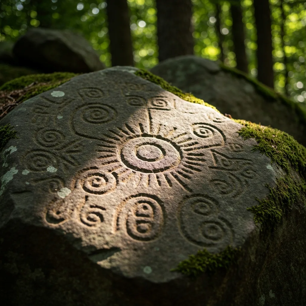
The Petroglyphs
Track Rock Gap, formally known as Track Rock Archaeological Area, sits at an elevation of about 2,200 feet on the western slope of the Blue Ridge within the Brasstown Ranger District of the Chattahoochee National Forest. The site consists of several large soapstone boulders into which a variety of symbols have been carved: circles, crosses, animal tracks, human footprints, and abstract designs that do not neatly fit into any single cultural tradition. The carvings were old when the first European settlers arrived in the region, and the Cherokee told early visitors that the stones were there before their people came to the mountains.
The site has been known to Euro-American researchers since at least the 1830s. Charles Lanman described the carvings in his 1848 book about the southern highlands, and they have been studied, sketched, and photographed by generations of archaeologists. The orthodox view, held by the majority of professional archaeologists, is that the petroglyphs are the work of Native American peoples -- most likely the ancestors of the Cherokee or Creek, spanning the Archaic period through the Woodland period -- and that they may have served as trail markers, territorial boundaries, or ceremonial records. This is the explanation you will find on the U.S. Forest Service interpretive signs at the site.
Richard Thornton's Mayan Theory
In 2011, an architect and urban planner named Richard Thornton ignited a firestorm when he published a series of articles claiming that the Track Rock Gap site, and particularly a complex of stone terraces and walls on a nearby mountainside, showed unmistakable evidence of Maya settlement. Thornton argued that the terraces resembled those found at Maya sites in Central America, that certain of the carved symbols had Maya parallels, and that the stone masonry techniques were unlike anything attributed to the Cherokee or other Southeastern tribes.
Thornton's theory was specific and dramatic: he proposed that a group of Itza Maya refugees, fleeing the collapse of their civilization around 900 AD, had migrated north through Mexico, up the Mississippi River system, and eventually into the mountains of North Georgia, where they established agricultural terraces and left their mark on the soapstone boulders. He pointed to 154 stone masonry walls and terraces documented on the mountainside above Track Rock Gap as his primary evidence, arguing that their construction techniques were virtually identical to Maya agricultural terraces in the Yucatan Peninsula. Thornton even connected the site to the legendary city of "Yupaha," which Hernando de Soto's expedition sought during its 1540 journey through the Southeast -- suggesting that the Spanish conquistador's fabled lost city might have been right here, in the mountains of North Georgia, built by Maya descendants who had migrated north centuries before de Soto's arrival.
"The 154 stone walls and terraces at Track Rock are unlike anything built by known Southeastern cultures. They are, however, virtually identical to Maya agricultural terraces in Central America."
The Orthodox Response
The reaction from professional archaeologists was swift and largely negative. The Society for Georgia Archaeology and the Council for Georgia Archaeology both issued statements rejecting Thornton's claims. Their principal arguments were that the stone terraces were more likely the work of European-American settlers who farmed the area in the 18th and 19th centuries, that the petroglyph symbols could be explained within known Southeastern Native American traditions, and that there was no genetic, linguistic, or ceramic evidence to support Maya presence in Georgia.
Crucially, the U.S. Forest Service, which manages the site, conducted its own review and concluded that the terraces were most likely historic-era agricultural features, not pre-Columbian constructions. The Forest Service also noted that the stone walls were built of stacked fieldstone, a common 19th-century farming technique throughout the Appalachians, and that similar terraces exist throughout the region with no connection to Mesoamerican cultures.
The Cherokee Perspective
The Eastern Band of Cherokee Indians has also weighed in, and their position is clear: the Track Rock Gap petroglyphs are Cherokee heritage, and theories attributing them to other cultures erase the legitimate history and achievements of the people who actually lived in these mountains for thousands of years. Cherokee oral tradition connects the site to their own cultural practices, and tribal historians point out that attributing Southeastern artifacts to Mesoamerican visitors is a pattern with a troubling history, one that implicitly suggests Native peoples could not have created sophisticated works without outside help.
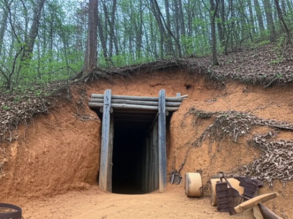
Visiting Track Rock Gap
Whatever you make of the controversy, Track Rock Gap is worth visiting. The site is located on Track Rock Gap Road (Forest Service Road 95) off US-76, about 8 miles south of Blairsville and 20 minutes from Helen. A small parking area leads to a short, paved interpretive trail with U.S. Forest Service signs explaining the petroglyphs. The carved boulders are protected by a fence, and you can view them from a few feet away.
Visitor Information
- Location: Track Rock Gap Road (FS Road 95), Union County, Georgia
- From Helen: About 20 minutes south via US-76 and Track Rock Gap Road.
- Trail: Short, paved interpretive path. Wheelchair accessible.
- Fee: Free. No reservations required.
- Note: Do not touch or climb on the carved boulders. They are protected cultural resources.
Stand in front of those carved boulders, run your eyes over symbols that were old before Columbus was born, and make up your own mind. That is the real gift of Track Rock Gap: not a definitive answer, but a genuine mystery, carved in stone and still unsolved in the mountains of North Georgia.
Local writers sharing the hidden stories and trails of North Georgia's mountain country.
Continue Exploring
More stories from North Georgia
Related Stories
More ancient mysteries and history from the mountains