Comprehensive Guide to the Chattahoochee National Forest for Helen Visitors
Over 750,000 acres of wilderness, hiking trails, waterfalls, and scenic drives just minutes from Helen
Key Points
Vast Scale: The Chattahoochee National Forest encompasses over 750,000 acres in North Georgia, forming part of a larger administrative unit (Chattahoochee-Oconee) totaling nearly 867,000 acres.
Wilderness Access: Three major federally designated wilderness areas surround Helen: Raven Cliffs, Tray Mountain, and Blood Mountain. These areas prohibit motorized equipment and offer primitive solitude.
Recreation Hubs: Major recreation sites near Helen include Anna Ruby Falls, Andrews Cove, and the Upper Chattahoochee River Campground. These provide developed amenities unlike the primitive wilderness zones.
Camping Regulations: Dispersed camping is generally allowed for up to 14 days in a 30-day period. However, strictly enforced seasonal rules require bear-resistant canisters for overnight camping in the Blood Mountain Wilderness (March 1–June 1).
Forest Roads: Access often requires navigating Forest Service (FS) roads. Key routes include Tray Mountain Road (FS 79) and Chattahoochee River Road (FS 44). These are subject to seasonal winter closures (typically January–March).
Ecological Significance: The forest serves as the critical headwaters for the Chattahoochee River, providing drinking water for millions downstream, including metro Atlanta, and protecting aquatic biodiversity.
Introduction
The Chattahoochee National Forest covers a huge amount of ground in North Georgia. If you are staying in Helen, this forest is not just the scenery out your window. It is more than 750,000 acres of public land where you can hike, camp, fish, swim, and get genuinely lost in the woods if you are not paying attention.
The U.S. Forest Service manages the land. It was not always this forested. Logging cleared most of it in the early 1900s, and the federal government started buying the land back under the Weeks Act of 1911, beginning with 31,000 acres from the Gennett family. It became a National Forest in 1936. The trees you see today are the result of a hundred years of regrowth.
Here is what you need to know about the forest around Helen: where to go, what the rules are, how to get there on forest roads, and why the whole area matters for the water supply all the way down to Atlanta.
Forest Overview and Management
The Chattahoochee-Oconee National Forests are administratively combined, but the Chattahoochee National Forest specifically refers to the mountainous block in North Georgia.
Acreage and Geography
The Chattahoochee National Forest spans approximately 750,000 acres across 26 counties. It stretches roughly 200 miles from Chattooga County in the west to the Chattooga River in the east. The terrain is characterized by the Blue Ridge physiographic province, featuring steep ridges, deep coves, and elevations ranging from approximately 1,000 feet to the state high point at Brasstown Bald (4,784 feet).
Administrative Districts
Helen, Georgia, is primarily situated within the Chattooga River Ranger District, though it sits near the boundary of the Blue Ridge Ranger District. This distinction is important for visitors, as management practices, road closures, and emergency contacts may vary by district.
Wilderness Areas Near Helen
The Wilderness Act of 1964 defines wilderness as an area "untrammeled by man." Near Helen, three designated wilderness areas offer the most primitive experiences available in Georgia. These areas prohibit motorized vehicles, bicycles, and mechanical transport (including carts).
1. Raven Cliffs Wilderness
Located immediately west/northwest of Helen, the Raven Cliffs Wilderness was designated in 1986.
Size: Approximately 9,115 to 9,240 acres.
Topography: This area is defined by the precipitous drop of the Blue Ridge Escarpment. Elevations range from 1,800 feet on Boggs Creek to 3,846 feet on Levelland Mountain.
Key Features:
Raven Cliff Falls: The namesake feature is a popular waterfall where Dodd Creek flows through a narrow fracture in a granite cliff. The trail to the falls (2.5 miles one way) is one of the most heavily trafficked in the state.
Appalachian Trail (AT): 6.6 miles of the AT traverse the high ridge of this wilderness.
2. Tray Mountain Wilderness
Located northeast of Helen, this wilderness covers the high crest of the Blue Ridge.
Size: Approximately 9,702 to 10,343 acres.
Topography: Dominated by Tray Mountain (4,430 feet), the eighth-highest peak in Georgia. The terrain includes "hanging valleys" and the headwaters of the Soque River.
Key Features:
Appalachian Trail: 16.5 miles of the AT cross this wilderness, noted for being unusually level along the ridgeline compared to other Georgia sections.
High Shoals Falls: A scenic area within the wilderness featuring Blue Hole Falls and High Shoals Falls, accessible via a steep 1.2-mile trail.
3. Blood Mountain Wilderness
Located west of Helen and south of Blairsville, this is perhaps the most iconic wilderness area in Georgia due to the AT traffic.
Size: Approximately 7,800 acres designated in 1991.
Topography: Centered on Blood Mountain (4,458 feet), the highest point on the Appalachian Trail in Georgia.
Key Features:
Blood Mountain Shelter: A historic stone shelter built by the Civilian Conservation Corps (CCC) in the 1930s sits at the summit.
Bear Canister Regulation: Due to heavy use and habituated bears, the USFS mandates that all overnight campers between Jarrard Gap and Neels Gap (approx. 5 miles of trail) must carry hard-sided, bear-resistant canisters. This rule is strictly enforced annually from March 1 through June 1.
Developed Recreation Areas Near Helen
For visitors seeking amenities (picnic tables, restrooms, paved trails), the forest offers several developed recreation areas (DRAs) within a short drive of Helen.
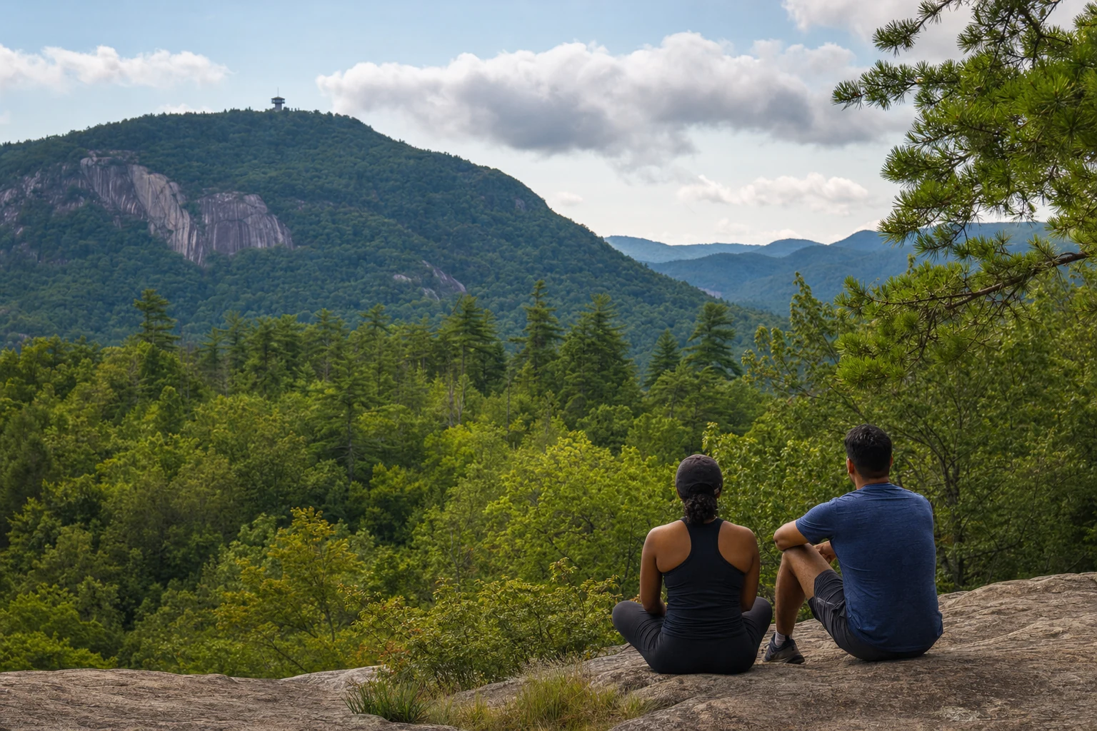
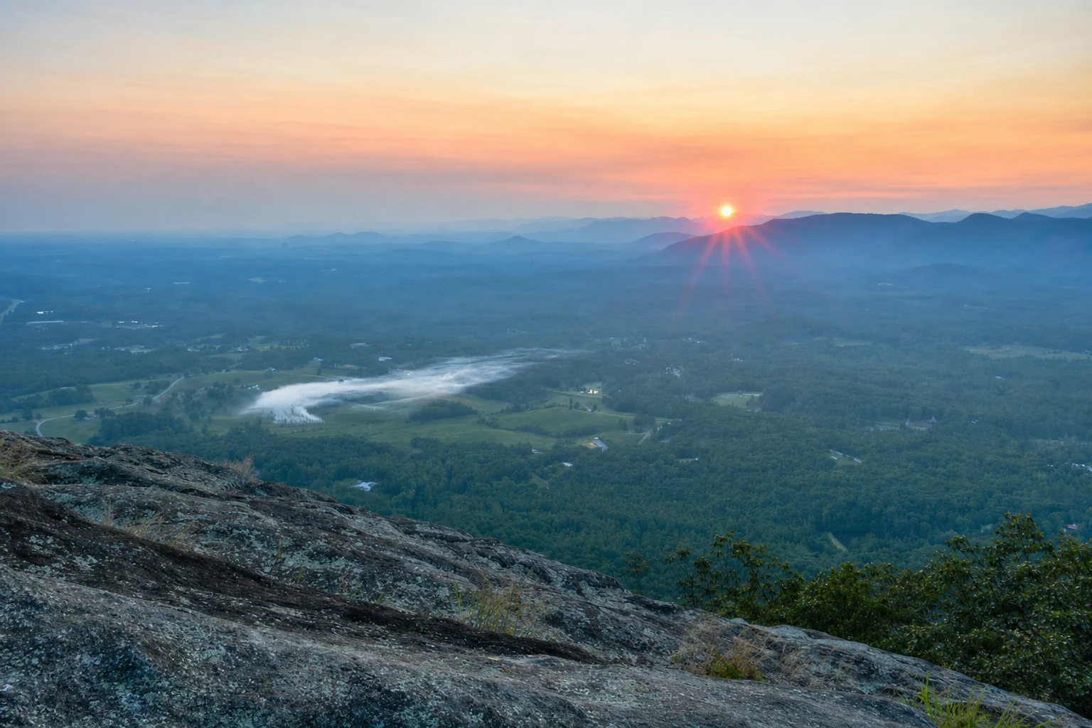
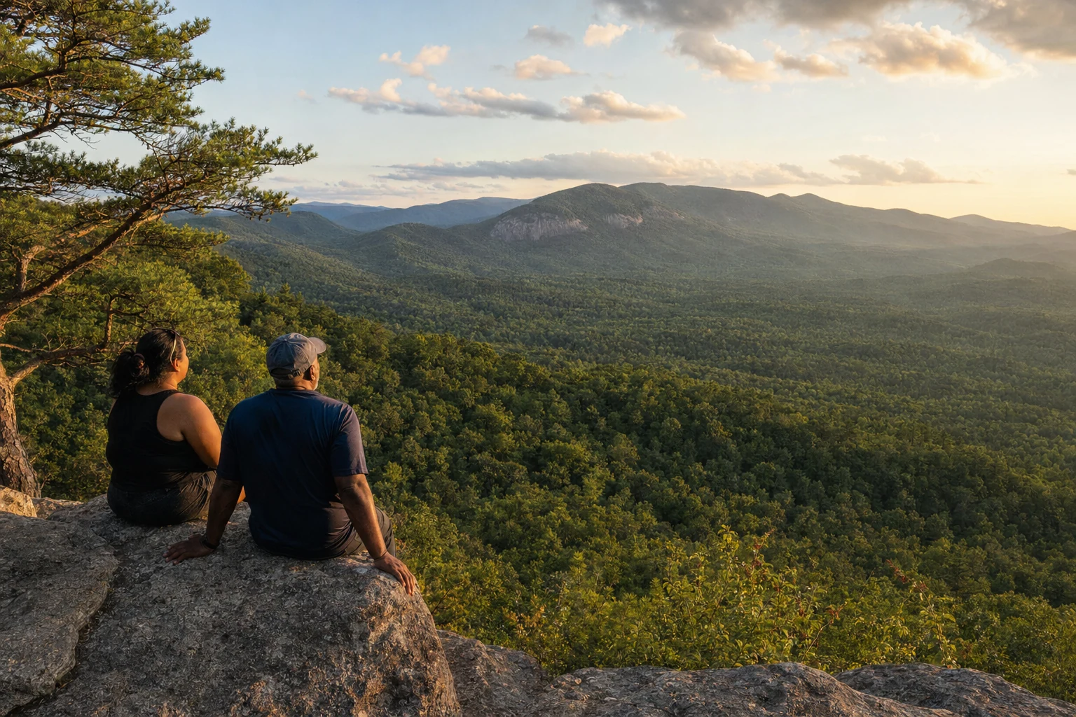
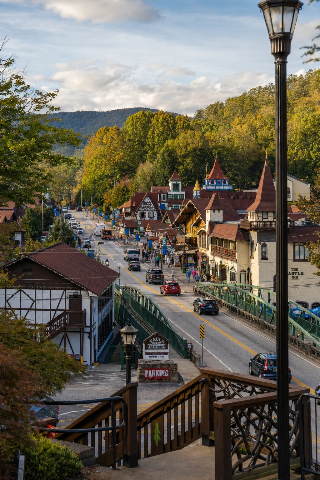
Related Imagery from Around Helen