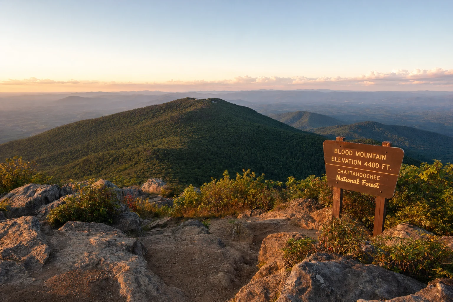
Blood Mountain
The highest peak on the Georgia Appalachian Trail at 4,458 feet with Cherokee legends
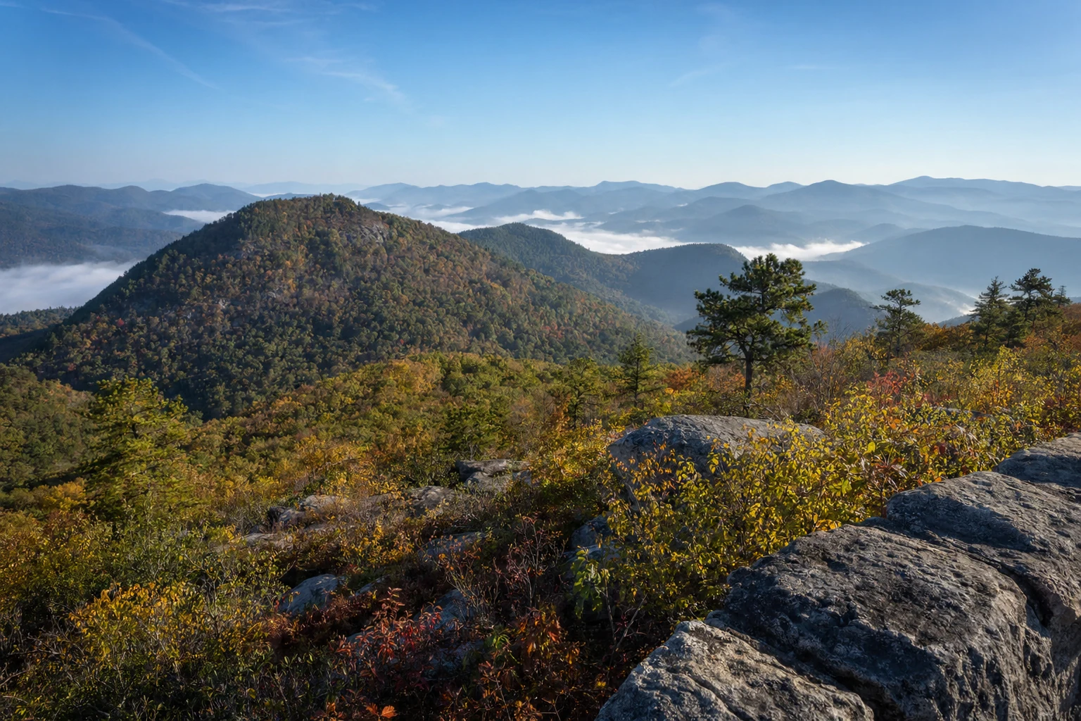
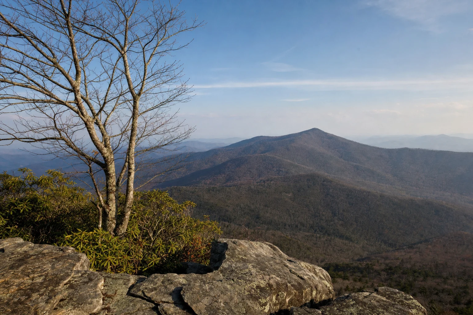
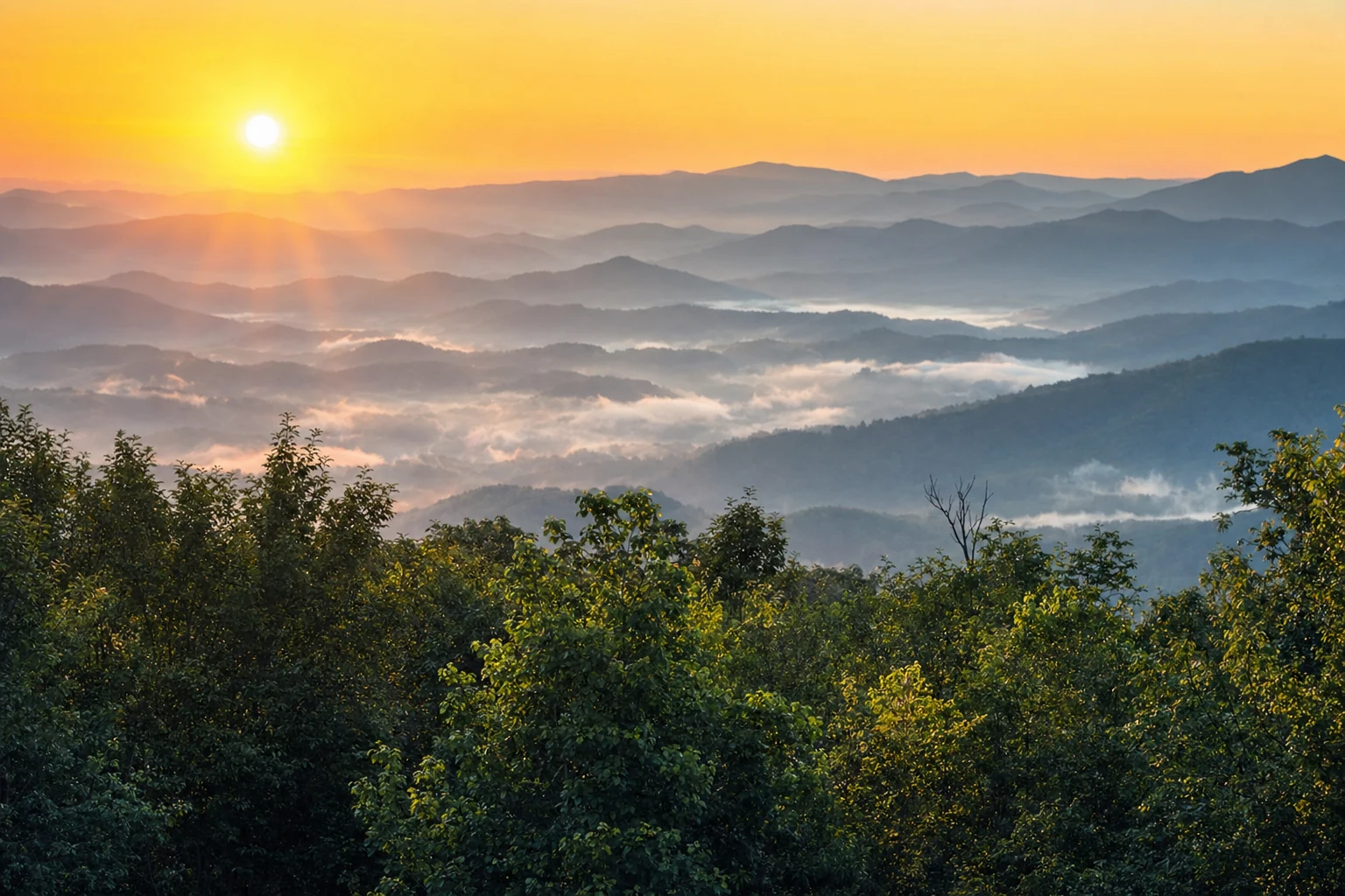
Blood Mountain is the highest point the Appalachian Trail reaches in Georgia, topping out at 4,458 feet. It sits on the Union-Lumpkin county line, about 25 minutes from Helen by car, and it is one of the most popular summit hikes in the state. The name comes from Cherokee oral tradition, which tells of a fierce battle fought between the Cherokee and Creek peoples on these slopes. Whether the story is literal history or something older and deeper, the name fits the mountain. There is something dramatic about Blood Mountain, from its steep rocky face to the way clouds wrap around the summit and the wind hits you when you clear the tree line.
The most common route to the top starts from Neel Gap on US-19/129, where Mountain Crossings outfitter occupies the historic CCC-built stone building. From there, the AT climbs 2.2 miles to the summit, gaining about 1,500 feet of elevation. It is a serious workout. The trail is rocky, steep in places, and the last push to the top will have your legs burning. But the payoff is enormous: 360-degree views of the Blue Ridge, stretching south toward the Piedmont and north into the Carolinas. Most people do the round trip in three to four hours.
The Summit & CCC Shelter
A stone building older than most hikers' grandparents
At the top of Blood Mountain sits a two-room stone shelter built by the Civilian Conservation Corps in the 1930s. It is one of the oldest structures on the entire Appalachian Trail and one of the few surviving CCC shelters still in use. The building is rough and utilitarian: stone walls, a dirt floor, no amenities. But it provides welcome protection from wind and rain, and on a cold night it has kept many a backpacker from a miserable experience. The shelter sleeps about eight people, first come first served, and it fills up on popular weekends.
The views from the summit rock outcroppings are the real reward. On a clear day, the visibility stretches for miles in every direction. You can pick out Brasstown Bald to the northeast, the Cohutta Wilderness to the northwest, and the hazy flatlands of the Georgia Piedmont far to the south. In October, the surrounding ridges light up in red, orange, and gold. It is one of the best vantage points in North Georgia for fall color.
Trail Routes & Options
Multiple ways up, from quick and steep to long and remote
The Neel Gap route (2.2 miles, northbound on the AT) is the most popular, but it is not the only way up. The Byron Reece Trail starts from a parking area on US-19/129 about a mile south of Neel Gap and connects to the AT, offering a slightly different approach. You can also reach Blood Mountain from Vogel State Park via the Coosa Backcountry Trail and the Duncan Ridge Trail, though this is a much longer and more demanding route better suited for experienced backpackers.
The Slaughter Creek Trail approaches from the south and is less traveled, which means fewer people and a wilder feel. Whichever route you choose, bring plenty of water. There are no reliable water sources near the summit, and dehydration is the most common mistake hikers make on Blood Mountain. Two liters per person minimum, more in summer heat.
What to Know Before You Go
Practical advice from people who have made the climb
Start early. By mid-morning on weekends, the Neel Gap parking area can fill up completely, and afternoon thunderstorms are common in summer. An 8 AM start gets you to the summit before the crowds and the weather. Wear sturdy boots with ankle support; the trail is rocky and uneven, and a twisted ankle up here means a long, painful descent. Trekking poles make a real difference on the way down.
Blood Mountain is active bear country, especially March through June. If you are camping overnight at the shelter, store your food in a bear canister or hang a bear bag properly. Even day hikers should keep food packed away rather than leaving it sitting out at the summit. Weather at 4,458 feet can change fast. Pack a rain layer even if the forecast looks clear, and be prepared for temperatures 10 to 15 degrees cooler than in the valleys. In winter, ice can make the upper sections of the trail treacherous. Check conditions at Mountain Crossings before heading up, and do not hesitate to turn back if things get dicey. The mountain will still be there next weekend.
More to Explore
Related destinations, trails, and experiences nearby
Related Imagery from Around Helen