Warwoman Dell and the Trails of Rabun County: A Comprehensive Guide to History, Hydrology, and Recreation
Waterfalls, the Bartram Trail, CCC-era ruins, and Cherokee history in Rabun County's forested dell
Warwoman Dell is a small, steep-sided valley about 3 miles east of Clayton, Georgia, in Rabun County, within the Chattahoochee-Oconee National Forest. The name "Warwoman" most likely honors Nanyehi (Nancy Ward), a Cherokee "Beloved Woman" (Ghigau) known for her role in the Battle of Taliwa and her advocacy for peace, though local folklore sometimes attributes it to Nancy Hart, a Revolutionary War figure from a different part of Georgia. The Dell has waterfalls, CCC-era ruins, and serves as the main access point for the Bartram Trail in this area.
1. Introduction and Geographic Context
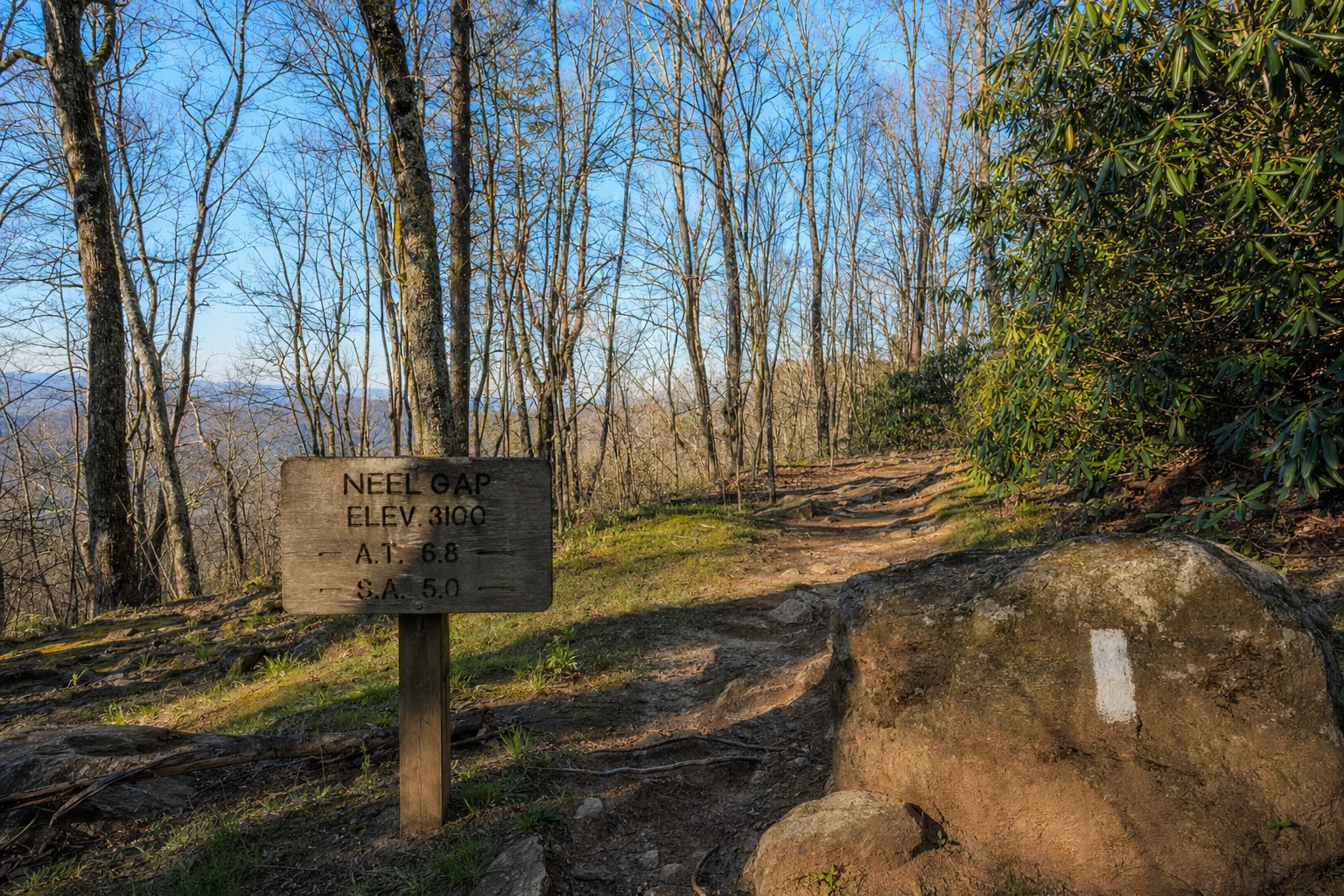
The Warwoman Dell Recreation Area sits in the Blue Ridge Mountains of northeast Georgia, in Rabun County. The Dell is a small, steep-sided valley carved by the headwaters of Warwoman Creek. It works as both a roadside park for picnicking and a trailhead for the Chattahoochee-Oconee National Forest and the Warwoman Wildlife Management Area (WMA).
Geographically, the area is situated east of the Eastern Continental Divide. The waterways here, including Warwoman Creek and Martin Creek, flow toward the Chattooga River, eventually reaching the Savannah River and the Atlantic Ocean. The topography is characterized by the dense hardwood forests, rhododendron thickets, and steep ravines typical of the southern Appalachians. Access to the Dell is provided via Warwoman Road, a historic corridor that traces an ancient indigenous trading route connecting the Cherokee settlements of the mountains to the coastal plains.
2. Historical Significance and Etymology
The history here covers Cherokee habitation, a failed railroad project from the 1850s, and Depression-era conservation work.
2.1 The "Warwoman" Name: Nancy Ward vs. Nancy Hart
The origin of the name "Warwoman" is debated among historians and locals. The term "War Woman" is an Anglicization of the Cherokee title Ghigau (Beloved Woman), a position of high status awarded to women who demonstrated exceptional bravery or wisdom. These women sat on tribal councils and held the power to decide the fate of captives.
Nancy Ward (Nanyehi): Scholarly consensus and geographical context heavily favor Nancy Ward as the namesake. Born circa 1738 in the Cherokee capital of Chota, Ward earned the title Ghigau after rallying Cherokee warriors during the Battle of Taliwa in 1755 against the Creek Indians. She later became a pivotal figure in advocating for peace between the Cherokee and white settlers. Given Rabun County's location within the historic Cherokee Nation, the attribution to Ward is historically consistent.
Nancy Hart: Some local legends attribute the name to Nancy Hart, a Revolutionary War patriot known for capturing British soldiers. However, Hart lived in Elbert County, and her exploits are geographically removed from the Warwoman Valley.
Local Folklore: Other oral histories suggest the name could refer to an otherwise unnamed woman, such as "Cateeche," or a mother who rescued her child from captors, earning the war title.
2.2 The Blue Ridge Railroad
In the 1850s, Warwoman Dell was the site of an ambitious engineering project: the Blue Ridge Railroad. Intended to connect Charleston, South Carolina, with Cincinnati, Ohio, the railroad required traversing the rugged Eastern Continental Divide.
Laborers constructed massive stone culverts and graded beds through the Dell. However, the project was plagued by financial difficulties and ultimately abandoned with the outbreak of the Civil War. Today, the "uncompleted tunnel" and moss-covered stone culverts remain visible along the trails, serving as monuments to this failed industrial enterprise.
2.3 The Civilian Conservation Corps (CCC)
During the Great Depression, the Civilian Conservation Corps (CCC) Company 457 established Camp Warwoman. These workers revitalized the landscape, which had been degraded by unmanaged logging. They constructed the recreational infrastructure still in use today, including the stone picnic shelters, the spring house, and the trout rearing tanks (now ruins) found along the nature trail.
3. Waterfall Trails and Guides
The Warwoman Dell area offers a density of waterfalls accessible via the Bartram Trail and spur trails.
3.1 Becky Branch Falls
Becky Branch Falls is one of the most accessible and popular waterfalls in Rabun County. It is a 20-foot cascade that tumbles over rock tiers surrounded by dense rhododendron.
Trailhead: Warwoman Dell Recreation Area (first parking lot on the right).
Distance: Approximately 0.6 miles round-trip (loop).
Difficulty: Moderate due to switchbacks.
Route Description: From the parking area, hikers follow the yellow-blazed Bartram Trail north. The trail crosses Warwoman Road (caution is advised due to traffic) and ascends via switchbacks. A wooden bridge spans the base of the falls, providing a viewing platform. The trail continues past the falls to rejoin the Bartram Trail or loops back down to the road.
Scenic Features: The falls are framed by a lush understory of ferns and wildflowers, particularly in spring.
3.2 Martin Creek Falls
Martin Creek Falls is a larger, two-tier waterfall dropping approximately 35 feet. There are two distinct ways to access this waterfall: the long scenic route via the Bartram Trail or the shorter "local" shortcut.
#### Method A: Via Bartram Trail (From Warwoman Dell)
Trailhead: Warwoman Dell Recreation Area.
Distance: Approximately 3.6 to 4 miles round-trip.
Difficulty: Moderate to Strenuous.
Route: Hikers proceed past Becky Branch Falls on the Bartram Trail, heading east/southeast. The trail traverses ridges, passing through lush coves and crossing small tributaries before descending to Martin Creek. An observation deck provides a view of the falls.
3.3 Warwoman Dell Falls (Nature Trail)
Often overlooked, there is a small waterfall located directly within the Dell along the Warwoman Dell Nature Trail.
Distance: 0.4-mile loop.
Description: This low-flow waterfall is located on a tributary of Becky Branch at the end of the short nature loop. The trail passes the historic CCC trout hatchery ruins and railway bed.
4. Creek Hiking and Hydrology
The hydrology of the area is dominated by Warwoman Creek and its tributaries. These streams are vital for local ecology and recreation.
Related Imagery from Around Helen